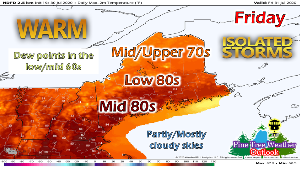
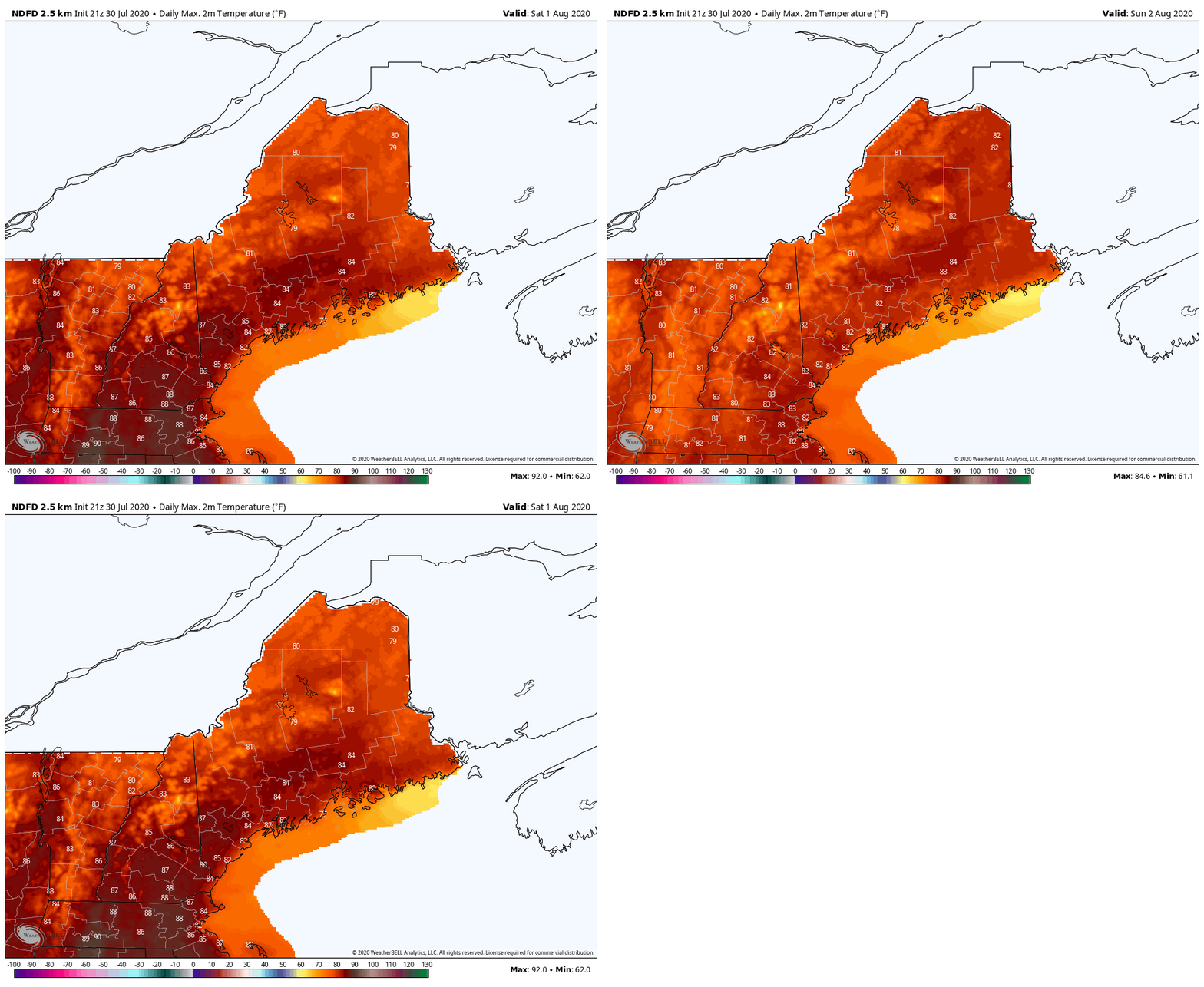
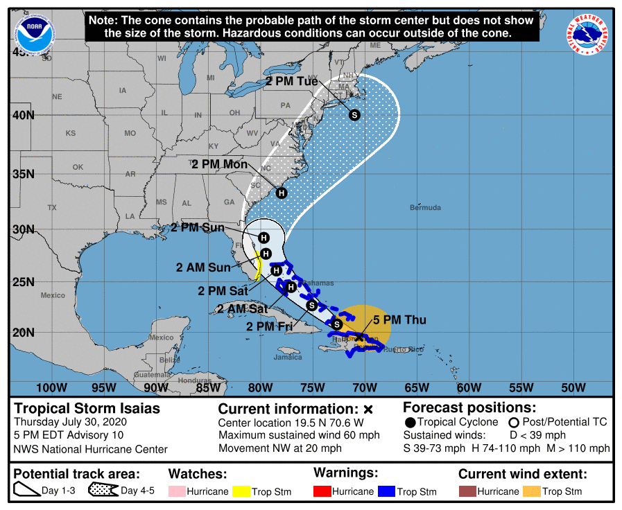
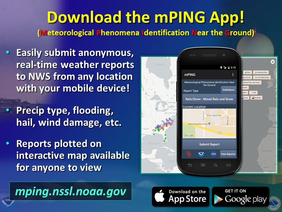
Slightly cooler on FridayFriday will be pretty seasonable with temperatures ranging from the mid 70s north to the mid 80s south. Dew points will be in the low 60s throughout most of the state with a few mid 60s along the southern coast. Overall, fairly average temperatures and humidity. As the system from today passes, it may leave behind a weak boundary to act as a forcing for some isolated showers and storms tomorrow. Otherwise, expect a fairly pleasant day with partly cloudy skies and clearing into the evening. Overnight, temperatures will drop into the low/mid 50s in northern regions and increase to the mid 60s as you head toward the coast. Fog is possible along northern regions extending to areas Downeast. Weekend outlookHigh pressure builds in for Saturday, so a pretty nice day! Saturday will feature clear skies, temperatures in the 80s and fairly dry. Areas near Portland however could see decent humidity due to dew points in the mid 60s, but most of the state will see upper 50s and low 60s. This will also lead to a calm and clear not, so some patchy valley fog is possible. Temperatures will remain similar for Sunday, but the high pressure system begins to make it's way out as a low moves in. Cloud cover will increase as the day progresses and showers are possible during the afternoon and evening hours, especially in western regions, as the low approaches. Showers will increase overnight, especially along northern and western portions of the state. A look at Tropical Storm IsaiasTropical Storm Isaias is currently over Hispanola and begin to strengthen as it makes its way up the eastern coast. It will reach New England by Tuesday, but will have weakened into a tropical storm by then. However, tropical storm winds can range from 39-73 mph, so damaging winds, heavy rain and storm surge can still be expected for parts of New England. However, this is still a few days away so the track and timing can vary. We'll make sure to keep you updated on the impacts to our area, but for now, start preparing for the storm. How to start preparing: strengthen your homeWe went through this a few weeks ago during Maine and NH Hurricane Preparedness Week, but I wanted to post this again. It's likely that Tropical Storm Isaias will have an impact on New England states, including Maine. So while we wait to see if/how the track or timing varies, it's a good idea to start preparing your home and yard for heavy rain and strong winds. Help forecast verification, and stay informed!
For more information, please follow Pine Tree Weather on Facebook and Twitter.
Thank you for supporting this community based weather information source that is funded by your financial contributions. Stay updated, stay on alert, and stay safe! Thank you so much for all of your continued support! This is my Venmo if you'd like to contribute: @Alex-Hatfield-7 Have a great weekend! - Alex :) |
Mike Haggett
|


