|
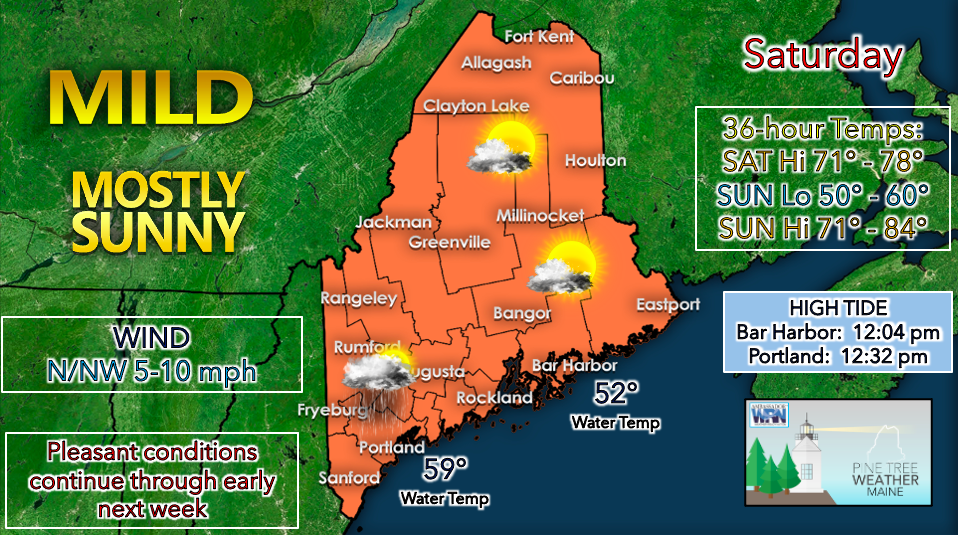
Saturday will feature mostly sunny skies and near-normal temperatures for much of the state. Elsa has tracked off the Gulf of Maine, giving way to clearer, drier conditions. A stray shower is possible during the afternoon due to cyclonic flow still remaining in the upper levels of the atmosphere, but this should be confined to the southwestern portion of the state. A HIGH SURF ADVISORY remains in effect until 11am for the coastal areas of Cumberland, Waldo, York, Knox, Lincoln, and Sagadahoc counties. The advisory continues until 2pm for Washington and Hancock counties. Elsa has churned up rough waters, leading to breaking waves of 5-9 feet. These conditions are dangerous for swimming and surfing and could cause beach erosion in certain areas. High temperatures on Saturday likely reach the mid 70s statewide. Skies are expected to be mostly sunny. Winds will be primarily from the north/northwest at 5-10 miles per hour. Some gustier winds upwards of 20 mph are possible during the morning hours but should calm down by early afternoon. Sea breeze does not appear to be a factor, so coastal locations should also see the 70s for a high. Overall, Saturday looks like a very pleasant day for most. A mostly dry night looks to be in store on Saturday as high pressure continues to build. Temperatures will likely fall to the 50s for a low. The southwest coast may be a bit milder in the lower 60s. The nice weather will continue on Sunday as strong upper-level ridging takes place over the eastern half of the country. High temperatures will likely be warmer than they were on Saturday. A cold front is expected to approach from the north on Sunday afternoon, bringing the potential for showers and thunderstorms for northern regions. The chance for precipitation will then come for areas further south and Downeast during the evening as the front tracks towards the Gulf of Maine. A pattern of warm, sunny mornings with afternoon showers and thunderstorms will be in store for the upcoming week. So far, significant rainfall does not appear imminent but locally higher amounts are always possible with strong passing storms. Be prepared to receive alerts and stay updated!
For more information in between posts, please follow Pine Tree Weather on Facebook and Twitter.
Thank you for supporting this community-based weather information source which operates by reader supported financial contributions. Stay updated, stay on alert, and stay safe! |
Mike Haggett
|


