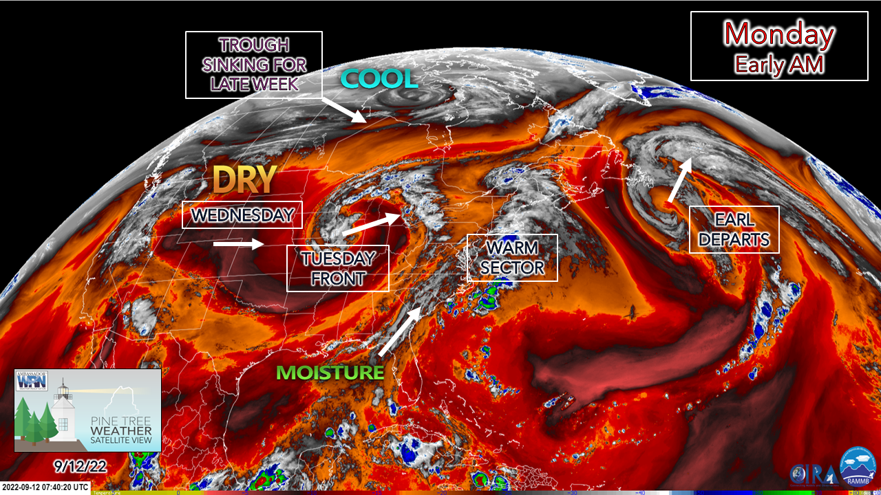
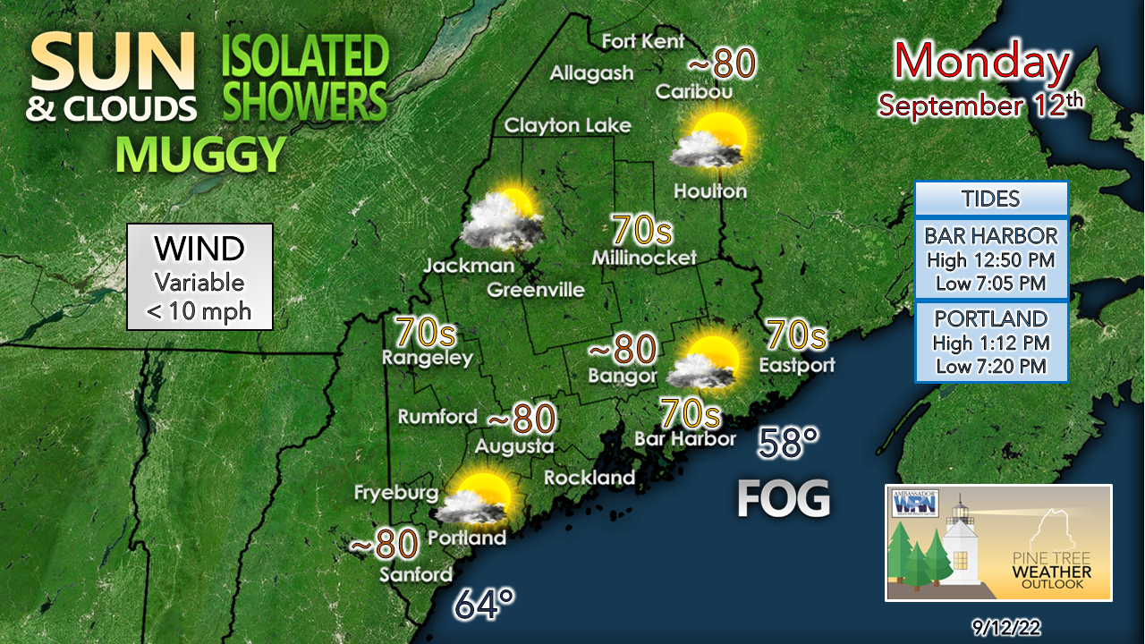
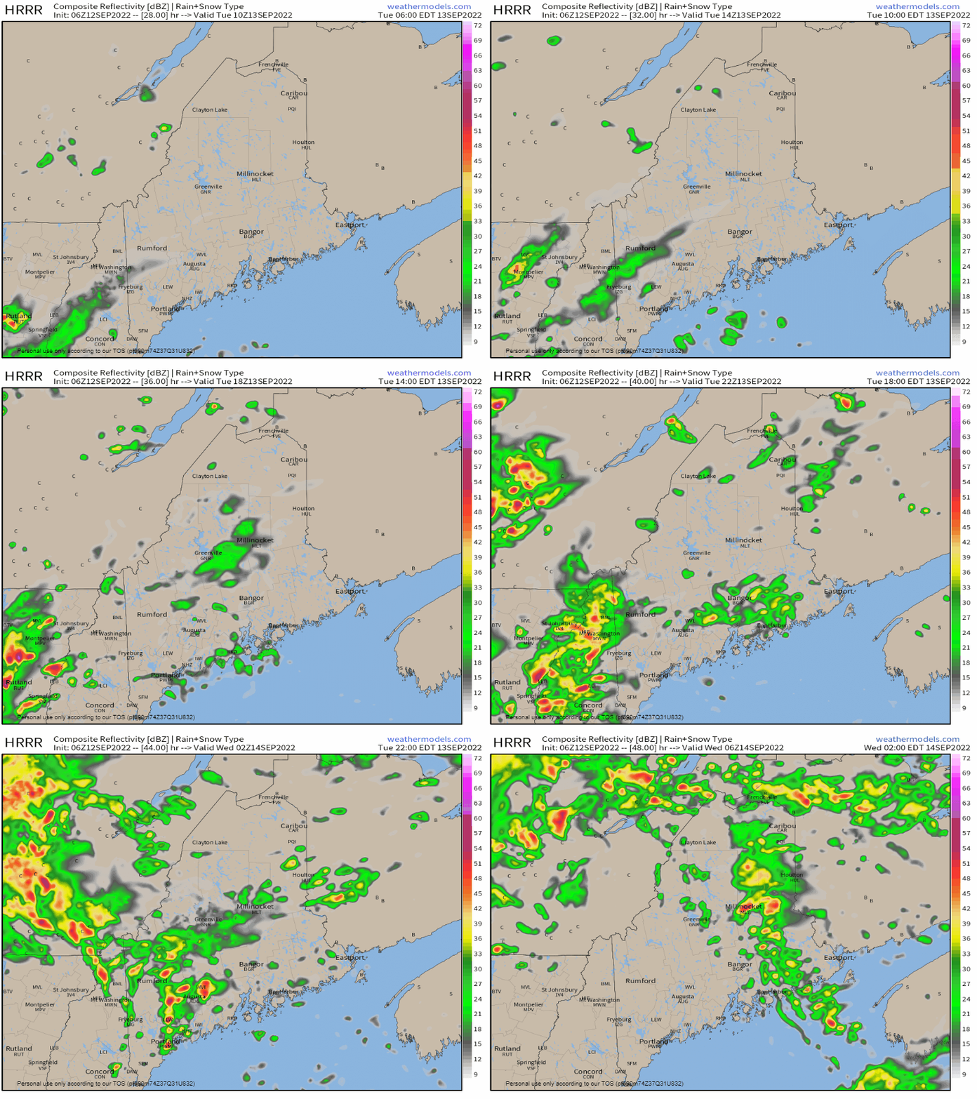
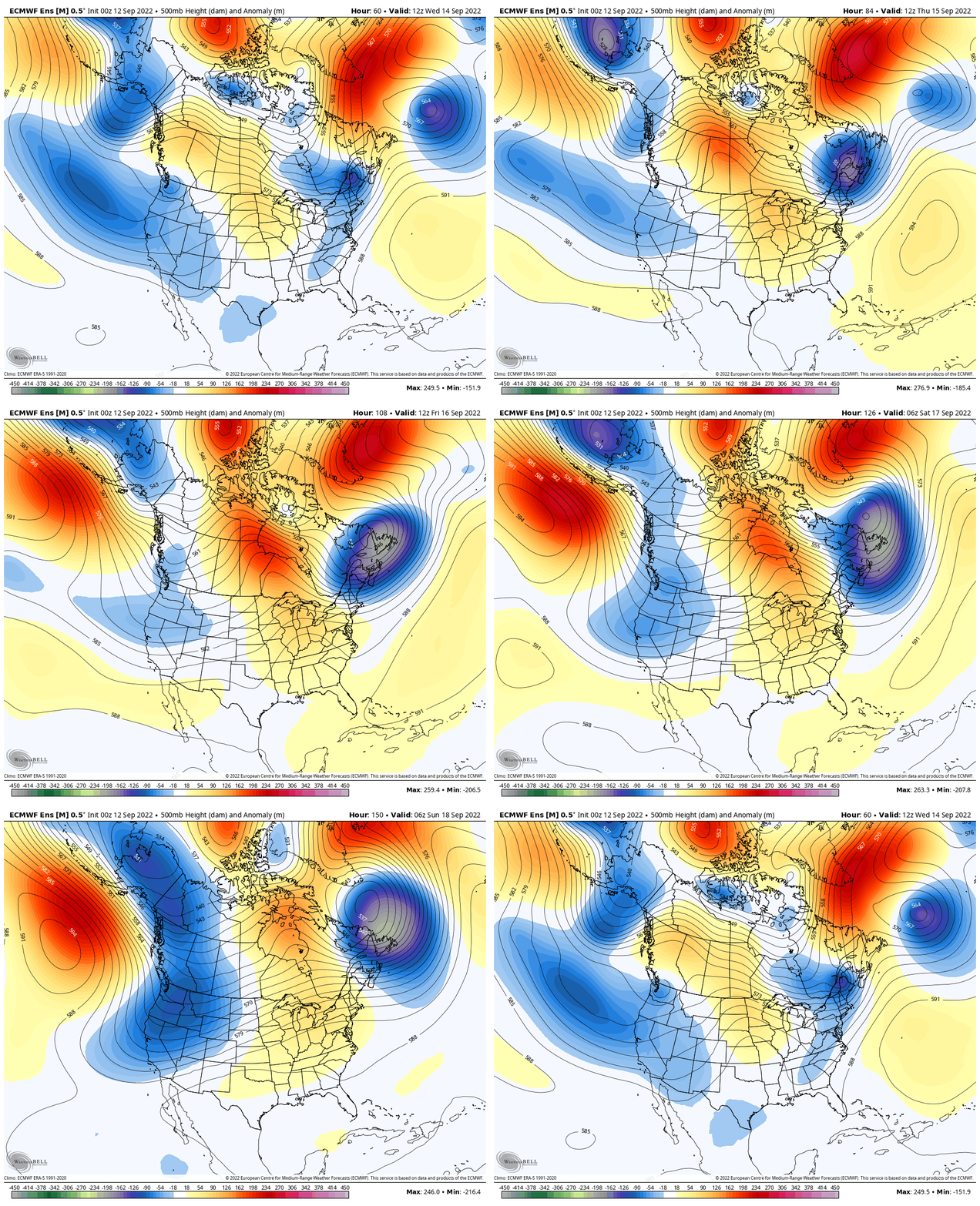
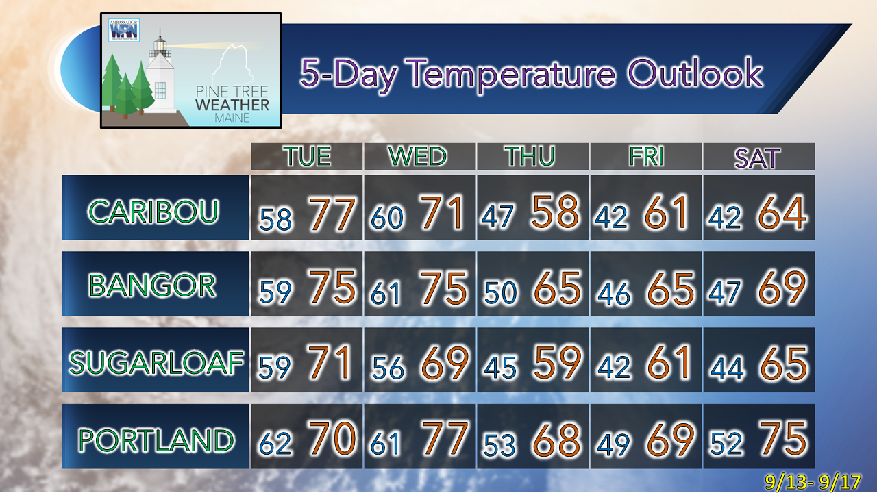
Best chance for rain for the week on TuesdayA look at the low-level water vapor image from 3:40 AM Monday shows all the players on the table for the pattern for the week. Maine is the peanut butter in the sandwich to start off with the region in the warm and muggy sector between a frontal boundary to the east that is ushering post-tropical storm Earl for Europe. An upper-low that is fizzling out over the Midwest is pushing a cold front towards the region for Tuesday. Drier and cooler air moves in for Wednesday and appears to stay with us through the remainder of the week. A bit humid but a fair day to start the weekBeing in the warm sector means temperatures make a run at the 80s where the sun makes an appearance over the north and the south. The western mountains over to Baxter and east may be dealing with more of a partial sun to cloudy affair which may keep temperatures down to upper-60s to low 70s there. Fog lurking off the DownEast shoreline may steal sunshine and warmth with little wind around to move the stable air. A sea breeze is possible over the southwest coast and MidCoast areas in the afternoon which will cause the mercury to fall there. An isolated shower or two may pop up mainly over the higher elevations as moisture increases aloft as the front to the west moves east. Showers and isolated thunder possible for TuesdayTuesday 6 AM to Wednesday 2 AM - Widely scattered showers are expected to start off Tuesday as the outflow ahead of the front moves into the region. More widespread showers along with the threat of a strong to severe storm are likely on Tuesday afternoon. The main wave of shower activity passes through Tuesday evening over western areas and early Wednesday over eastern areas as the front passes through the state The main threat with any isolated strong to severe storms that develop will be for damaging wind and heavy rain. Storm chances are likely to be cloud cover dependent, which initiates the rule, "if the sun is out, look out" through early evening. As the front passes through Tuesday night, a few non-severe storm rumbles are possible. This is another potluck rainfall event, and the last chance for liquid gold in any widespread manner with any confidence anytime soon. Outlook through the weekendWednesday 8 AM to Sunday 8 PM - Once the cooler, drier air moves in, the thought may come that summer is over, it's time to pull the air conditioners out and drag out the fall wardrobe. I wouldn't do that quite yet. Yes. as you will see below. we'll have a taste of early fall temperatures as the cool trough aloft hangs over us for the next several days. As the 500mb atmospheric steering level loop above indicates, a deep trough is expected over the west as we head into the weekend, which means a ridge builds in the east. That means we're not done with potential high temperatures in the 80s and muggy air just yet. As a recent reference, my weather station in Kennebunk recorded a warm spell September 20-24 in 2019 where the temperature was as high as 89° on the 23rd that year. While it may not get that warm, the indications is that summer isn't quite over yet. Thank you for supporting this community-based weather information source which operates by financial contributions from people like you. NEXT UPDATE: TUESDAY Stay updated, stay on alert, and stay safe! - Mike NOTE: The forecast information depicted on this platform is for general information purposes only for the public and is not designed or intended for commercial use. For those seeking pinpoint weather information for business operations, you should use a private sector source. For information about where to find commercial forecasters to assist your business, please message me and I will be happy to help you. |
Mike Haggett
|

