Pine Tree Weather
  • DISCUSSIONS
  • DONATE
  • WEATHER WALL
  • MAPS
  • RAIN OUTLOOK
  • SEVERE
  • MARINE
  • CPC OUTLOOK
  • Kennebunk
  • MY BIO
  • PTW IN MEDIA
  • OBSERVING WEATHER
  • INTERNSHIPS
  • INTERN ALUMNI
  • DISCUSSIONS
  • DONATE
  • WEATHER WALL
  • MAPS
  • RAIN OUTLOOK
  • SEVERE
  • MARINE
  • CPC OUTLOOK
  • Kennebunk
  • MY BIO
  • PTW IN MEDIA
  • OBSERVING WEATHER
  • INTERNSHIPS
  • INTERN ALUMNI

Scattered showers on Thursday, and a look into the Holiday weekend

6/30/2020

Comments


Wednesday: Warm with isolated showers

Picture
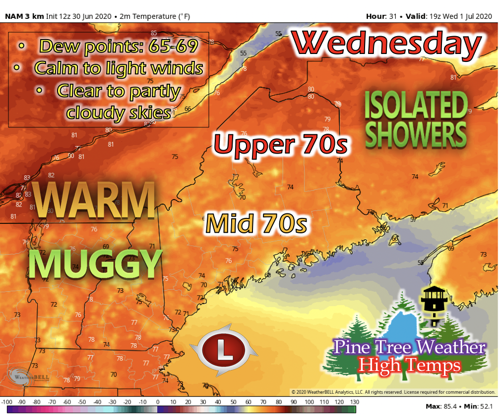
The low pressure system to the south of Maine will linger again on Wednesday, bringing isolated showers to southern portions of Maine. It'll be a little muggy, with dew points statewide ranging from 65-69. Northern areas of Maine will be in the upper 70s with small pockets reaching into the low 80s for high temperatures, and the rest of the state in the low to mid 70s. Winds will be calm to light and from the north. As the low pressure begins to linger away from the state, skies will begin to clear by the afternoon.
Picture
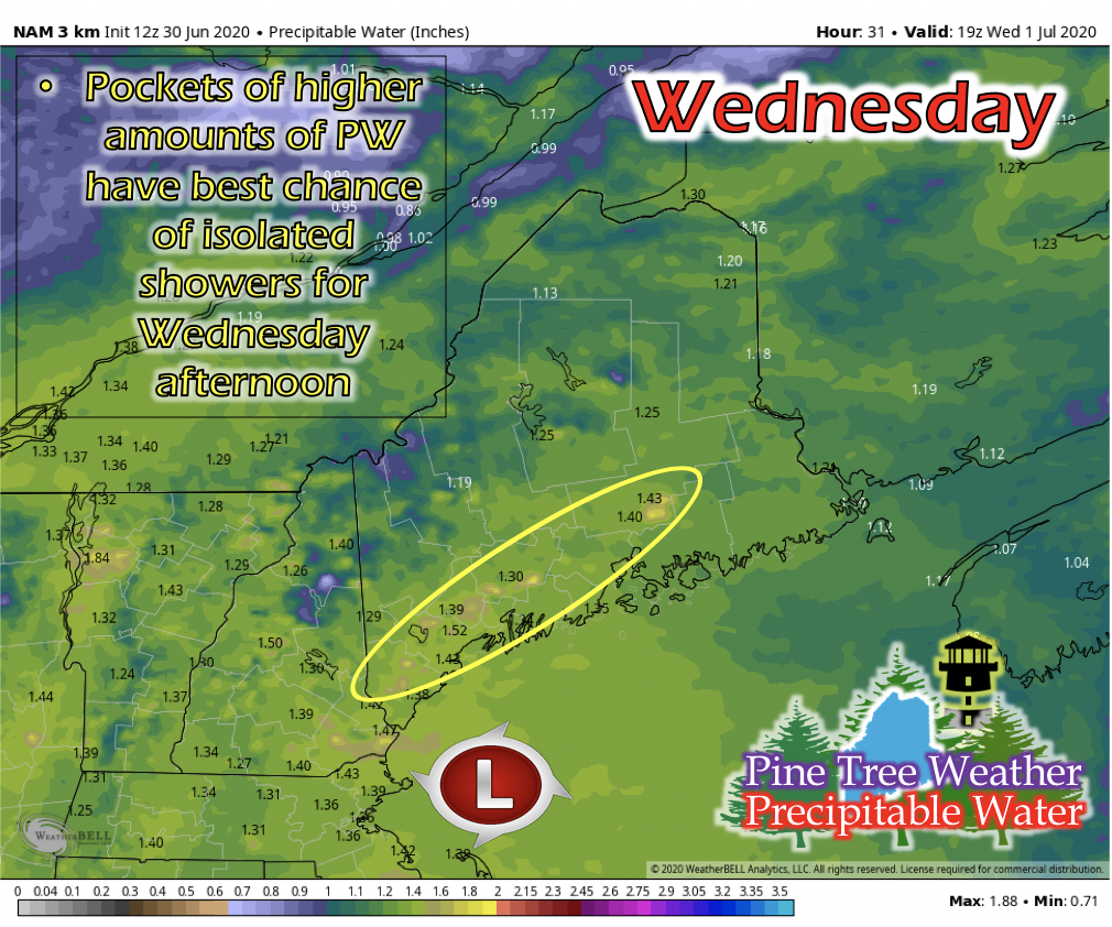
The image above displays precipitable water (PW), which is the amount of water vapor in the air above a specific point. In combination with lifting mechanisms and energy available in the atmosphere, it is potentially the amount of water it could rain in that spot. As this moderately weak low pressure begins to linger away, spots in the Portland and Mid Coast areas have a spike in PW, where there most likely will be isolated showers for Wednesday. Though, since there is little energy and the lifting mechanism is weak and moving away, these showers won't produce nearly as much as the PW value is, but the image helps with location of potential rain showers.

Thursday: Cold front swings in, bringing some scattered showers

Picture
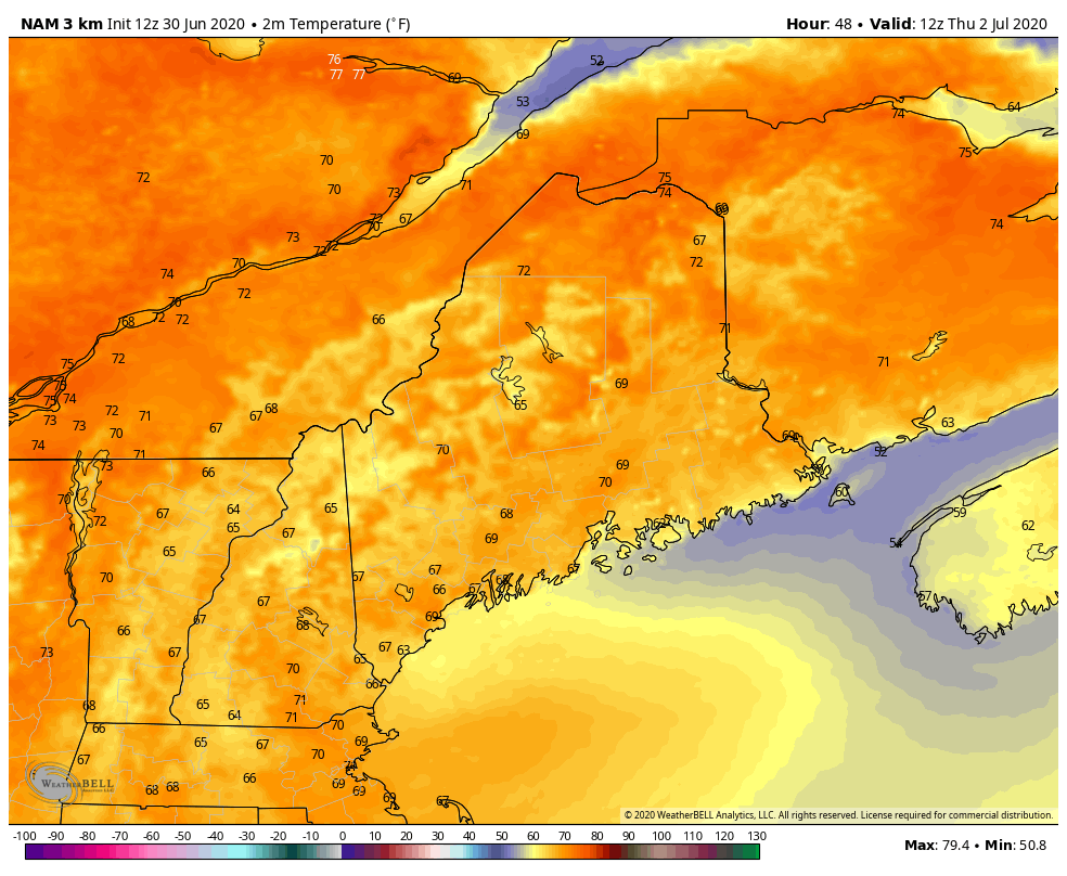
The GIF above runs from 7 AM to 7 PM Thursday. Thursday will begin warm and heat up into the low 80s by early afternoon. During mid-afternoon, a cold front will swing down from the north, cooling down the state into the low to mid 70s by late afternoon and evening.
Picture
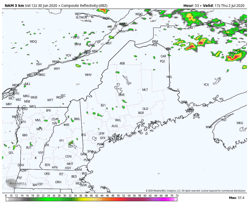
The GIF above runs from 12 PM to 7 PM Thursday. A cold front acts as a lifting mechanism, so as it pushes down into the state from the north, isolated and scattered showers and small thunderstorms are likely for mid to late afternoon. Statewide is susceptible to these scattered showers, so at the first sign of thunder, move indoors to prevent any lightning incidents, and check your local radar for exact location of any storm that develops near you.

Holiday Weekend Outlook

Picture
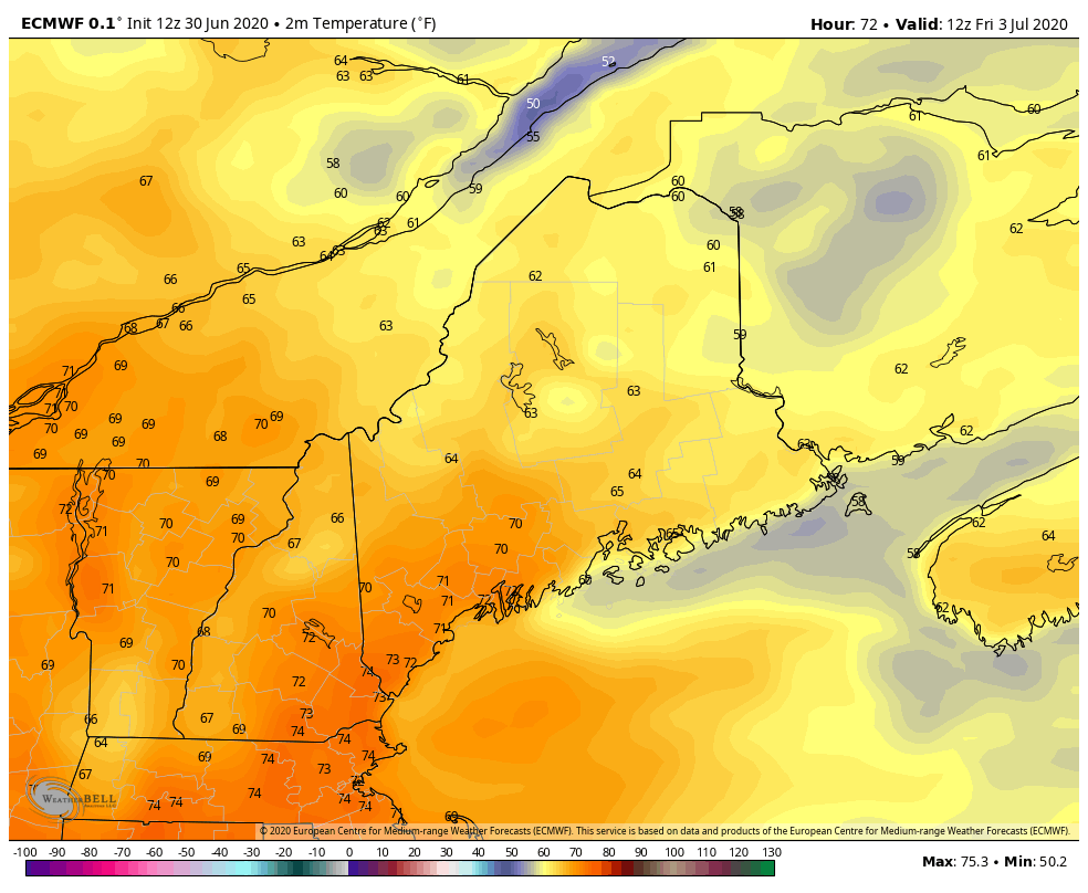
The GIF above runs from 7 AM Friday to 7 PM Sunday. As the Fourth of July weekend approaches, we can look at potential temperatures for Friday, Saturday and Sunday. Temperatures look pleasantly warm through the weekend; Friday in the mid to upper 70s, Saturday in the mid 70s to low 80s, and Sunday in the mid to upper 70s. There looks to be no significant precipitation for the weekend.

​​Help forecast verification, and stay informed!

Picture
mPINGers Wanted! Report your weather anywhere anytime anonymously and help improve forecast verification. No special training required. Download the mPING app and start reporting what you see from any location.  For more information, check out the mPing site. 

Picture
​Hiking, camping or boating this summer?
BE PREPARED WITH A
 NOAA Weather Radio.

​For $20-$40, it could provide important information to you when you need it. The weather bands are standard on most public safety scanners, and newer scanner models and weather radios can be programmed for auto alert.  Click here for more information.

Picture
► ► For the latest official forecasts, bulletins and advisories, please check in with the National Weather Service in Gray for western and southern areas, or Caribou for northern and eastern parts of Maine.

For more information, please follow Pine Tree Weather on Facebook and Twitter. 

Thank you for supporting this community based weather information source that is funded by your financial contributions. 

Stay updated, stay on alert, and stay safe!

Enjoy today!
​- Kaitlyn
Comments
    Picture

    Mike Haggett
    Kennebunk, ME

    Weather-Ready Nation
    Ambassador

    Certified Weather
    Forecaster
    Penn State '21

    American Meteorological Society

    National Weather Association
    ​
    ​SKYWARN-CWOP

    Matthew 19:26


    DONATE

    Picture
    Picture
    Picture
    Picture
    Picture

    Picture

    Picture

    Picture

    Picture

    Picture

    Picture

    Picture

    Picture

    Picture

    Picture

    Picture

    Picture


    Archives

    April 2025
    March 2025
    February 2025
    January 2025
    December 2024
    November 2024
    October 2024
    September 2024
    August 2024
    July 2024
    June 2024
    May 2024
    April 2024
    March 2024
    February 2024
    January 2024
    December 2023
    November 2023
    October 2023
    September 2023
    August 2023
    July 2023
    June 2023
    May 2023
    April 2023
    March 2023
    February 2023
    January 2023
    December 2022
    November 2022
    October 2022
    September 2022
    August 2022
    July 2022
    June 2022
    May 2022
    April 2022
    March 2022
    February 2022
    January 2022
    December 2021
    November 2021
    October 2021
    September 2021
    August 2021
    July 2021
    June 2021
    May 2021
    April 2021
    March 2021
    February 2021
    January 2021
    December 2020
    November 2020
    October 2020
    September 2020
    August 2020
    July 2020
    June 2020
    May 2020
    April 2020
    March 2020
    February 2020
    January 2020
    December 2019
    November 2019
    October 2019
    September 2019
    August 2019
    July 2019
    June 2019
    May 2019
    April 2019
    March 2019
    February 2019
    January 2019
    December 2018
    November 2018
    October 2018
    September 2018
    August 2018
    July 2018
    June 2018
    May 2018
    April 2018
    March 2018
    February 2018
    January 2018
    December 2017
    November 2017
    October 2017

Proudly powered by Weebly