
Summer is back to simmer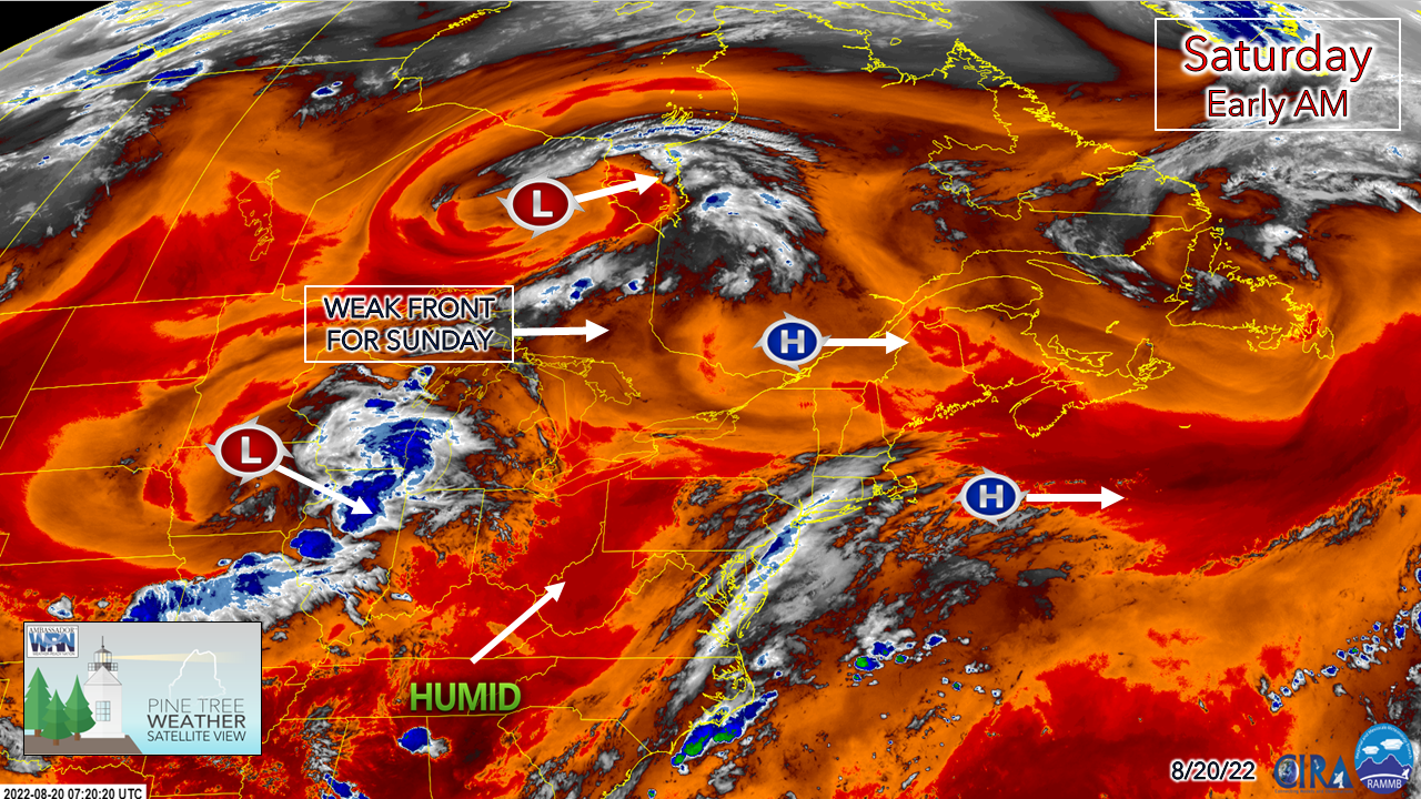 On Friday, my CWOP station in Kennebunk recorded a high of 90°, which made that the thirteenth time since May 30th eclipsed that level, tied the 2021 mark for the same number, but is currently two short of 15 set in 2020. It's also the 51st time that the high was ≥ 80°, which is 5 short of 56 times set in the past two years. Looking at the forecast and the longer-term outlook, I see a solid chance that the number of both 80° and 90° days will exceed the levels established in the past two years. Through August 18th, Portland and Bangor are the 7th warmest and Augusta is the 9th warmest overall month to date. Looking at potential high temperatures through the next week, I see no real cooling of impact, and expect the rankings to climb as we head into the final stretch of the month. All this said, I do not expect any aggressive heat like what was seen earlier in the month during the 5-day heatwave. Dew points appear to meander between tolerable (60-64°) to uncomfortable (65-69°) through the week ahead, but swampy (70°+) levels appear to stay away outside of a short spike here and there. With the heat comes the risk for showers and storms, and those chances increase through midweek. A warm Saturday with a risk of an isolated shower 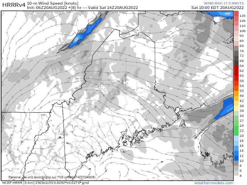 Saturday 10 AM to 9 PM - A look at the 10m wind speeds here shows the sea breeze picking up around noon time. With the uptick in dewpoints with the onshore flow and temperatures well into the 80s if not 90° by then, this set up pops some popcorn cumulous clouds which may look like could produce a shower or two. While the threat of a thunderstorm is unlikely, I've seen these sea breeze fronts make a fool out of me in the past, so I won't rule out the potential of a renegade pop-up. As the sun sets and the surface cools, that mitigates the chances for showers heading into the overnight. 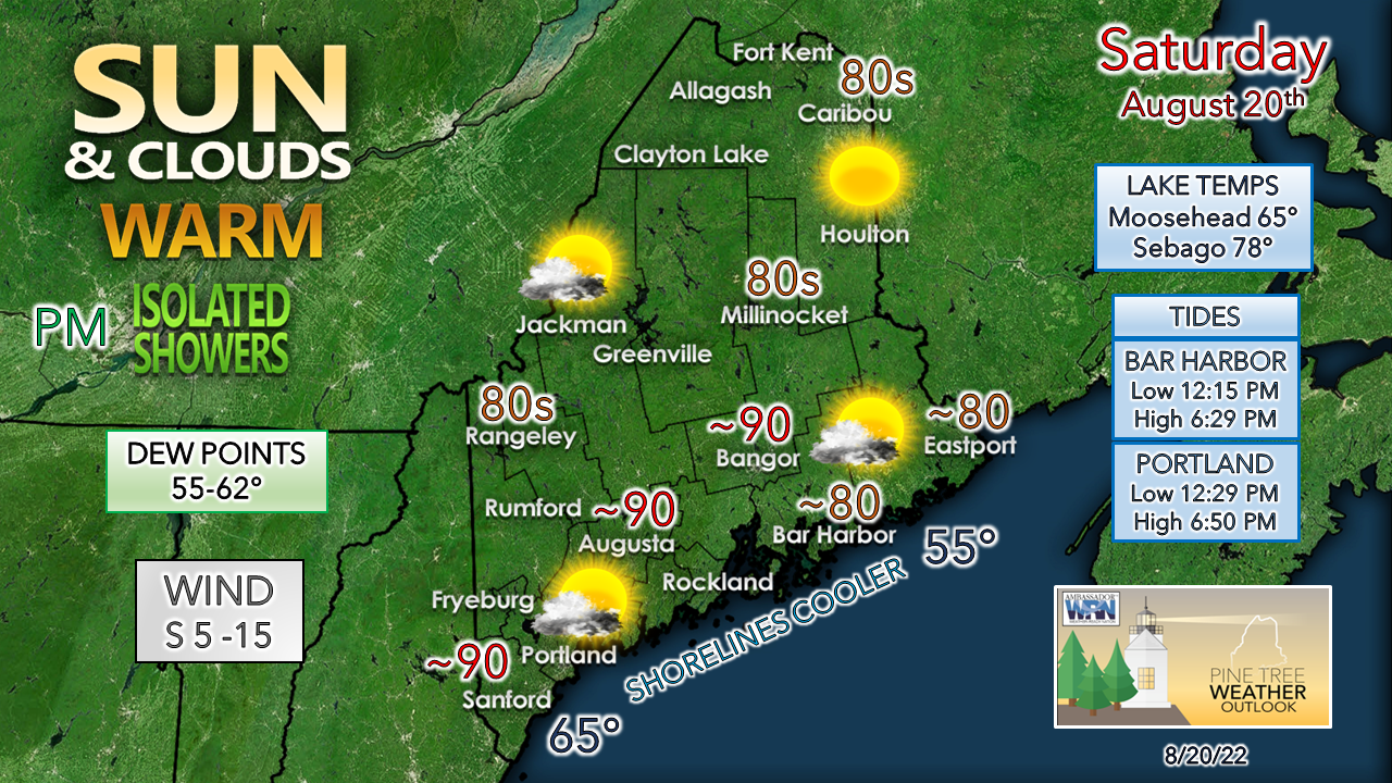 If you are headed to the ocean, it will be a 10/10 beach day. If you can find a place to park, there will be plenty of room to perch. If you are headed to Sebago or any other lake over the interior from the foothills south, just watch out for that pop-up shower which might dampen your late afternoon grilling. Chance for an interior shower / storm for Sunday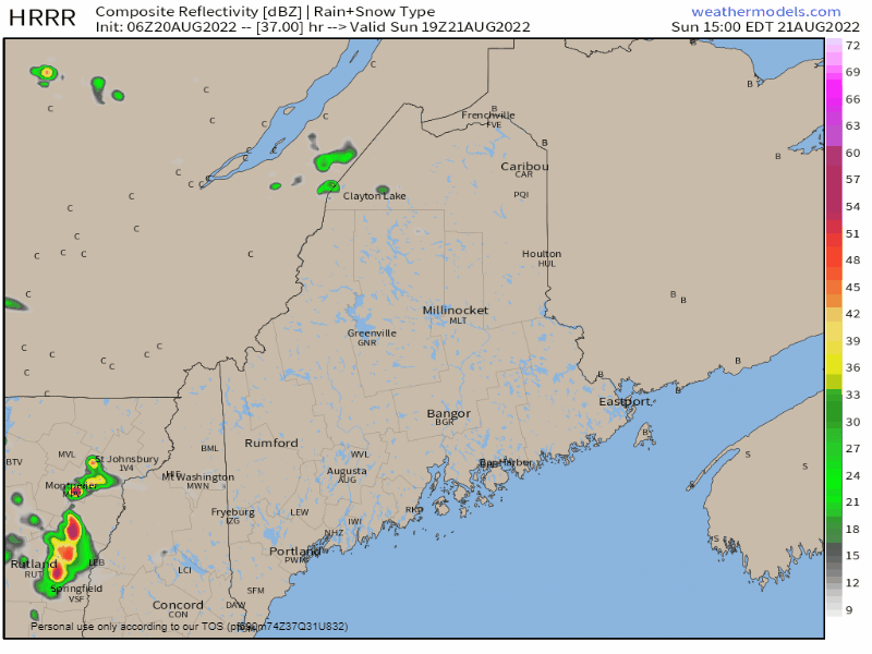 Sunday 3 PM to Monday 2 AM - A weak cold front approaches the region during the day. Folks in the western foothills and mountains upward to the north should stay mindful of the threat of showers and storms from late afternoon into the evening. Showers are possible in the overnight hours into Monday morning as the front slides through. Outlook through midweek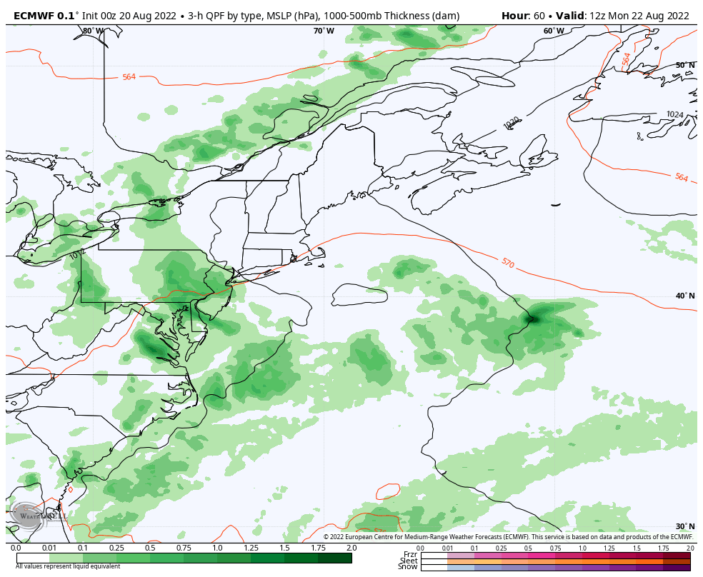 Monday 8 AM to Thursday 8 AM - A trough digs in south of the Great Lakes as a sub-tropical ridge builds over the northeast. This puts the squeeze play on over the region as moisture pumps in from the southwest and brings the risk for showers and thunderstorms through Wednesday. The Weather Prediction Center in their Day 3 Outlook (time sensitive) has the region at marginal risk of flash flooding from localized downpours. Showers and storms will be of the potluck variety bringing potential for some localized needed rainfall Monday night into Tuesday. The threat continues for showers and storms into Wednesday. Temperature outlook through ThursdayCaribou's average high for August 20th is 75° with an average low of 54°. For Portland, 79° and 60°. Temperatures are expected to be above normal overall through the period. 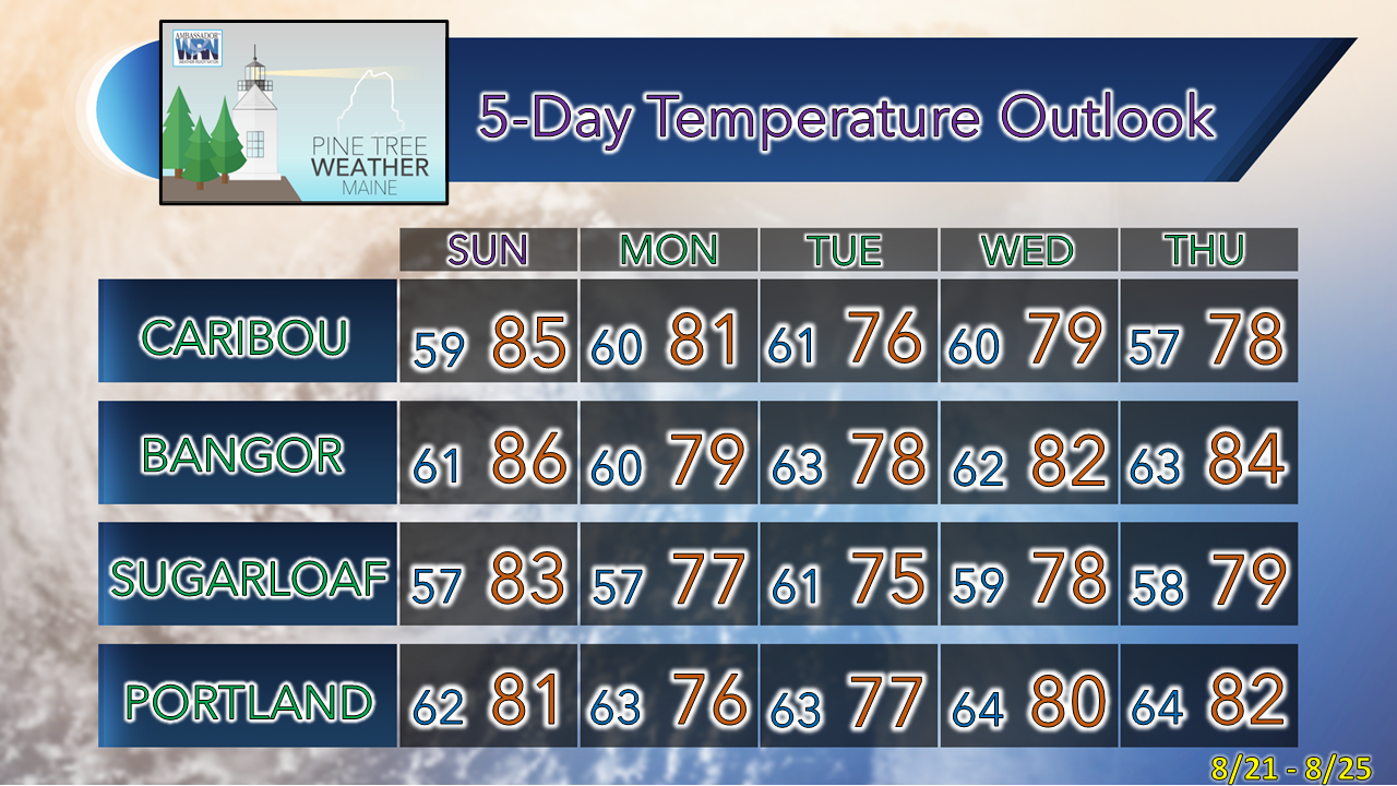 Thank you for supporting this community-based weather information source which operates by financial contributions from people like you. NEXT SCHEDULED POST HERE MONDAY Stay updated, stay on alert, and stay safe! - Mike NOTE: The forecast information depicted on this platform is for general information purposes only for the public and is not designed or intended for commercial use. For those seeking pinpoint weather information for business operations, you should use a private sector source. For information about where to find commercial forecasters to assist your business, please message me and I will be happy to help you. |

Mike Haggett
|


