Temperatures rise above freezing for most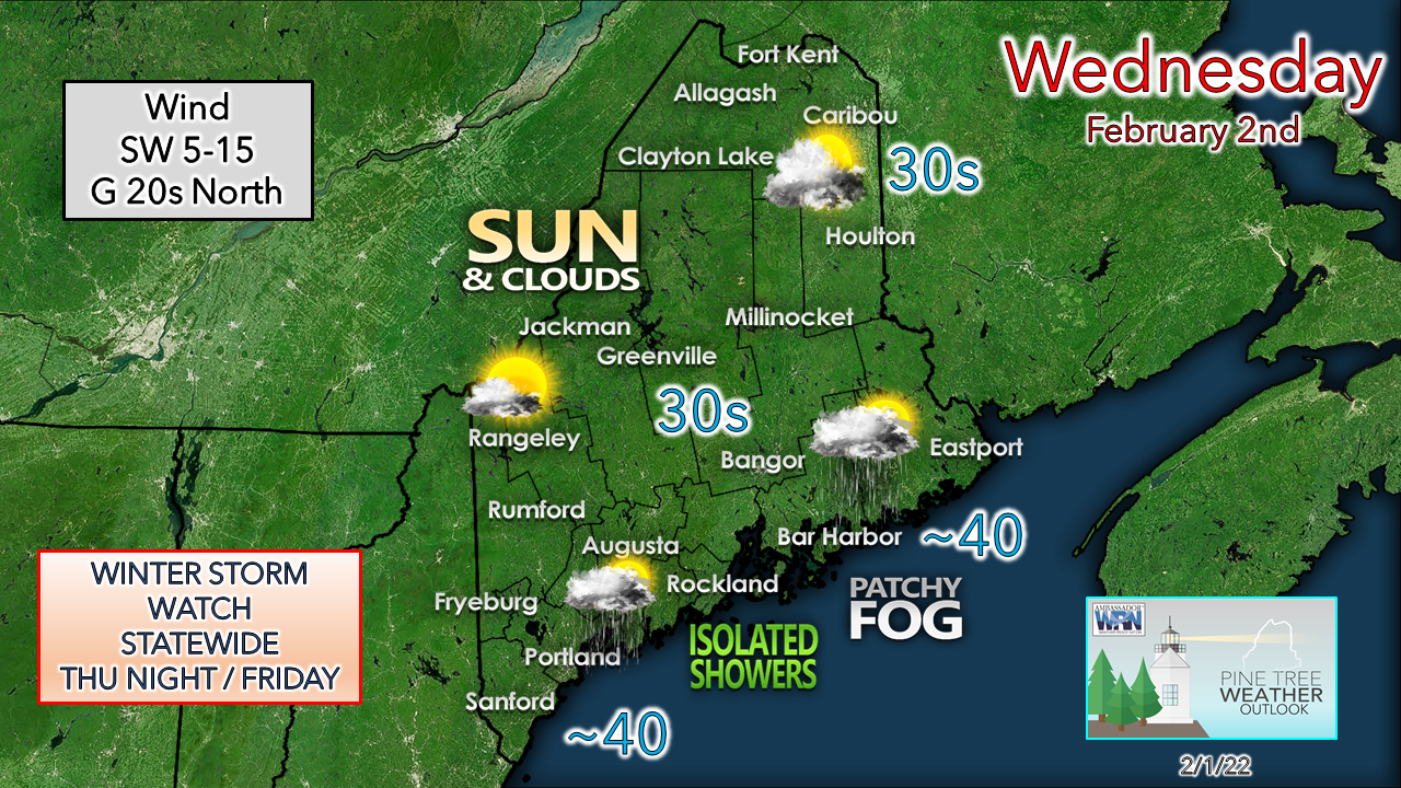 This is a great day for the ski hills in the western mountains as that is the region expected to see the most sun. High pressure to the northeast slowly moves eastward. A southwest flow pumps the warmer air into the region. The coastal plain could see some scattered rain or snow showers Wednesday morning, then scattered rain showers or drizzle with patchy fog developing toward evening and into the night. Northern areas are the breeziest as the high offshore moves east. A couple of days of storminess to wrap up the week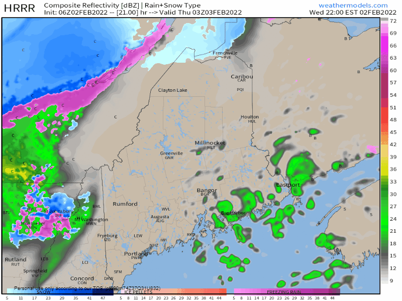 Thursday Midnight to Friday Midnight - A longwave cold front begins its slow decent from the northwest early Thursday morning. Moisture from the southwest rides up along it. The north and the mountains appear to escape the plain rain by-in-large but may start off with a light round of freezing rain and /or sleet which appears short lived with little to impact. Those areas should flip to snow Thursday morning. As the front continues to move slowly to the southeast, temperatures begin to fall. Areas over the foothills on up into southern parts of The County and the coastal plain that see melting can expect it to freeze up. Add snow on top of that ice, roads become slick. Pending on the frequency of the snow, this could be a challenge for road crews as the benefit of salted roads washes away with the rain and melting. This becomes more of a travel issue heading into Thursday night. 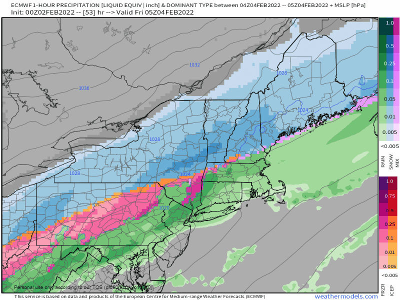 Midnight Friday to Midnight Saturday - This is the time period that contains the most questions as I monitor it for a couple reasons. First, will it sag further enough to the south to keep the sleet and freezing rain for the coast to a minimum? Second, when will the axis of the heaviest precipitation come through and in what form? This is a flat system as the isobars indicate, but low pressure that forms along it could bring enhancement for precipitation in close proximity to the boundary. There is an element of surprise here for the coast as a result. While those questions get figured out, what is important to know is travel is likely to be slow going and slick for both the morning and evening commutes as the storm is not expected to wrap up until Friday night for western, eastern and southern areas, and early Saturday for The County. 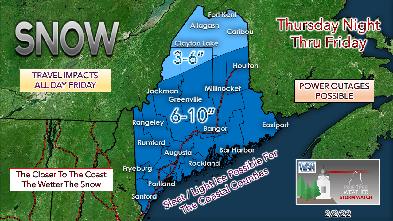 I am playing a bit on the conservative side with snowfall amounts until I start seeing answers to those questions. The idea still remains that the coast gets 1"+ of liquid equivalent out of this, so the snow is likely to stick, and ratios are likely to get lower, meaning more sloppier. With the southward trend, the slop factor is not as much of a concern as it was for the western foothills and eastern interior areas northward. Coastal areas need to be concerned about some wind. While the system is flat, low pressure that forms along the front could kick up the northeasterly breeze with gusts in the 20-30 mph range. If snow is sticking, power outages are certainly possible. Expect more fine tuning on the forecast to come.  Temperature outlook through MondayAfter the storm passes, it's back to the basement for temperatures through the weekend. Good news for skiers is there is little to no wind over the period, which makes conditions excellent. The idea of a coastal storm to start next week has faded for now, with a warmer trend on the way as the week unfolds. 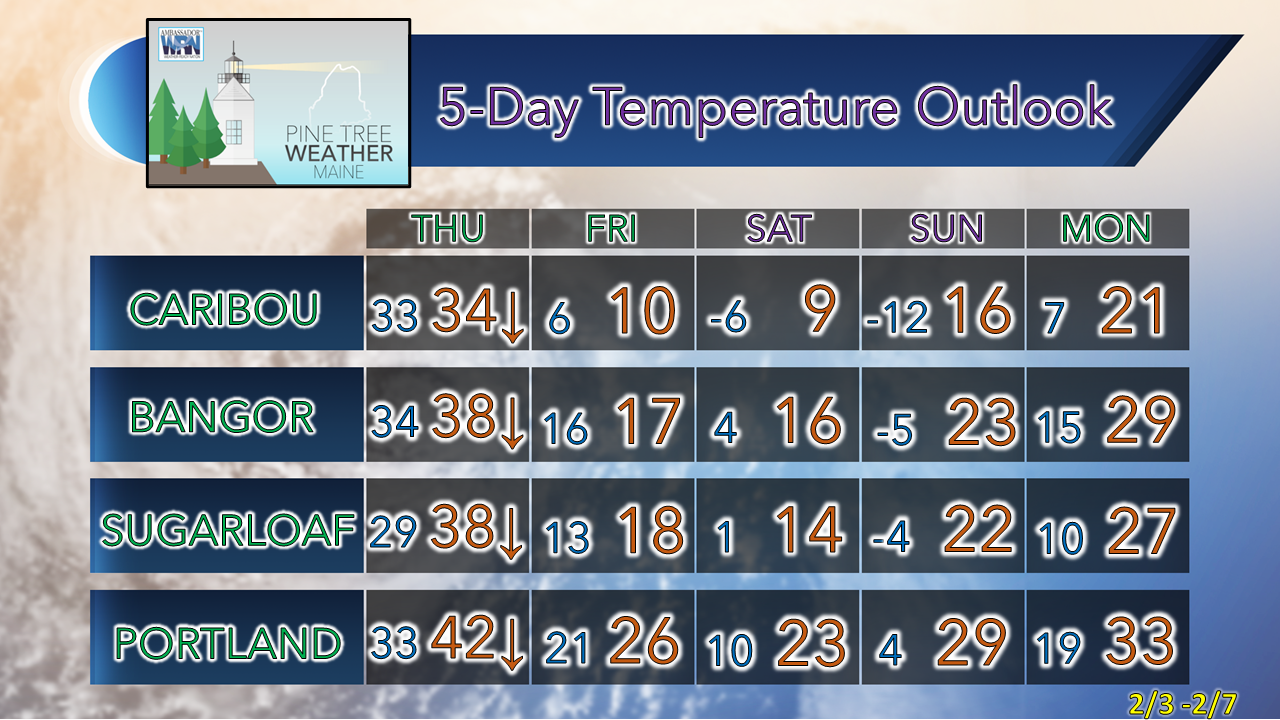 Rain with a Temperature Near Freezing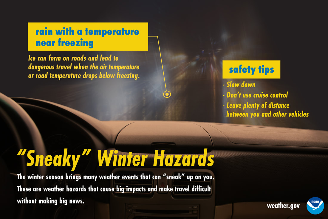 Rain may appear less of a winter driving hazard than snow, but when temperatures are near freezing, that’s not the case. Ice can form quickly and make roads slick. In these conditions, slow down, don’t use cruise control, and keep plenty of distance between you and other vehicles. Don’t let this winter hazard sneak up on you! Be prepared to receive alerts and stay updated!
 For more information in between posts, please follow Pine Tree Weather on Facebook and Twitter. Thank you for supporting this community-based weather information source which operates by reader supported financial contributions. Thank you as always for your support! - Mike NOTE: The forecast information depicted on this platform is for general information purposes only for the public and is not designed or intended for commercial use. For those seeking pinpoint weather information for business operations should use a private sector source. For information about where to find commercial forecasters to assist your business, please message me and I will be happy to help you. |

Mike Haggett
|