
Pattern becomes more active through midweek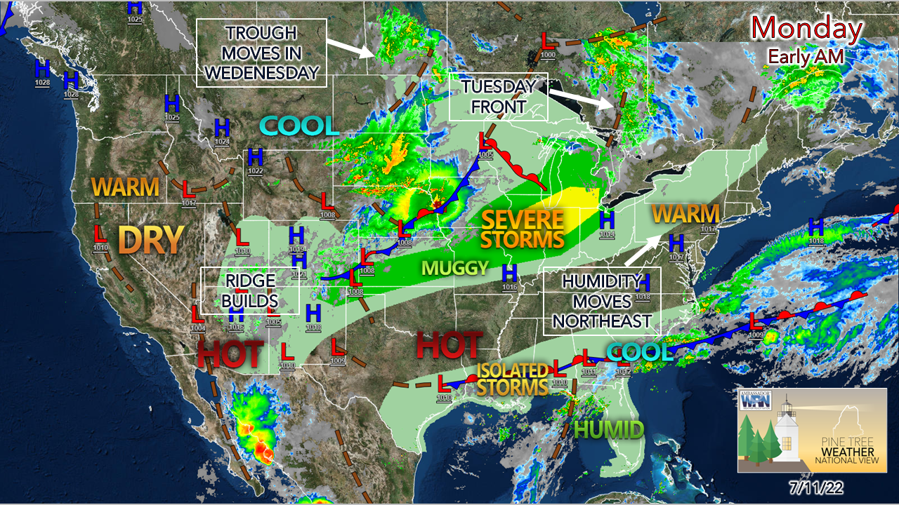 High pressure south of Nova Scotia slides east Monday, A southwesterly flow develops and brings humidity into the region for Tuesday. An advancing cold front from the northwest increases the risk for showers and storms Tuesday afternoon. An upper-level trough slides in for Wednesday, bringing the isolated risk of showers and storms to the mountains and north for Wednesday. There is uncertainty as to where the trough boundary is set up, which keeps the chance for showers and perhaps a storm for Thursday into Friday. A few showers for the north on Monday Monday Noon to Tuesday Midnight - Outflow of warm air ahead of the approaching frontal boundary may bring some isolated shower activity to the north in the afternoon into early evening. I can't rule out a pop-up sprinkle or light shower for the western mountains later in the afternoon into the overnight. Isolated shower activity continues for the north country through Tuesday morning. 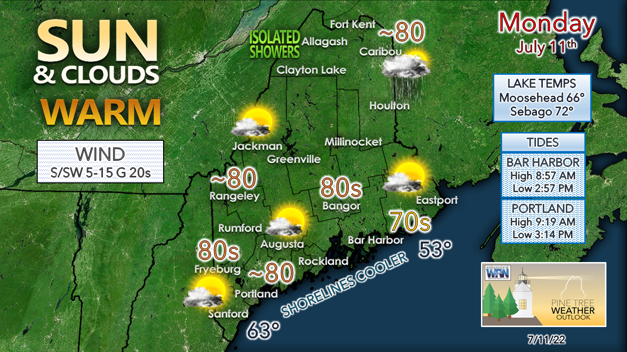 The amount of cloud cover and shower activity will dictate the high temperature for the crown of the state. Most areas away from the shorelines east of Portland hit 80° for the high point of the day. Dew points stay on the dry side until Monday night when they rise ahead of the approaching front. Expect a muggy start to Tuesday in most areas. The tides are near perfect for the beaches of the southwest coast with lows in the mid-afternoon but expect it to be breezy. Storm threat for Tuesday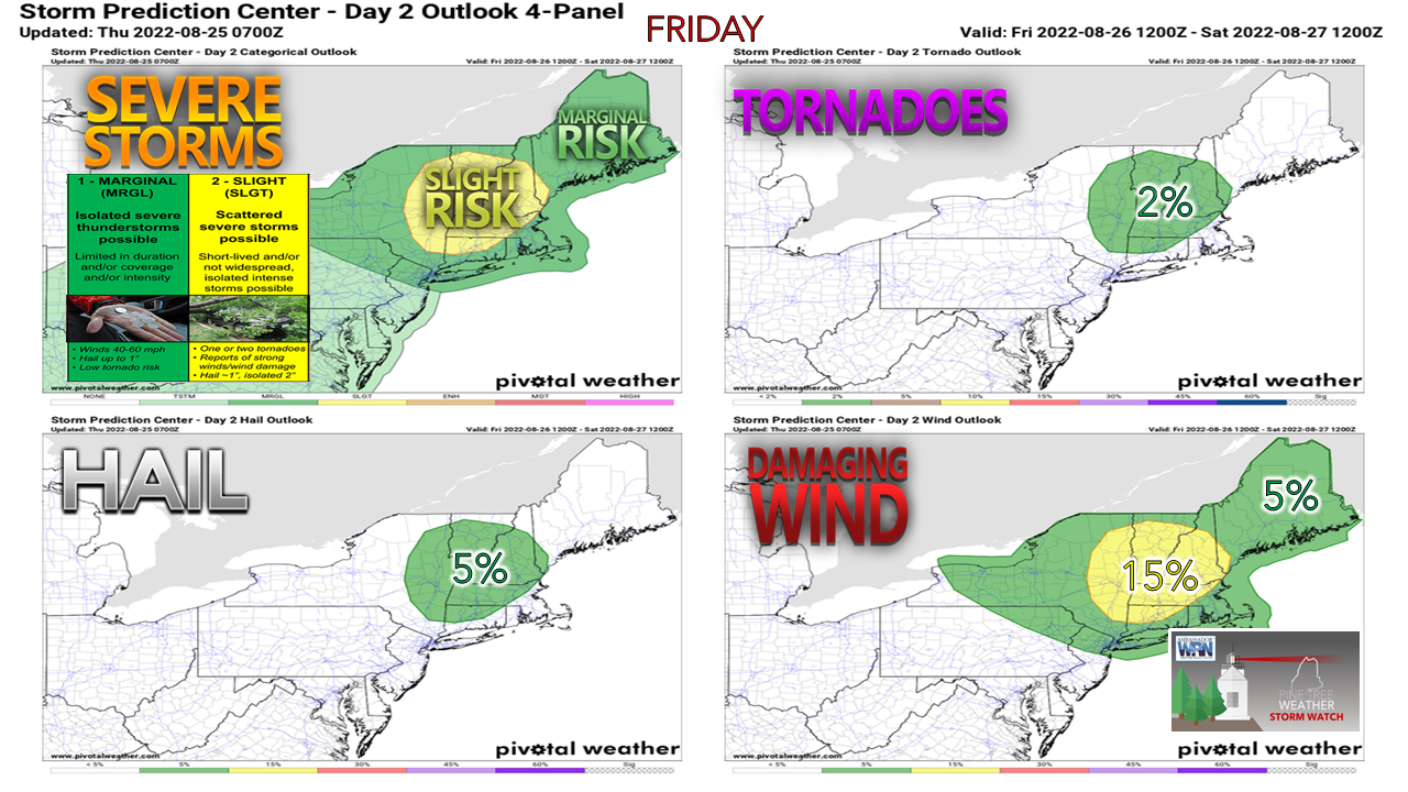 While this Day 2 Outlook (time sensitive link) appears to be a bit concerning from the Storm Prediction Center, it will depend on cloud cover and timing. It is important to know that these threats exist, but whether they materialize may not be known until Tuesday as the day unfolds.  Tuesday 6 AM to Wednesday Midnight - Showers working through the area in the morning and early afternoon may generate cloud debris which could diminish the threat for severe potential. For now, the short-term ideas indicate the sky clears out enough to generate strong to severe storms in the afternoon. If that happens, it could get rough in spots. There could be some training of storms that would cause localized flash flooding. With cold air moving in aloft, there comes the risk of hail. to generate. A strong low-level jet could produce enough spin to bring the risk of tornadic activity, and/or the threat of damaging wind. Again, this is a wait and see situation. For those enjoying the outdoors, it would be wise to stay on alert, have multiple ways to receive alerts, which should include a NOAA weather radio, and stay updated on the forecast. Temperatures and outlook through SaturdayThe next chance for showers and storms at this point comes Thursday into Friday. A weak ridge moves in for Saturday which gives the region a dry day. A cold front approaches on Sunday, which may bring a shower chance to the mountains and north to wrap up the weekend. There is uncertainty with the extended outlook, stay tuned for updates as time arrives. 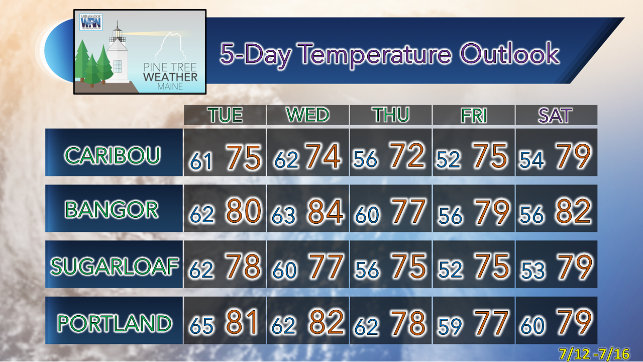 Thank you for supporting this community-based weather information source which operates by financial contributions from people like you. Stay updated, stay on alert, and stay safe! - Mike NOTE: The forecast information depicted on this platform is for general information purposes only for the public and is not designed or intended for commercial use. For those seeking pinpoint weather information for business operations, you should use a private sector source. For information about where to find commercial forecasters to assist your business, please message me and I will be happy to help you. |

Mike Haggett
|


