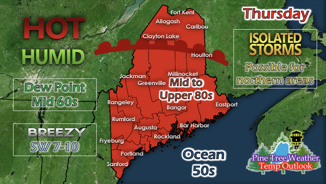
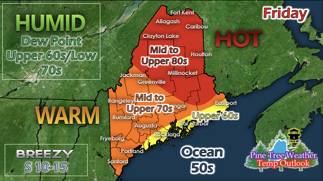
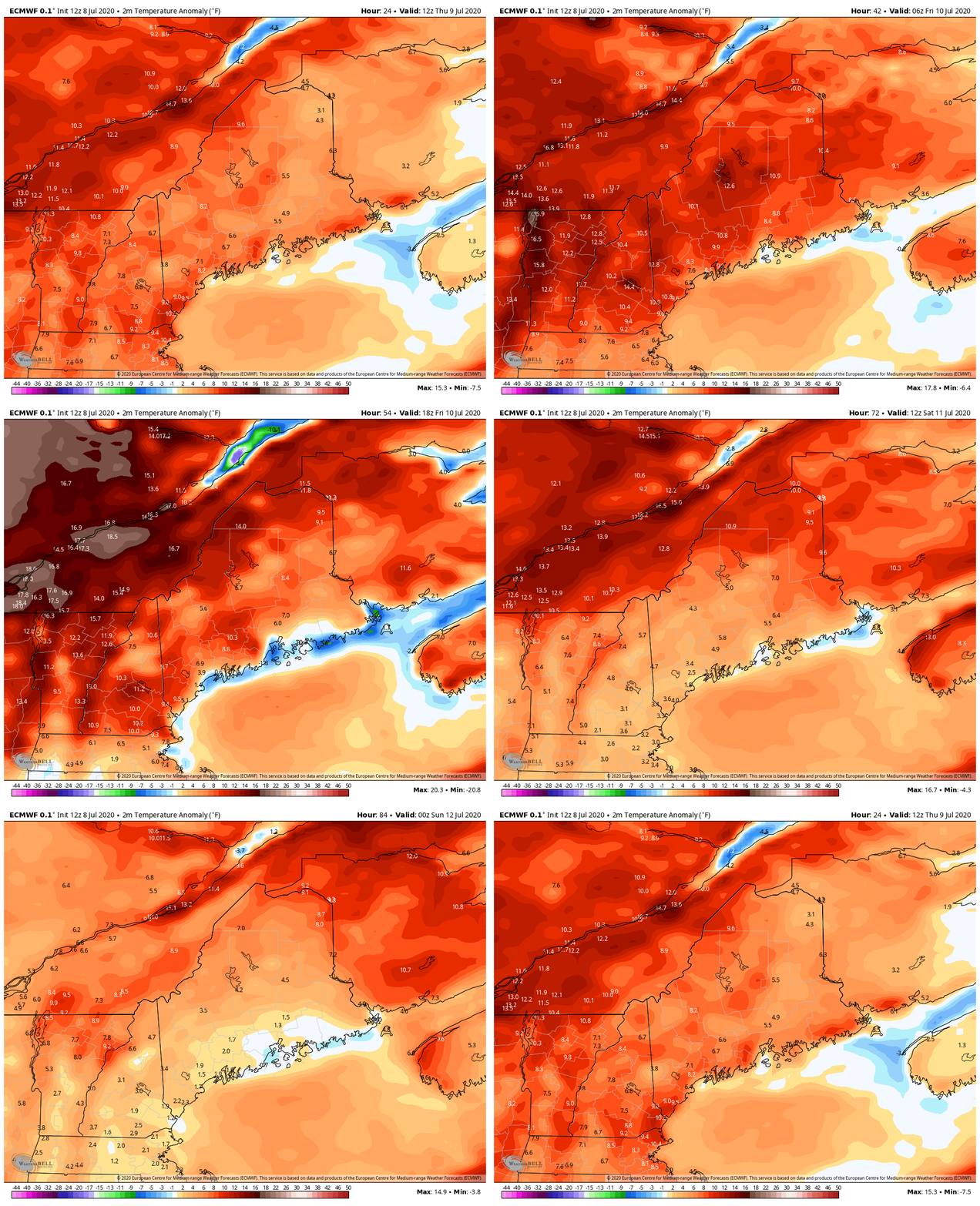
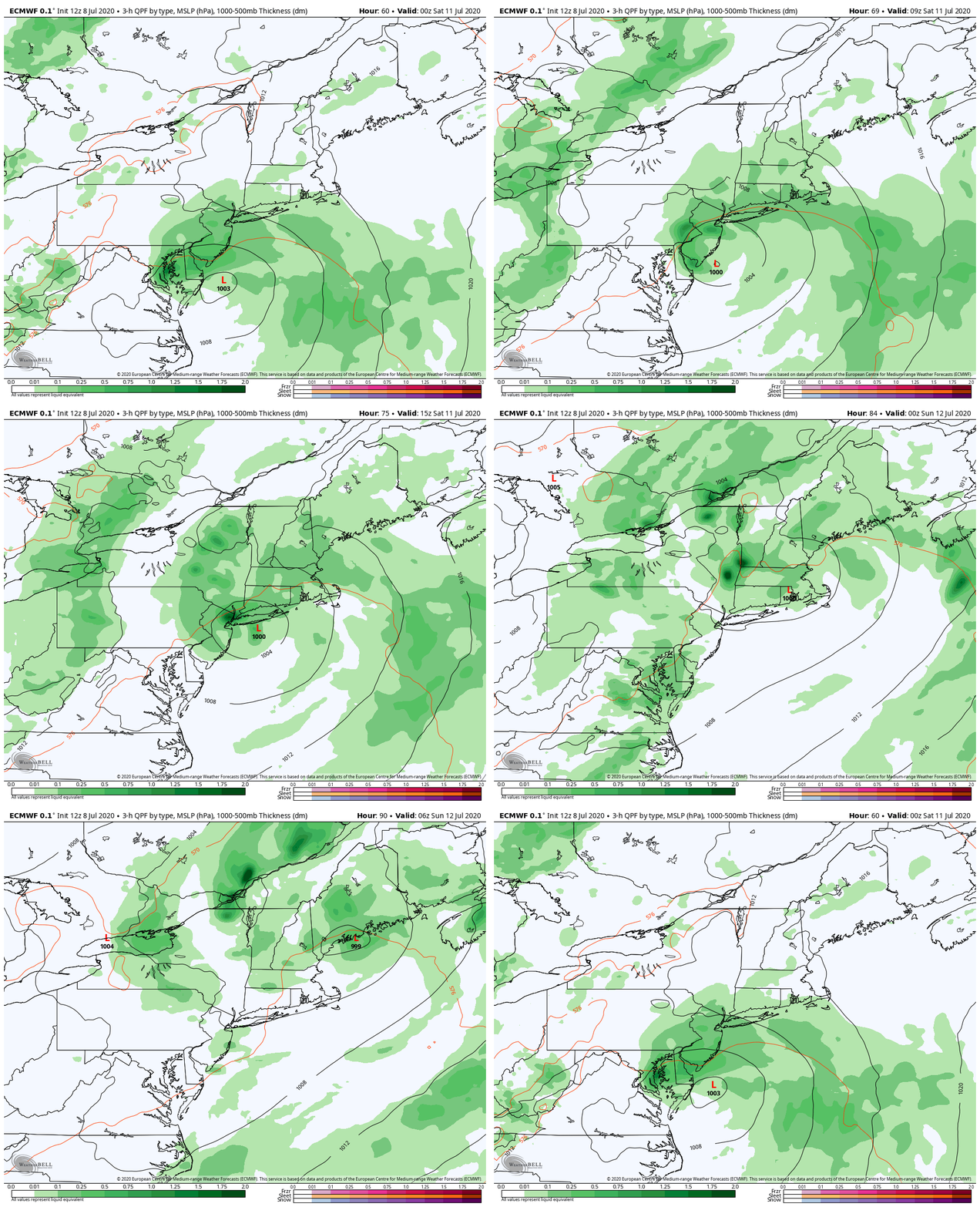
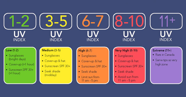
Thursday: Statewide hot temperaturesThursday is looking hot statewide with temperatures in the mid to upper 80s. Dew points are in the mid 60s, so the outside feel may be in the upper 80s. A weak warm front from a pre-existing low pressure that is west of Maine (and will not collide with the state) will help initiate some afternoon thunderstorms for the Caribou and northern areas of Maine. Thursday morning will be cloudy, but most clouds will dissolve by the afternoon and the sun will come out. Friday: Hot and humidAir with increased moisture from the Gulf of Maine will increase dew points into the upper 60s and low 70s. Parts of central Maine will feel uncomfortable when going outside, as most relative humidity values are in the mid to upper 90% and dew points around the low 70s. Southerly winds keep the coastal areas of Mid Coast and Down East slightly cooler, but may still be muggy. Northern areas of Maine will also feel uncomfortable the increased temperatures in the mid to upper 80s and dew points in the upper 60s. Temperature AnomaliesThe GIF above runs from 8 AM Thursday to 8 AM Sunday and shows projected temperature anomalies. As much as it may feel like it, Maine isn't technically under a heat wave under certain criteria. An area must be 9 degrees above average maximum temperature for 5 consecutive days. Some areas have been dancing around the criteria, but there are some days where there are some holes and the anomaly is only 5 degrees above average. What makes this week feeling miserable is the relative humidity. It feels sticky and muggy and humid because of the increased moisture in the air thanks to the southerly winds bringing air from the tropics and Gulf of Maine. If the model run above verifies and this does happen, this week may be a heat wave, but only time will tell. Weekend RainThe GIF above runs from 8 AM Saturday to 8 PM Sunday of this weekend, and shows 3-hour QPF (liquid precipitation). This long-range model picks up this low pressure system well and displays key characteristics and confidence you'd see in short-range models, which increases my confidence for some rainfall and thunderstorms on Sunday. This shows a 3-hour liquid precipitation rainfall, so this event likely won't be widespread and more isolated or scattered showers and storms. This precipitation will also help lower temperatures for the southern areas of Maine. UV Index SafetyA common summer aspect we often forget about is the UV Index. UV Index is the strength of the sun's rays at a particular time of day. The higher the UV Index, the more protection you need against the sun. You can easily find the UV Index any time from your smartphone's weather app or simply searching "(Location) UV Index" into a search engine online. Utilize the graphic above to take the necessary precautions before heading outside in the summertime heat. Help forecast verification, and stay informed!
For more information, please follow Pine Tree Weather on Facebook and Twitter.
Thank you for supporting this community based weather information source that is funded by your financial contributions. Stay updated, stay on alert, and stay safe! Have a great day! We're halfway through the week! - Kaitlyn |
Mike Haggett
|

