Tuesday: Warm temperatures, feels muggy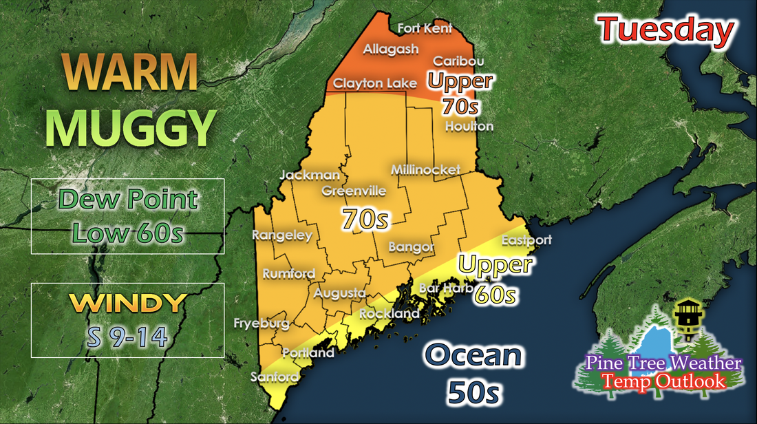 As the ridge begins to build west of Maine, the oncoming warm front from a low pressure system brings southerly winds and moisture from the south. Dew points increase into the low 60s, making the air feel muggy. Across the coast will stay in the mid to upper 60s while inland is in the 70s. Wednesday: Getting warmer, scattered showers and storms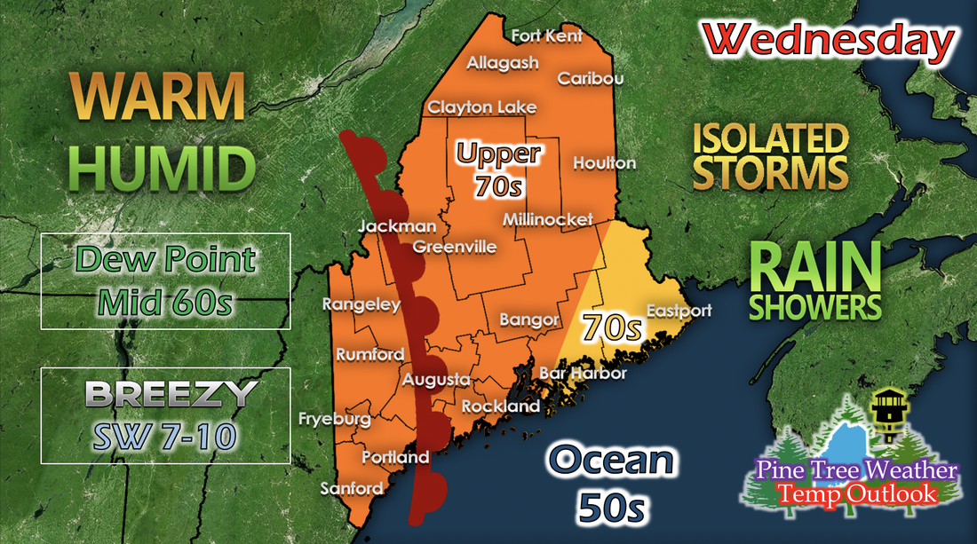 As the building ridge propagates closer to Maine, a warm front from a low pressure system pushed through the state. Dew points increases to the mid 60s, and the majority of the state will be in the upper 70s with exception to Down East, Maine, who will stay in the 70s through the day. 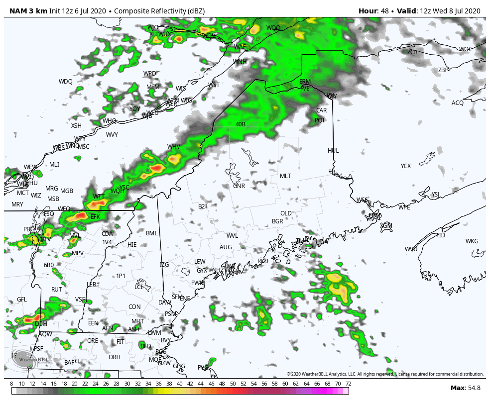 The GIF above runs from 7 AM Wednesday to 7 PM Wednesday. The warm front begins to push through western Maine in the morning and bring isolated showers and thunderstorms throughout the day until late afternoon. The week ahead: Temperature warm up, possible heat wave later in the week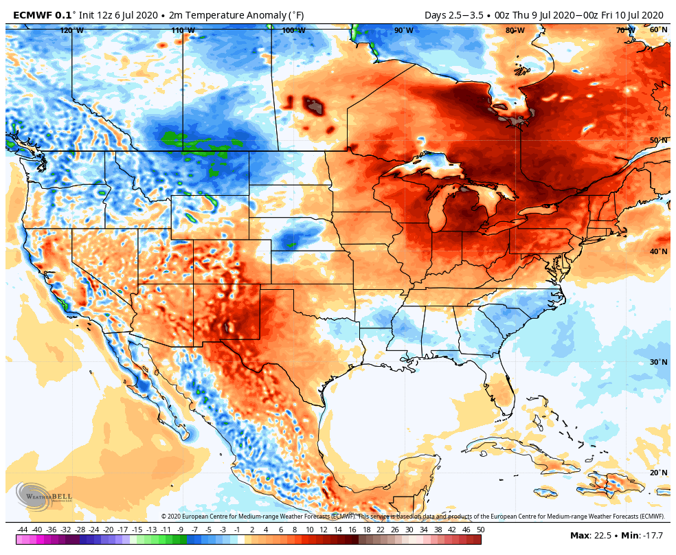 The GIF above shows 1-day temperature anomalies and runs from 7 AM Thursday to 7 AM Sunday. As the ridge moves over Maine, temperatures are highly above average for a few days in a row. Even though short-range models can't tell us the exact or around-exact temperatures for later in the week right now, this long-range model can still tell us that there will be above average temperatures because of the upcoming ridge moving over the state. Help forecast verification, and stay informed!
For more information, please follow Pine Tree Weather on Facebook and Twitter.
Thank you for supporting this community based weather information source that is funded by your financial contributions. Stay updated, stay on alert, and stay safe! Have a good week! - Kaitlyn |

Mike Haggett
|