Watching the tropics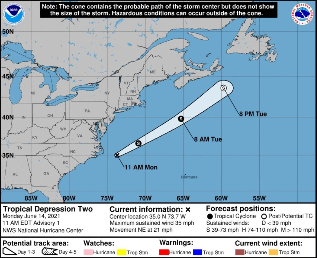 The second tropical system of the 2021 Atlantic Hurricane Season formed Monday morning. This tropical depression is currently located about 105 miles east of Cape Hatteras, North Carolina and has sustained winds of 35 mph. The tropical depression is expected to briefly strengthen into a tropical storm before weakening by Tuesday evening as it accelerates to the northeast towards Newfoundland over the open waters of the western Atlantic. 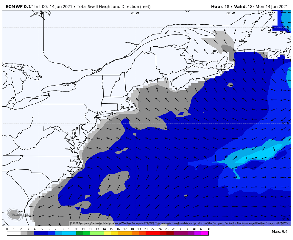 The main impact from this tropical system for Maine will likely be increased wave heights/swells and an increased risk of rip currents. Along much of our coastal waters, we will likely see an increase in the wave swell height into Wednesday from 2 to 3 feet to 4 to 5 feet as the tropical system offshore passes by our latitude. Showers and thunderstorms possible Monday night and Tuesday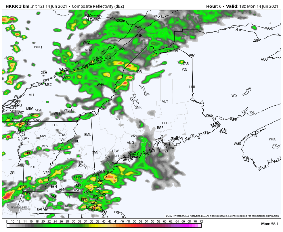 Monday night there will likely be numerous showers and a few isolated thunderstorms across the state. Some areas of patchy fog are possible by Tuesday morning particularly across Downeast Maine. Low temperatures should be in the 50's statewide. During the day Tuesday, there will be a chance of scattered showers and thunderstorms associated with a broad trough moving over the state. At the time of writing, these thunderstorms are not expected to be severe on Tuesday. The primary threats with any thunderstorms that do develop should be gusty winds and locally heavy rainfall. High temperatures should range from the 60's for the coastal locations and the Central Highlands to the upper 70's for interior SW Maine. Dry and seasonable weather for Wednesday and Thursday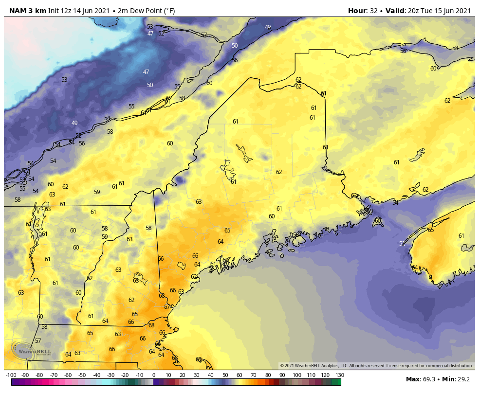 Wednesday and Thursday should feature comfortable and seasonable weather conditions with highs in the 70's expected across much of the state. Temperatures should be in the 60's along the coast on both days with the sea breeze. Dewpoints will also be more comfortable with dewpoints in the 40's on both days as opposed to the muggy dewpoints likely in the 60's on Tuesday. Temperature outlook through the third week of JuneThe plots below show the temperature outlook for Carrabassett, Bangor, Caribou, and Portland for the next ten days. The blue bars denote the daily high temperatures and the green bars denote the daily low temperatures. Temperatures will be seasonably cool the next few days. Heading into the weekend, expect a gradual warmup to slightly above average temperatures for most of the state. Temperatures look to continue to be seasonable to slightly above average into next week. 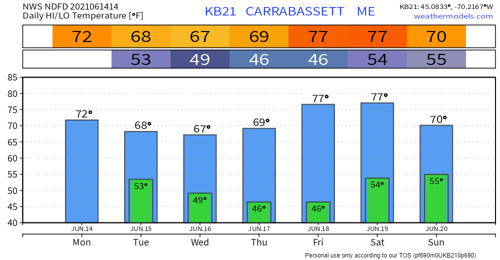 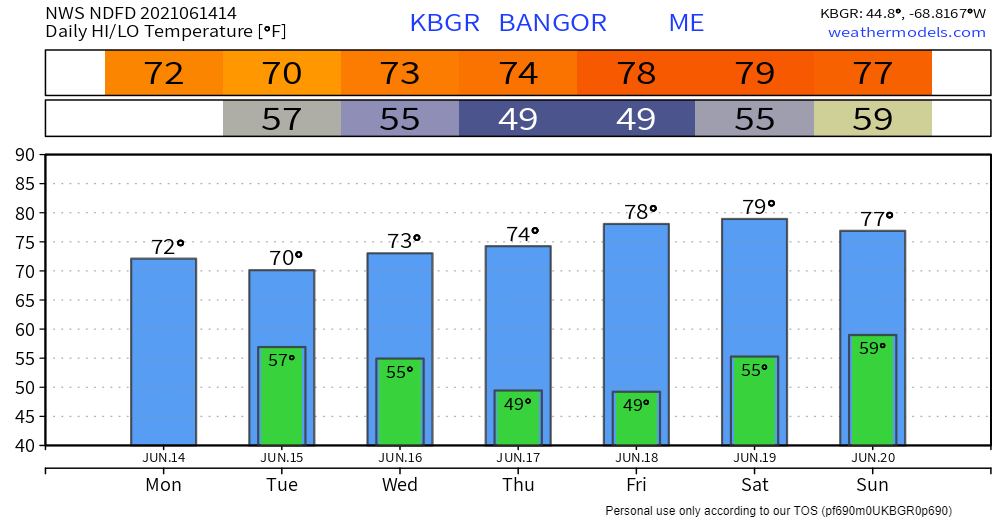 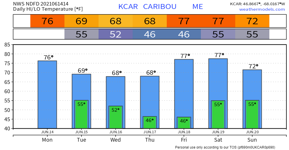 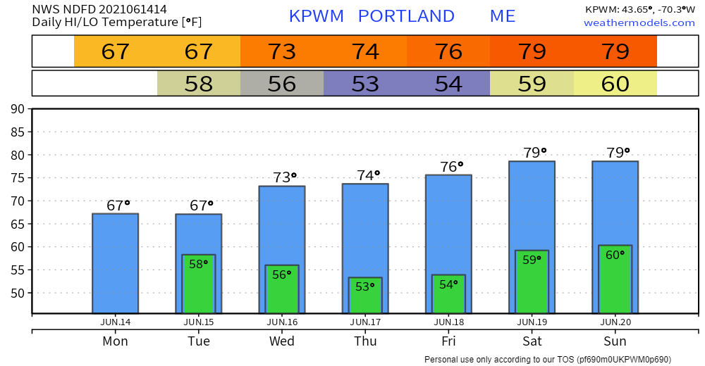 Be prepared to receive alerts and stay updated!
For more information in between posts, please follow Pine Tree Weather on Facebook and Twitter.
Thank you for supporting this community-based weather information source which operates by reader supported financial contributions. Stay updated, stay on alert, and stay safe! |

Mike Haggett
|