Showers for Sunday; showers & storms possible Monday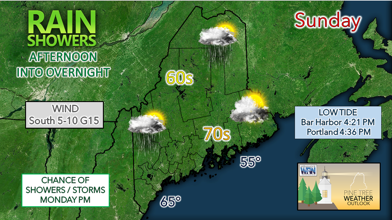 High pressure slides east and a weak wave approaches the region on Sunday. Clouds will be on the increase statewide, with showers breaking out in some areas by afternoon. Temperatures will be a bit on the cool side as compared to average with 60s for the mountains and north and low 70s for the coastal plain. A southerly wind picks up during the day which will cool the shorelines with the onshore flow. Timing out the shower activity through Labor Day... 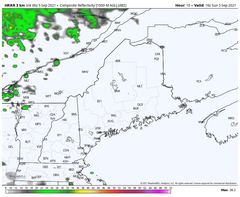 From noon Sunday to 8 PM shows the increase of showers activity over the mountains and north in the early afternoon, and southern areas late afternoon into early evening. Eastern areas appear to stay dry through much of the day, with the chance for showers increasing heading into Sunday night. 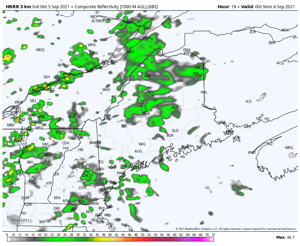 From 8 PM Sunday to 9 AM Labor Day shows the frontal boundary continuing to move eastward and continues the chance for showers in the process. Steady rainfall ends from west to east heading into Monday morning, and skies clear out, bringing sun in for a time before clouds increase again. 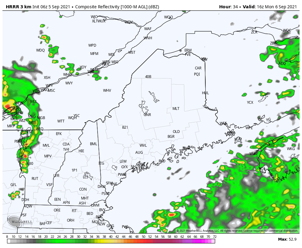 Showers and thunderstorms are possible Monday afternoon as an upper-level wave passes through the region. The best chance for a storm appears for the north and mountains, with an isolated chance for rest of the region. While the convective features are minimal with impact, some gusty wind, heavy rain, and small hail is possible. The severe threat overall is very low. Rain chances return mid-week Tuesday sees a sunny start for the coastal plain, with increasing sun over the interior as the morning progresses. A frontal boundary approaches the region on Wednesday and brings the chance for showers in the afternoon into Thursday. The frontal boundary is on track to capture Hurricane Larry and steer it towards Newfoundland on Friday.  Larry is looking healthy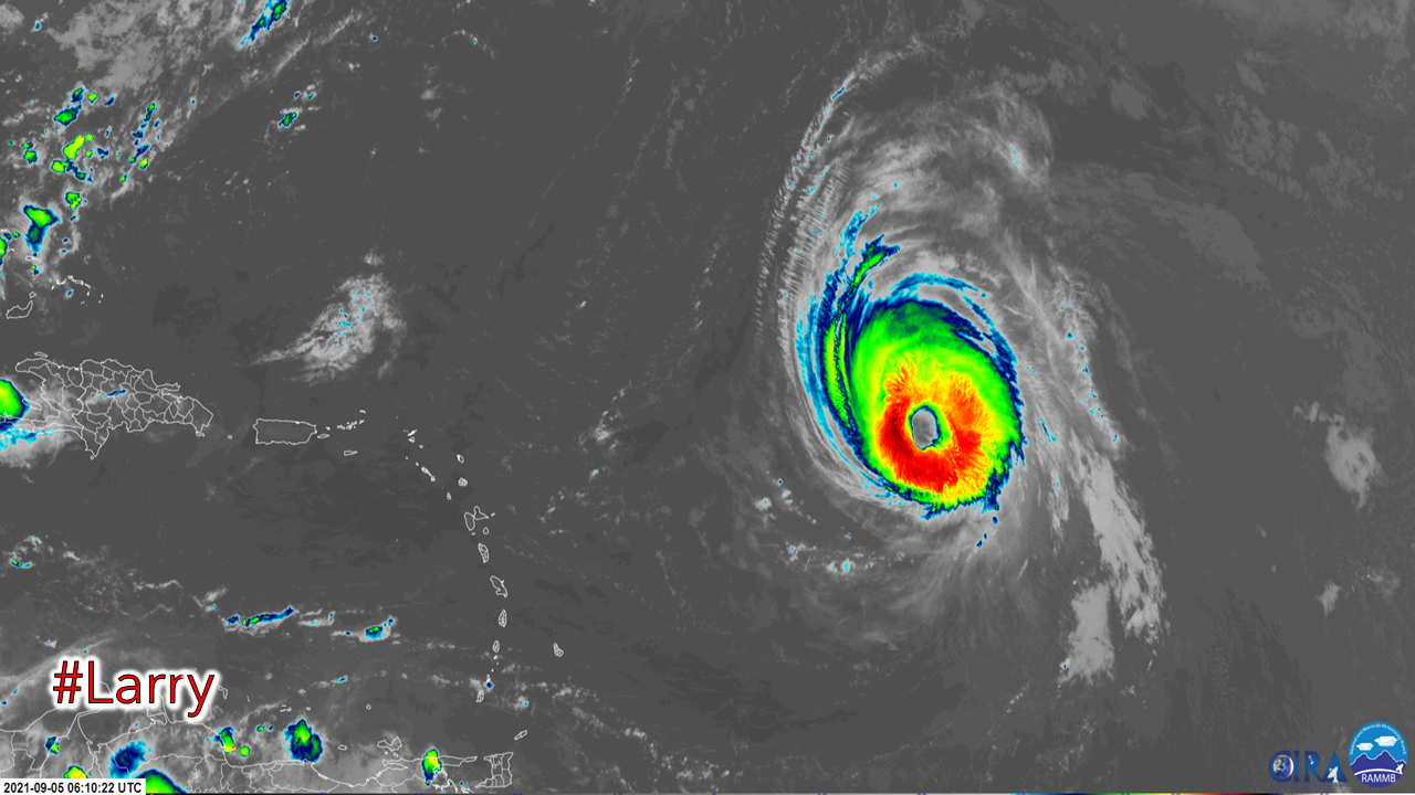 Larry has reached major hurricane status per the National Hurricane Center and satellite photos indicate the large size and a healthy, wide eye of the storm. The storm is expected to flirt with Bermuda on Thursday, passing to the east, then head off the northeast, gain in speed and weaken heading into the weekend. 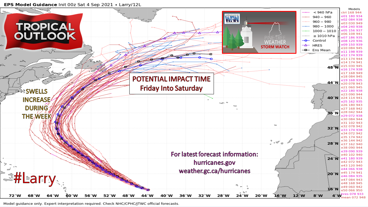 The impacts of the storm on Maine appear to come in the form of long wave swells starting on Tuesday. As the storm gets closer late week, the waves become higher and more frequent. Astronomical high tide due to the new moon elevate the ocean level, and in combination with the surf could cause some splash-over, moderate to high rip currents, minor flooding and beach erosion Friday into Saturday. Folks in Nova Scotia could see some heavy rain associated with a pre-frontal trough on Friday, and for those in Newfoundland may see more widespread impacts from rain, wind and surf Friday into Saturday. For the latest official forecast information on Larry, please check in with the National Hurricane Center and/or the Canadian Hurricane Center. Temperature outlook through FridayAfter Sunday, the temperature trend in on track to run above normal through the end of the week, with overnight lows the warmer end by Thursday. 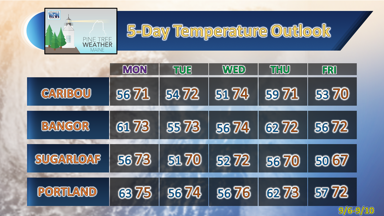 Be prepared to receive alerts and stay updated!
For more information in between posts, please follow Pine Tree Weather on Facebook and Twitter.
Thank you for supporting this community-based weather information source which operates by reader supported financial contributions. Stay updated, stay on alert, and stay safe! - Mike |

Mike Haggett
|