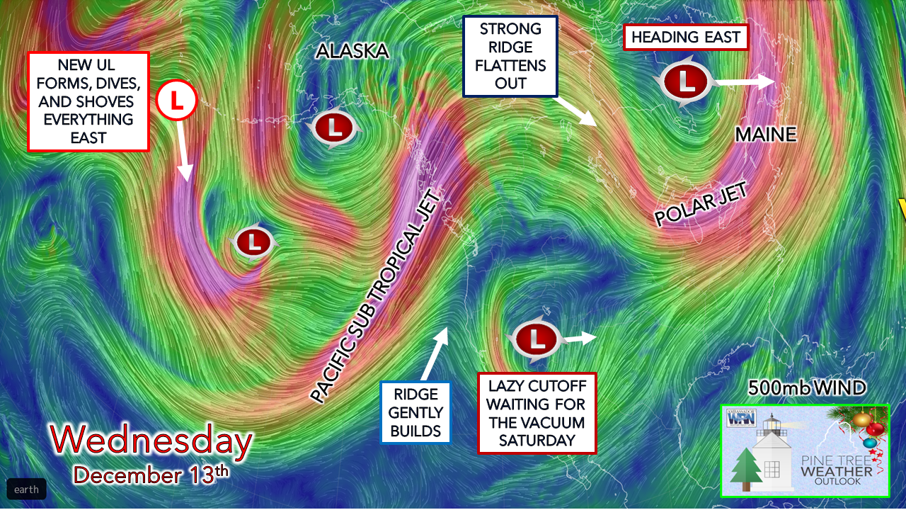
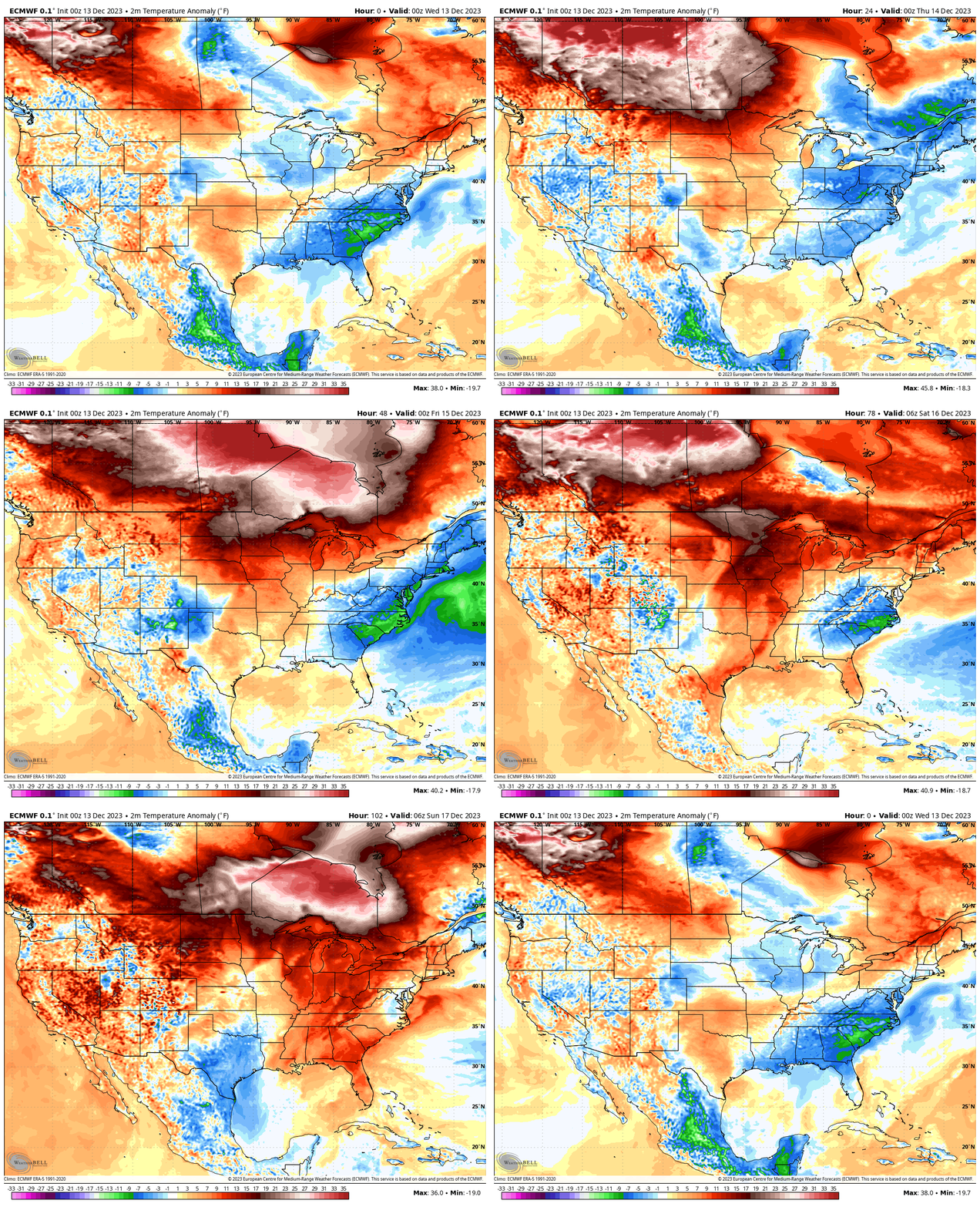
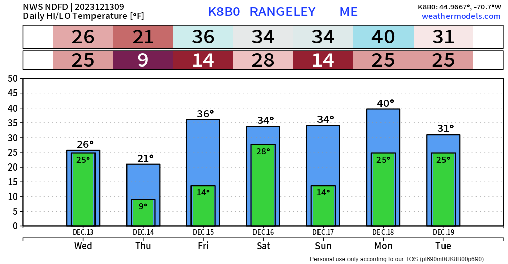
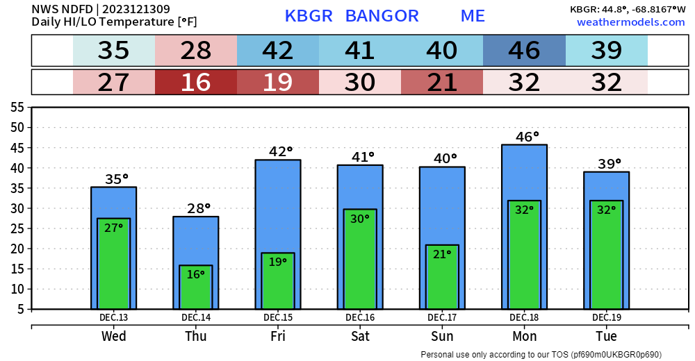
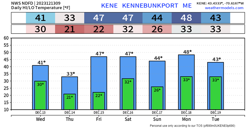
A look at the steering levelThe strong ridge over the west is doing a good job of slowing the pattern down over the continent and will continue to over the next several days. Outside of weak boundaries passing through the region that brings clouds and a few snow showers for the mountains. there isn't much going on until early next week. In the short term, a weak cold front passes through the state Wednesday which keeps the snow showers over the mountains through evening. As the trough dips in, that brings a cold day for Thursday. The strong ridge over the northwest gets chopped down and moves east, which brings the warm up starting Friday and continues into the weekend. Putting all of this into motion, my concerns for what happens Monday revolve around the cut off upper low over the southwest. Models consistently mishandle this feature. My recent week long trip to Arizona back in October which allowed me to see and experience first hand the geographical features of the Sonoran Desert on up through Sedona to the Grand Canyon was a bit of an eye opener. The stark differences in climate and elevation within 225 miles provided a few clues as to why this feature is misread, and my hunch is the desert plays a role in tricking guidance due to the arid conditions and wind pattern. It's not until these cut-offs move east that guidance gets a better handle on what happens upstream. Keeping that in mind, I don't trust the outcomes that model ideas are generating at this point. In the past couple of days, it's gone from a chance for interior snow and coastal rain to all rain, but a few ensemble ideas are still clinging to inland snow potential. The other caveat in this is IF the diving trough in the east over the weekend can drive moisture up from the south and phase it together in time. We'll see. It may not be until Saturday before a clear picture comes into play. Temperature outlookLooking at the anomaly compared to average here. Temperatures are expected to run above normal overall through the period after a chilly day on Thursday. Pending on how the upper-low evolves out of the southwest will dictate if there will be enough cold air over the interior around or not prior to early next week. Designed for you, supported by youThank you to Allspeed Cyclery & Snow in Portland, Downeast Aerial Photography in Rockland, Dutch Elm Golf Club in Arundel, and Sunrise Property Services in Bridgton, for partnering with Pine Tree Weather. Special thanks to all the individuals who financially contribute. I sincerely appreciate your support. Stay updated, stay on alert, and stay safe! - Mike PRINT MEDIA: Feel free to quote and cite my work here for your stories. Please give me the professional courtesy of knowing that you are referencing my material so I can read your final product and acknowledge it on my media and link it on the Who I Am page here on the website. Feel free to send me a message via the Facebook page or Twitter (X) to get my phone number if necessary. Thank you! NOTE: The forecast information depicted on this platform is for general information purposes only for the public and is not designed or intended for commercial use. For those seeking pinpoint weather information for business operations, you should use a private sector source. For information about where to find commercial forecasters to assist your business, please message me and I will be happy to help you. |
Mike Haggett
|

