|
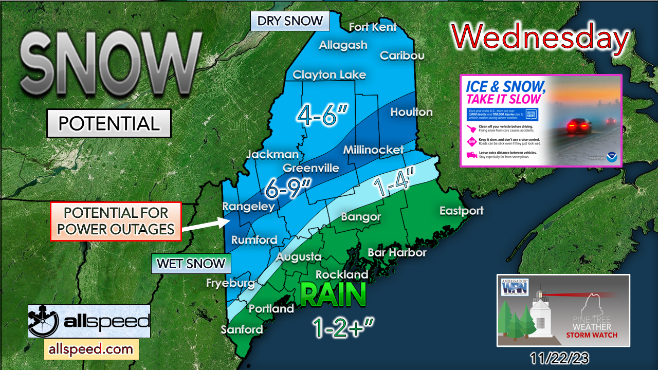
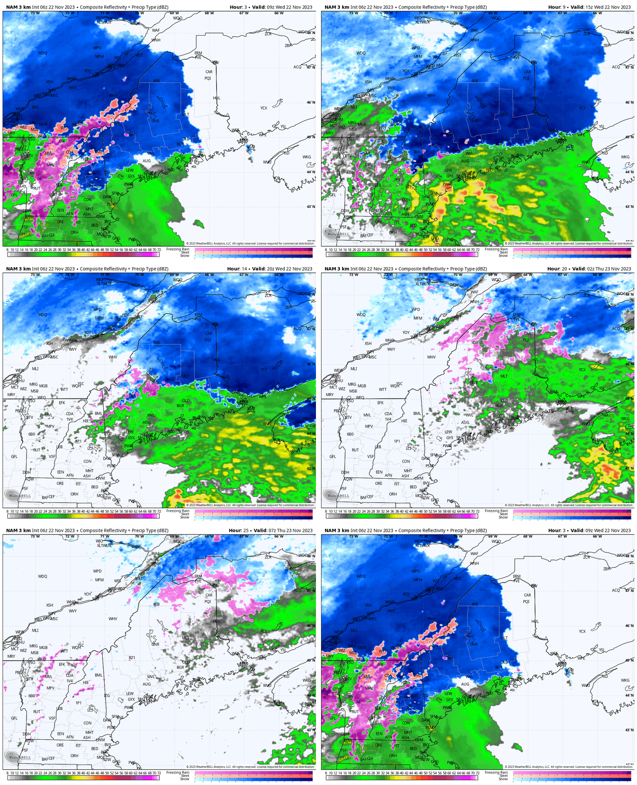
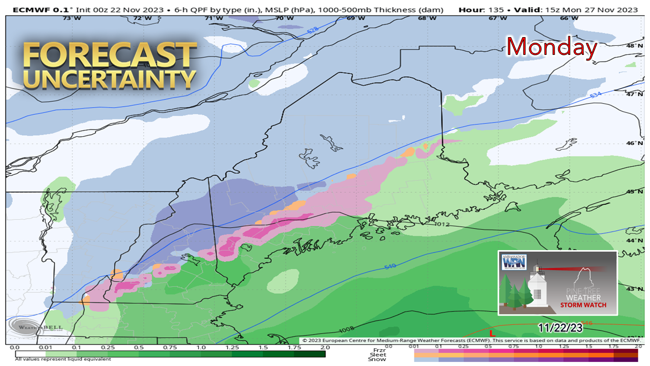
For those traveling to see family or commuting to the day job, expect road conditions to be a challenge with low visibility at times in areas of heavy rain and snow, some fog in places, along with standing water on roadways along the coastal plain and slushy slop from the western mountains over to southern Aroostook. Please allow plenty of extra time to get to where you are going. A sloppy day aheadAs I have discussed in the past two days, the coastal front will dictate snowfall amounts south of the mountains. The difference between no snow and 6" could be a scant handful of miles. Elevation plays a role in this, with the taller hills likely to hold onto snow longer. The region of the Winter Weather Advisory has been extended to cover all of northern Maine. Cold air is doing what cold air does and that is to ignore what guidance thinks it is going to do. Even with the southeast wind that could gust 20-40 mph at times as the day progresses, the cold air is likely to hold over the interior. This sets up a warm nose aloft, and with that comes the risk of sleet and freezing rain at the surface in the advisory area. Most areas end with either a mix of junk or rain by the time it is over. Where the snow sticks are where power outages may occur. Be aware there could be a rumble of thunder embedded in this as well. Wednesday 5 AM to Thursday 7 AM - So you are aware, the NAM3 model depicted here has a well-known warm bias to it and as a result, the precipitation types at specific points may differ. The coastal front that I have discussed previously is the most intriguing piece in the scenario which brings the element of surprise. Snow amounts can bust on both the high and low end. What was 6" of snow could look like 2" of slop in the matter of an hour. Precipitation rates could fall upwards of 1-1½" per hour at times in either frozen, about to freeze, or liquid form. The idea continues that the storm will be intensifying on its way to Nova Scotia, which means precipitation rates will increase as it is heading out the side door. A snow / mix could rip along and to the north of the frontal boundary, with heavy rain to the south of it. Precipitation ends from southwest to northeast Wednesday evening into early Thanksgiving Day. Outlook through early next weekOn Thanksgiving Day, any precipitation ends early. A northwesterly stream flow sets up as the storm heads east with gusts 20-30 mph. Temperatures are expected to be on the mild side in the 30s and 40s south of the mountains. A strong moisture starved cold front passes through the region on Friday that will bring snow showers to the north and mountains where 1-3" of fluff may fall along with gusty winds in the 20-35 mph range that will dump cold air into the region and bring January low temperatures in the single digits north and teens to low 20s south by Saturday morning. After a relatively quiet weekend with high pressure and cooler than normal temperatures the dominating feature, the next system rolls in on Monday. It's too early to get into specifics on timing and/or precipitation types and amounts, but the idea is there. Updates will come on that over the weekend. PTW is 67% funded for 2024Thank you for your years of following and for your financial support. It is because of your funding that this operation continues. God bless and stay strong. Be good to yourself. Have a safe and wonderful Thanksgiving. Stay updated, stay on alert, and stay safe! - Mike NOTE: The forecast information depicted on this platform is for general information purposes only for the public and is not designed or intended for commercial use. For those seeking pinpoint weather information for business operations, you should use a private sector source. For information about where to find commercial forecasters to assist your business, please message me and I will be happy to help you. |
Mike Haggett
|


