A few snow / rain showers around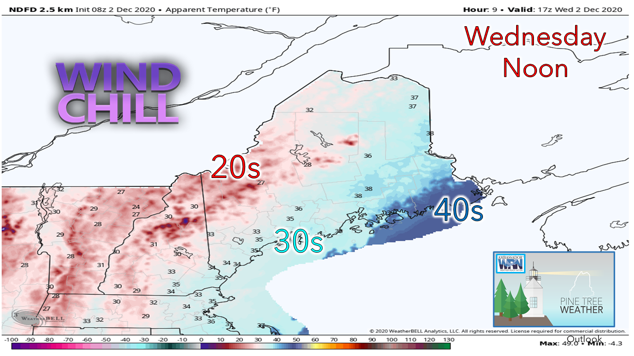 The breeze continues across Maine as low pressure in central Quebec is stalled. A south/southwesterly wind flow helps to keep DownEast areas warmer due to the ocean temperature in the upper 40s. For folks in the western mountains and Great North Woods, it would be best to grab an extra layer as you head out the door. 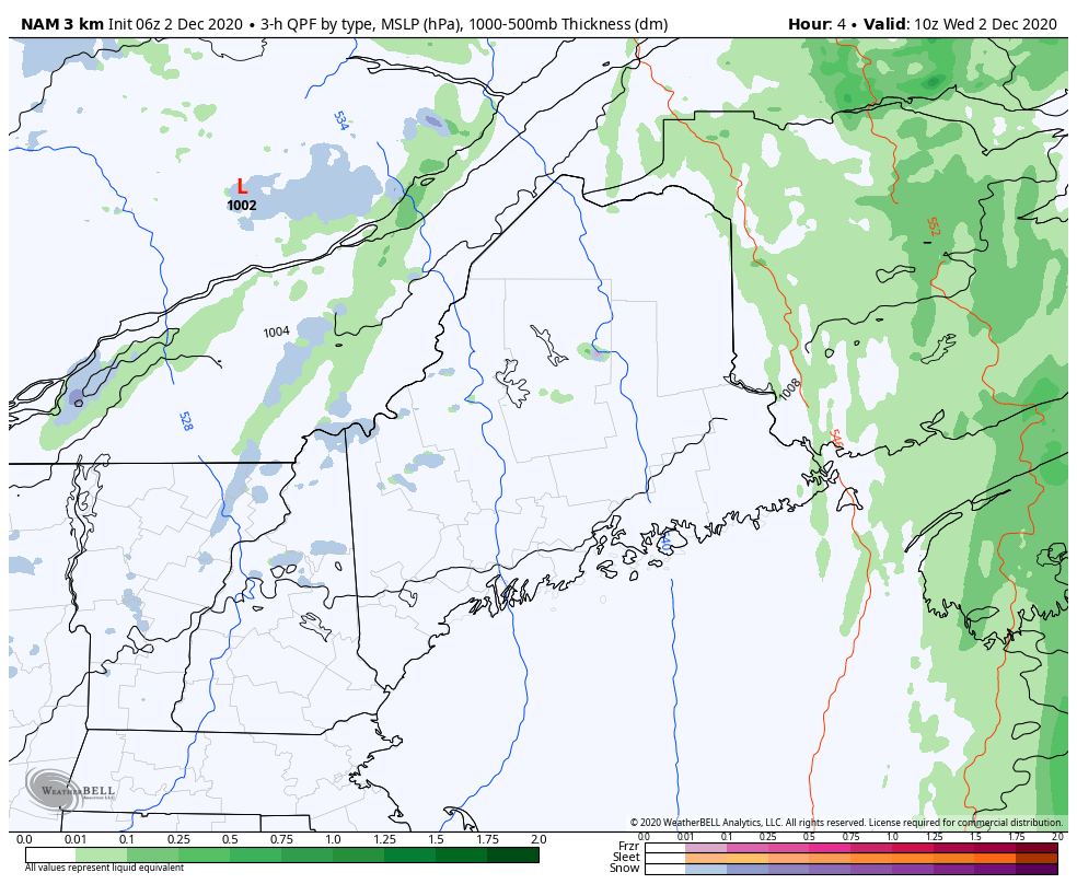 With the surface low stalled out to the northwest, a series of disturbances will rotate around the associated upper low. That will bring varying amounts of clouds, along with a chance for snow or rain showers pending on geography and temperature. The western mountains may pick up a couple inches of snow on the higher peaks due to upslope winds and moisture aloft through Thursday morning. Uncertainty for what happens nextBy trade, I am a professionally trained chef. Although I have not practiced that trade in over 20 years, one of the basic fundamentals of cooking that I carry with me in life and in forecasting is consistency. I look for consistency in model ideas. I have learned not to hang my hat on one solution. Like a milkshake or a smoothie, blending ingredients together is the key of the quality of the finished product. Chaos is a good word to describe the atmosphere over the northern hemisphere at the moment. The cold in the north is fighting against the warmth of the south for control and consequently guidance is having some difficulty figuring out the polar jet and its interaction with the subtropical jet. The net result is a changing model ideas. It will be important to stay updated on the forecast, and be prepared for changes with it in the foreseeable future. 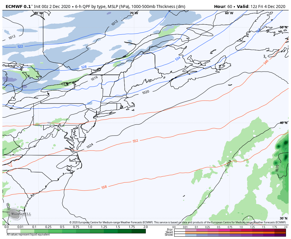 European forecast idea from 7 AM Friday to 7 PM Sunday The European solution above shows a warm solution for the approaching storm for the weekend. This idea could bring a great deal of wind, and heavy amounts of snow and rain to the region. It is progressive in its idea, starting precipitation early, Friday afternoon over southern areas. This is another one of these situations where the timing of the polar jet with the subtropical jet is going to be key with the result. When I speak of the polar jet, I insinuate cold air. Cold air has a mind of its own due to its dense nature, and will do what it wants to when it feels like it, no matter what models think it will do. 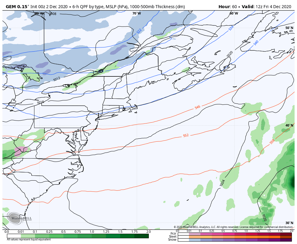 Canadian GEM model idea from 7 AM Friday to 7 PM Sunday The Canadian solution is later in forming, and colder. The results are much different. This is a snow event for the interior, a mixed bag for the coast, and not as windy. The storm tracks offshore, rather than an inside runner the European idea thinks. The European idea is shifting more eastward. If you saw the image I posted here yesterday from the Canadian model, it's consistent. Both models make their cases well. The cold may be slow in arrival, but the pieces may not come together as quickly as the idea that is being sold on the warmer idea. The bottom line is expect a storm this weekend. For who gets what and for how long, along with impacts from it, you need to stay tuned to the forecast. I will update on this again Thursday.  "It seems like we've had a windy fall. Is that true?"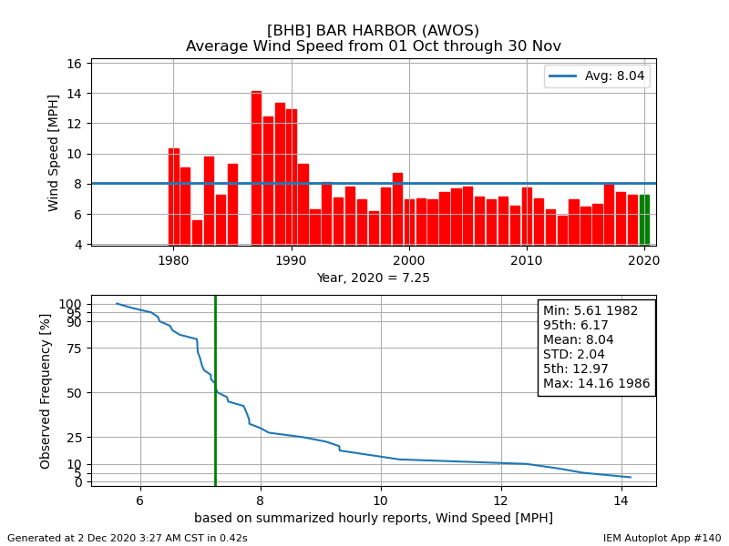 I was asked this question on Twitter yesterday, so I polled a bunch of NOAA sites that have good history to see if that was the case. Since we've had plenty of southeast wind related storm activity, a good place to check is the small airfield in Trenton just over the bridge from Mount Desert Island. The answer, as you can see, is no. All other sites I looked over revealed similar results. October and most of November was relatively quiet. It has only been recently where the pattern has become more active. The wind, when we get it, is creating more impacts. The root structure of the trees in this state is not geared for a steady diet of strong southeast directed wind storms. Our wind patterns range from the southwest to northeast by in large year round. This is why the Great October Gale of 2017 was so impactful. Temperature outlook through TuesdayThe average temperatures for Caribou is 32° for a high and 18° for a low. For Portland, 42° and 26°. The trend is for below normal temperatures for the north, cooler than normal highs with slightly above average lows for the south. 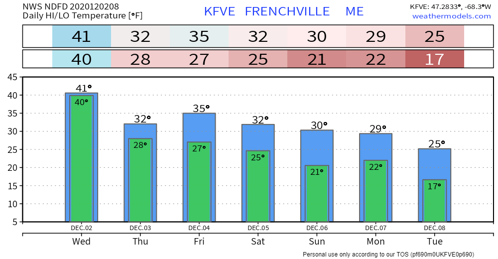  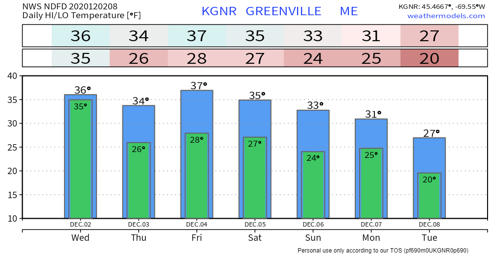 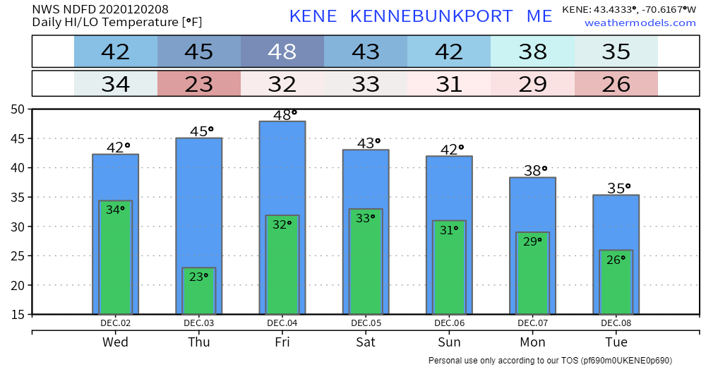 Upslope snow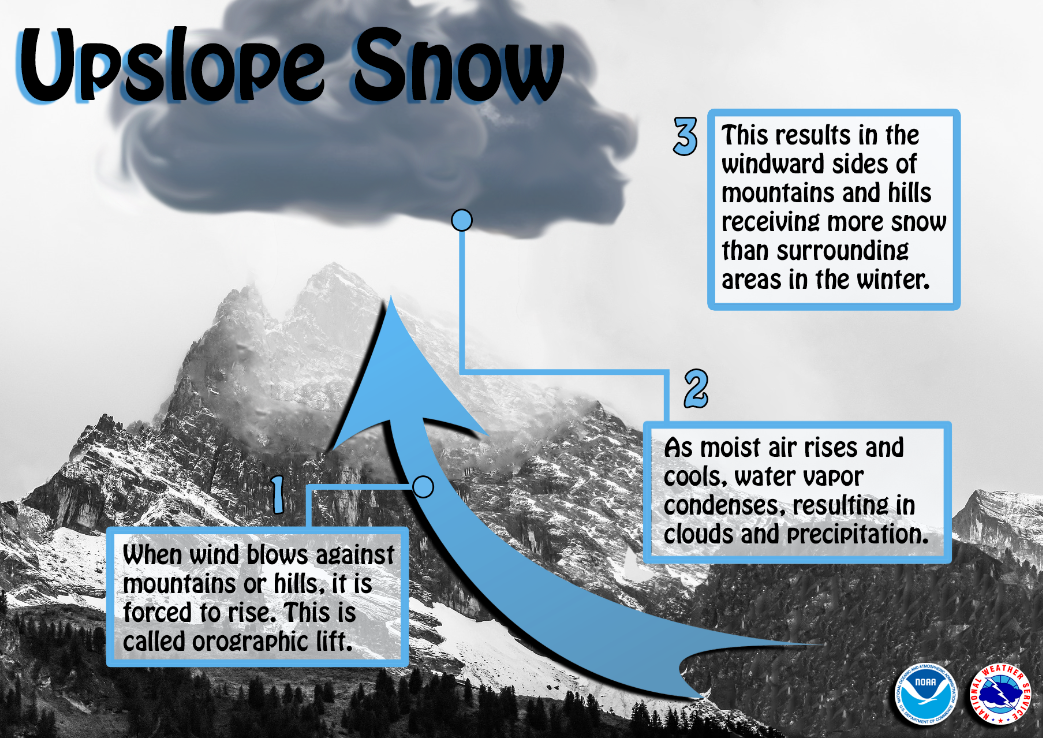 Have you wondered why the windward side of mountains or large hills receives so much more snow than surrounding areas? This is due to upslope snow. When moist wind blows against the side of mountains/hills, the air is forced to rise (called orographic lift). As the air rises and cools, water vapor condenses, resulting in clouds and precipitation over the windward region. Conversely, the leeward side often receives less snow due to descending air. Be prepared to receive alerts and stay updated!
For more information, please follow Pine Tree Weather on Facebook and Twitter.
** FUNDING NEEDED FOR 2021 ** Thank you for supporting this community based weather information source that is funded by your financial contributions. Stay updated, stay on alert, and stay safe! - Mike |

Mike Haggett
|