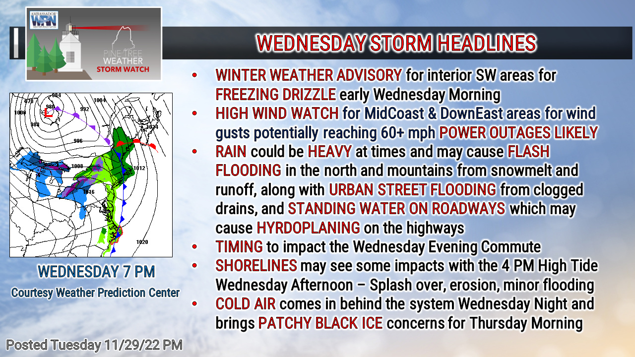
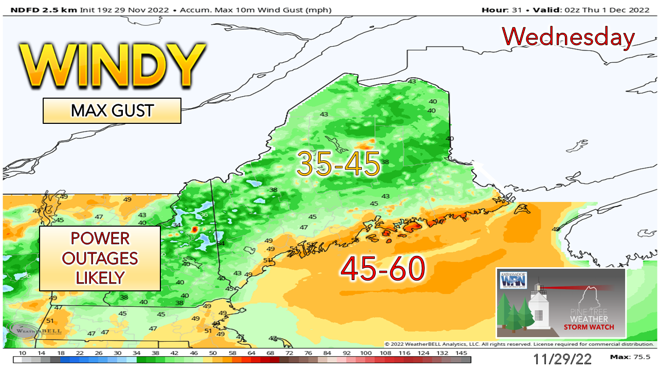
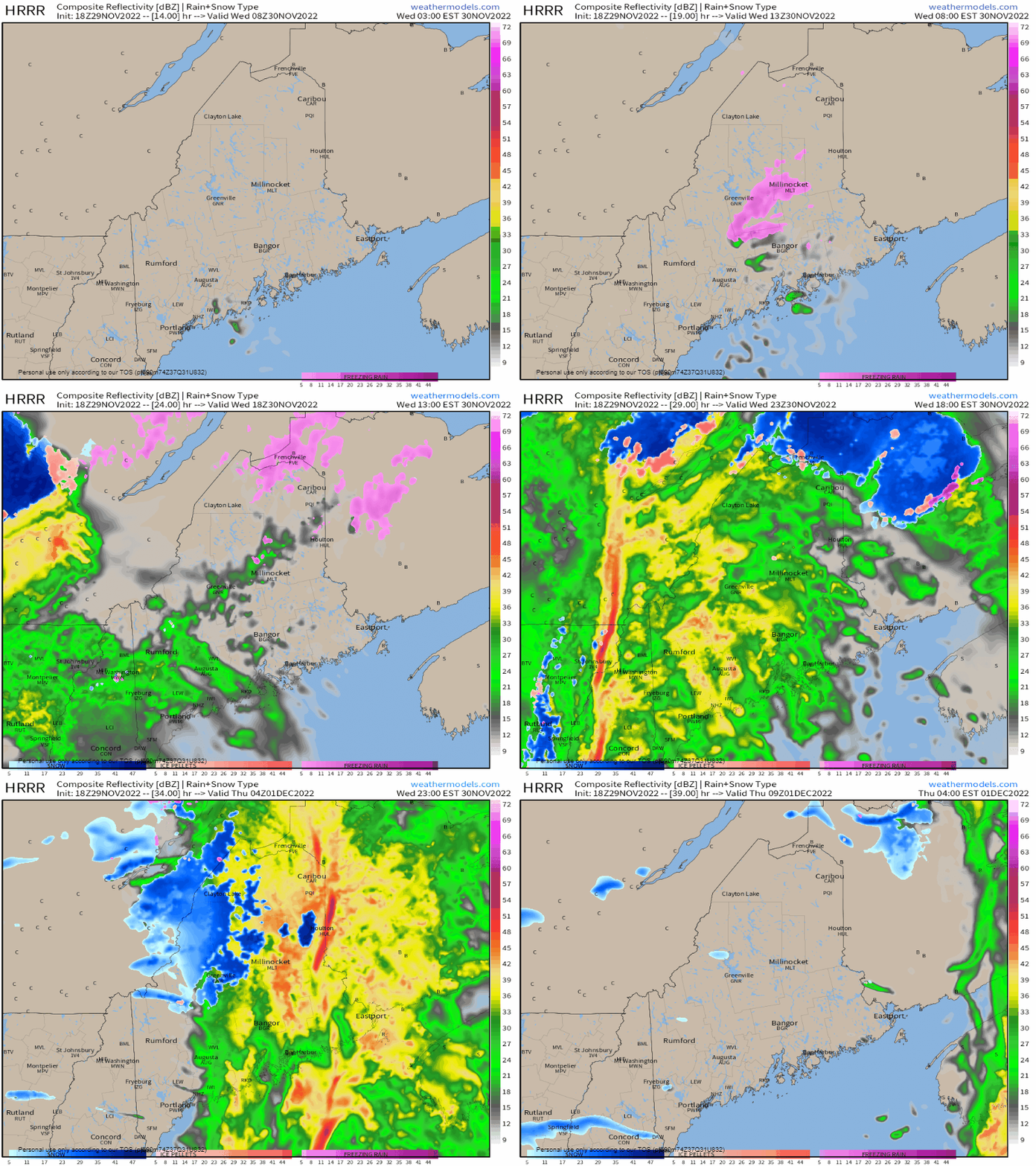
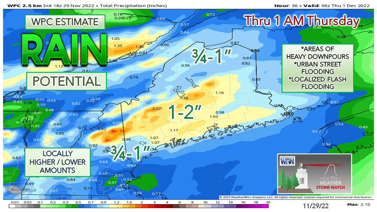
What you need to know...As of the time of this post at 5 PM Tuesday, the only change in forecast headlines was the addition of the Winter Weather Advisory over interior southwestern Maine as pockets of freezing drizzle may develop in the wee hours of Wednesday morning. That advisory is scheduled to expire at 7 AM Wednesday morning. We'll see if any cold air damming may come into play, but southerly winds are expected to increase and scour out the cold as the morning progresses. A HIGH WIND WATCH for MidCoast and DownEast continues. Don't be surprised if you see wind advisories posted, and the high wind watch turned into a warning by Wednesday morning. WIND is the main concern here, with coastal areas getting the brunt of it. The timing of 1 PM to 9 PM for Portland south, 2 PM to 10 PM for the MidCoast / Bangor, 3 PM to 11 PM for Bar Harbor and 4 PM to midnight for Eastport continue to be on track. This is not good news for the evening commute for the highways. Scattered power outages are likely. Important to note with the strong low-level jet, heavy rain and strong surface low that the wind threat is both horizontal and vertical. Damaging wind could accompany any downpours, much like what happens with thunderstorms. While the strong winds diminish with the frontal passage, it will remain breezy overnight and into Thursday. SHORELINES will need to be watched for potential splash over and erosion at the time of high tide around 4 PM. Wednesday 6 AM to Thursday 4 AM - Pockets of freezing rain early may develop over central areas before the warmer air and the steady to heavy rain arrives Wednesday afternoon. Note the streak of the front working through the region from 7 PM onward. There could be some thunder embedded in that as it passes east and clears DownEast areas by 1 - 2 AM. It appears to be a free car wash for those travelling during the evening commute time. Between the heavy rain and the wind, reduced speeds are the safe way to go. Up in the mountains, expect fog from the melting snowpack in addition to heavy rainfall which will reduce visibilities there. The mountains and north may see snow showers to start off Thursday morning. With the southeast wind flow throwing water at the mountains, that is where the most rain is expected. Keep in mind all of this water is going to freeze up Wednesday night into the wee hours of Thursday. Patchy black ice will be a concern for the Thursday morning commute. Current deficit for 2023 ... $1900Thank you as always for your support! Stay updated, stay on alert, and stay safe! - Mike NOTE: The forecast information depicted on this platform is for general information purposes only for the public and is not designed or intended for commercial use. For those seeking pinpoint weather information for business operations, you should use a private sector source. For information about where to find commercial forecasters to assist your business, please message me and I will be happy to help you. |
Mike Haggett
|

