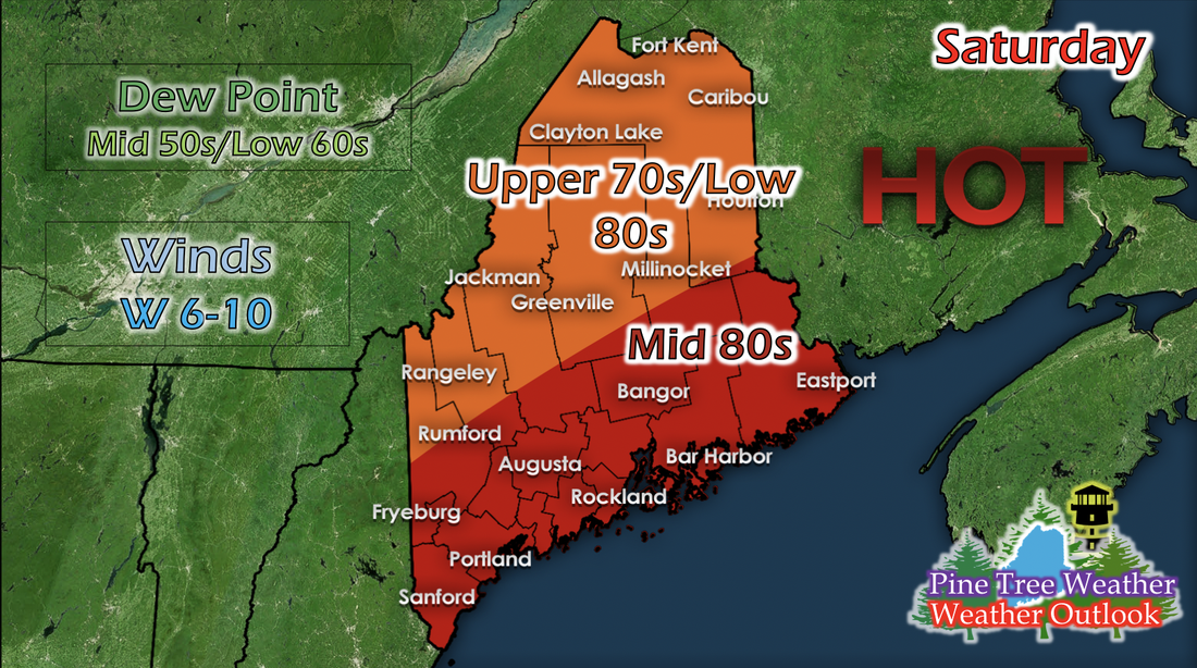
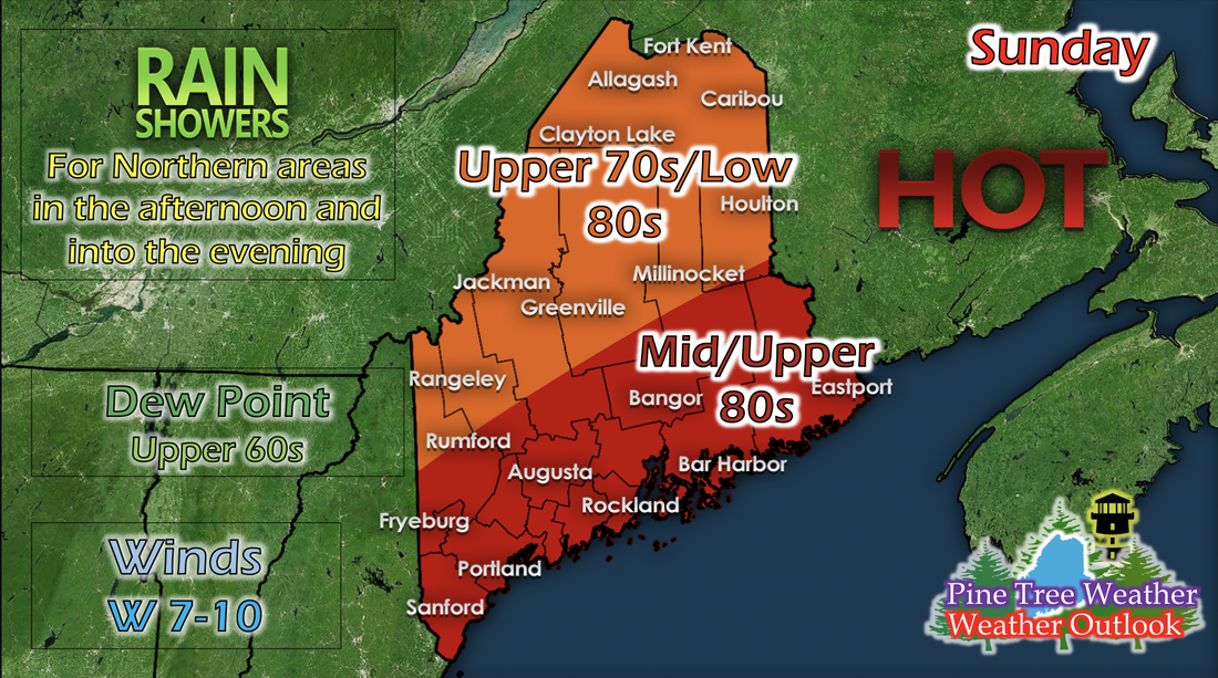
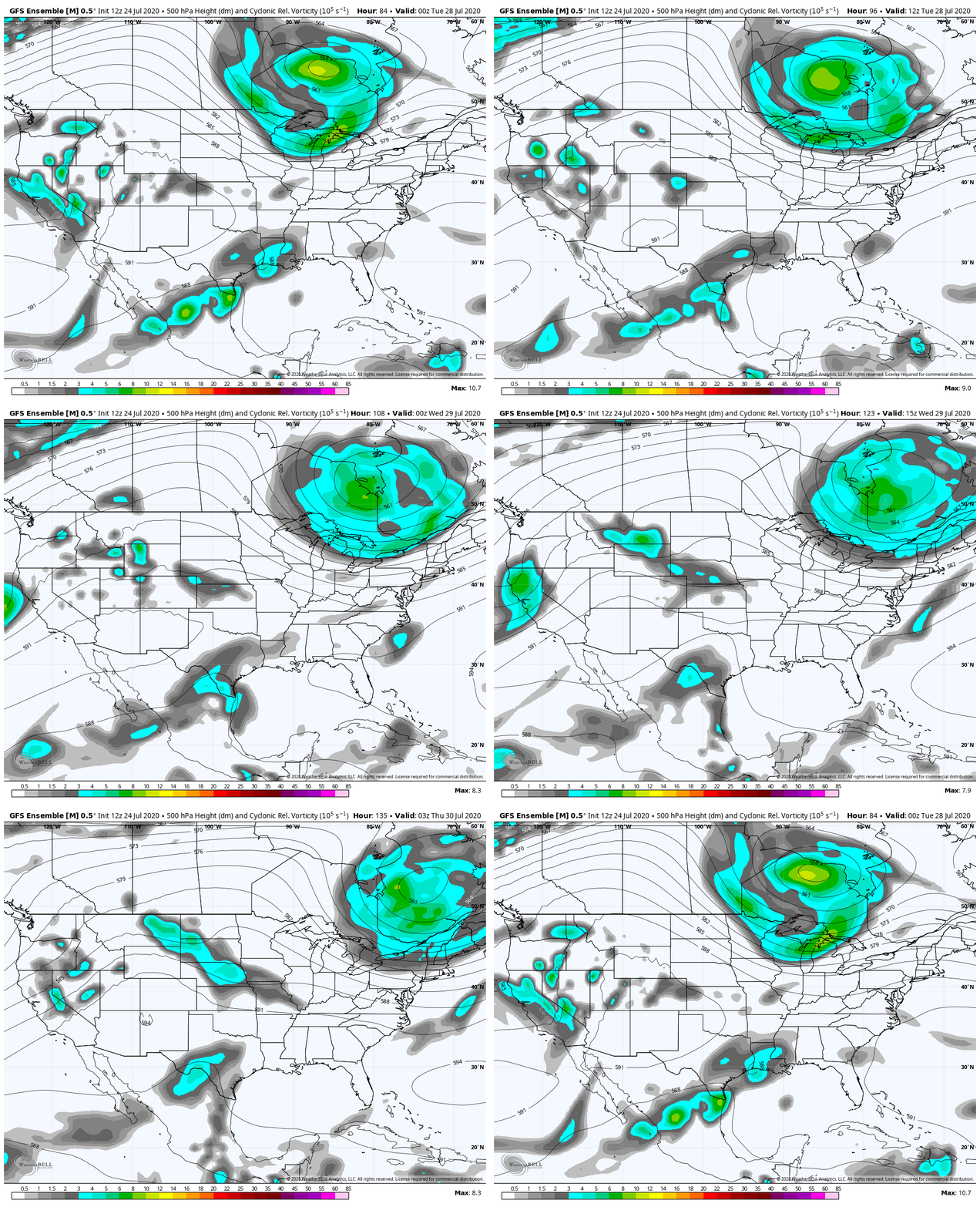
Saturday: Hot temperatures and comfortable humidityAs a high pressure lingers over the New England region, Saturday looks like a nice day for outdoor activities statewide. Temperatures reach up to the mid 80s for coastal and central regions, and upper 70s to 80s elsewhere in the state. Dew points are comfortably ranging from the mid 50s to low 60s, and partly cloudy skies make for a beautiful day. The northern regions may be slightly breezy with winds ranging from 6 to 10 mph, but it'll be a pleasant breeze. A chance for any precipitation is low, since moisture is a key missing factor in the development of any storms. Saturday looks to be the best bet to do anything outdoors statewide; a cold front from the north will bring some rain showers and small thunderstorms on Sunday for northern regions that may push into central Maine. Sunday: Hot temperatures, slightly muggy, chance for rain showersAs the cold front from the north pushes down closer to Maine, rain showers begin to form and move over the northern portions of Maine in the afternoon. An oncoming low pressure system will keep cloudy skies around and chances of rain showers possible statewide for Monday and Tuesday. For Sunday, it looks like only northern Maine will have the greatest chance of being affected by any precipitation. More specific locations of any rain for Monday or Tuesday will be available once more model runs are available. Oncoming low pressure systemThe GIF above runs from 8 PM Monday to 8 AM Thursday and shows 500 mb (mid-level in the atmosphere) vorticity. A pretty strong low pressure system is making its way towards the New England region and should arrive Monday night and into Tuesday. This system is likely to bring rain showers and some storms to Maine. Although it shows the system arriving on Wednesday, the cold front is ahead of this system at the surface, and the actual surface system is ahead of the vorticity signature (they aren't stacked). This signature has shown on multiple runs on long-range models for days, and it's slightly stronger than a few days ago. More information on the upcoming system will come once more short-range model runs are available. Help forecast verification, and stay informed!
For more information, please follow Pine Tree Weather on Facebook and Twitter.
Thank you for supporting this community based weather information source that is funded by your financial contributions. Stay updated, stay on alert, and stay safe! Thank you so much for all of your continued support! This is my Venmo if you'd like to contribute: @Kaitlyn-Lardeo Have a great weekend! - Kaitlyn |
Mike Haggett
|

