|
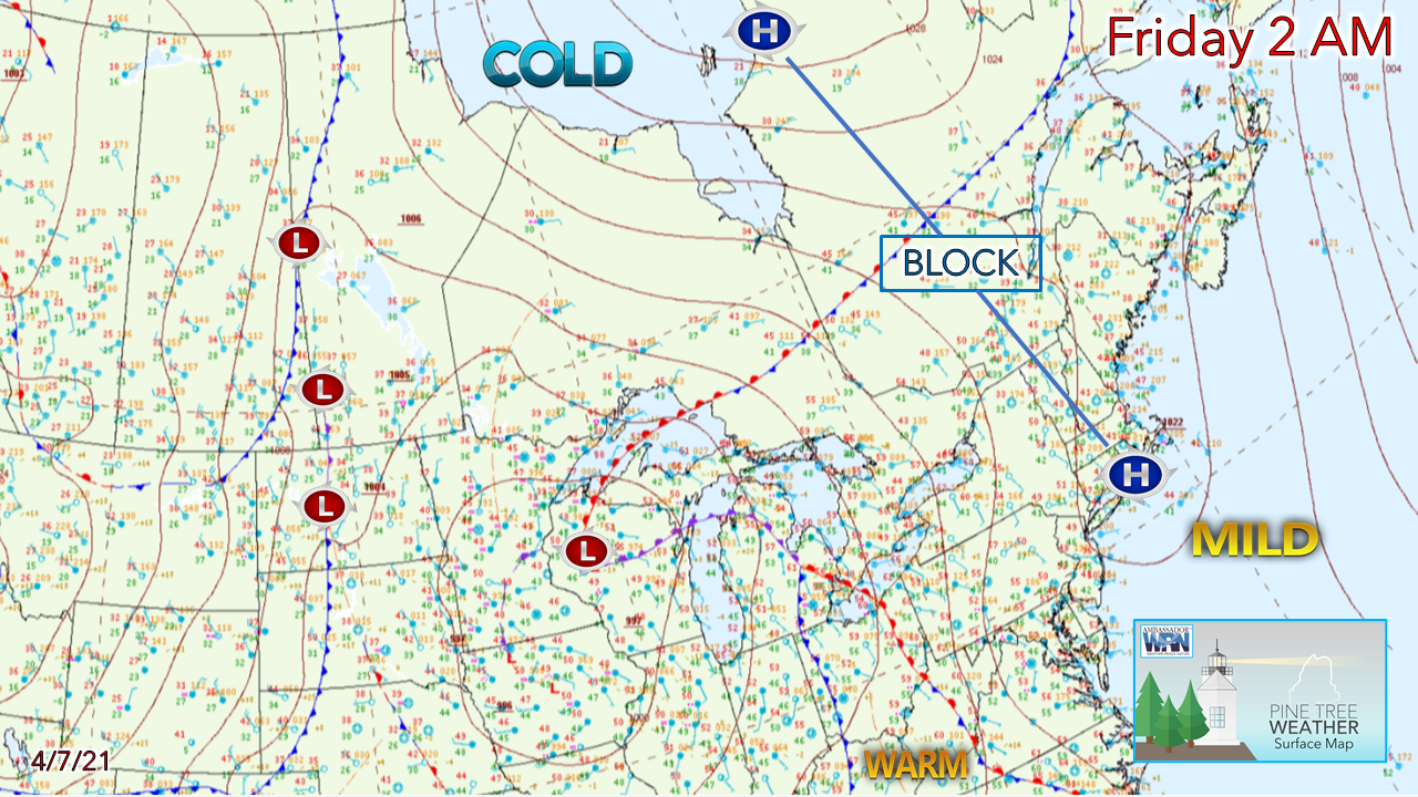
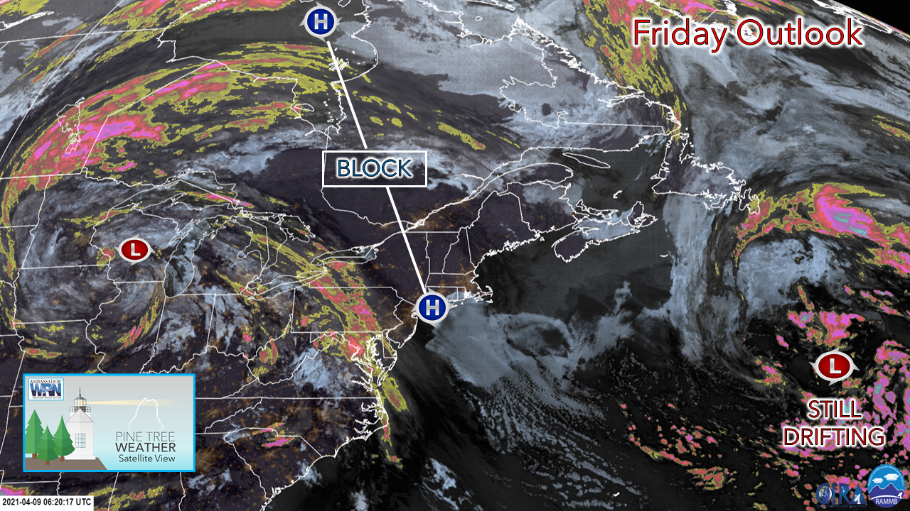
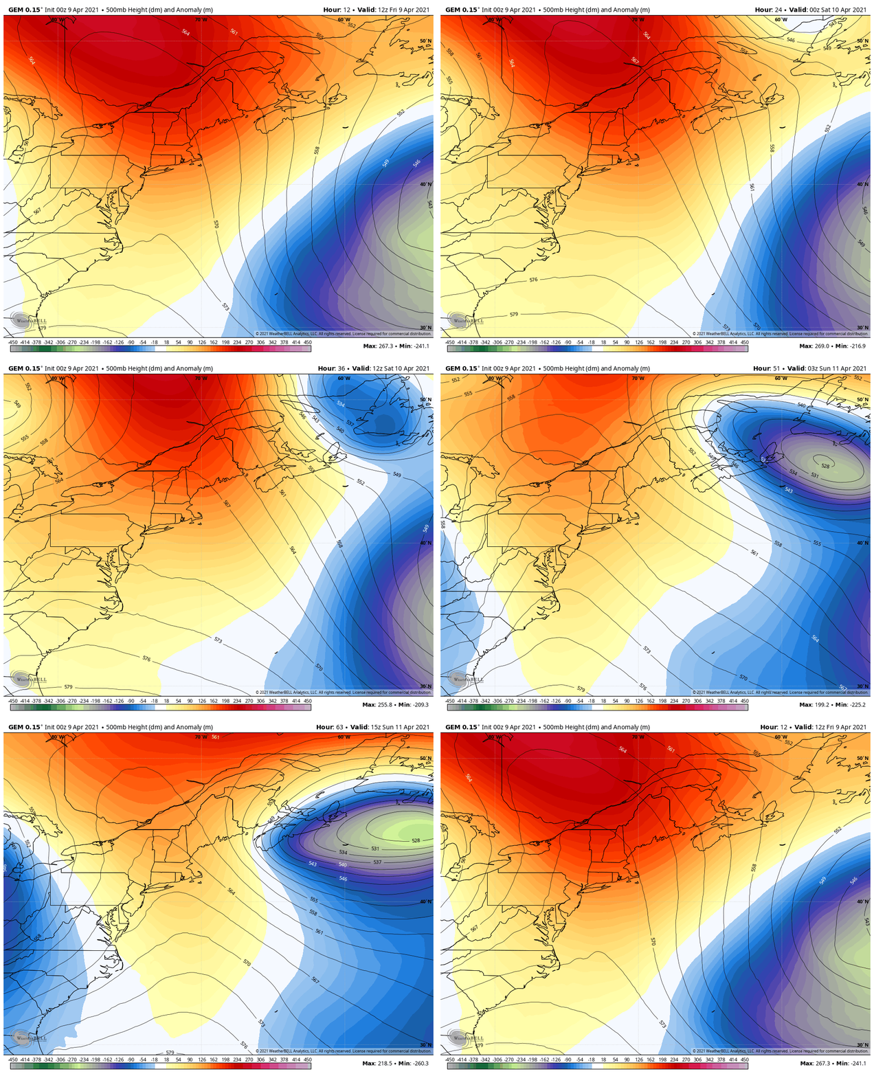
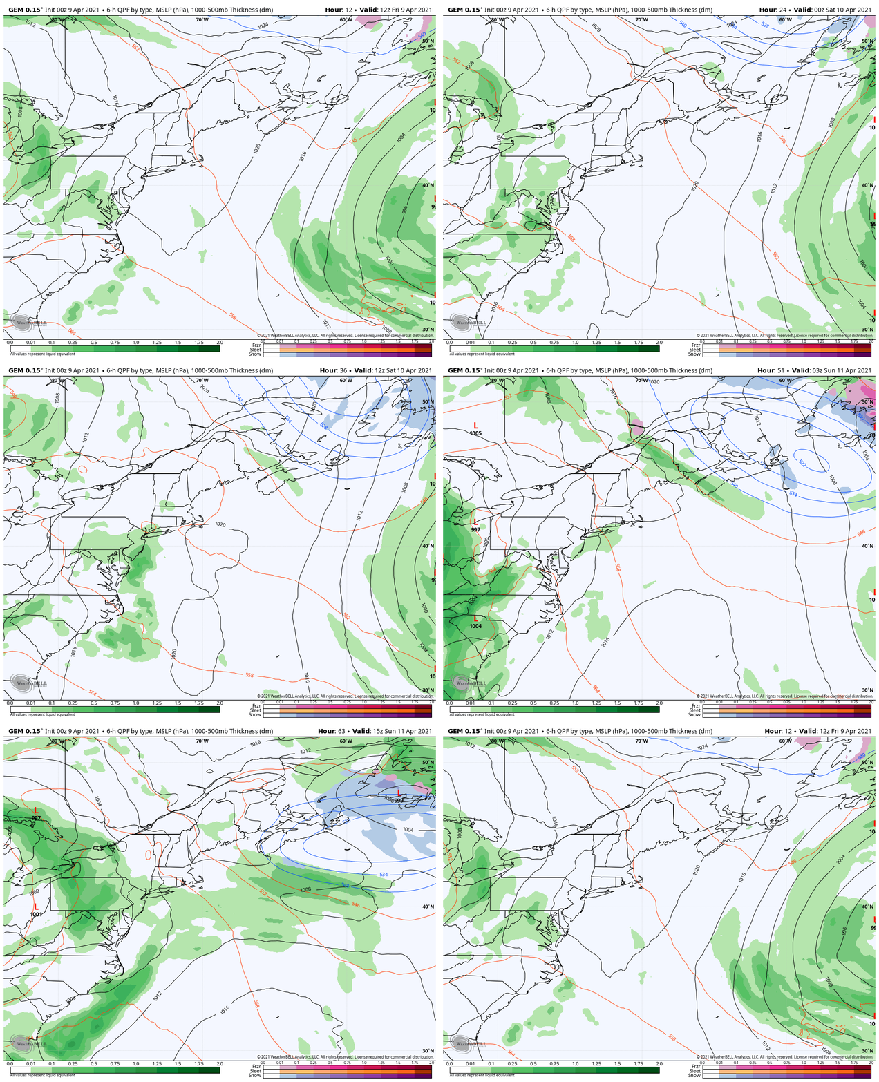
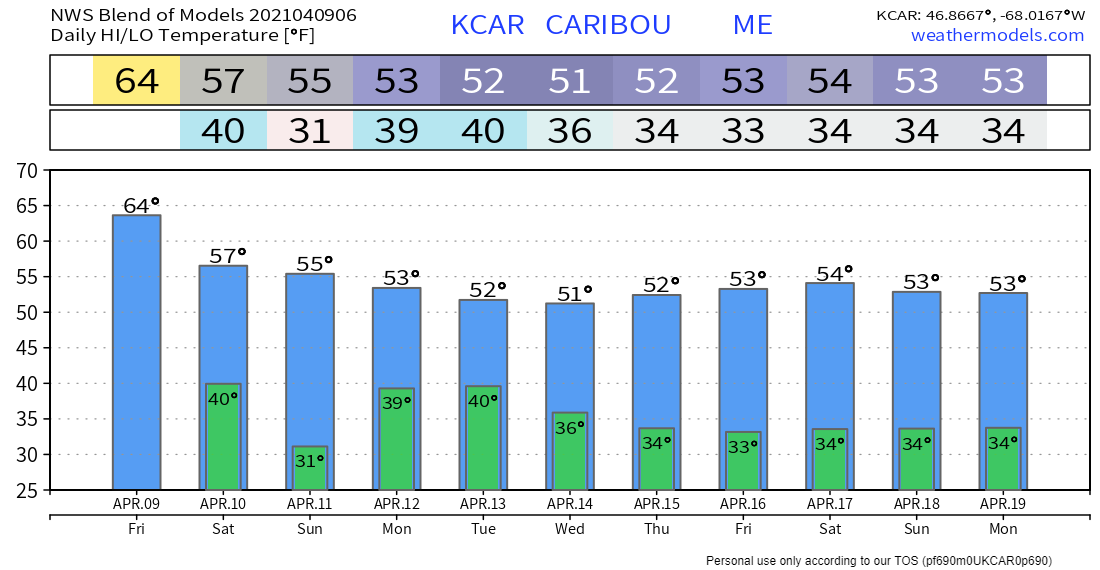
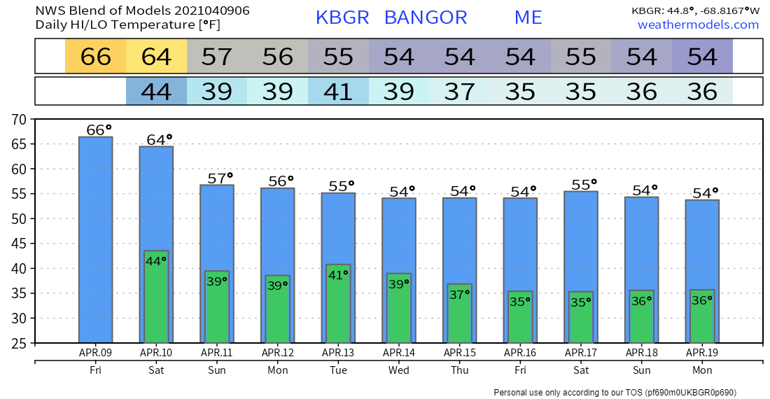
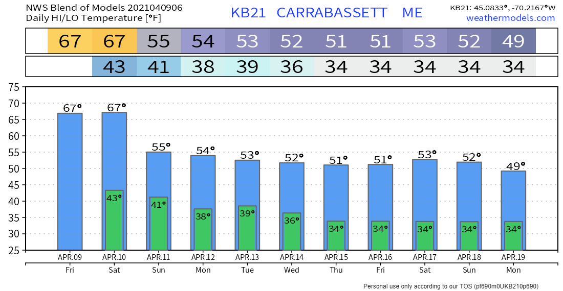
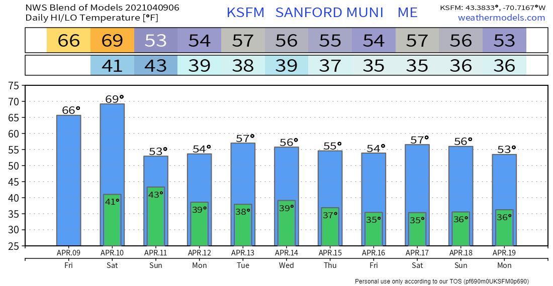
A personal note to start off to inform you that my mother passed away Tuesday morning. As you may have noticed I have been busy this week with updates, some cosmetic work and tweaking on the site and Facebook page. My work for Pine Tree Weather is part of my therapy as I work through the emotional side of it. This has also been a way that I remember my father, who passed away in March of 2006. Those of you who have followed me over the years know of the loss of family members that has gone on with me since November 2016. It's been a parade of memorial services as the count is up to seven since that time. I am eternally grateful to Penn State and my professor who helped me finish ahead as the loss of my mother has been imminent since early February. I am also grateful to each of you for your support of Pine Tree Weather, whether through shares, encouragement, and financial support. While I operate this for multiple reasons, it's a godsend that even through challenging times over the years that I continue to give back to the world for the gift of the incredible life I have been given. Much has happened in the nine plus years since I started forecasting publicly, and I sincerely appreciate those of you who continue to stand by me as I move onward. When I say that I appreciate your support, I mean that from the bottom of my heart. Thank you. A pleasant end of the weekWith the block in control, a beautiful day is in store for the region, with temperatures pushing 20° above normal in areas. The sky features abundant sun for most. A back door cold front may bring clouds to northern areas this afternoon. The early morning satellite photo shows the fringe of low clouds hovering over southeaster Quebec over into northern New Brunswick, with the cold front just to the north. With abundant sun in April, the sea breeze is likely to set up, which will keep the shorelines cool. Interior areas should reach the 60s with ease. Shoreline areas may flirt with 60s, upper 50s for Rockland and DownEast coastline areas. Weekend outlookThe strength of the blocking to the north will dictate the chance for rain later in the weekend. The surface high over southern New England moves east Saturday. The intense ridge will be challenged from the west and the northeast. The standard rule in meteorology is where there is a strong area of high pressure, there is a strong low not far away. This anomalous steering level loop shows just that. A strong area of low pressure moves in back door fashion from Newfoundland southwest. As that happens, another approaches the Great Lakes Sunday. Maine is caught in the middle of that squeeze play, which brings uncertainty to the forecast beyond Sunday. As the upper low over Newfoundland moves southwest, a cold front associated with it may bring showers to northern areas Saturday afternoon into Sunday morning. With the squeeze play on, clouds are likely to be more numerous as we wrap up the weekend. Ten-day temperature outlookEnjoy the 60s and perhaps low 70s over the next couple of days, pending on where you are. It will be a while before the region sees them again. As I mentioned in the previous update, we'll be flirting with frost potential in the time ahead. While the green thumb may have the itch to plant, it's still early to get too expansive with gardening. Be prepared to receive alerts and stay updated!
For more information in between posts, please follow Pine Tree Weather on Facebook and Twitter.
Thank you for supporting this community-based weather information source which operates by reader supported financial contributions. Stay updated, stay on alert, and stay safe! Thank you as always for your support! - Mike |
Mike Haggett
|

