A moment to reflect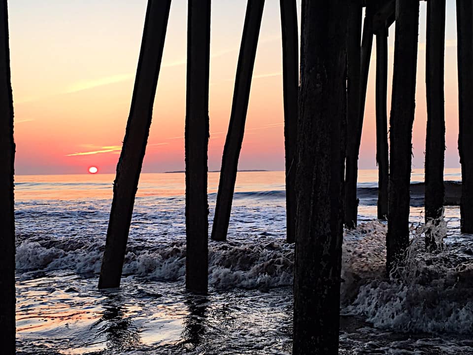 Sunrise from under the pier in Old Orchard Beach, my photo First off I want to say thank you again to Alex Hatfield and Kaitlyn Lardeo for their fine work shared here over the summer. I just recently finished my second semester with Penn State studying mesoscale forecasting (in a nutshell, thunderstorms). It was a joy to work with these two future meteorologists. They both brought energy and enthusiasm, and kept the content of the website updated all summer long. Alex will continue to contribute at times over breaks through the school year, for which I am grateful. I am set to begin my third semester studying tropical forecasting on Monday. With the peak of hurricane season fast approaching, it's exciting and rather timely. I am actively pursuing part time contributors from the meteorological college ranks to assist here through the winter in order to continue my studies and keep the information here updated. I appreciate your readership, your encouragement and financial support, along with your patience as my education continues. Best chance for storms on Saturday south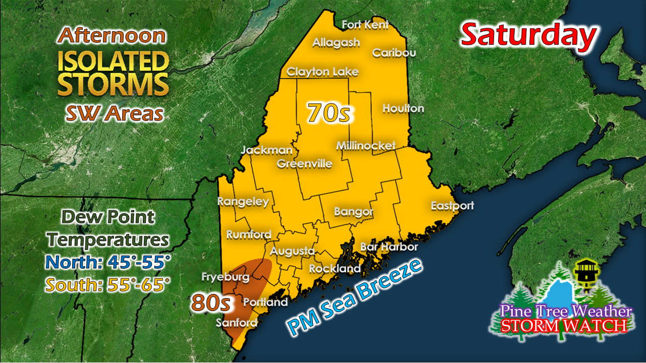 In a nutshell, if you are feeling the humidity, that could be a partial indicator of where storms flair up. Where you see the sea breeze and the 80s over interior southern areas is the other potential... 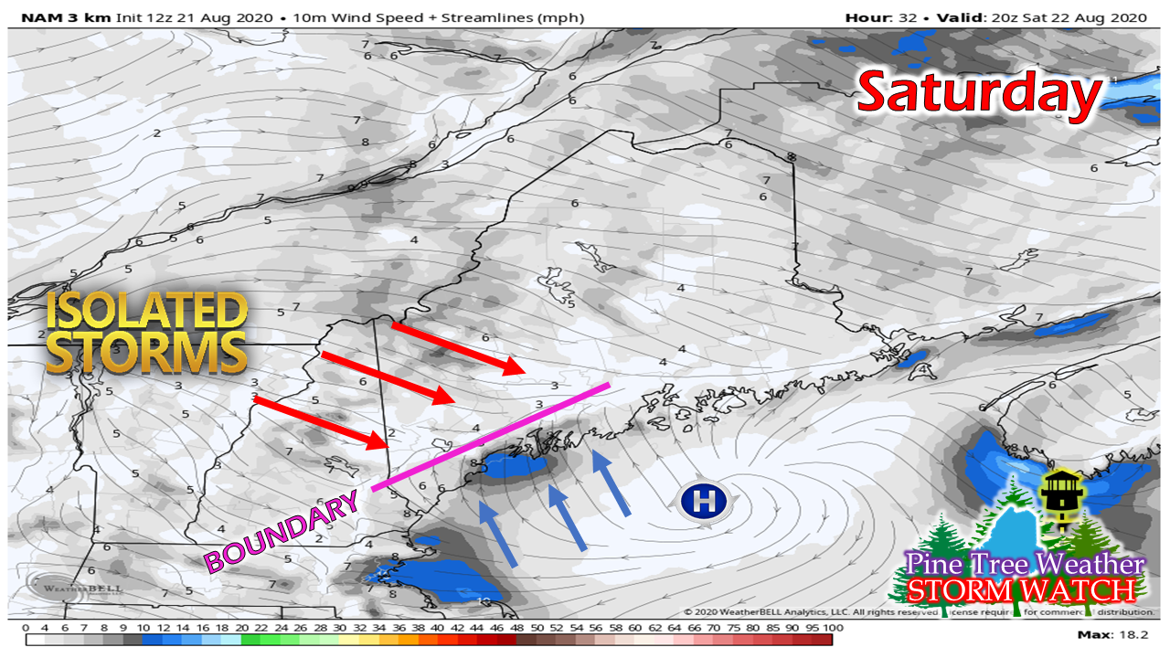 Anytime there is a cool sea breeze moving inland meeting up with warm west/northwesterly wind flow over the coastal interior, that sets up a surface boundary. As heat rises up into the atmosphere with the cooler air pushing it, that sets up a potential to generate showers and thunderstorms. Folks in southwestern areas should keep an eye to the sky Saturday afternoon, watch for popcorn cumulus clouds to form, and then anticipate storm activity. Any activity appears isolated. At this point, Sunday has the better chance for activity. Another round on Sunday, but warmer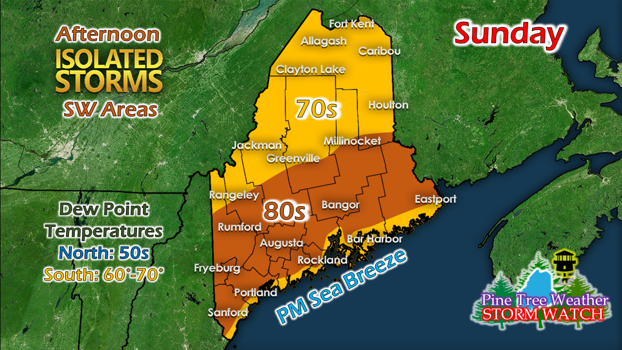 Warmer, more humid air drives northward. The best chance for storms appears from around Jackman over to Houlton south Sunday afternoon. With a cold front approaching from the northwest and humid air in place, this sets up more of a possibility. Timing of the frontal boundary will be the key. Stay tuned for updates on that. A look ahead to early next week We're going to be stuck in the west to east zonal flow pattern heading into next week. A trough to the north will try to work south and bring showers to the region for Tuesday. I don't expect a drought buster, but perhaps something to take the edge off a bit, especially for the north and western mountains. We're going to need some tropical remnants to work up from the southwest or a change in pattern to bring the rain most of the region desperately needs. As always, you can check the rain forecast page on the website here for the latest rain amount forecasts, as well as drought information to get an idea of what to expect. You can also check the CPC outlook page for an idea of what to expect in the 6-10 day range, which at this point appears cooler and a bit more damp as we head into September. Wildfire smoke from out west could arrive midweek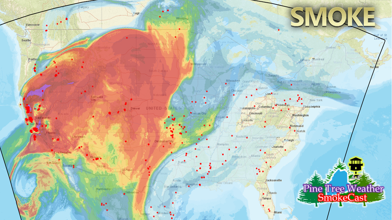 Using the HRRR model as a guide to show where the heavy smoke and the location of active wildfires (red dots) are located as Friday morning, it's easy to see a large plume of smoke and plenty of activity to keep it going. With the drought out west worse than what we are dealing with here, the subject of smoke in weather forecasts will be a source of discussion going forward.  Looking at the upper air pattern show the strong ridge over the southwestern part of the country collapsing. As it does, the jet stream will pick up the smoke and bring it eastward. It should arrive over northern New England roughly Wednesday. Expect vivid sunrises and sunsets, so have your camera ready. 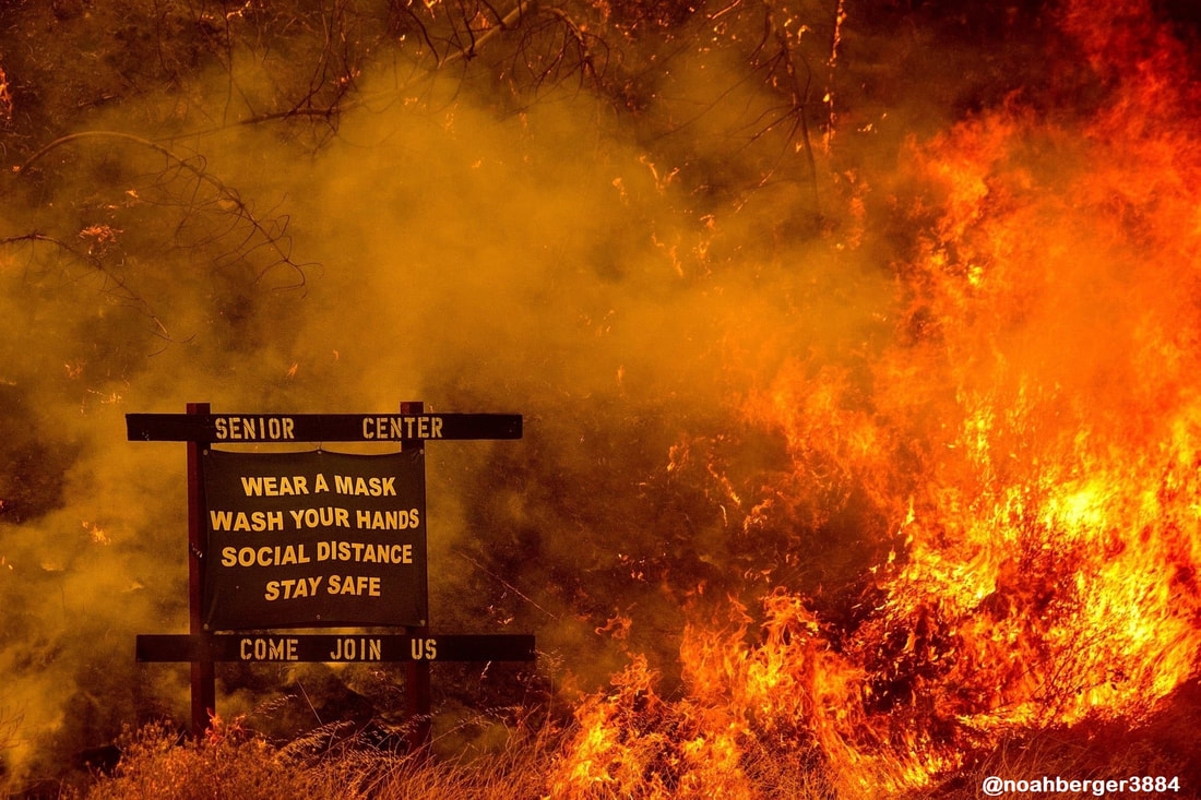 I saw this photo on Twitter on Thursday. This is 2020 in one image. What a year it has been, and the meteorological aspects are about to get more interesting. Double hurricanes in the Gulf of Mexico?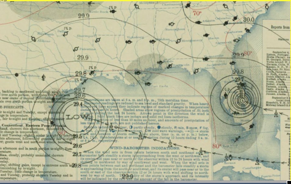 Double major hurricanes hit the US mainland. September 4, 1933 NOAA Archives We have to go back in recorded history to early September, 1933 to find something close to that idea, but the notion of two hurricanes in the Gulf of Mexico will be interesting to see how that plays out. While there is a chance, there are some hurdles both storms have to get through, and then will compete for energy once they clear those. 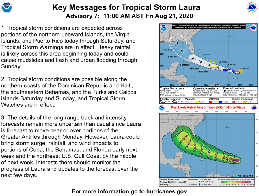 In Laura's case, the hurdle will be Hispaniola. The island of Haiti and the Dominican Republic with it's mountainous terrain has been a graveyard for tropical systems over years. Cuba has it's highlands, also. The forecast track comes very close to those areas. While there is a chance the storm interacts with land and dissipates, or gets wounded as it passes close by, there is no time to waste for storm preparation for Florida and the eastern Gulf coast. Waiting to see if it clears gives little to no time to prepare for storm conditions, especially as it enters the Gulf and could rapidly intensify with 30° C (86° F) temperature waters that await. 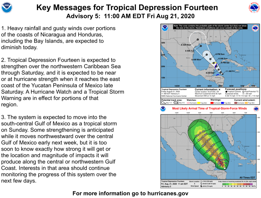 For TD14 (potential Marco), the Yucatan Peninsula is the main hurdle for that to get through. How well that storm holds together will dictate what happens from there. As with Linda, there is no time to wait for storm preparations for western Gulf coast interests. This storm will accelerate and could also rapidly intensify as it works northwest. For the latest information on both storms, check in with the National Hurricane Center. Will Maine get any remnant moisture from either storm? It appears doubtful for now. Regardless, stay tuned. Prepare for the season of storms now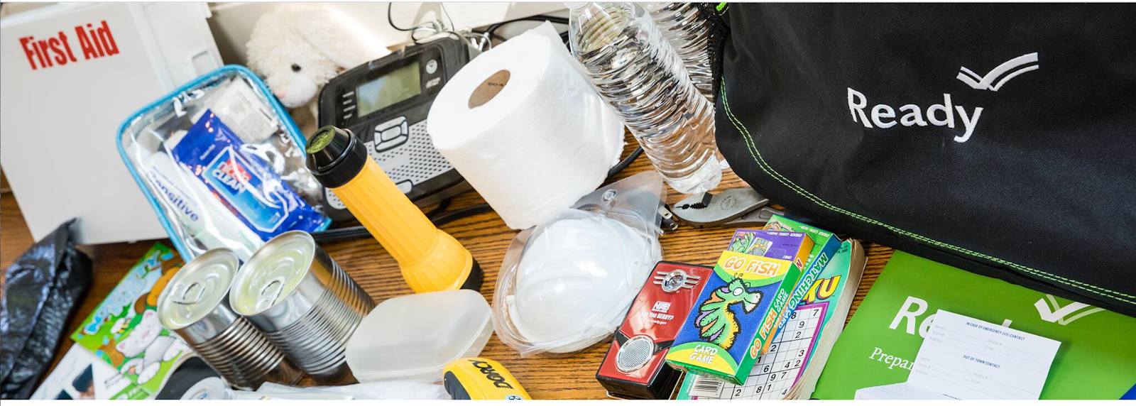 Get ready for hurricanes and severe weather with an Emergency Supply Kit that includes at least three days of food and water. Having your supplies stored in one place will give you peace of mind if you need to take shelter or evacuate. Everything will already be ready for you! ready.gov/kit Help forecast verification, and stay informed!
For more information, please follow Pine Tree Weather on Facebook and Twitter.
Thank you for supporting this community based weather information source that is funded by your financial contributions. Stay updated, stay on alert, and stay safe! - Mike |

Mike Haggett
|