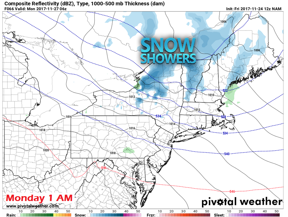
Warmer conditions for Saturday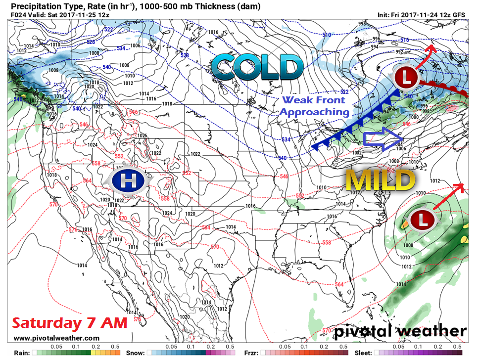 The region continues a west-east zonal flow pattern which will bring disturbances from time to time through the next several days. A weak frontal boundary will approach the area on Saturday, which will cause clouds to thicken and increase during the day. 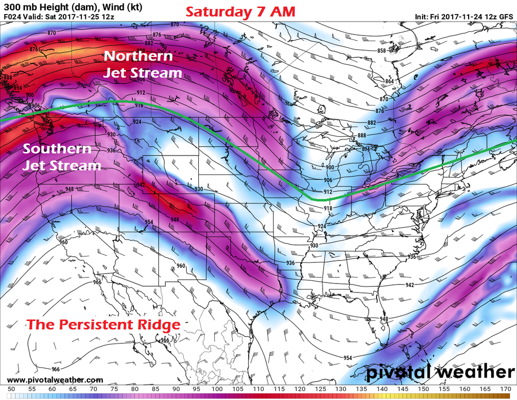 A split flow in the jet stream keeps low pressure to the south out to sea, not causing any potential enhancement of the front.  As the boundary approaches, it may cause some widely scattered rain / snow shower activity for the south, mountains and north in the afternoon. 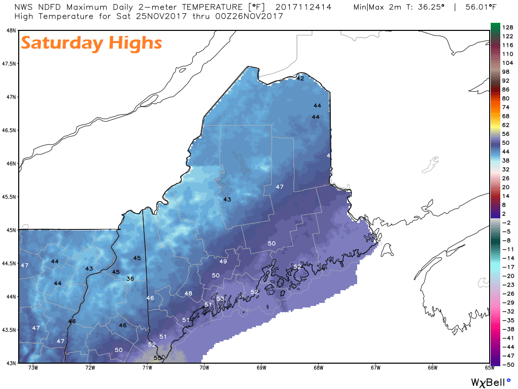 Highs for the day are a figurative torch for this time of year with 40s and 50s dominating the area. These highs range roughly 5° - 10° above normal. It appears to be on the breezy side with southwest wind in the 5-15 mph range with gusts in the 20-30 mph range pending on elevation and location. Frontal passage Saturday night into Sunday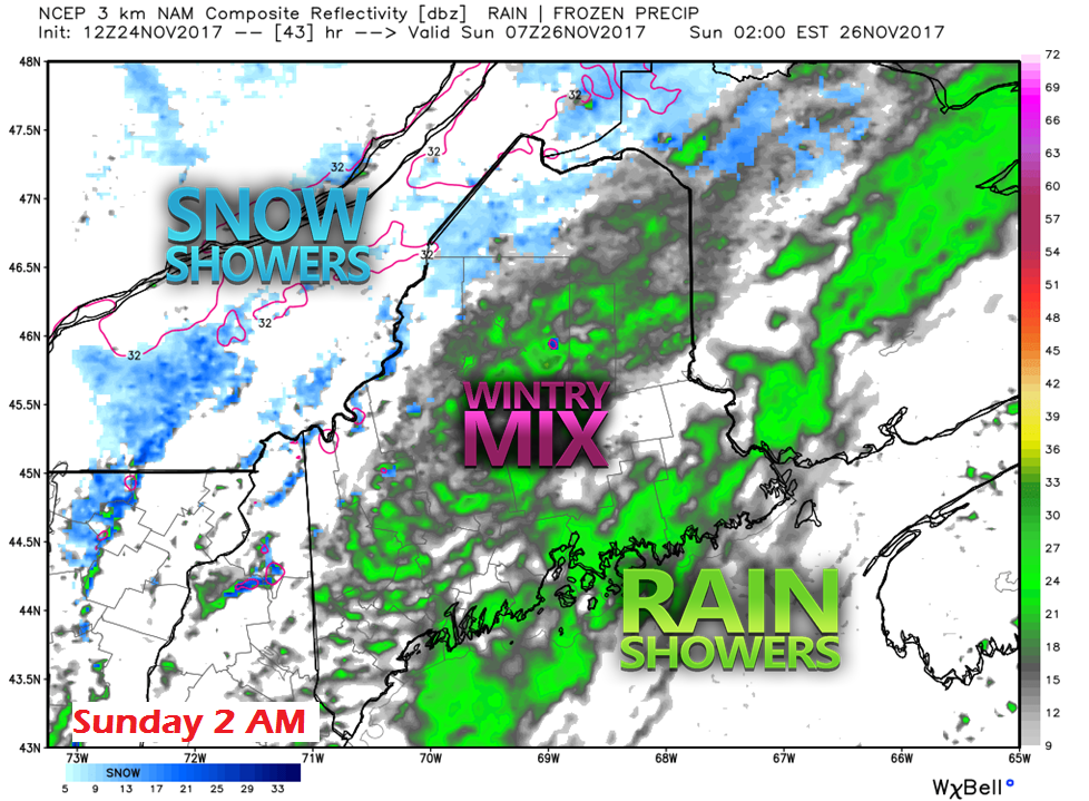 Shower activity picks up a bit Saturday night making for a damp overnight. A bit of a mix of sleet is possible for the western foothills on up into southern Aroostook County. 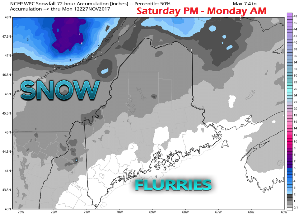 Cold air on the backside of the front may bring some light accumulations of snow for much of the region. The ski hills and higher terrain may get the benefit of a upward of a couple of inches of upslope enhancement. The rooftop of the state may see localized amounts in the 1-2" range as well. 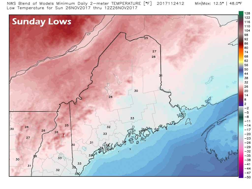 With the falling temperatures toward sunrise, areas of patchy ice & snow on roadways may be an issue around the entire region. Use caution if headed out Sunday morning. Improvement for Sunday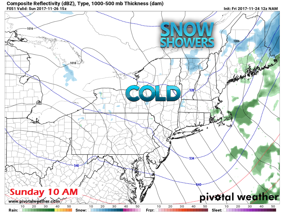 By mid-morning on Sunday, most of any remnant trailing showers appears to end for most of the region. Widely scattered snow showers may persist for the north and mountains into the afternoon. Don't let the greens that normally indicate rain on this futurecast fool you; this model runs warm. The weather feature will most likely be snow showers Sunday morning. 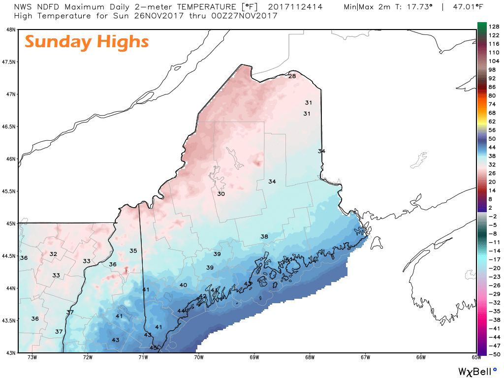 Sunday's highs range from the upper 20s to mid-40s pending on region. As Saturday was well above normal, these are normal values for the coast and 4°- 5° below normal for interior areas. Snow showers possible again Sunday night |

Mike Haggett
|