
A great day to wrap up the week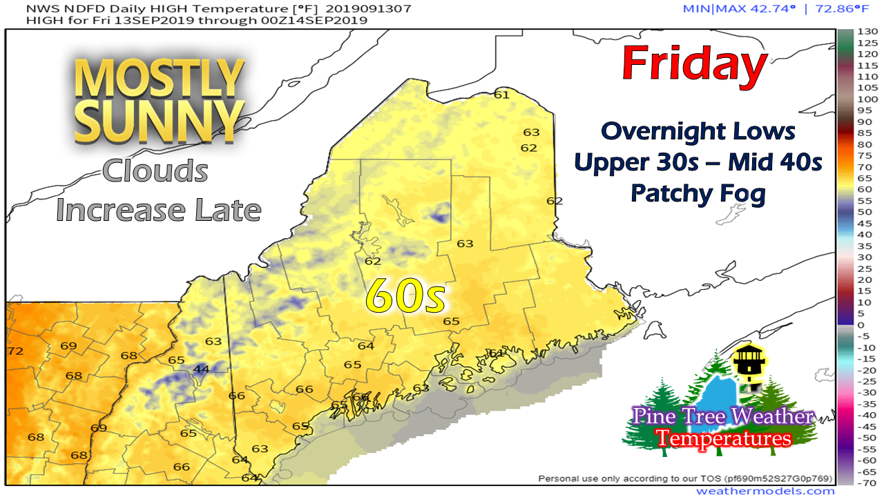 High pressure passes through the region today. It may be a bit breezy for MidCoast areas this morning, but other than, a quiet day with little wind and plenty of sunshine. Temperatures will be in the 60s, with the higher peaks a bit cooler in the 50s. A bit of rain for Saturday A cold front drops to the southeast on Saturday and will bring scattered showers along with it. The north and mountains see activity in the morning into the early afternoon. The speed of the front may be slow enough to keep southern and eastern areas dry until late in the afternoon or early evening. 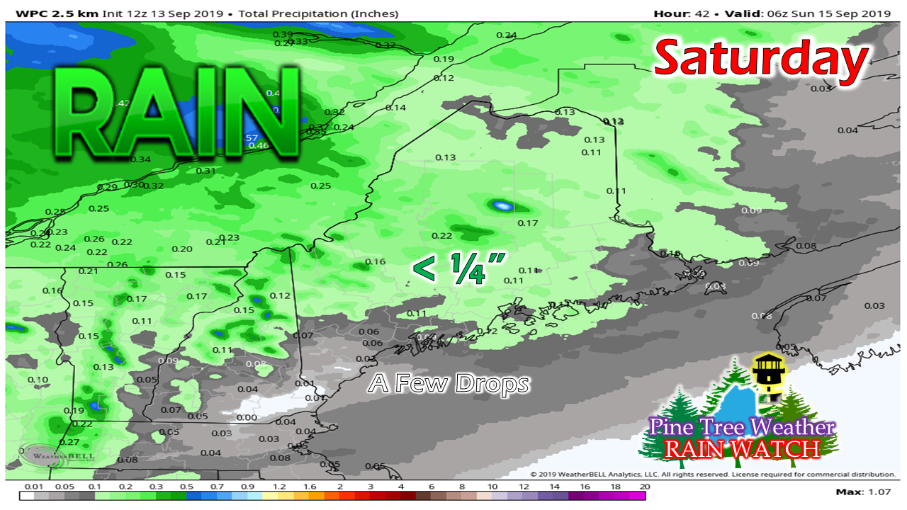 Overall, a tenth of an inch or two is about all that can be expected from this. Higher elevations may see a ¼", but that may be pushing it. 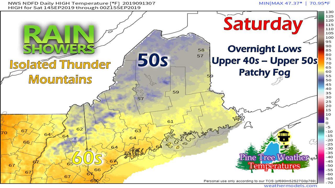 It will be a cool one for the north and mountains as clouds and showers keep temperatures in the 50s there. Eastern areas flirt with 60° as clouds appear to be more prevalent there ahead of the showers. Southern areas will see the warmer temperatures of the day as morning sun will help get the mercury up, but will likely cool off in the afternoon to the 50s as clouds increase and showers develop later in the day. Sunday generally pleasant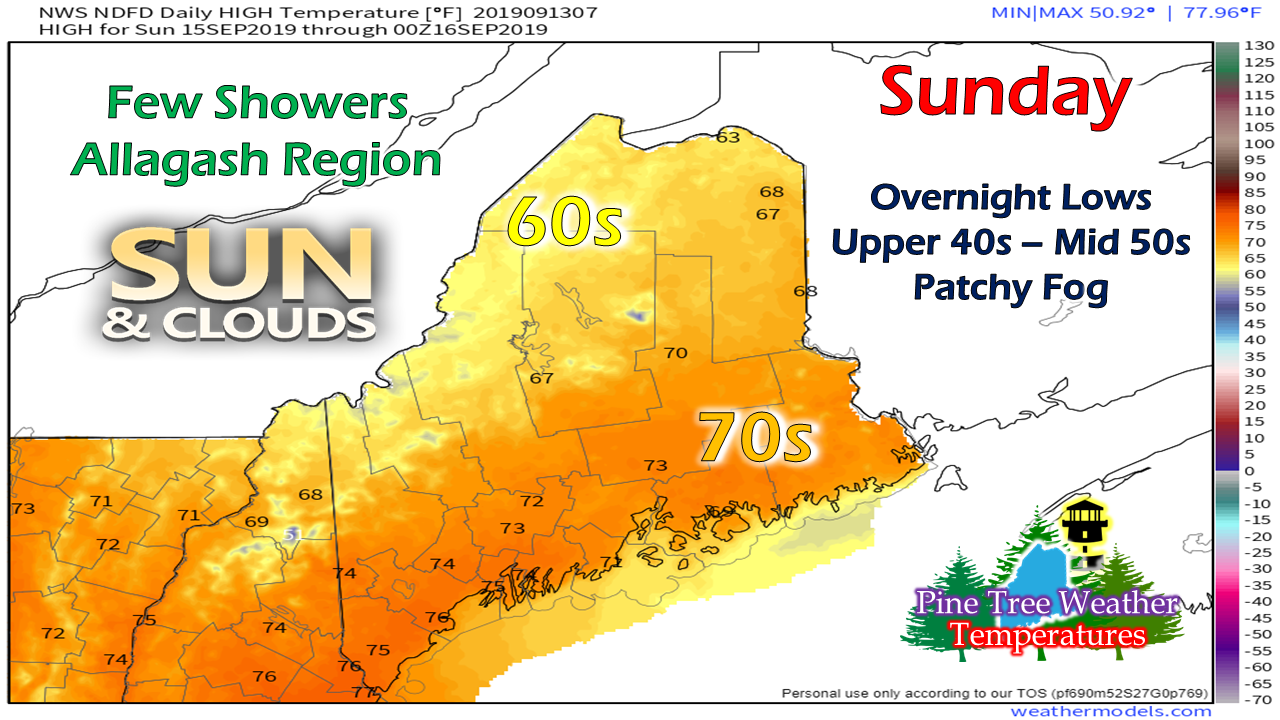 Outside of some spotty areas of light showers or sprinkle for the western areas of The County, the state stays dry for the day. An upper level trough passing through may bring some clouds. It appears to be a nice day overall with slightly above normal temperatures for most of the region. Another tropical system to watch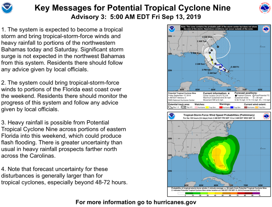 For areas impacted by Dorian, this is not good news. While it may not be nearly as strong, "Humberto" once named is likely to bring tropical storm conditions and heavy rain to the southeast and Bahamas over the next few days. With an eerily similar track as Dorian just offshore of the east coast of Florida, this is one for that area to monitor. As for any impacts on the northeast, it's too early to tell. Models are scattered in ideas as the storm has been slow to develop an area of circulation. Once it forms, better data will be captured and it will help determine where it could go. Please support Pine Tree Weather Pine Tree Weather is funded through the support of people like you. To this point, I do not accept outside advertising, and would like to keep it that way. Thanks to the Patreon monthly donors and those that have mailed checks, the site is roughly 40% funded for the year. In order to continue, a total of $3,000 is needed to pay the bills. October and January are when most of the bills come due. I have spent over $10,000 of my own funds over the years, and refuse to spend any more out of my own pocket to keep this going. If you find value in what I do, I will humbly ask you to support it. Without the financial support, this site will cease. No amount is too small. I would appreciate your support!
► ► For the latest official forecasts, bulletins and advisories, please check in with the National Weather Service in Gray for western and southern areas, or Caribou for northern and eastern parts of Maine. Please consider supporting Pine Tree Weather ► ► Your financial donations are much appreciated to keep this site funded and for further development. I sincerely appreciate your support not only financially, but also in sharing my efforts with others. For more information from me, please check the Pine Tree Weather Facebook page as well as my Twitter feed. Always stay weather aware! - Mike |

Mike Haggett
|


