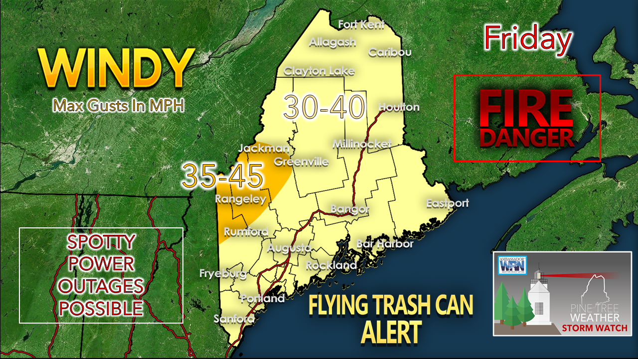
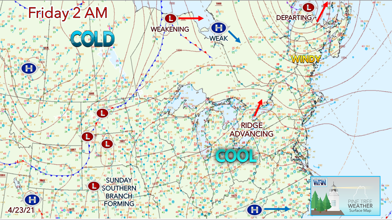
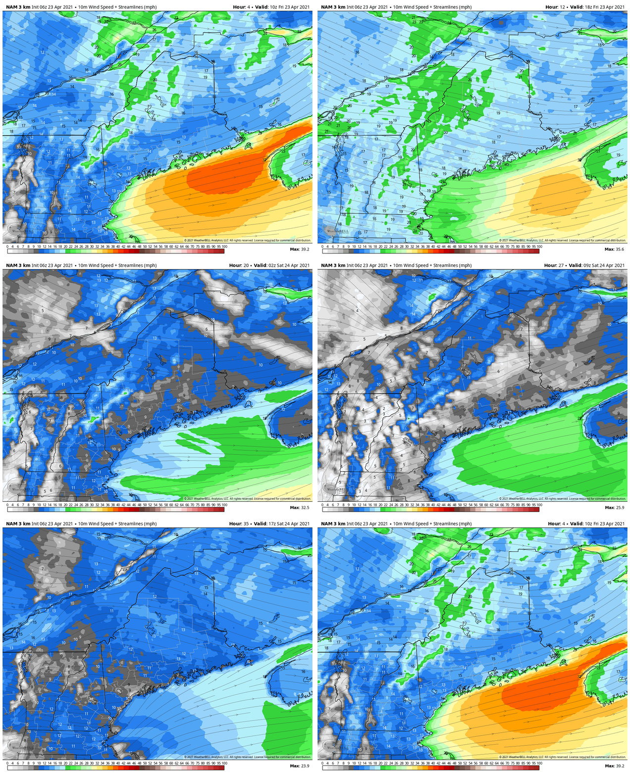
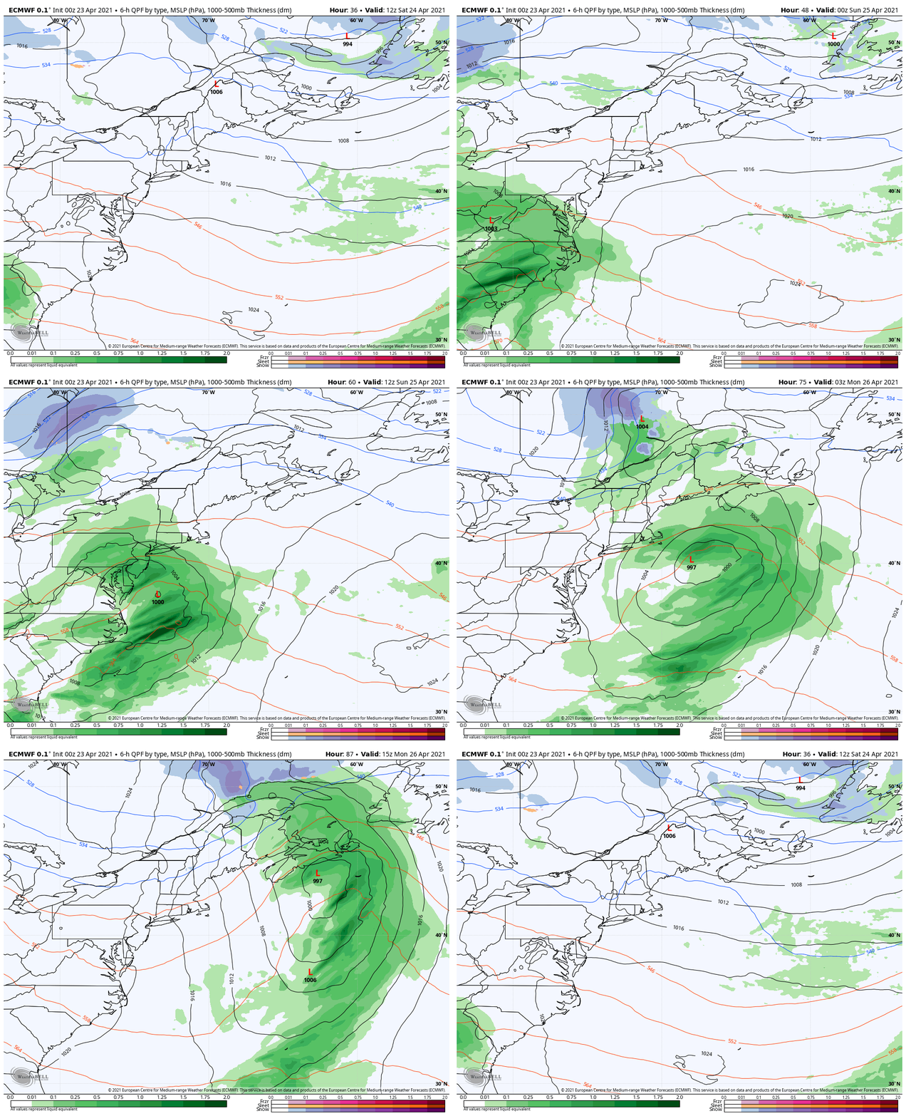
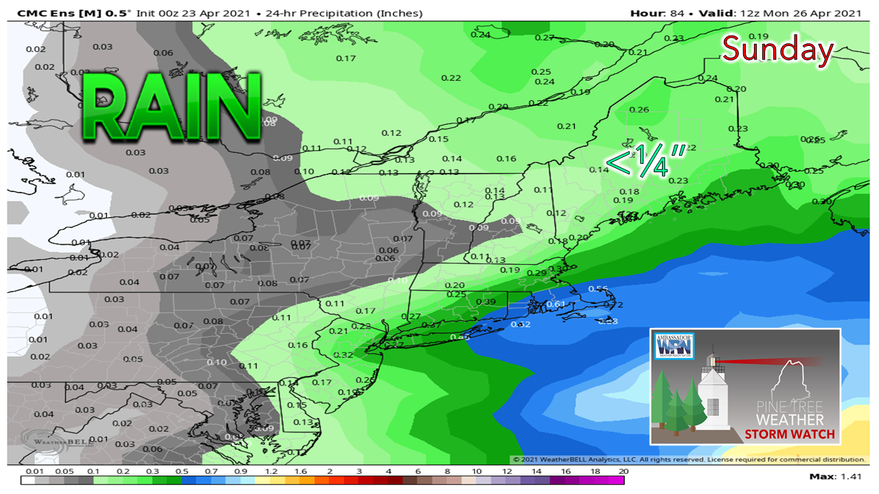
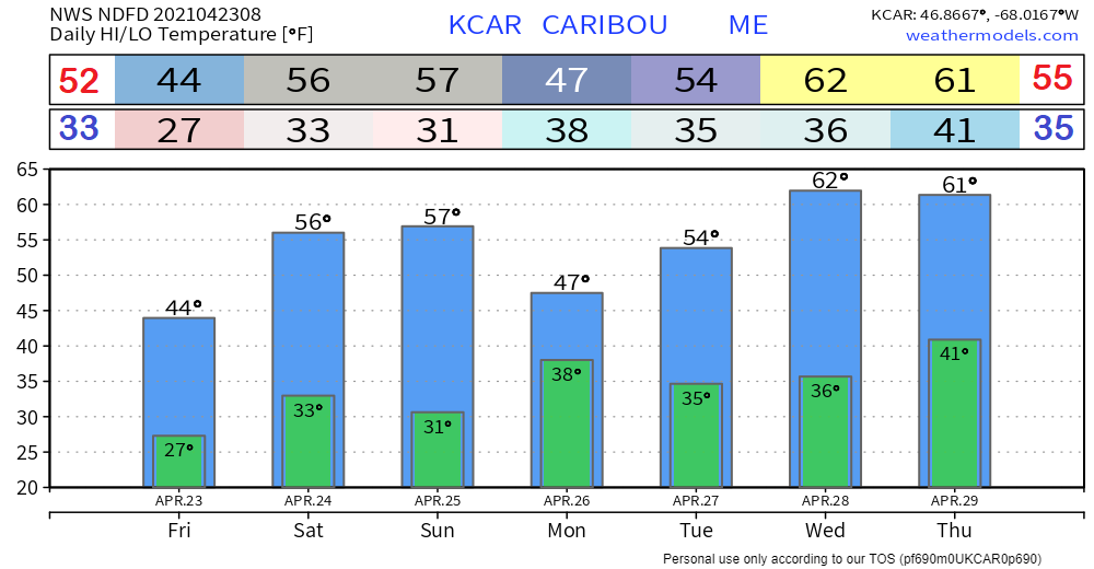
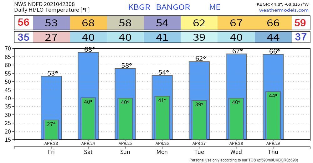
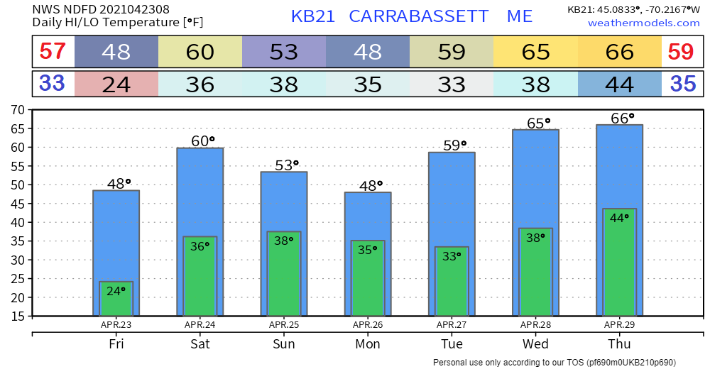
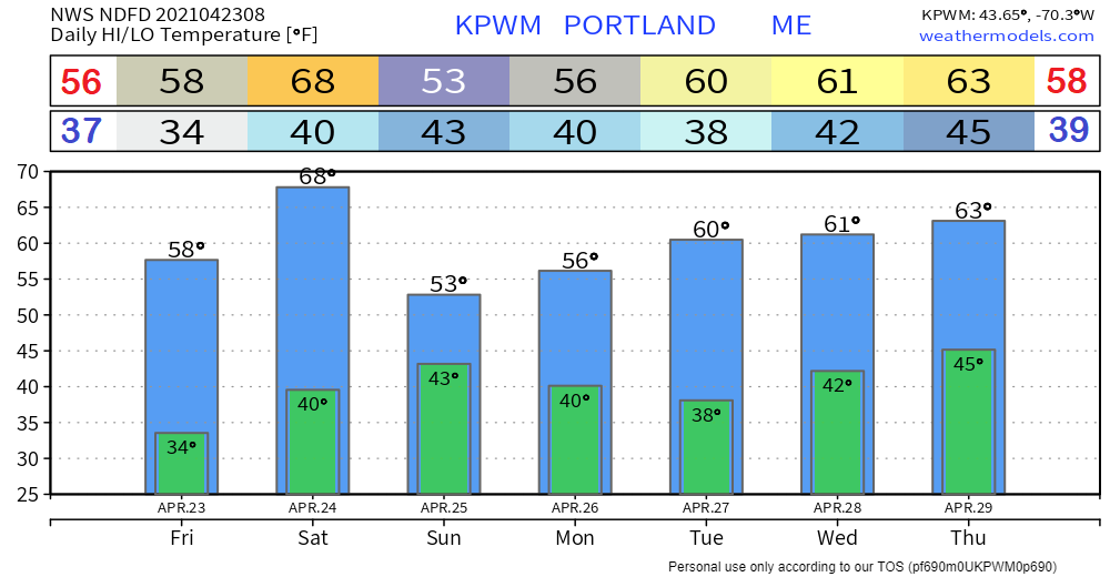
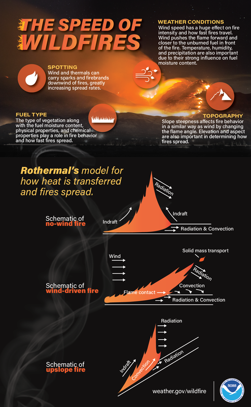
Strong wind raises wildfire concerns through SaturdayFor those burning, please hold off. For those using flammable materials outside, please use caution. Strong gusty wind and low relative humidity are a combination that can create wildfire potential. The culprit of the wind is the slowly departing low over the Gaspe Peninsula. That storm along with dry air from a weak area of high pressure to the northwest fuels the wildfire concern through Saturday. Wind speeds from the northwest in the 30-40+ mph range continue through Friday. As the low moves northeast and the weak high to the northwest moves east southeast, the breeze continues into Saturday at lesser speeds. Coastal areas east of Portland can expect a sea breeze to develop on Saturday to keep temperatures cooler in the afternoon. Sunday's potential soaker busting outOne of the difficulties in long range forecasting is that models have a tendency to be progressive at times with certain stream flows. What appeared to be soaker with potential to square up our early season deficit earlier in the week has turned into scattered showers for Sunday. The phasing between the northern and southern streams do not appear to happen in time to bring the gully washer. Atlantic Canada is poised to get the charge of rain. This rainfall idea may be a bit generous in amounts. DownEast areas are likely to see the most accumulation of any part of the state through early Monday. Northern areas squeak out two dry days. Southern, western and eastern areas avoid the showers in the morning, then see a few pop up in the afternoon into the evening. Outlook into next weekNOTE: Confidence in the forecast as we head into the middle part of next week is low. While the temperature forecast indicates potential for 60s, a back door cold front may spoil that idea. The next chance for rain after Sunday is Wednesday as it appears for now. Speed of WildfiresThere are a lot of factors that determine the speed of wildfires. Check out the infographic above to learn a little wildfire science and visit weather.gov/safety/wildfire for the latest safety tips. For Maine fire class levels, please check in with the Maine Forestry Service wildfire danger report that is updated daily at 9 AM, and always check with your local fire department of forest ranger prior to ignition. Be prepared to receive alerts and stay updated!
For more information in between posts, please follow Pine Tree Weather on Facebook and Twitter.
Thank you for supporting this community-based weather information source which operates by reader supported financial contributions. Stay updated, stay on alert, and stay safe! Thank you as always for your support! - Mike |
Mike Haggett
|

