
Coastal plain the area to be for the weekend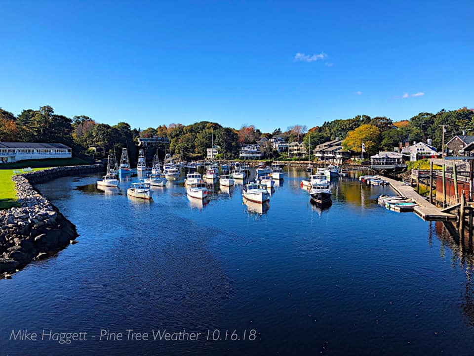 As the foliage has passed peak for the interior, it has reached peak along the coast. While the recent wind of the week has impacted some of the leaf drop, there is still come decent color around. This photo above from Perkins Cove in Ogunquit earlier this week still shows a fair amount of green. The chilly nights ahead will help expedite the turning of leaves, and with that come color to still come. The weekend forecast geographically dependent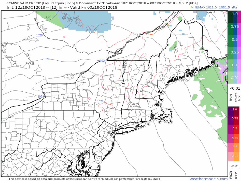 This European model loop idea from Thursday evening to early Wednesday indicates some hit or miss showers for Saturday in the mountains, then dry conditions until Monday night into Tuesday. An upper level low spins weak troughs through the region which may vary the clouds at times, especially in the north and mountains over the next few days. Southern and eastern areas have a better chance to see more sun than clouds, but again these disturbances aloft may gray the skies for a time and drop a quick sprinkle or light shower before clearing out as the days evolve. What precipitation comes does not appear to be much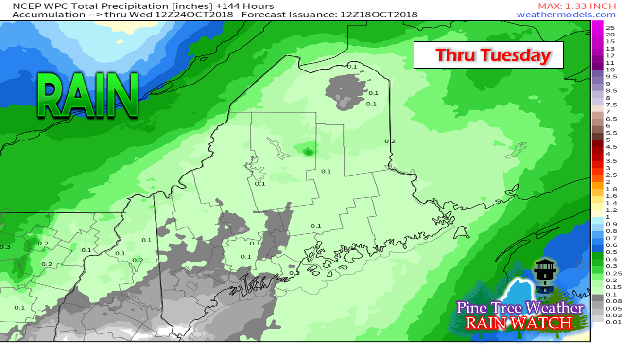 What rain comes won't amount to much over as it appears for now. We'll have to watch the Tuesday system as that may pop low pressure along the front which may bring added rains for the MidCoast and DownEast areas. For now, what comes will be light, and more of a slight nuisance to outdoor activity than anything else. Outlook through Tuesday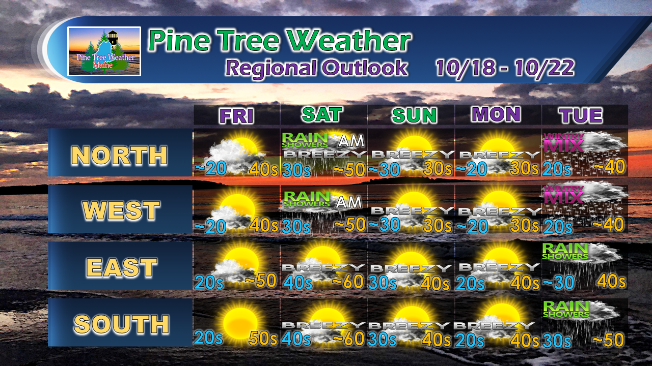 Friday and Monday mornings will be the coolest over the period. Breezy times will return over the weekend into the beginning of next week. A warm front works into the region Monday night and appears to bring showers for Tuesday. Folks in The County will have to keep tabs on the forecast for the middle part of next week as there is a chance for measurable, and perhaps a plowable snow Wednesday into Thursday. At this point, it is too far out to know for sure. As I mentioned in my update last night, there remains concern for a potential NorEaster to form given the evolving pattern as we head towards the end of the month. Timing, details and impacts still to be determined if it is to materialize, but something to watch for in the week ahead. Plan on getting your outdoor work accomplished sooner rather than later. Stay Updated! For the latest official forecasts, bulletins and advisories, please check in with the National Weather Service in Gray for western and southern areas, or Caribou for northern and eastern parts of Maine.
For more information from me, please follow the Pine Tree Weather Facebook page and my Twitter feed. Thanks as always for your support! Please consider making a donation to keep Pine Tree Weather going through the year ahead. Check out the donate page on how to contribute. Always stay weather aware! - Mike |

Mike Haggett
|


