
December 1st kicks the season off While astrologically the season does not officially begin until December 21st, meteorologically it begins today. December, January and February are the coldest months of the year for the Northern Hemisphere, hence why the winter season for forecasters begins now. We'll have three more weeks of shortening days before the poles shift direction and tilt towards the longer days summer. With winter comes the wild and the crazy of weather model charts circulating around social media. In my Bangor Daily News column, I discuss how to survive the hysteria of the season. Know your sources for weather information. Meteorologists could be certified at all levels, but sadly some engage in the hype and fear to feed their egos and their wallets. By doing so, they do a disservice to the public, and do not help the credibility and trust of the public. Thankfully, most of those who cover weather for a living in Maine do not engage in that activity, but unfortunately that cannot be said for many of the major cities in the northeast and nationally. Look for the trend, not for one model idea of an outcome. Trust your sources. Flurries for the north country Saturday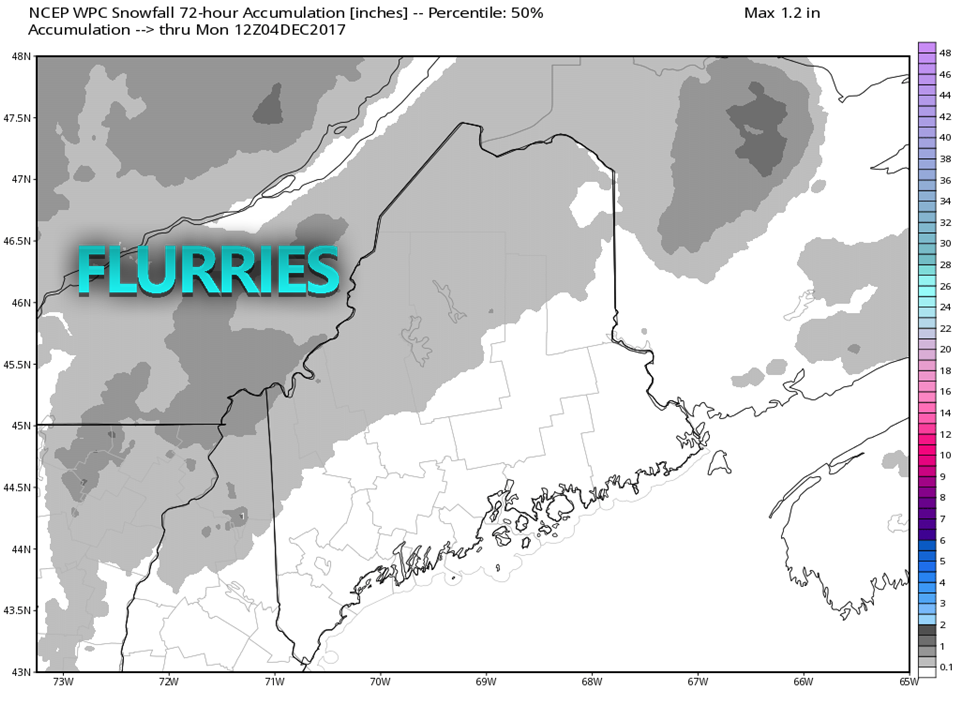 For those headed to the slopes for some early season skiing, you may experience a touch of snow to add to the ambiance of the day. Not expecting a whole lot, less than a half inch, and should not create any travel problems. The closer to the coast and further east, the more sun is expected for the day. High pressure controls Sunday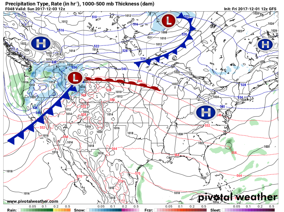 High pressure situated to the northeast and southwest will be the dominate feature for Sunday. There may be a few clouds in the afternoon, but otherwise a decent day with temperatures within a degree or two around normal for the early part of December. Bluebird skies for most Monday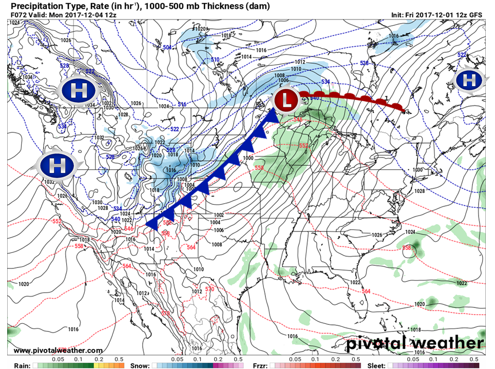 Strong high pressure remains in control to start the day before it slides eastward. A southwest flow will develop in the afternoon which may bring in a few high clouds late in the day for southern areas. The ridge over the west coast continues to build, and will be a key player for colder air to enter the region later in the week. Showers and mixed precipitation returns Tuesday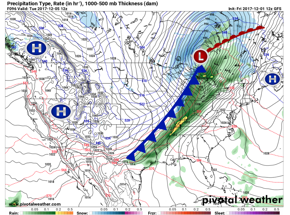 Timing of the approaching front is a bit of a question at this point, but it is a safe bet that outflow ahead of it will arrive during the day Tuesday. For now I am thinking a snow to rain mix over the north and mountains with rain showers for the coast. Unsettled weather continues into Wednesday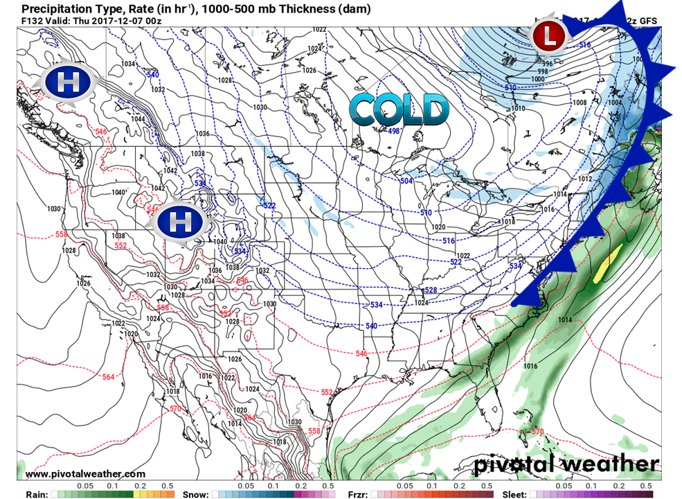 The front works through the region during the day Wednesday. On the backside of the front, cold air appears to change the rain to snow. Time will tell how close to the coast the snow will get, but it appears that it could be tricky travel Wednesday afternoon for the north country, and may last into the evening. It is still early to nail down all the details on this. Given the moisture stream from the Gulf of Mexico, there is a possibility for coastal low development. Stay tuned on that. Omega to impact the region into the following week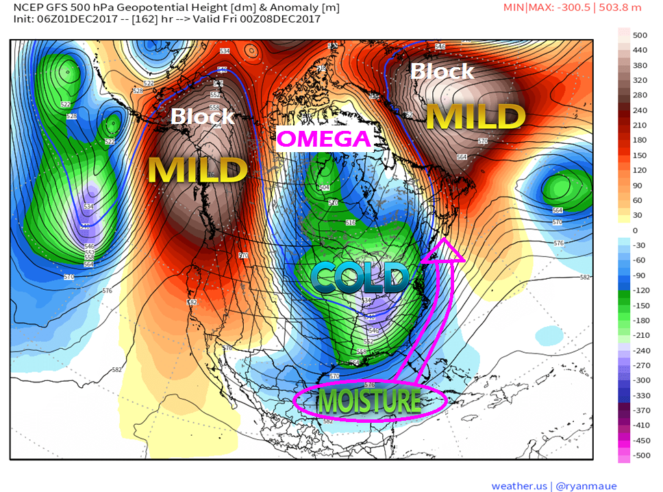 The forecast beyond Wednesday will be have to be watched carefully for snow impacts. What is certain is the cold is coming. What is uncertain is where the boundary of the cold ends up. It will be that position in proximity of the Gulf of Mexico along with the eastern ridge that will dictate any storm tracks. Models have shifted slightly west, but it is a week out. A lot can, and likely will change in the next few days.
The 5-Day Outlook page has been updated, with the link on the menu at the top. More updates to come. -Mike |

Mike Haggett
|


