
 Rain and snow Monday afternoon into Tuesday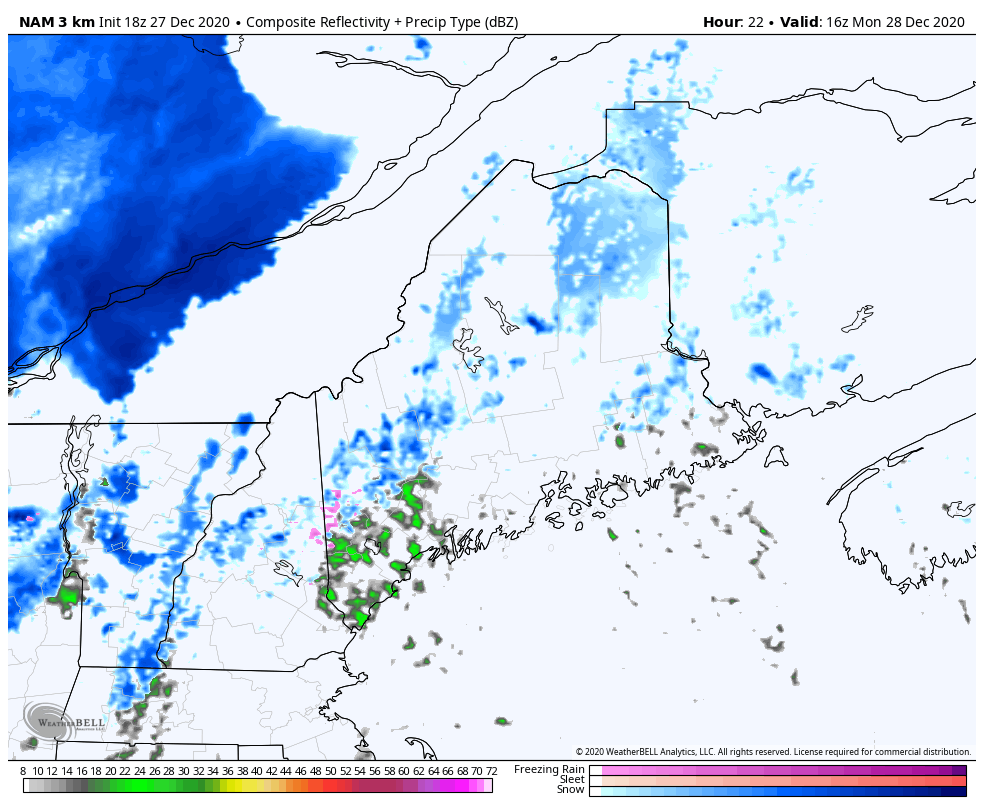 This is a GIF of simulated reflectivity and precipitation type from the NAM model from 12pm on Monday to 7am on Tuesday. A low pressure system will approach the region during the afternoon hours on Monday and precipitation may linger into early Tuesday. The associated warm front will pass right over Maine, putting the state within the warm sector and keeping much of the precipitation as rain. However, Central and Northern regions may stay cold enough to initially begin as snow but transition to a mix or even fully rain as the day progresses. The mountains and some areas North will stay mostly as snow, with accumulations around an inch or two. Overnight, the cold front will pass, turning any lingering precipitation into snow showers. All precipitation is expected to be light to moderate, with no major flooding expected. Take caution on roadways in Central and Northern Maine during rush hour on Monday, as roads could get slippery due to any mix or snow. Also, take caution Tuesday morning as any moisture on roadways or sidewalks will likely freeze into black ice due to the rapidly dropping temperatures after the cold front passage. Chilly weather after the cold front passage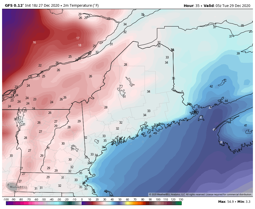 This is a GIF of temperatures from the GFS model from Monday night (midnight) to Wednesday at 7pm. As the cold front passes Monday night, temperatures will fall into the 20s and teens for Tuesday and Tuesday night. It will also be windy on Tuesday, with a brisk northwest wind at 10-15 mph with gusts up to 25 mph. Clouds will linger in the Northern portions of the state, but clear out as the day progresses. By Wednesday, coastal regions will rise into the 30s with much of the rest of the state still lingering in the mid-upper 20s. Winds will die down but clouds will move back in to the state during the afternoon and overnight hours. More rain and snow to start off the new year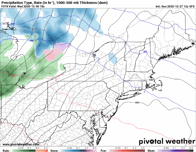 The beginning of 2021 will feature an interesting weather set-up. First, a quick moving low pressure system will sweep through on Thursday. This system, similar to Monday's storm, will bring rain, snow and a mix to much of the state. The precipitation is expected to begin during the very early hours of Thursday as snow, then transition to rain as the precipitation heads south and the day progresses. However, this is 5 days away and there is still much uncertainty with this storm. It will likely be low-impact though, with low precipitation totals due to the fact that it's a quick-hitting system. Then, on Saturday, another system moves through with a higher probability of wintry mix and heavier precipitation. As the week progresses, Mike and Kaitlyn will keep an eye on both of these systems though and keep you all updated! Be prepared to receive alerts and stay updated!
For more information, please follow Pine Tree Weather on Facebook and Twitter.
** FUNDING NEEDED FOR 2021 ** Thank you for supporting this community based weather information source that is funded by your financial contributions. Stay updated, stay on alert, and stay safe! Happy New Year! Here's to a safe, healthy and happy 2021! -Alex |

Mike Haggett
|


