Wicked hot and humid through the weekend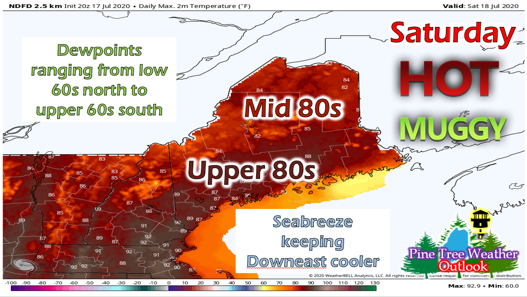 Saturday will begin the hot and muggy trend that will persist into next week. Expect temperatures in the mid-upper 80s throughout the state, with 90s possible. Dew points will range from the low 60s in northern regions to upper 60s in southern regions. A southwesterly breeze with keep the Downeast coast confined to the 80s and cooler than the rest of the state. There's a chance of a few isolated thunderstorms in the afternoon, but there's not much forcing for storms to form or sustain themselves. So, any storm that does pop-up will not last long. Saturday night, temperatures will range from the low 60s north to upper 60s south. There is a chance of fog along the coast overnight, especially in Downeast areas. 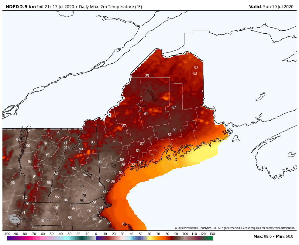 NWS High Temperature Forecast for Sunday 7/19 to Monday 7/20 Sunday and Monday will both feature temperatures in the 80s throughout most of the state and low 90s in southern regions. Dewpoints will be in the upper 60s and low 70s both days as well. The chance of precipitation on Sunday is low, but a cold front arrives on Monday so there's a higher chance of storms then. However, the timing of the cold front is a big factor in how strong the storms will be or if they'll happen at all. Slightly less humid for Tuesday, then rain on Wednesday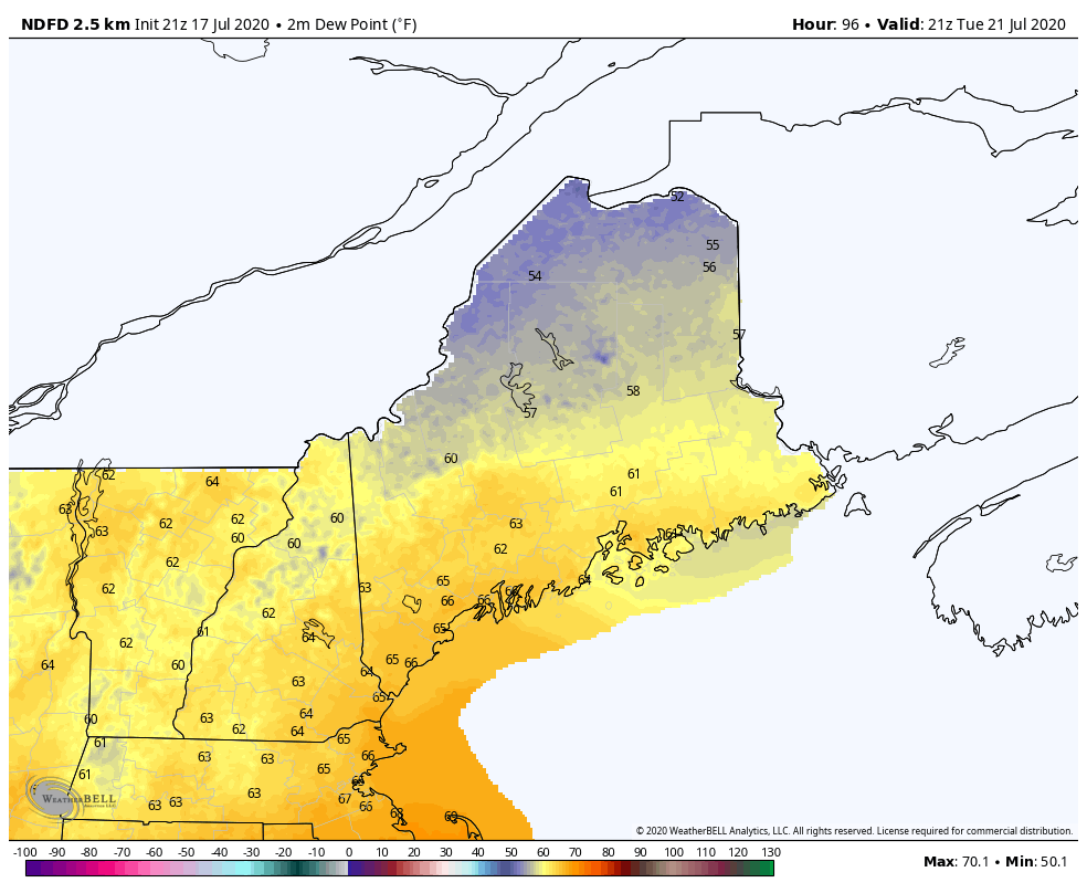 Temperature wise, Tuesday will be similar as the past few days with highs in the mid/upper 80s in the southern regions and low 80s up north. However, the cold front passage will offer a little break in terms of oppressive humidity, with northern and central regions staying in the 50s for dew points. Though southern regions will still see mid 60s for dew points, much of the state will feel less uncomfortable. 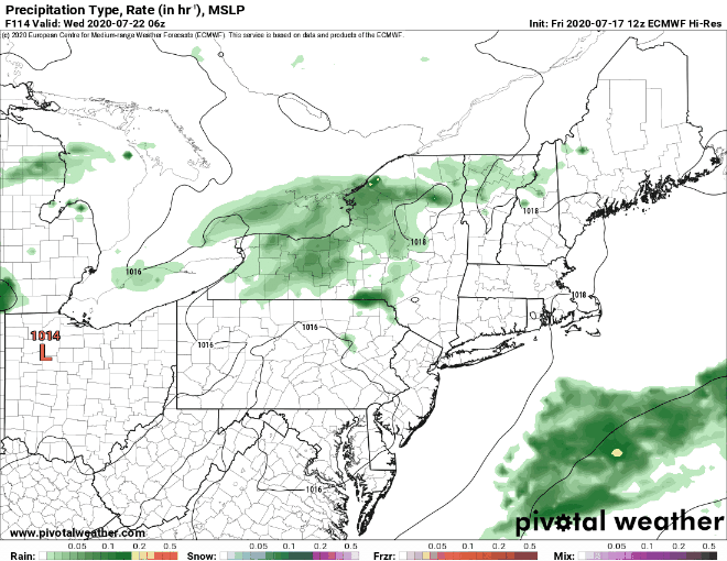 Rain will move in overnight on Tuesday and linger throughout the day and into the evening. Temperatures will cool down a bit on Wednesday, barely making it out of the 70s. Hurricane preparedness!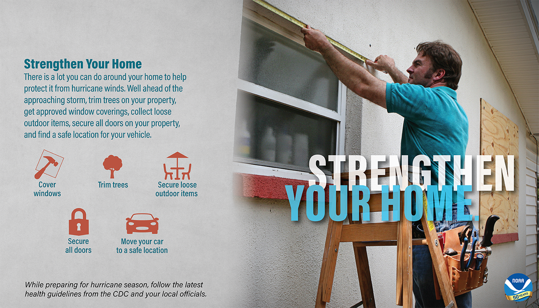 As we continue through NH and Maine Hurricane Preparedness Week, another thing to consider would be strengthening your home. If you plan to ride out the storm from your house, make sure to board up windows, trim any large tree branches, secure loose items outside, lock all doors and windows and move your car into your garage or a safe location. All of these things will help mitigate any further damage to your house or personal belongings. Help forecast verification, and stay informed!
For more information, please follow Pine Tree Weather on Facebook and Twitter.
Thank you for supporting this community based weather information source that is funded by your financial contributions. Stay updated, stay on alert, and stay safe! Happy Friday! - Alex :) |

Mike Haggett
|