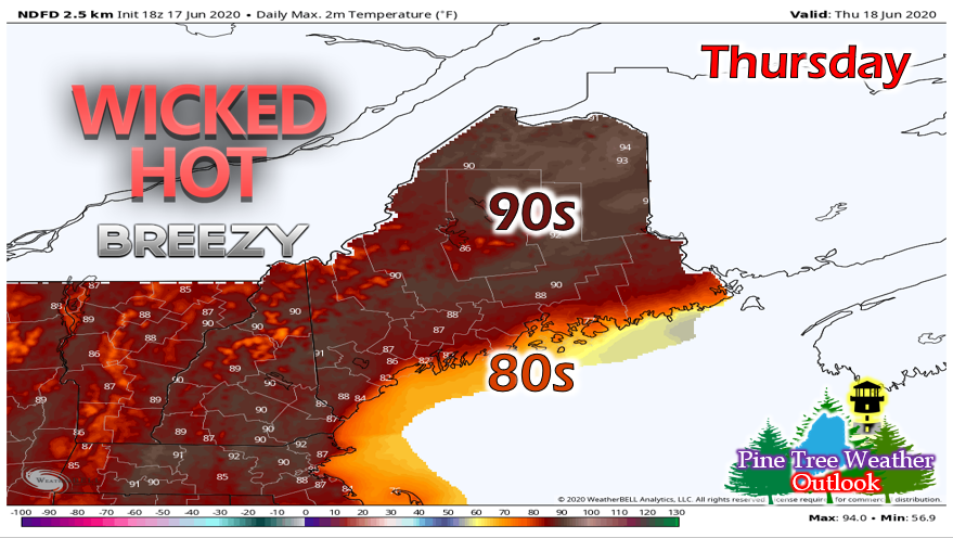
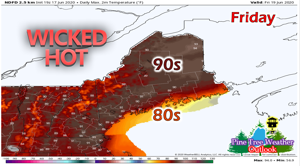
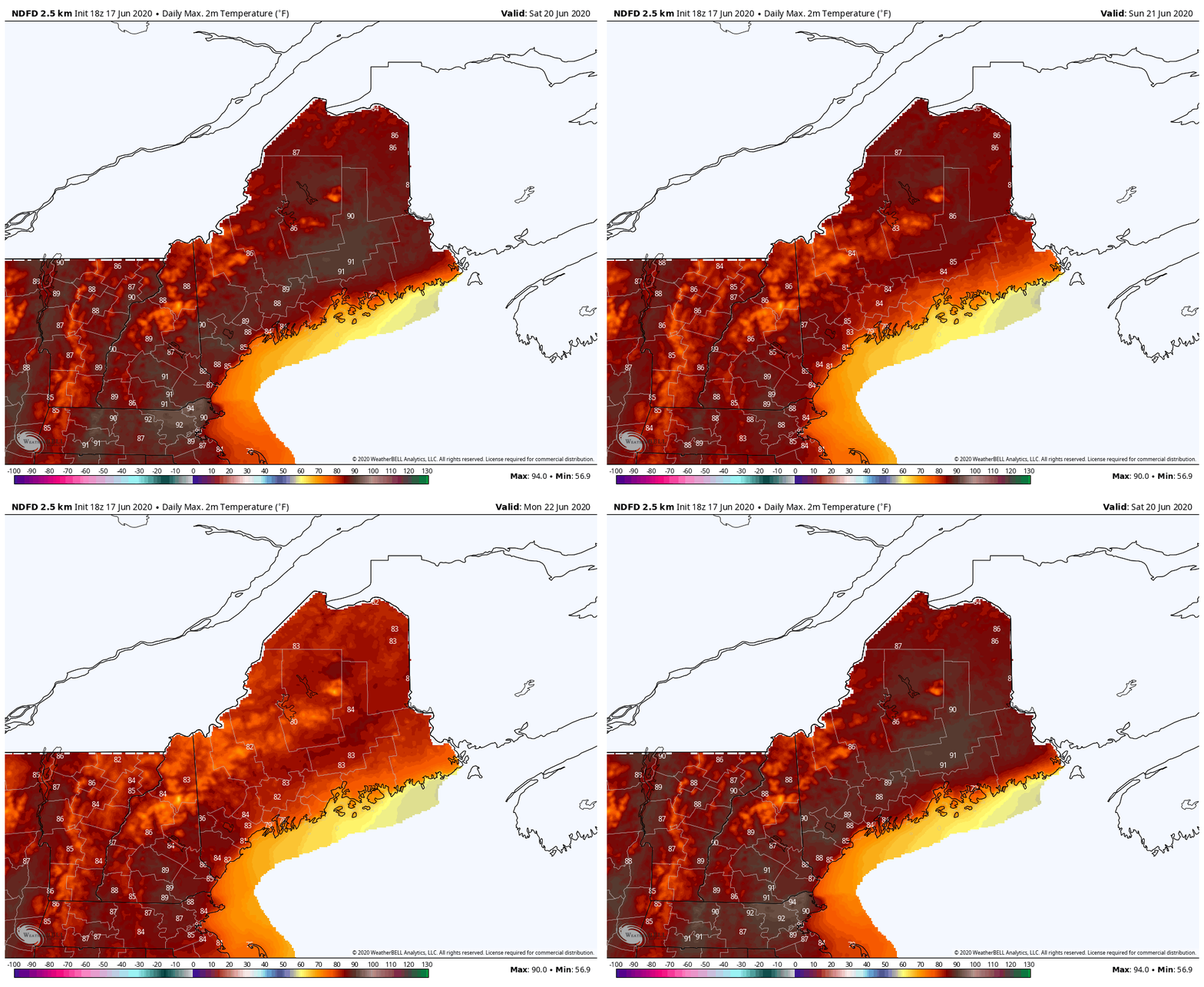
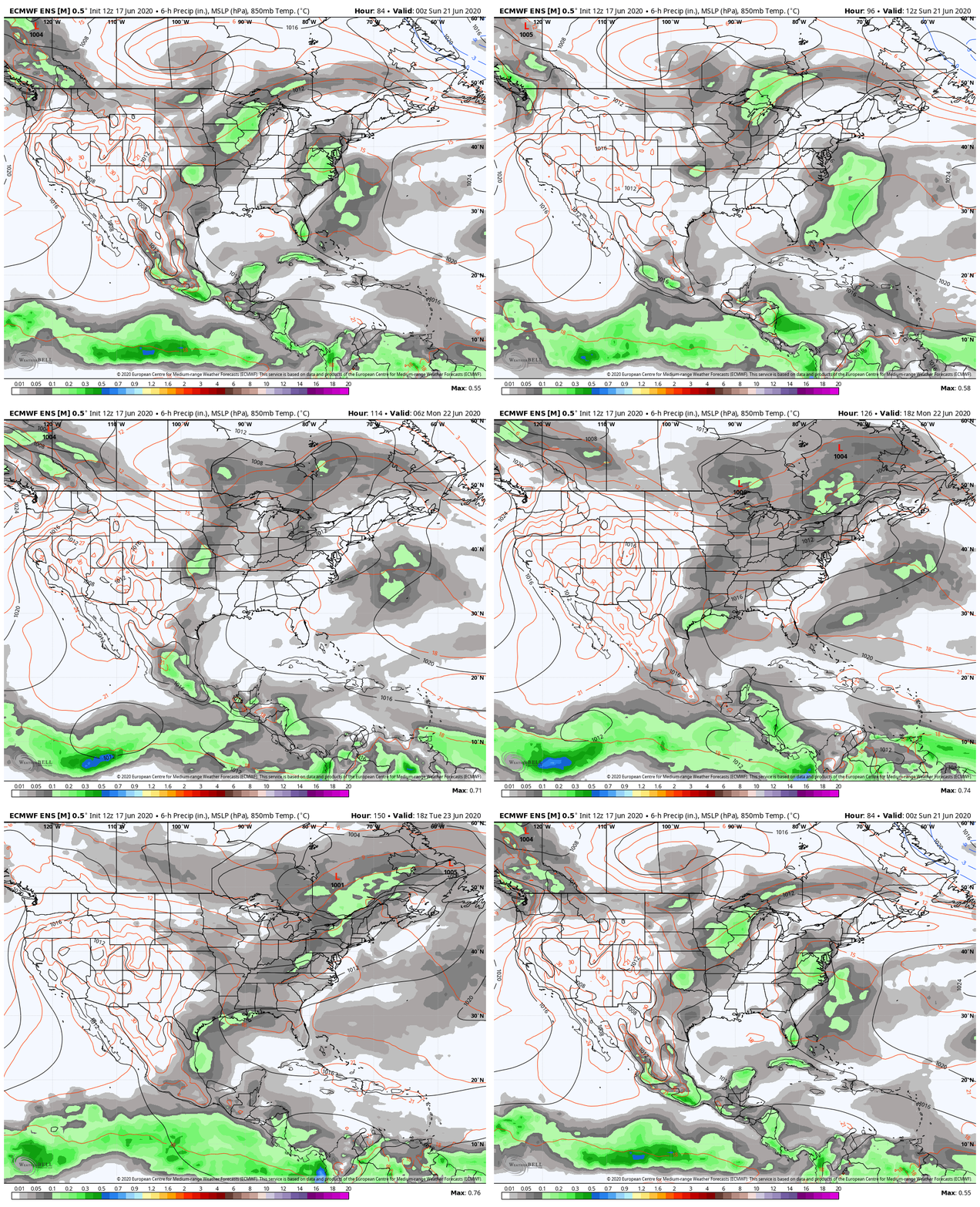
Hot and breezy Thursday, uncomfortably hot FridayA high pressure system is bringing significantly above average temperatures to the state from Thursday until Saturday. Much of the state will see low 90s on Thursday, with the mountainous and coastal regions in the mid-upper 80s. A seabreeze will set up, with the stronger winds in the Downeast and northern regions, and help keep the hot conditions slightly more bearable. Skies will be mostly clear with only a few high clouds passing through the state during the day. Overnight temperatures will be in the low 60s throughout the state with some isolated high 50s Downeast and along the coast. There is also a chance for fog along the coast in the early morning hours. The wicked hot temperatures continue into Friday with more widespread low 90s across the state and even some mid 90s near Caribou! Like Thursday, mountainous and coastal regions will remain in the mid-upper 80s and skies will remain mostly clear. However, Friday won't feature much of a breeze so it may feel much more uncomfortable. Double check that your A/C is working and don't forget to check on any elderly friends/family members to make sure they're staying cool! Temperatures will fall into the low 60s throughout most of the state overnight. Regions along the border of New Hampshire will see mid 60s, while northwestern and Downeast regions will fall into the upper 50s. The threat of fog remains along the coast. Weekend OutlookA backdoor cold front slides into the region on Saturday, slightly dropping temperatures along the northern regions of the state, but central regions could still get up into the low 90s. Temperatures on Sunday will drop into the mid-upper 80s and Monday seeing mainly low 80s. Rain OutlookIt looks like the next chance of rain for the state comes on Tuesday with an approaching low pressure system. It looks like the system may linger for a bit, but the timing and details are still uncertain. We'll be sure to keep you updated as we know more. Help forecast verification, and stay informed!
For more information, please follow Pine Tree Weather on Facebook and Twitter.
Thank you for supporting this community based weather information source that is funded by your financial contributions. Stay safe and healthy! -Alex |
Mike Haggett
|

