Pine Tree Weather
  • DISCUSSIONS
  • DONATE
  • MAPS
  • NWS BRIEFINGS
  • SATRAD
  • MARINE
  • SNOW / ICE OUTLOOK
  • RAIN OUTLOOK
  • CPC OUTLOOK
  • Kennebunk
  • OBSERVING WEATHER
  • Who We Are
  • My Photography
  • DISCUSSIONS
  • DONATE
  • MAPS
  • NWS BRIEFINGS
  • SATRAD
  • MARINE
  • SNOW / ICE OUTLOOK
  • RAIN OUTLOOK
  • CPC OUTLOOK
  • Kennebunk
  • OBSERVING WEATHER
  • Who We Are
  • My Photography

Wind advisory expanded for the coast; snow and sleet to impact the mountains and north

12/5/2017

Comments


MidCoast included in wind advisory

Picture
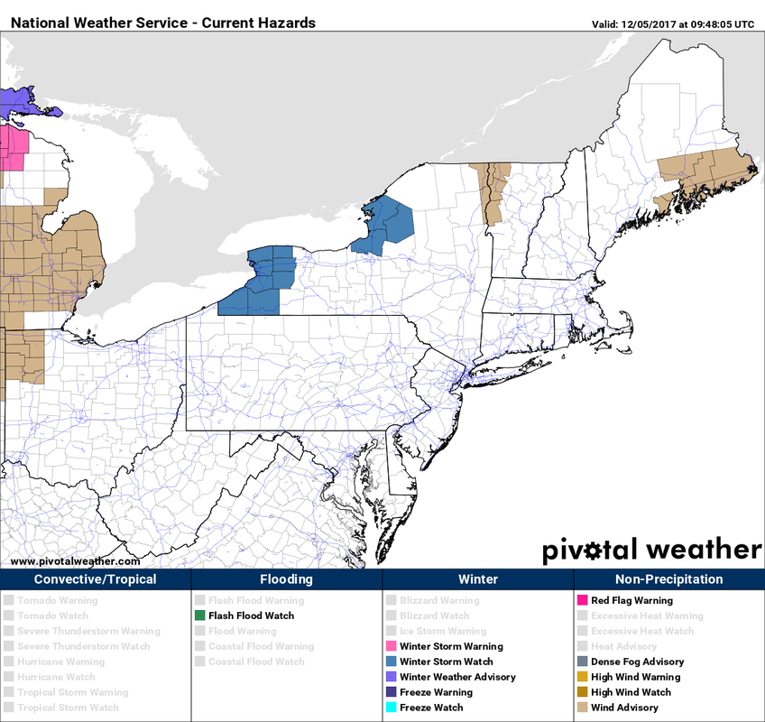
As of 5 AM, the following counties are under wind advisory: coastal and central Washington, coastal and central Hancock, southern Penobscot, coastal Waldo and all of Knox County. 

Not shown, a coastal flood statement has been issued for Cumberland and York counties for high tide around noon. Gale warnings are also posted for coastal waters of the Gulf of Maine.

Short term predictive radar

Picture
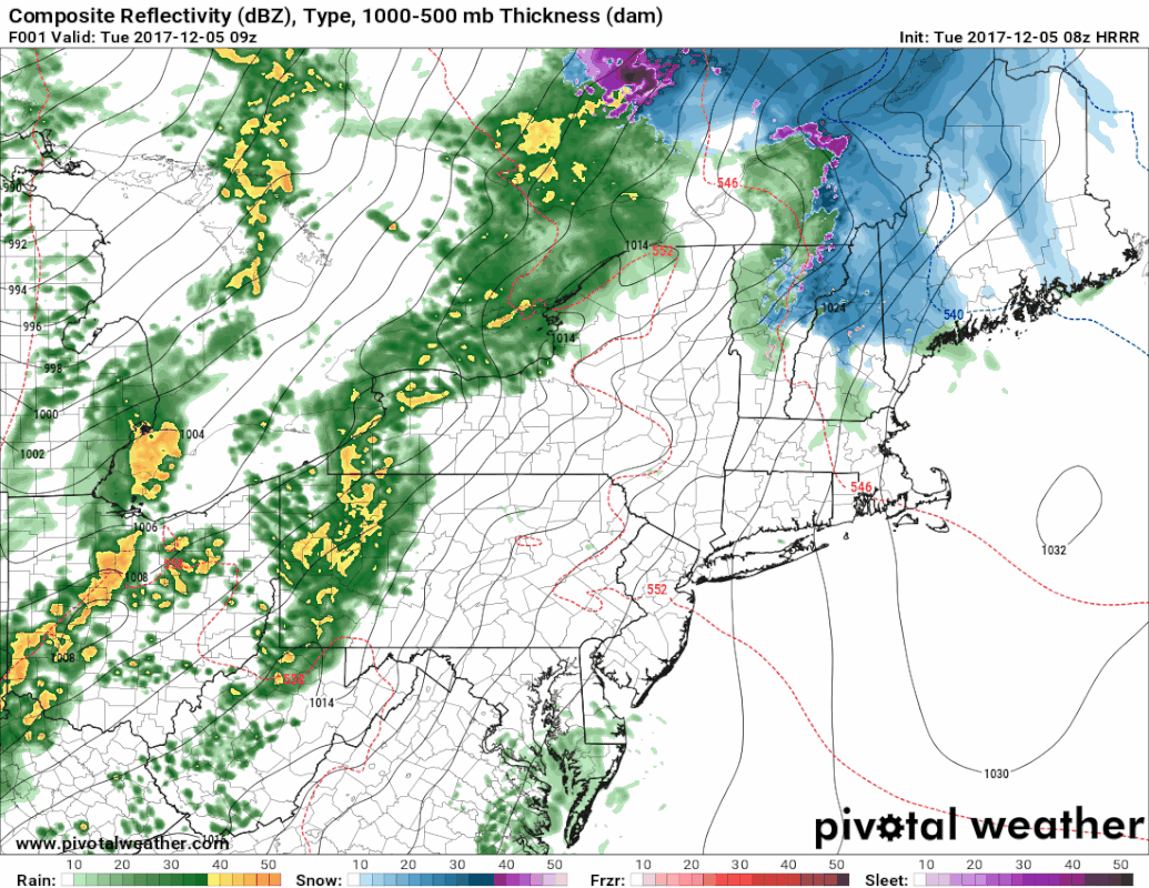
The only thing that has changed from last evenings update is the threat for sleet for the mountains and north has increased through the day. Western areas will change to rain this afternoon, northern areas tonight. 
Picture
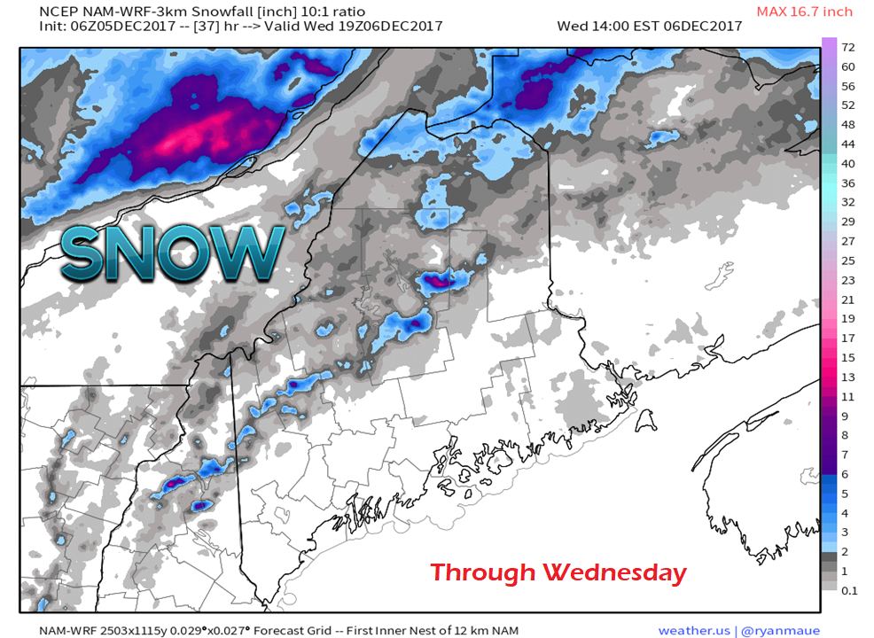
The chance for accumulating snow remains confined to the higher elevations of the mountains and far northern Maine. In combination with sleet, this may make for some slick areas along the Route 2 corridor over western areas, and west of Route 11 in northern areas. 
Picture
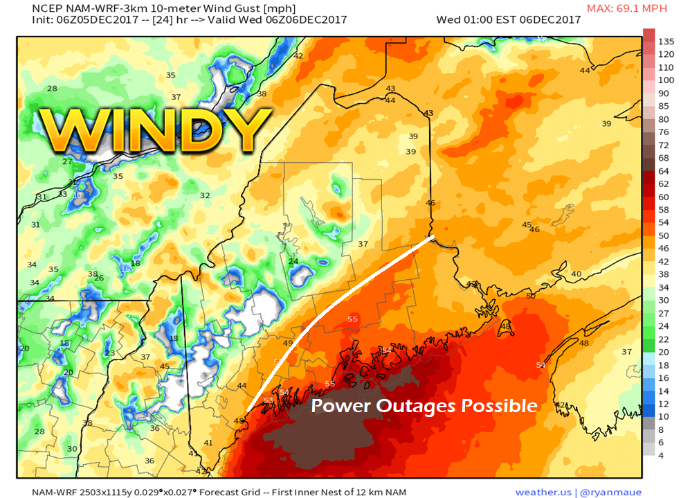
Southerly winds will pick up this afternoon and be strongest overnight. Gusts in the 40-50 mph range are possible east of Portland through DownEast. This may cause some power outages. The worst of the wind appears over by 7 AM Wednesday for areas west of Penobscot Bay, and by 10 AM for the Eastport / Lubec region. 

Snow threats for the weekend

Picture
Operational and deterministic guidance is still having difficulty remaining consistent on a late weekend snow threat. Stark differences in the 24 hour period beginning at 7 PM Saturday through 7 PM Sunday on these two charts between yesterday and today. The chance for snow over the weekend continues, but it is still too early to get into specifics or potential impacts.

Stay tuned.

​- Mike
Comments
    Picture

    Mike Haggett
    Kennebunk, ME

    Certified Weather
    Forecaster
    Penn State '21

    American Meteorological Society

    National Weather Association

    Weather-Ready Nation 
    Ambassador
    ​
    ​SKYWARN-CWOP

    Matthew 19:26


    Support
    Pine Tree Weather

    DONATE

    Picture

    Picture

    Picture

    Picture

    Picture

    Picture

    Picture

    Picture

    Picture

    Picture

    Archives

    January 2023
    December 2022
    November 2022
    October 2022
    September 2022
    August 2022
    July 2022
    June 2022
    May 2022
    April 2022
    March 2022
    February 2022
    January 2022
    December 2021
    November 2021
    October 2021
    September 2021
    August 2021
    July 2021
    June 2021
    May 2021
    April 2021
    March 2021
    February 2021
    January 2021
    December 2020
    November 2020
    October 2020
    September 2020
    August 2020
    July 2020
    June 2020
    May 2020
    April 2020
    March 2020
    February 2020
    January 2020
    December 2019
    November 2019
    October 2019
    September 2019
    August 2019
    July 2019
    June 2019
    May 2019
    April 2019
    March 2019
    February 2019
    January 2019
    December 2018
    November 2018
    October 2018
    September 2018
    August 2018
    July 2018
    June 2018
    May 2018
    April 2018
    March 2018
    February 2018
    January 2018
    December 2017
    November 2017
    October 2017

    RSS Feed

Proudly powered by Weebly