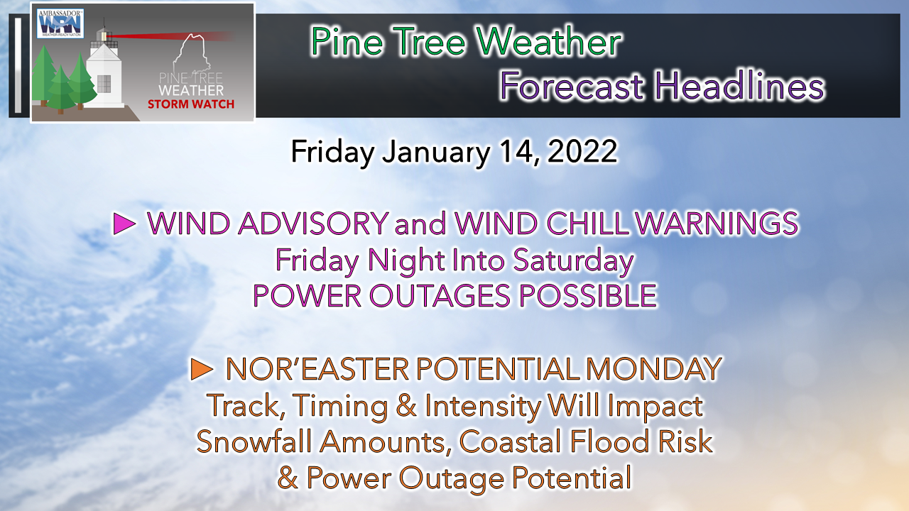
 I want to thank those for passing along support as I mentioned on Facebook Monday afternoon that two family members admitted into two different hospitals for non-COVID related issues. That created a logistical situation as one was in a medical facility located 2 hours from home. Thankfully, that one has returned home, while the other remains hospitalized. I am currently in Bath to recharge my batteries for a couple of days as this was a previously planned trip before these family members went into care. Again, I thank you for your support and sticking with me through challenging times that occur in life. We have a double-whammy wind situation in development, along with a potential strong event for Monday. Winter is wintering. Nasty cold for Saturday into Sunday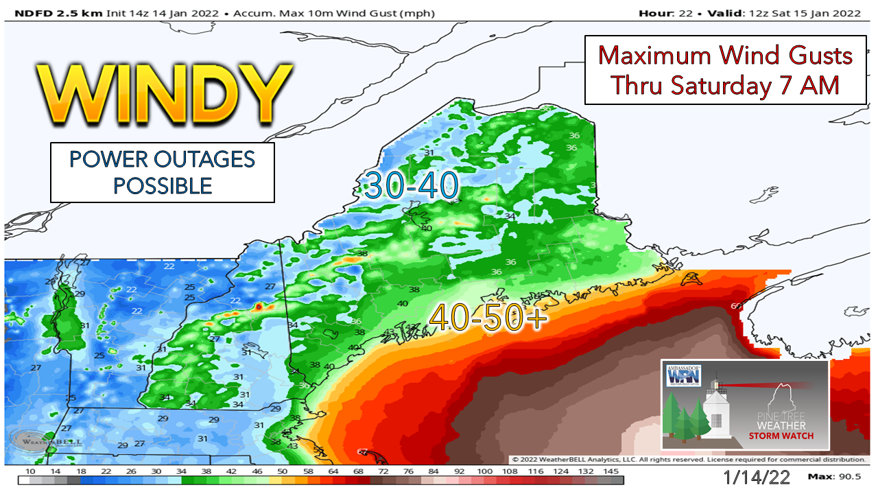 The storm passing offshore of the region Friday is expected to bury the Maritimes in a blizzard after giving Way DownEast areas a couple inches of snow. The developing storm intensifies as it moves northeast and draws down the next arctic blast with strong wind from the north / northwest Friday night into Saturday. Coastal areas and the mountains and nearby valleys see the strongest gusts that could peak in the 40-50+ mph range overnight into Saturday morning. 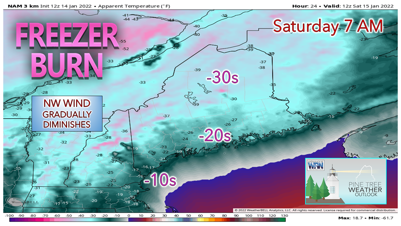 Just brutal cold starts off Saturday with all areas feeling the frigid burn and could rival a Hoth morning for temperatures. With dew points in the -20s and -10s, here's your reminder to hydrate as moisture in the body will quickly evaporate and fatigue is likely to occur. It will be a clear day, but the wind appears slow to drop. It may be Sunday afternoon before the wind settles over northern areas and the mountains. 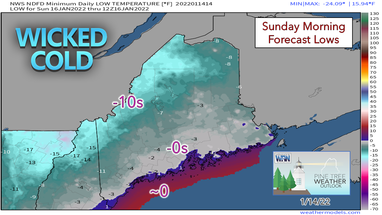 While the wind is brutal on apparent temperatures, the force of the moving air keeps temperatures a bit warmer. If the air was completely stable, temperatures in the mountains and north could hit -20 or colder Sunday morning. For folks in well protected areas, take notice. I expect a few bone shattering observations when the NWS reports roll out. Thoughts on Monday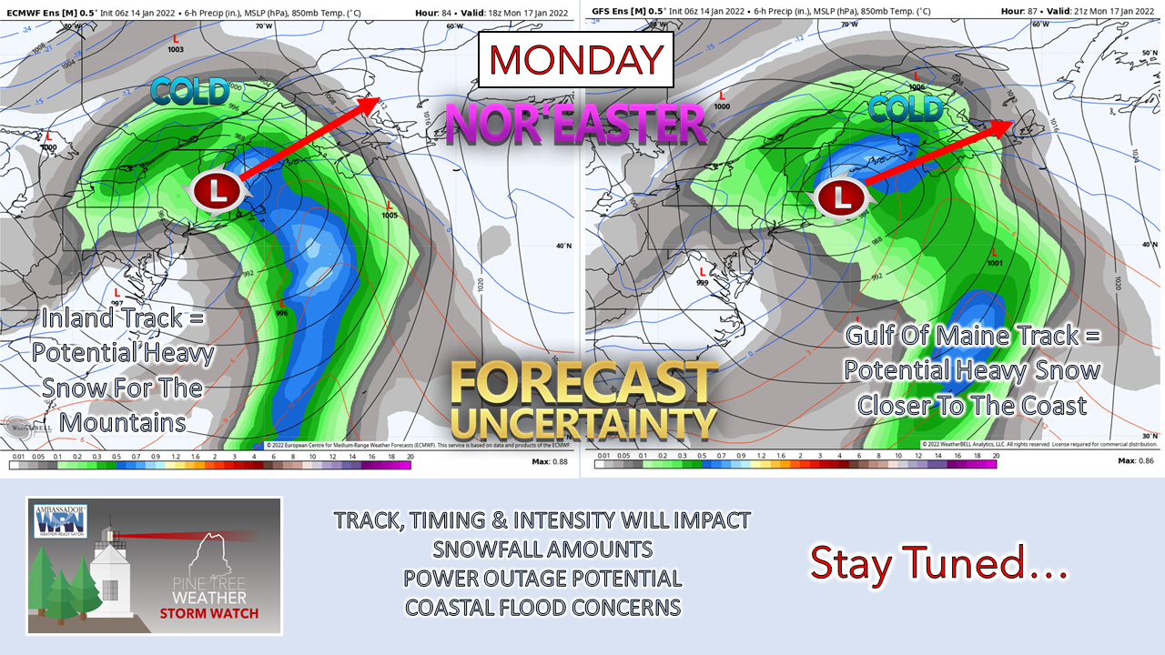 Earlier in the week (previous post here) I mentioned the potential for a storm late weekend. I missed it by a day, but here it is. Monday is likely to be a stormy affair, with wind being an issue. Ensemble ideas vary, and in this case, 50-100 miles variance is a key factor in who gets what for precipitation type, for how long, and impacts that go along with it. At this point I suspect with 1-1½" of potential liquid to work with, that areas on the cold side could see a foot or more of snow. Whether that is the western mountains, foothills or near the shorelines is yet to be figured out. All areas have a chance for accumulating snow to start off. An inside runner track (left) favors a changeover to rain for the coast, a mix of snow, sleet & light ice for the foothills and a big dump of snow for the Rangeley / Eustis / Jackman / Greenville region. Wind is likely to be problematic for much of the coastal plain and into the foothills under this solution. The Gulf of Maine track (right) brings the heavy snow further south closer to the coast as the cold air is likely to hold, and less wind impacts. A bit more on the snow aspect, this could be a heavy, wet, heart-attack type event with the amount of moisture involved. It could be brutal to shovel, and with wind could bring power outages. For those with shoreline interests, coastal flooding is a potential issue here with the inside runner track. While the region is off peak from astronomically high tides, as strong southeasterly wind could pile water up and hold it onshore, which sets up potential problems with battering waves and storm surge. Keep the storm supplies well stocked! Temperature outlook through WednesdayAfter Monday's storm, the next chance for light snow is possible Wednesday night into Thursday as a reinforcing shot of cold via a clipper system works through the region. Below normal temperatures are expected late week. There are signals out there for a storm potentially next weekend. 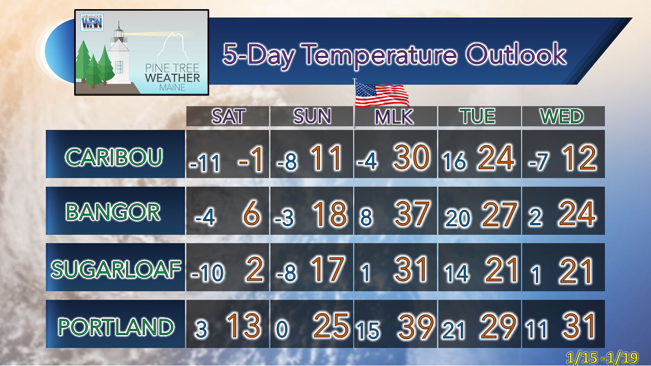  Cold Weather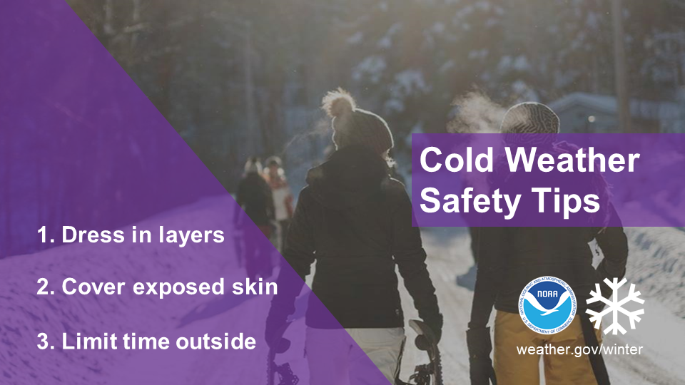 Cold weather can be life-threatening. If you can’t avoid being outside, remember to follow these 3 steps and make sure to always tell someone where you’re going. weather.gov/safety/cold Be prepared to receive alerts and stay updated!
 For more information in between posts, please follow Pine Tree Weather on Facebook and Twitter. Thank you for supporting this community-based weather information source which operates by reader supported financial contributions. Thank you as always for your support! - Mike NOTE: The forecast information depicted on this platform is for general information purposes only for the public and is not designed or intended for commercial use. For those seeking pinpoint weather information for business operations should use a private sector source. For information about where to find commercial forecasters to assist your business, please message me and I will be happy to help you.
|

Mike Haggett
|