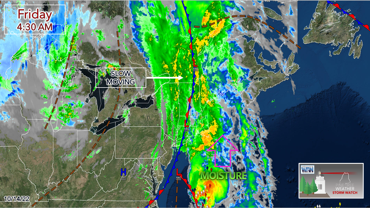
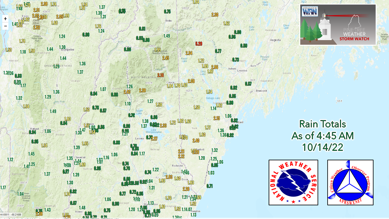
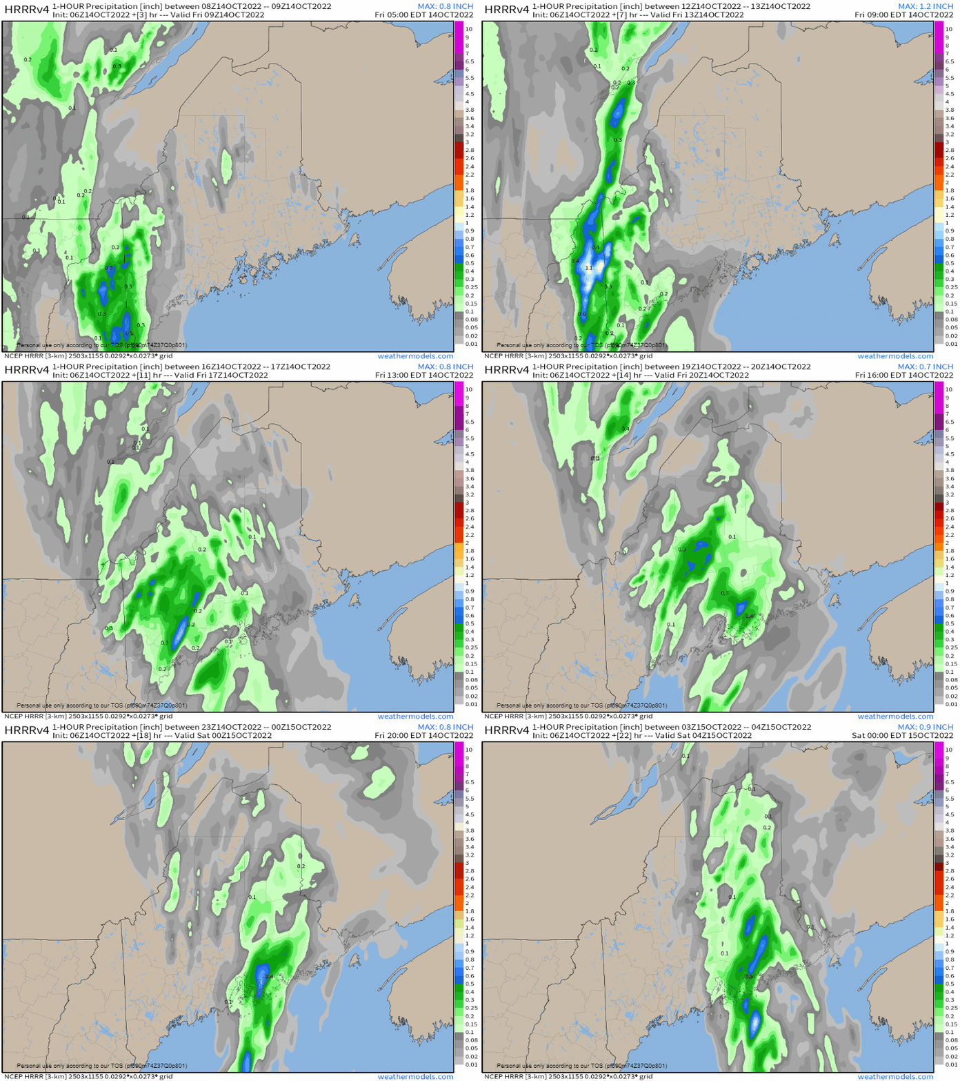
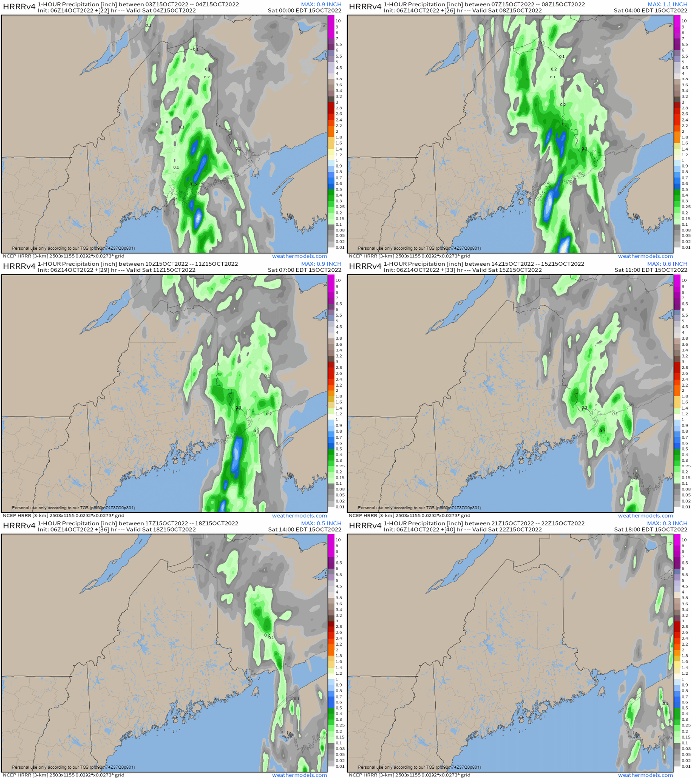
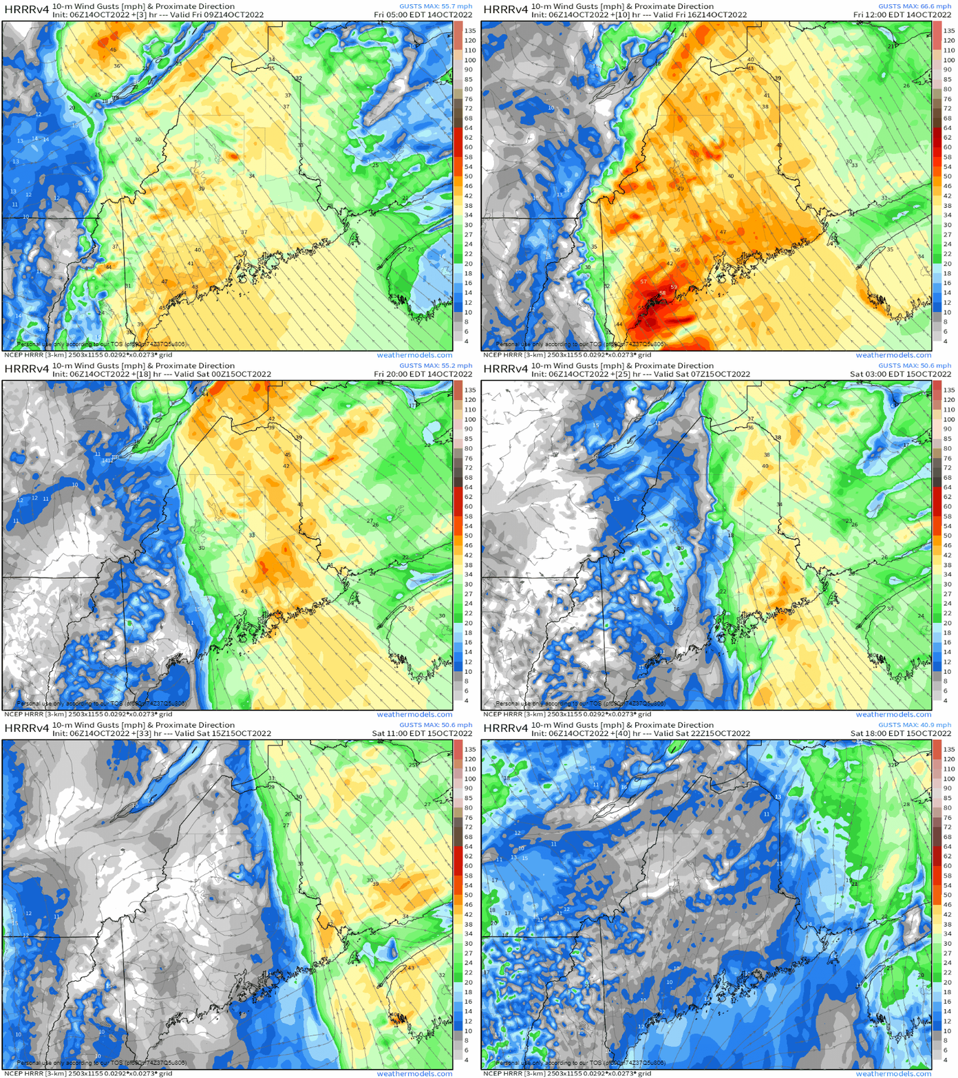
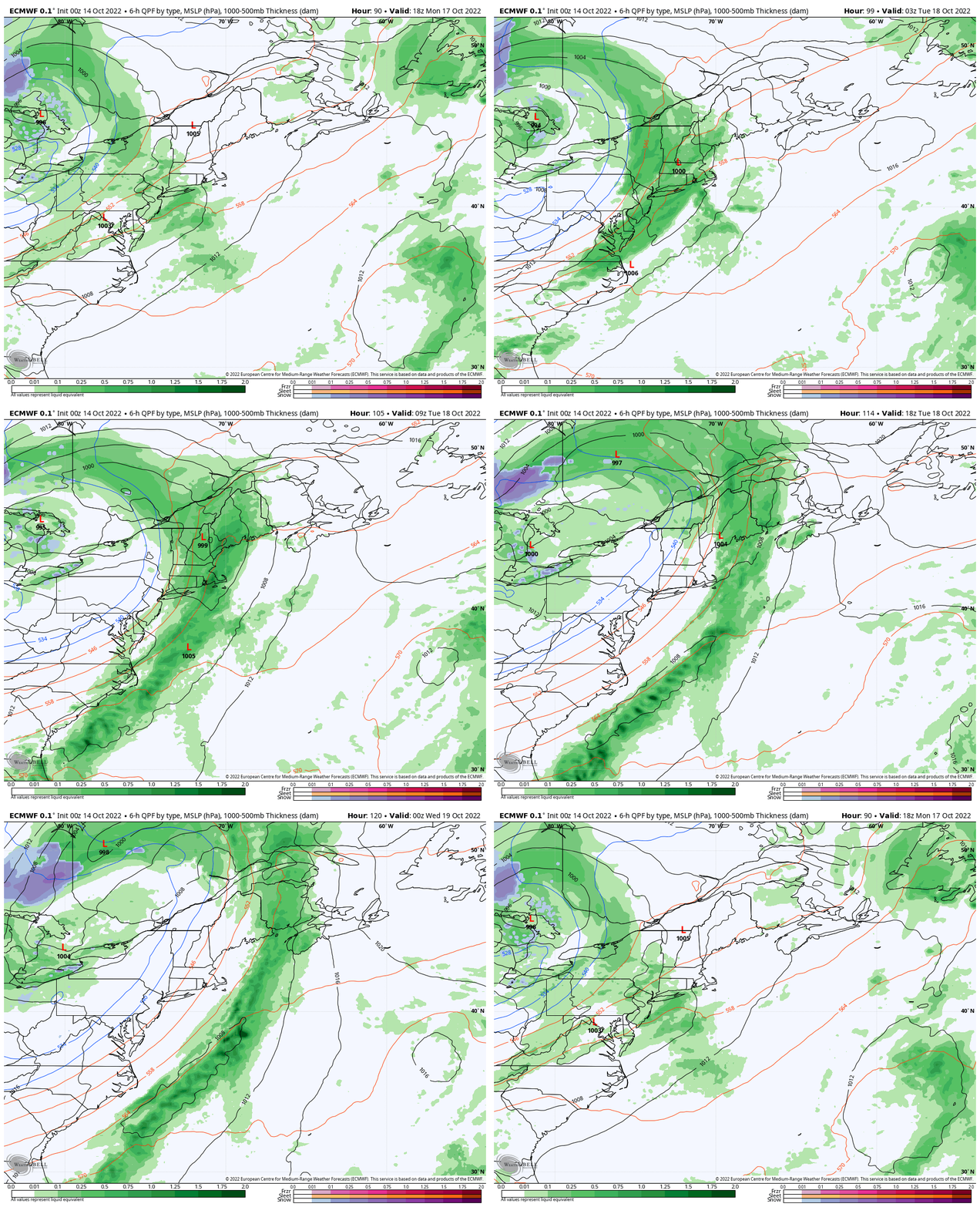
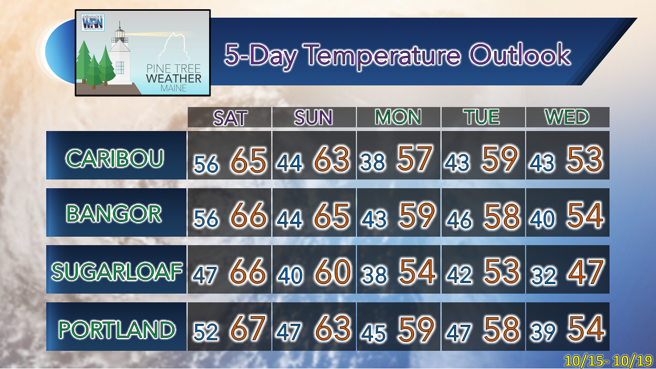
Plenty of each still to comeThe forecast has held up well to this point. The main question heading into the storm was when it was going to end, and there is a better idea on that at this point. Main impacts continue to focus on heavy rain causing localized flash flooding, urban street flooding from clogged storm drains, ponding on roadways, reduced visibility with the rain and fog, slick roads from the leaf and pine needle drop, and the risk of flying debris and power outages from the wind. Some impressive rain totals from this event through the overnight. Over 5" of rain in Albany, 1½-2½" in the region of the White Mountains, and 1-2" over southwestern areas. Another 1-3" of rain is expected to come before the fire hose shuts off. Wind gusts have reached 30+ mph as far north as Caribou and Greenville. A CWOP station in Turner reported a 44-mph gust early Friday morning. There are still several hours of wind to come. For the folks in the north and east, it's just beginning to start. This is what is coming to your area. Update on timingFriday 5 AM to Saturday Midnight - Rain continues to slowly crawl to the east. Steady rain over the south and west begins to taper off Friday afternoon. At that point, the storm is just getting ramped up over the north and east. Saturday Midnight to 6 PM - Rain begins to taper off over eastern areas Saturday morning and is on track to end in the afternoon, Rain ends the Bangor region around mid to late morning. It will be mid-afternoon for Caribou and eastern Washington County. Friday 5 AM to Saturday 6 PM - As the rain ends, so does the wind. It may feel a bit freaky when it does stop. Usually, we get wind before and after with a frontal passage, but not in this case. Important to note here that the wind really cranks up ahead of just ahead of the front. This is when the concern for power outages elevates. When the wind drops off and the rain ends and you have power, chances are good that you are in the clear. The next one on the wayMonday 2 PM to Wednesday 2 AM - Pardon me if you've seen this movie already from the current system, but the DVR is on repeat. This could be another 1"+ rain event and feature some wind. There are more questions than answers at this point, this being far out, which is typical. While there is a window for a dry period over the weekend to do some outdoor clean-up for those who want to get started on it, but more leaves will come down with this storm. Thank you for supporting this community-based weather information source which operates by financial contributions from people like you. Stay updated, stay on alert, and stay safe! - Mike NOTE: The forecast information depicted on this platform is for general information purposes only for the public and is not designed or intended for commercial use. For those seeking pinpoint weather information for business operations, you should use a private sector source. For information about where to find commercial forecasters to assist your business, please message me and I will be happy to help you. |
Mike Haggett
|

