|
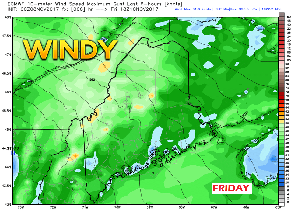
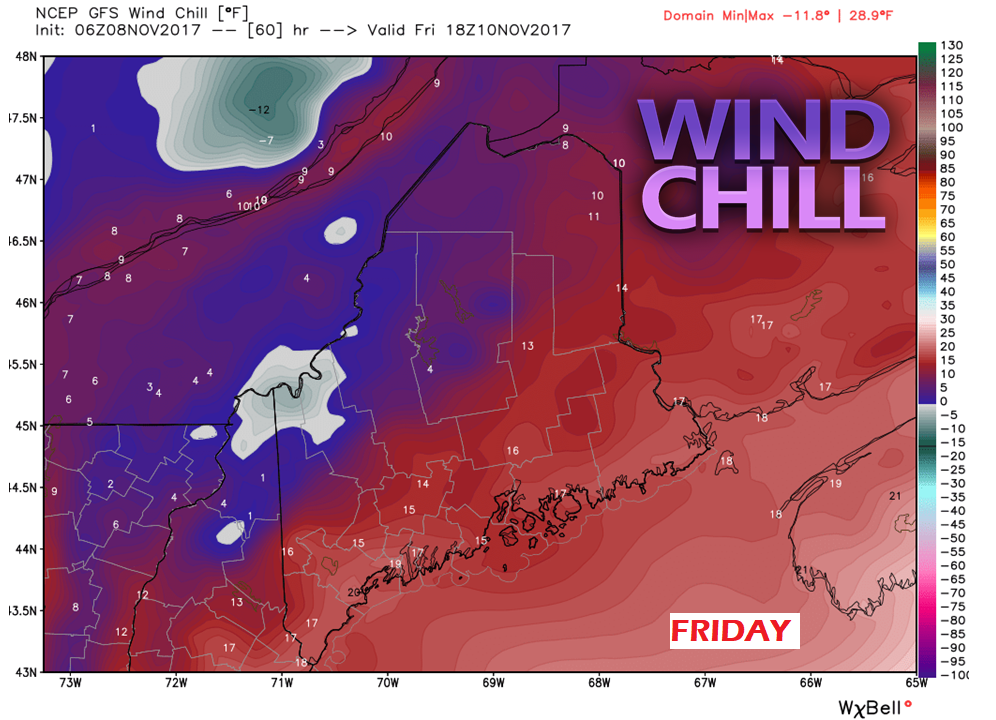
While the region has almost recovered fully from power outages incurred by Late October Gale, more wind is on the way for Friday. As an arctic front sweeps through the region providing light snow for the state, the wind cranks up on the backside of the front from the northwest. Gusts in the 30-40 mph range appear to be a dominant feature for much of the state, with higher elevations of the mountains seeing higher speeds. There is the potential for some power outages given the higher speeds and weakened trees. Given the nature of how the Late October Gale impacted the region, any moderate to strong wind event will have those concerns in the coming months. With the wind comes the wind chill. While the thermometer may read in the 20s and 30s, actual feel temperatures appear to be half that. It will be a day to bundle up.
The latest snowfall idea from WPC is posted on the precip outlook page. This does not appear to be much of an inconvenience in that regard. What snow falls will mainly be confined away from the coast. Northern Maine may need to get the plows out, but this snow will blow around. It may cause brief whiteout conditions in heavier squalls. Other than that, it appears to be nuisance more than anything. Another busy day ahead for me, I will get the 7-Day Outlook page updated as soon as I can. The Maps page and precip outlook page has been updated. - Mike |
Mike Haggett
|


