
Winter Weather Advisory / Winter Storm Watch posted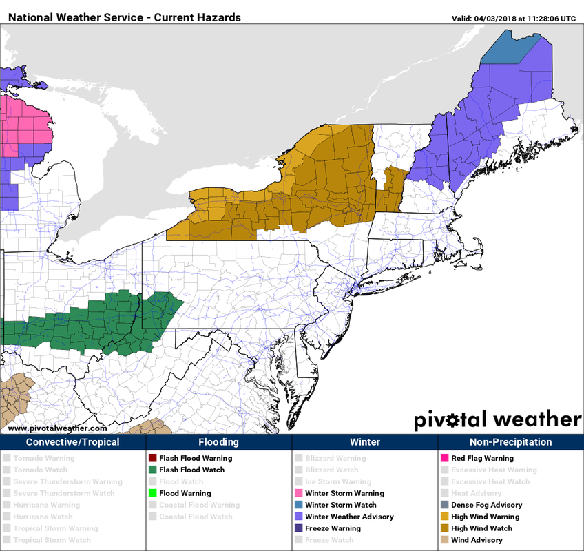 A warm front approaches the region Tuesday. With cold air in place at the surface with warm air invading aloft, a mixed bag of snow, sleet, freezing rain and rain is on the way Tuesday night into Wednesday. 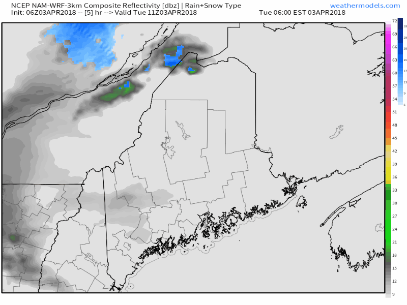 With the factors involved, it could be slick in spots for travel tonight into Wednesday for much of the state away from the shorelines. Some interior areas could see roughly a tenth of an inch of ice, along with varying amounts of snow and sleet. Steadier precipitation ends from southwest to northeast Wednesday morning. Best chance for accumulating snow appears over interior areas... 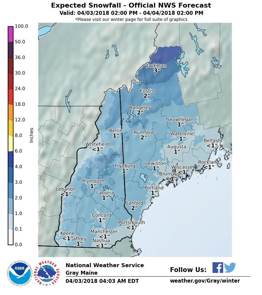 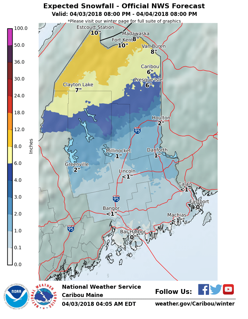 The rooftop of the state is on track to have the highest amounts of snowfall. For much of the coastal plain, what accumulations come appear to be minor, primarily on grassy surfaces and secondary roads. That said, it will be cold enough that sand and salt may be required on roads, parking lots and sidewalks. 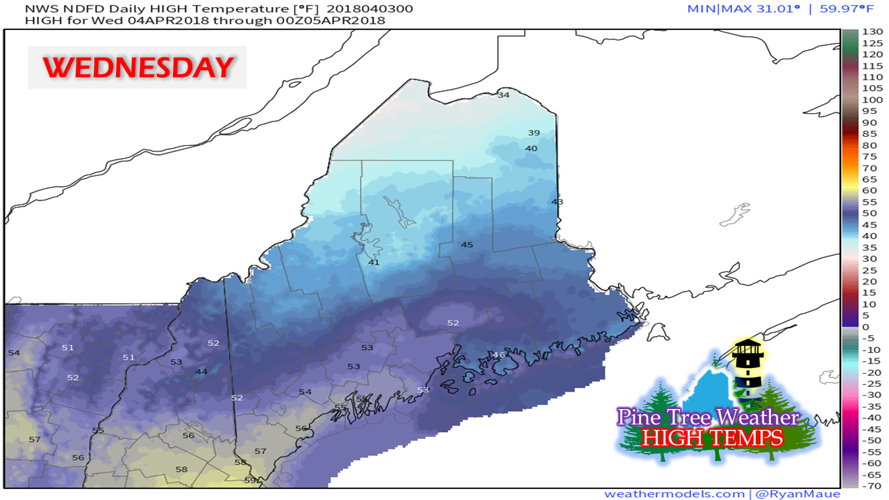 With the exception of the Great North Woods and the rooftop, whatever frozen precipitation falls won't hang around for long. Temperatures are on track to warm well above freezing for the coastal plain, with 40s on the way for western areas over to Millinocket and Houlton. Two more systems for winter concernsAs I said in a post in March, spring does not typically begin for coastal areas until roughly mid-April and roughly early May for the mountains and north. That is the way this setting up at this point. There are signals that the coast has a couple more hurdles to go through before the shovels can be put away with confidence. That may also end up being the case for the rest of the state, but for now I remain guarded on making any declaration of winter being over for the mountains and north after mid-April. 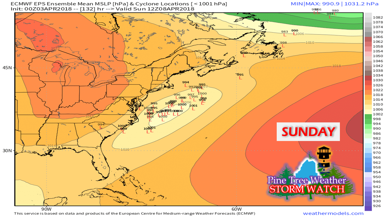 After the current storm passes through, the next hurdle to watch will be for ocean storm development Saturday into Sunday. Operational models are hinting this will stay out to sea, or may bring a close shave for the shorelines. Ensembles, like this pictured here, show a reasonable amount of uncertainty. 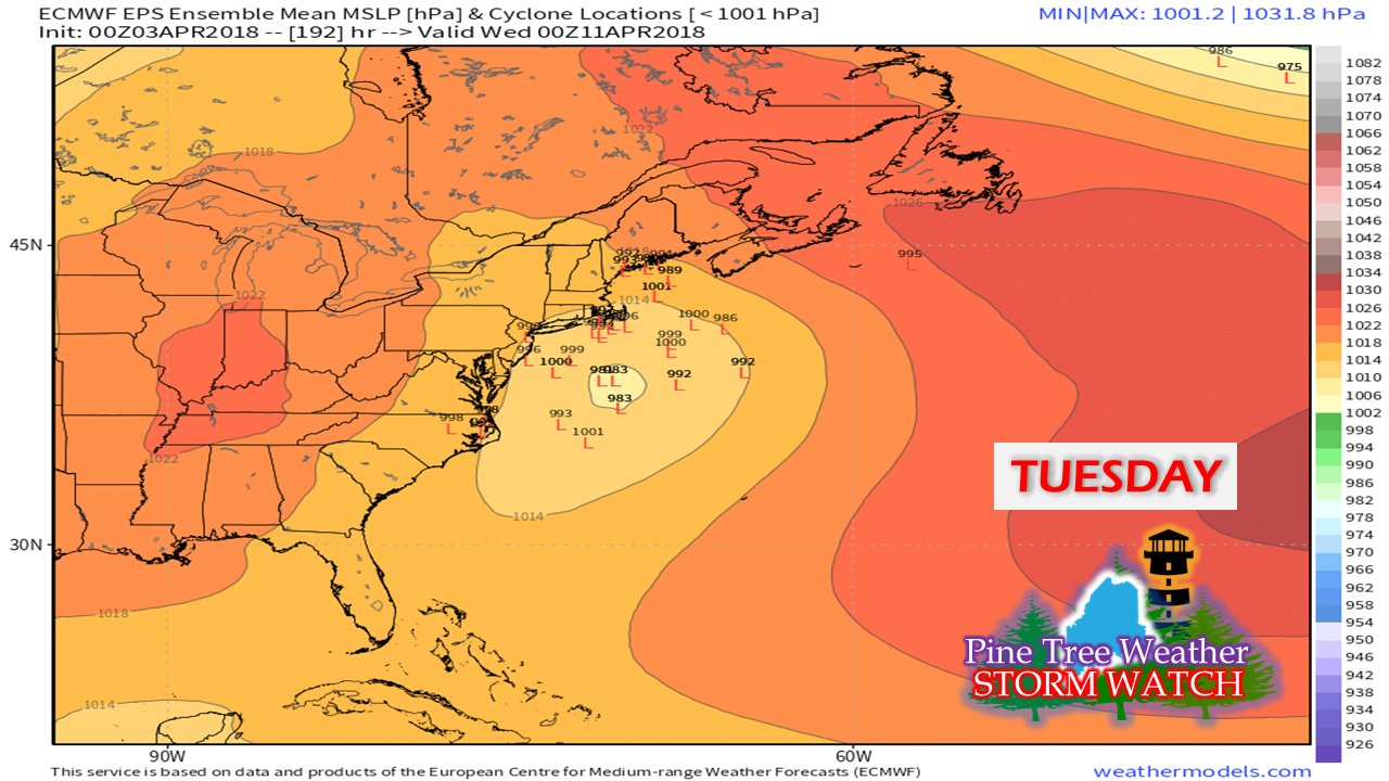 On the heels of that storm follows a trailing event next Tuesday into Wednesday, also with uncertainty. The one common denominator in both systems is cold air. There will be plenty of it aloft. Storm track and characteristics will determine precipitation outcome and potential impacts. Based on current long term model trends, this event appears to be the final storm of any meaningful wintry concern for the coastal areas. Again, it's April, and cold air does fool models, without question. That said, I do feel confident that after this storm passes, the coast is likely done with winter until it returns later in the year. Just be forewarned that April is still on track to remain on the cool side overall, and that may continue into early May. Stay updated!Given my intermittent updates due to relocation, please stay in touch with NWS Gray or NWS Caribou for the latest official forecast information and bulletins. For more information from me, you can follow on Twitter in between posts.
Thanks as always for your shares, comments, and support! -Mike |

Mike Haggett
|


