
A rough stretch ahead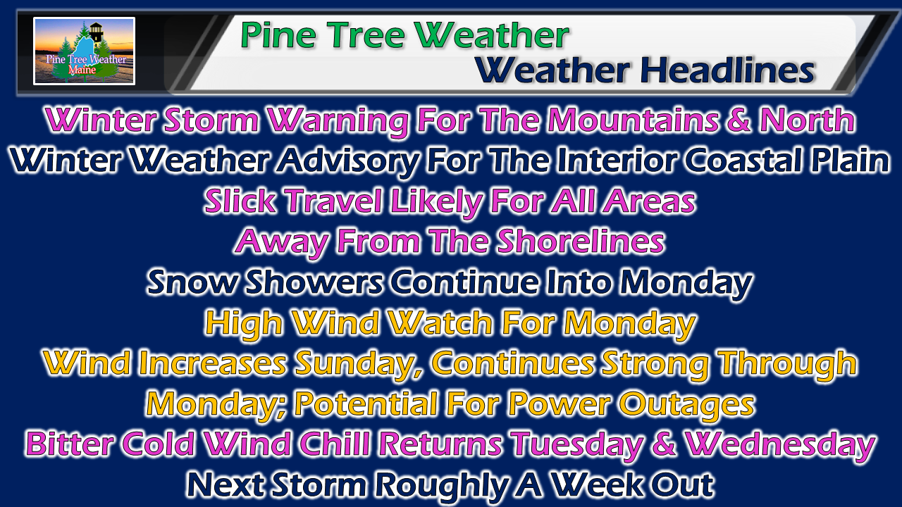 Three factors to think about over the next few days. First, precipitation for Sunday. Second, wind increases Sunday, blows hard Monday, a stiff breeze lingers Tuesday and Wednesday before settling down Thursday. Third, wind chill that will feel like January all over again. As we head into March, the atmosphere is becoming more unstable as we head into spring, and the potential for strong storms will be around in the weeks ahead. Keep your storm supplies stocked, the generator on the ready, and fuel for your heat sources filled. Timing / totals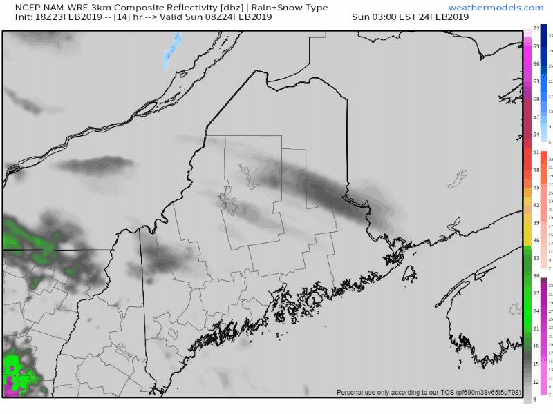 Precipitation begins around daylight in western and southern areas, and then overspreads eastern and northern areas by around noon. Steadier precipitation ends over southern areas between 7-9 PM Sunday evening. Eastern areas see precipitation continue until around daybreak on Monday. Snow showers and squalls continue for northern and western areas well into Monday, and may not shut off completely until late Monday night. 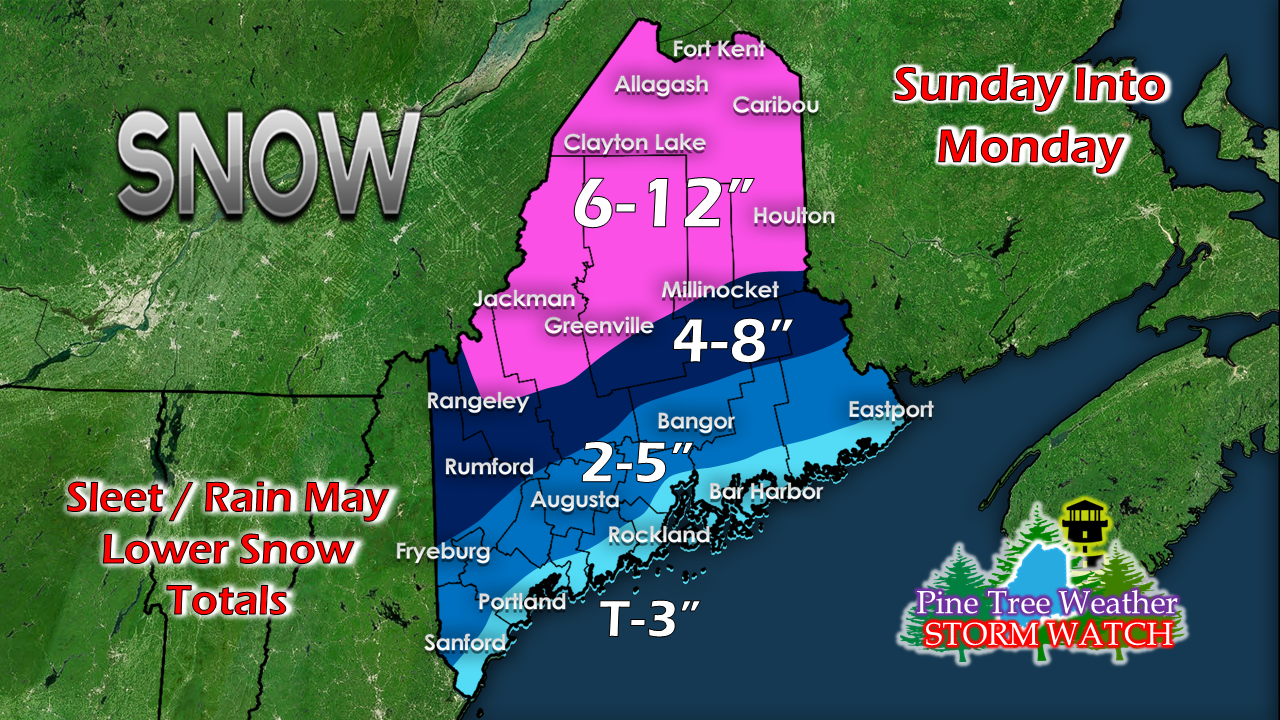 Only a slight change in the forecast posted here Friday evening. Sleet is likely going to be a factor in the final snow tallies below the 6-12" area. Rain will keep totals down for the shorelines and perhaps for the coastal interior regions. Remember, this map includes snow totals for Monday, where I expect another 1-3" to fall in the form of snow showers and squalls as arctic air blows in. Several days of wind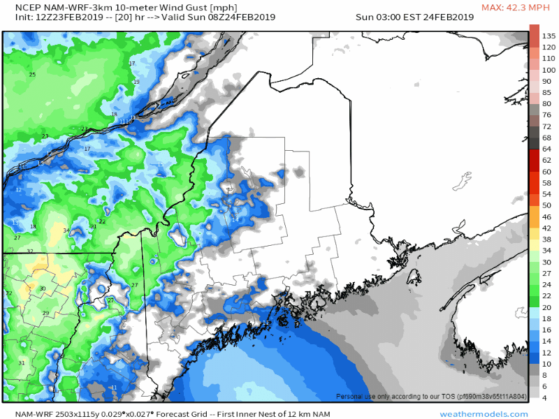 The short term view shows wind picking up Sunday as the coastal storm passes through the area. We'll get a bit of a break Sunday night as the storm moves into the Canadian Maritimes. The storm then rapidly intensifies early Monday. As it does, a stiff north / northwesterly wind is expected to impact the area, with gusts in areas over 50 mph. 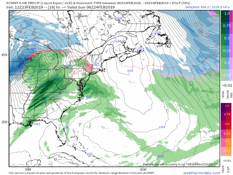 A longer view over six hour steps through early Thursday shows the storm intensification and slow movement through the Gulf of St. Lawrence before running into a traffic jam off the Labrador coast. While the wind won't be as strong, gusts on Tuesday could reach 25-35 mph in areas, with 20-30 mph possible for Wednesday. Consider the Flying Trash Can Alert to remain in effect until Thursday, where it will still be breezy but diminishing through the day. For the north country, blowing and drifting of snow will cause slick areas on roads and reduced visibility through Thursday morning. Outlook through Thursday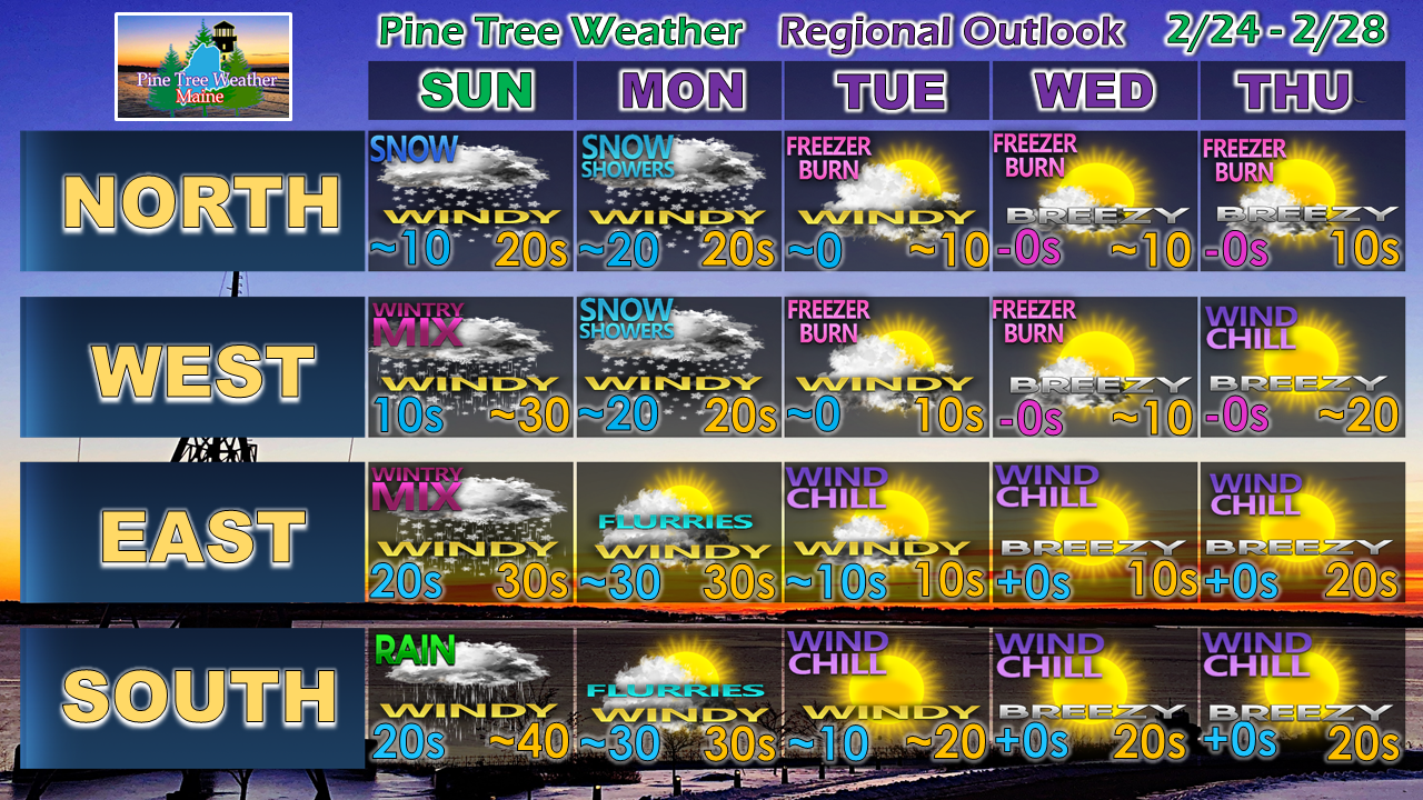 Outside of the wind and bitter cold through most of the week, the precipitation machine shuts down until next weekend. For now, that looks like another mixed bag event, but it's way too early to get into any specifics or outcome for now.
► ► For the latest official forecasts, bulletins and advisories, please check in with the National Weather Service in Gray for western and southern areas, or Caribou for northern and eastern parts of Maine. ► ► Your financial donations are much appreciated to keep this site funded and for further development. I am going through a busy time right now. Keep watch on my Twitter feed and Facebook in case this page is silent. I sincerely appreciate your support not only financially, but also in sharing my efforts with others. Always stay weather aware! - Mike |

Mike Haggett
|


