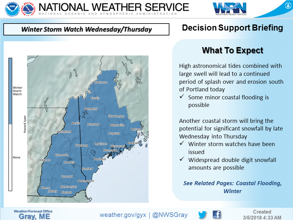
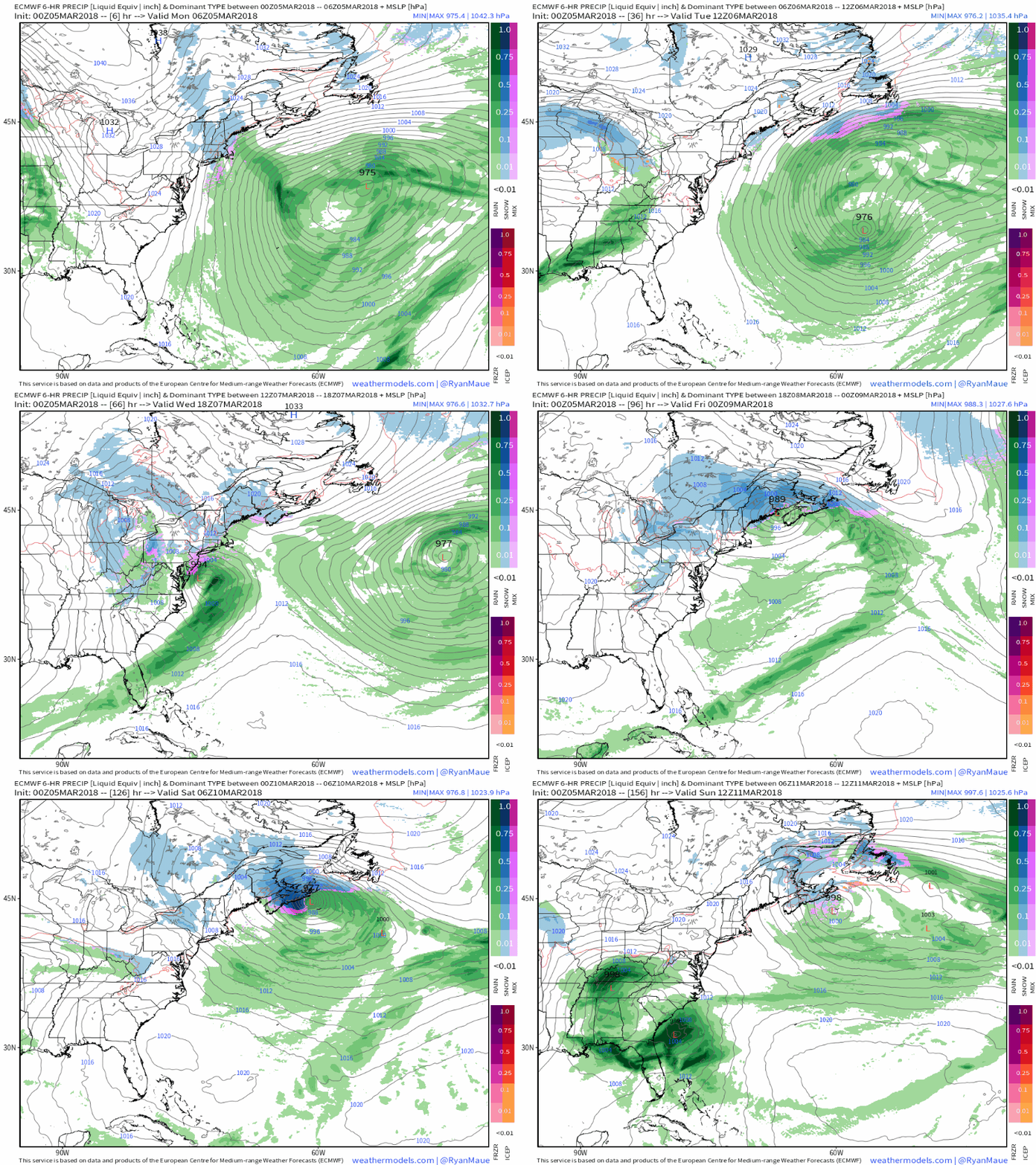
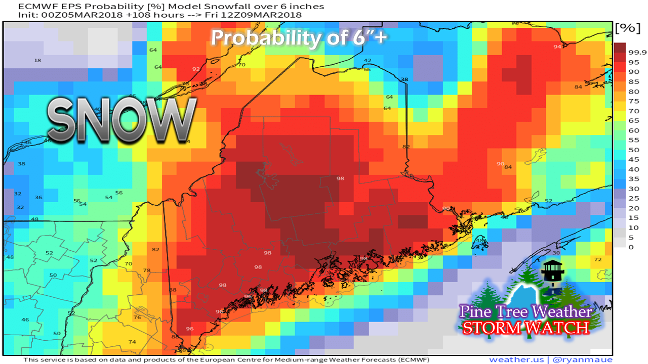
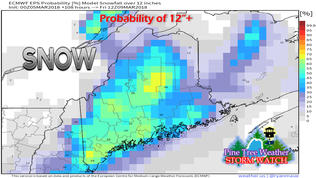
Confidence in double-digit snow event increasingA winter storm watch is posted for western Maine and all of New Hampshire by NWS Gray. Given the circumstances, I suspect NWS Caribou will be hoisting their watches by later in the day. Confidence is increasing that this storm could bring heavy snow and gusty winds that could cause whiteout conditions and rough travel Wednesday afternoon into Thursday, statewide. The forecast loop of the ECMWF model from data at 7 PM Sunday shows the massive storm that brought destruction to the northeast shorelines moving eastward. In it's wake, another storm comes together near the DelMarVa and heads towards the Gulf of Maine. The area begins to feel impacts during the day on Wednesday. Snow becomes heavy at times Wednesday night into Thursday. Heavier snow tapers to snow showers Thursday night. Snow showers persist for the mountains and north through Friday and Saturday. So how much snow?The idea of snow is always track dependent, which still needs to be figured out. European ensemble ideas give us a clue of what to expect. Percentage confidence is very high for a 6"+ snowfall for much of the state. Given the confidence of guidance, this is a good basis point as to what to expect no matter where you are in the region Percentage confidence is also there for the idea for a solid foot or more to fall across much of the region.
The wrench that always plays a factor in these types of storms is where and when the coastal front sets up, and how far inland it gets. For now, I take the 50+% idea for a foot or more of snow for areas west of Penobscot Bay along the shorelines with a grain of salt. That isn't to say it won't happen... it very well could, pending on track of the surface low. The coastal interior on up into the mountains are fair game for a foot or more as it stands for now. Along with the snow, wind can be expected which will blow it around and cause whiteout conditions. The ocean will churn again, which is likely to hamper shoreline recovery efforts from the latest storm. The astronomical tide cycle will be past by then, but the idea of minor flooding, beach erosion and battering waves are something to be concerned with. I will do my best to keep you updated. As always, check for the latest from NWS Gray and NWS Caribou for the latest bulletins and information. Follow on Twitter @WesternMEwx - Mike |
Mike Haggett
|


