
Track will be key for this one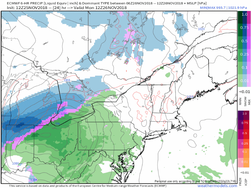 Low pressure rides up along the Mid-Atlantic on Monday and rides along the Maine coast and intensifies in the process. Since this is a "coastal hugger" type storm, snowfall amounts are expected to be minimal along the coastal plain, and more of a concern for interior areas. Given the close proximity of the track, this is likely to be a heavy wet snow in most areas, which will be a concern with gusty winds on Tuesday. The storm track brings it near Rockland / Penobscot Bay region, which is always a challenge factoring in snow totals and associated ratios to go with them. Timing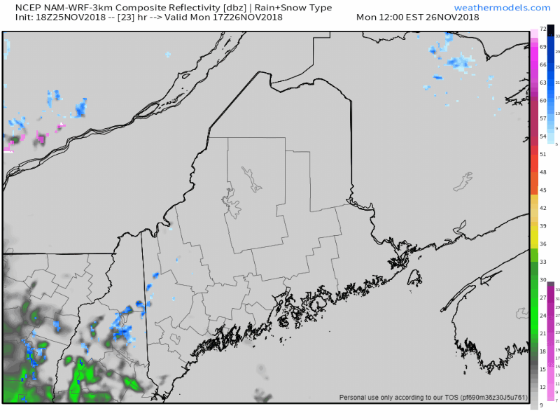 Western and southern areas begin to see precipitation break out Monday afternoon and is likely to advance over eastern and northern areas overnight into Tuesday morning. Southern areas sees rain or rain/snow mix taper to showers Tuesday afternoon, and Tuesday evening for eastern areas. Off and on showers are expected to continue over the coastal plain into Wednesday. Snow in various intensity will continue over northern and western areas Tuesday night through early Thursday. Wind and heavy snow could bring power outages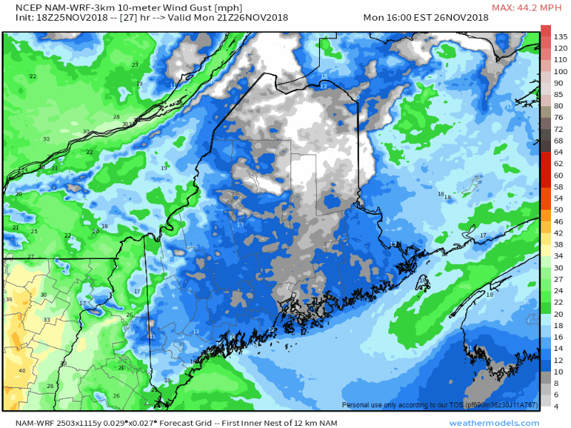 As the storm overspreads the region, the wind picks up along with it. A Flying Trash Can Alert will be in effect all day Tuesday for those towns that have curbside trash pick up. The heavy snow along with wind gusting 25-35+ mph over the interior is likely to cause power outages. As the storm weakens, wind begins to drop heading into Wednesday. Snowfall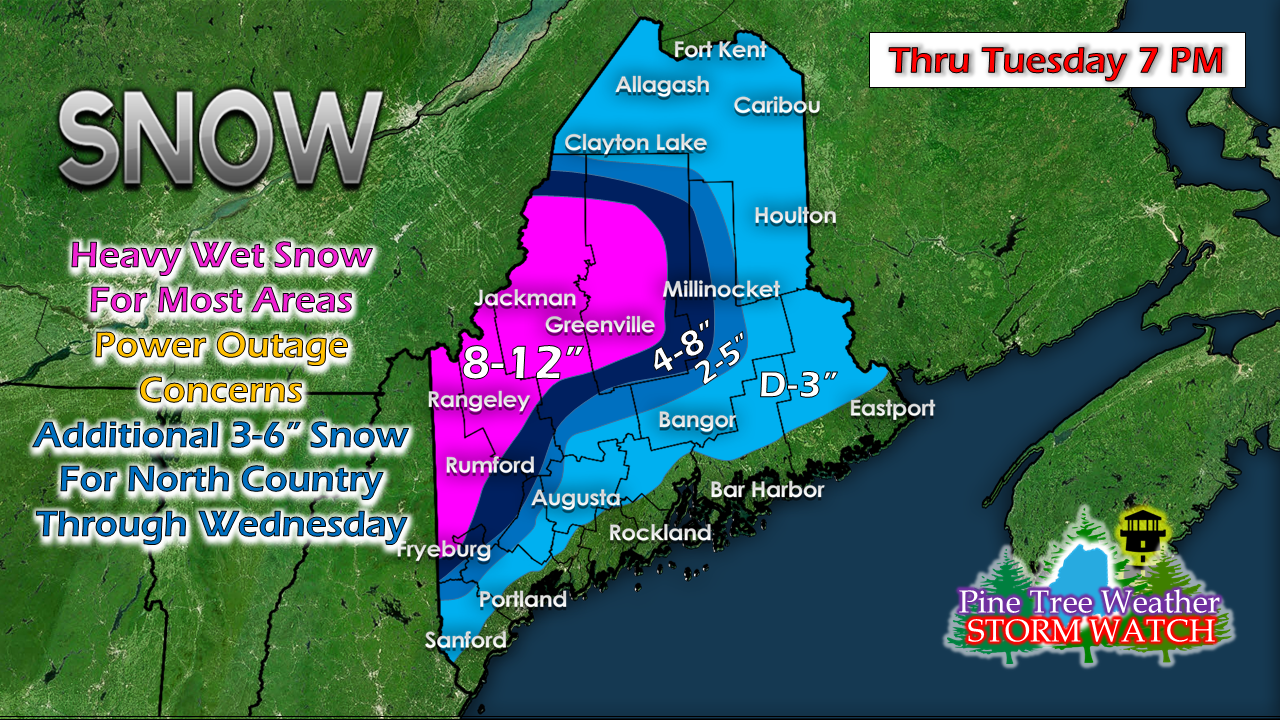 Since the storm track appears to make landfall around the Rockland / Penobscot Bay region, eastern areas will be on the warm side, and western areas on the cooler. The ski hills will be the jackpot areas where totals may flirt with 2 feet by the time all is said and done Thursday morning. While this will be a heavy snow Tuesday, it will become more lighter as the storm weakens and pulls away Wednesday into Thursday. Northern Maine will get heavier snow Tuesday afternoon into the evening, and likely top out in the 8-12" range by Wednesday morning. Regional outlook through the work week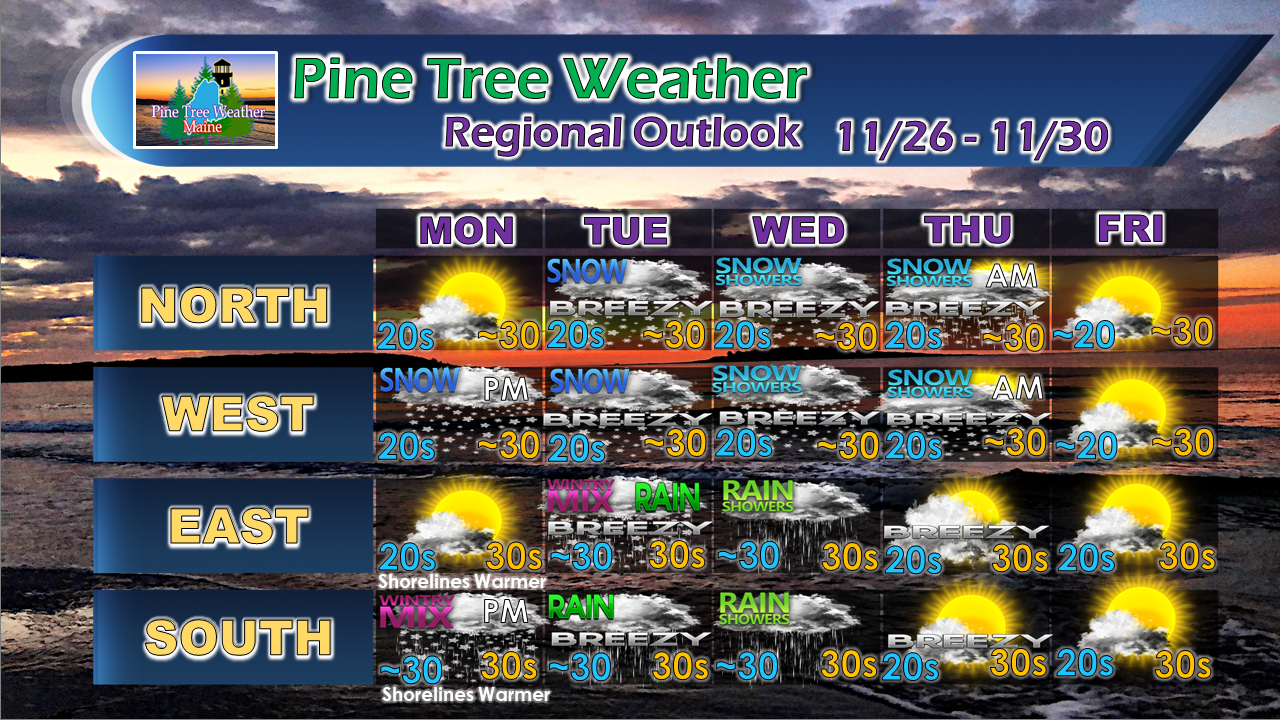 For the latest official forecasts, bulletins and advisories, please check in with the National Weather Service in Gray for western and southern areas, or Caribou for northern and eastern parts of Maine. Your support is valued and appreciated! Every Saturday morning I get caught up on the bookkeeping to see where I am at. I am about 80% covered for year as it stands right now, which is amazing. You folks have stepped up, which really means a great deal to me. I've known that I have been working on something special for quite awhile now. The towns listed above have at least one donor. Some have two or three. The support from out of state is the real eye catcher. I get overwhelmed when I read the notes that are mailed with checks to my home. I am truly honored and blessed by your faith and belief in me. I love doing this for you folks. So long as I am funded, I will keep doing it.
The final 20% of fundraising is always the most difficult. If you have not as of yet, I ask that you please consider it during this season of giving. You can message me through the Pine Tree Weather Facebook page or tweet me so I can give you my mailing address. You can also set up for a monthly donation on my Patreon page if that works for you. For the latest official forecasts, bulletins and advisories, please check in with the National Weather Service in Gray for western and southern areas, or Caribou for northern and eastern parts of Maine. Always stay weather aware, and thank you for your support... it is truly an honor. - Mike |

Mike Haggett
|


