
|
First off, thanks for hanging in there with me as I have been nursing a flare up of rheumatoid arthritis in my thumbs. My Twitter interaction has been to post updates here only. I have been able to keep things going here as best as possible. The good news is the arthritis pain is receding. I am glad to see that after this storm, there is not much going on next week. With a few more days to stay off the keyboard and phone, I hope to get back to my normal activity soon. I appreciate everyone's messages and comments of support. I know I have something special going on here due to great supporters like yourself who pass along what I do to others and for the financial contributions to keep the lights on and the bills paid. The final storm of the week to be a doozy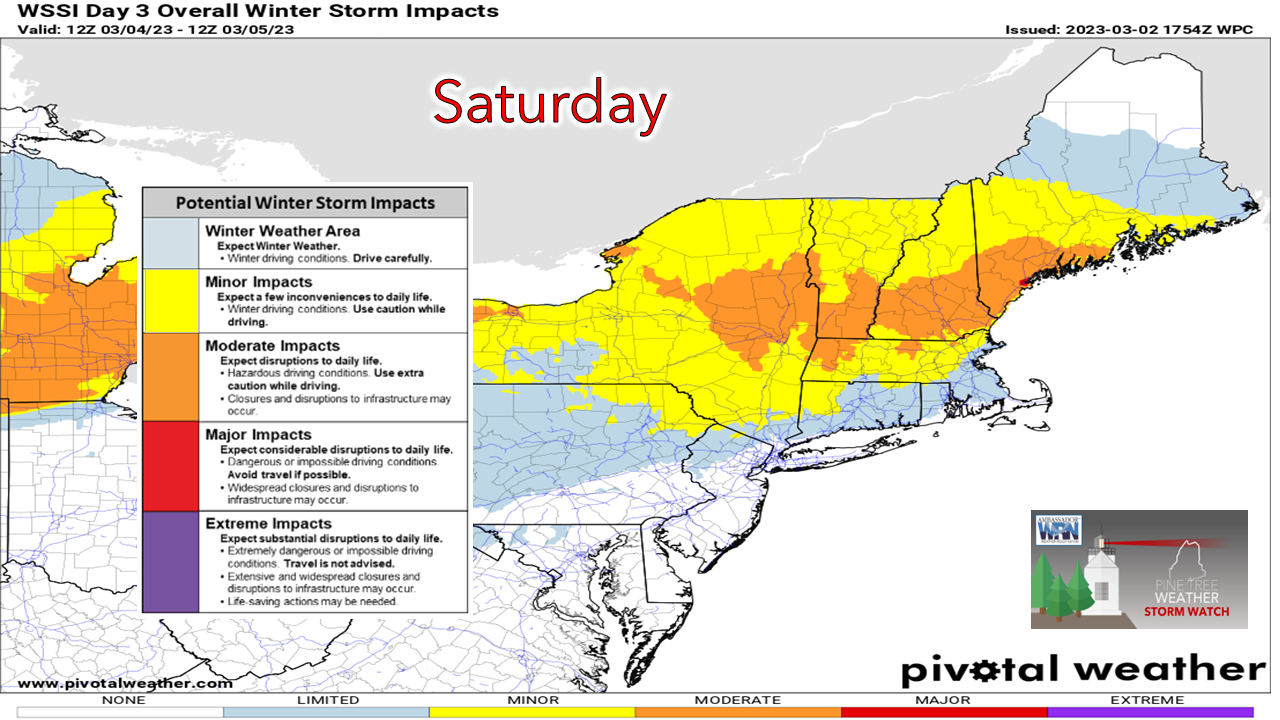 For those who absolutely must travel on Saturday, especially Saturday morning, it would be wise to prepare for nasty conditions over southwestern areas. For vehicles that slide off the road, they may be in for a long wait. Make sure you have what you need in case that happens. If you are travelling thirty miles or more, good luck. Leave well ahead of time to get to work. For those that do not need to travel, just stay home. 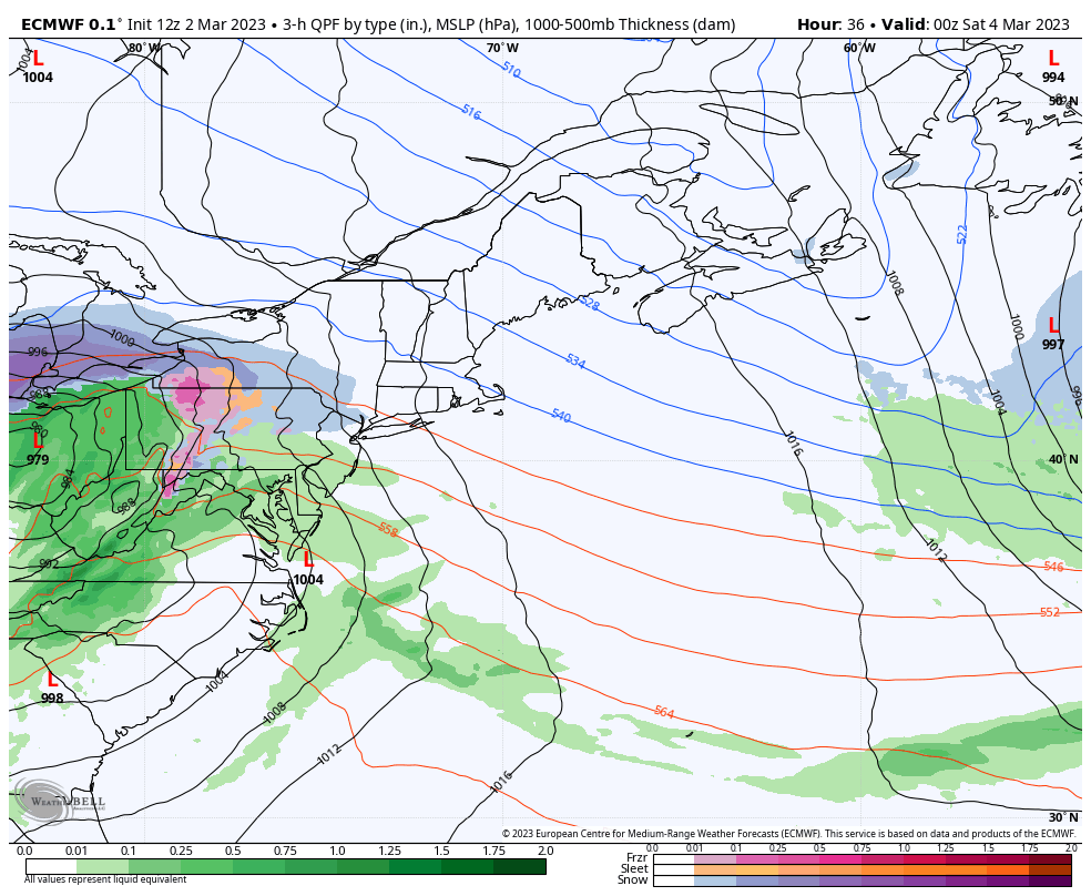 Friday 7 PM to Sunday 7 AM - I mentioned it in Wednesday's update and I will mention it again. high pressure to the north holds the cards on the northward extent of the snow shield. It looks like the track of the storm is slightly north of benchmark 40° N / 70° W, but it will get squashed by the high. Guidance is still in some debate how the high impacts northward extent, but also how strong the storm gets. This is a quick moving storm, but it is also quick to occlude (weaken) and flatten out. Also notice how the remnants may drift to the southeast Saturday night. This is not a typical pattern with these storms. 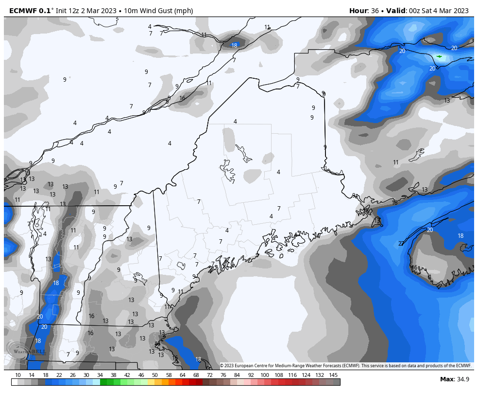 Friday 7 PM to Sunday 1 AM - Heavy snow and wind is not a good combination for potential power outages. The shorelines could see wind gusts of 30-40 mph and the southwest interior could see speeds 20-30 mph. Thankfully due to the blocking of the high to the north, the wind settles down Saturday night. Typically, we get a backside NW breeze with these types of storms, but in this case with the storm exiting to the southeast and weakening rapidly, we won't get much this time. 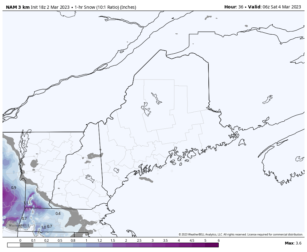 Saturday 1 AM to Sunday Midnight - With a strong high to the north, the storm basically gets squished like a fluffernutter, and as a result, the atmosphere is likely to nuke snowfall. Snowfall rates 1-4" per hour is what makes Saturday morning miserable for travel. This makes it tough for plow crews to keep up. As the storm slides to the southeast and weakens, an inverted trough potentially sets up in the late afternoon and keeps snow showers going into Saturday evening, ending in the wee hours of Sunday. 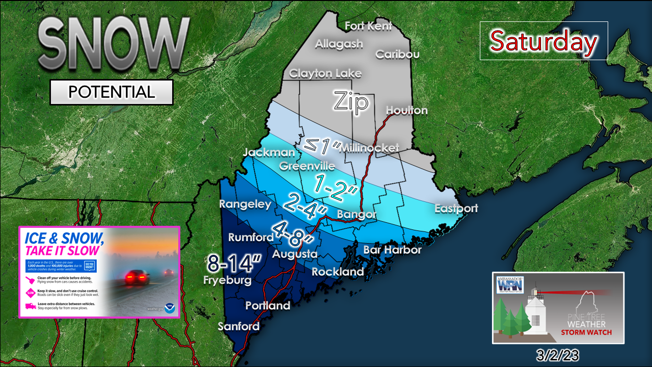 Respecting the influence of the high to the north and the chance the storm may come in further south, I am being a bit conservative here. There is a case for 12-18" of snow for Fryeburg to Portland south, but I am not willing to take the bait yet. The other thing that is going on is marginal temperatures for the coast, but if nuclear banding occurs, the temperature may not matter as it will dump through the morning. I do expect a wetter, heavier snow for the coastal plain and lower snow to water ratios as a result. It may be heart attack level for snow removal purposes closer to the ocean. The further north, the fluffier it gets. Stay tuned!  Temperature outlook through Tuesday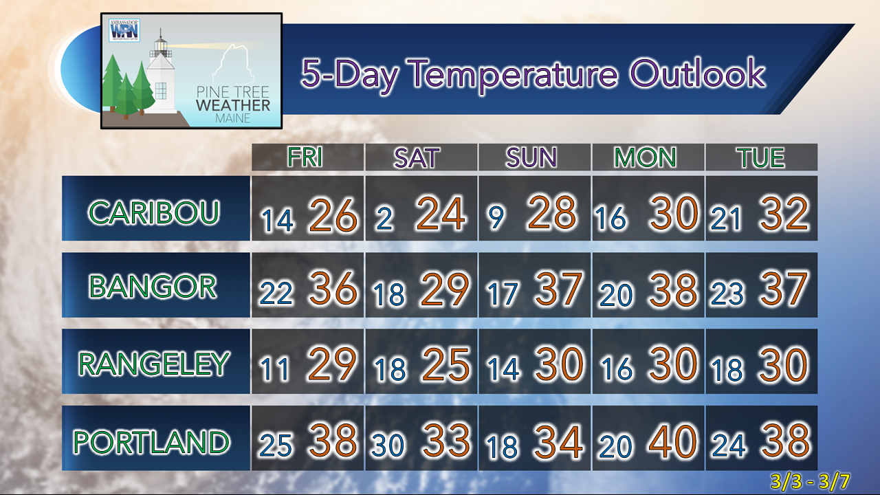 Thank you as always for your support! You may not like the weather, but I hope you like what I do! Please hit the like button on Twitter and Facebook, and share! Stay updated, stay on alert, and stay safe! - Mike NOTE: The forecast information depicted on this platform is for general information purposes only for the public and is not designed or intended for commercial use. For those seeking pinpoint weather information for business operations, you should use a private sector source. For information about where to find commercial forecasters to assist your business, please message me and I will be happy to help you |

Mike Haggett
|


