
Heavy snow, sleet, coastal mix to have travel impacts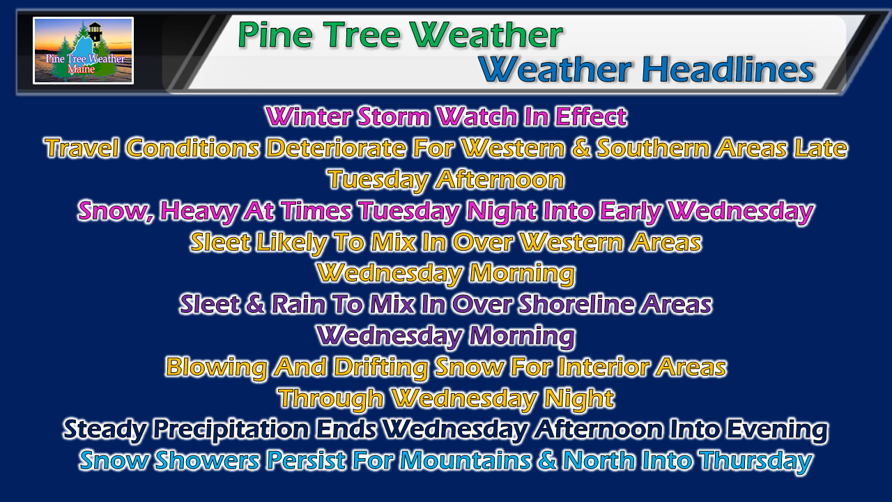 After quiet but breezy Monday, clouds increase on Tuesday ahead of the next winter storm to affect the region. As we have seen with many storms this winter, mixed precipitation appears likely for some areas Wednesday morning, which will add to commuting headaches as well as potential to eat into final snow amounts. Northern areas appear to stay all snow with this one. The jury is still out how the rest of the state plays out precipitation type. Rough idea on timing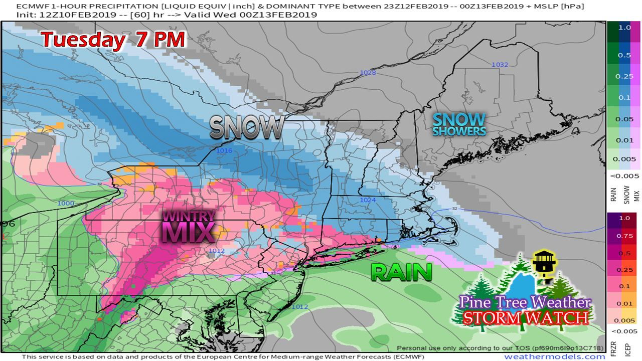 Southern areas can expect to see some snowflakes begin to fly by the time of the evening commute. The Portland to Fryeburg areas south may escape with little in the way of accumulation until after rush hour, but by early evening the snow will begin to pile up. 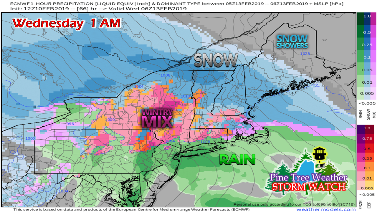 Snow begins to pile up in the Bangor area late Tuesday night and works into northern areas in the wee hours of Wednesday. 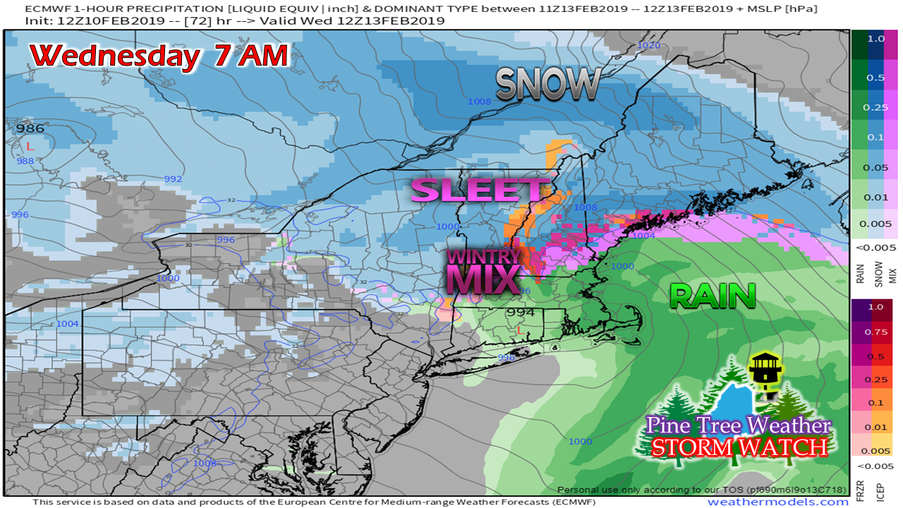 As time approaches daybreak is when the the shorelines of the southwest coast, MidCoast and western areas begin to see a change in precipitation type. This is where the forecast becomes a challenge. 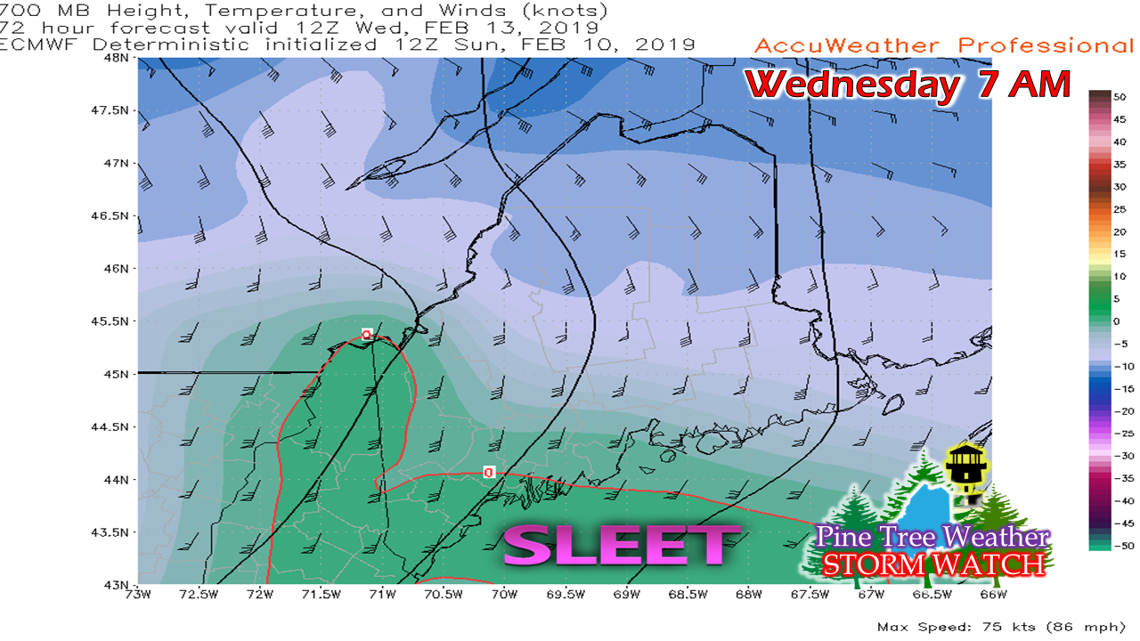 A warm nose could work in around 10,000 feet in time for the Wednesday morning commute and bring sleet into western areas. Around the same time, a coastal front works in off the ocean which could bring a mix of sleet, freezing rain and/or rain. That coastal front works into Penobscot Bay and DownEast areas during the morning. 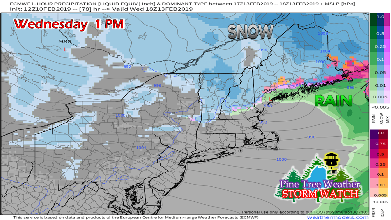 Precipitation begins to taper by early Wednesday afternoon over southern areas. Western areas that may experience sleet are likely to switch back to snow as low pressure travels up the coastline into DownEast areas. 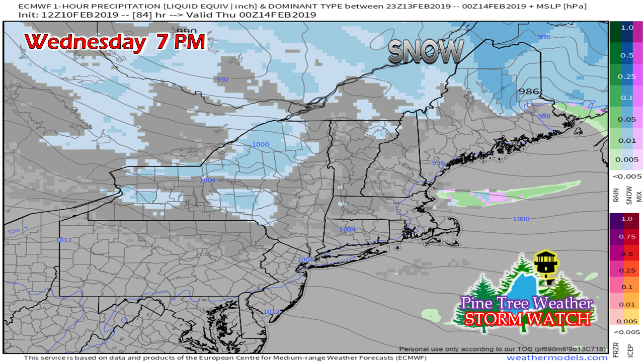 By Wednesday evening, precipitation tapers over eastern areas. The western mountains see snow showers that will persist into the overnight hours into Thursday morning. Northern areas see the steadier snow end by late evening, with snow showers persisting there into Thursday morning. First call snow totals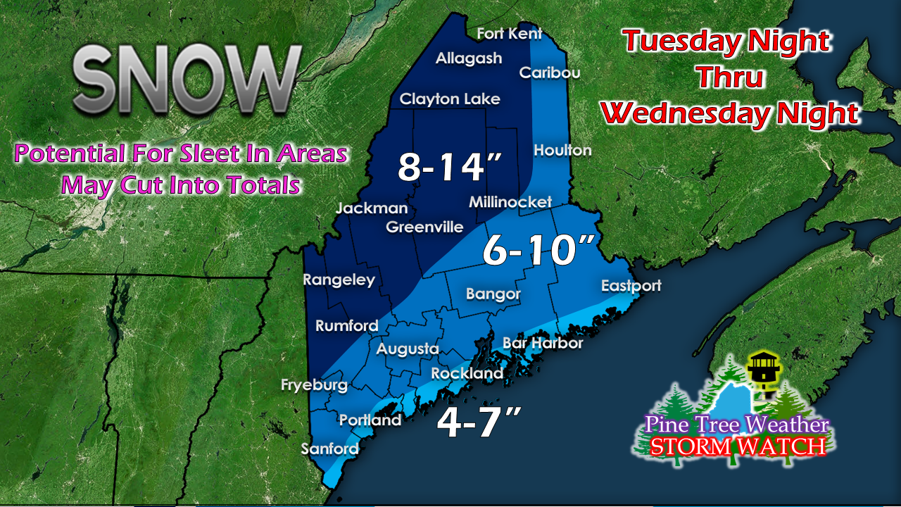 Before the mix comes, I do expect a plowable snow for the shorelines. The jackpot area for this event appears for the Chesuncook Lake region where totals could reach 16". The western ski hills could see a foot or more from this, but sleet may knock totals down there. Track confidence is fair at this point. Anytime there is a coastal hugger system involved, a few miles in deviation changes the outcome. I expect deformation bands to play a role in the outcome of this, also. Some areas away from the shorelines could see snowfall rates 1-2" per hour, possibly more pending on how this plays out. With this event comes blowing and drifting snow which will be a concern for areas away from the coast. Stay tuned for updates... Outlook through Friday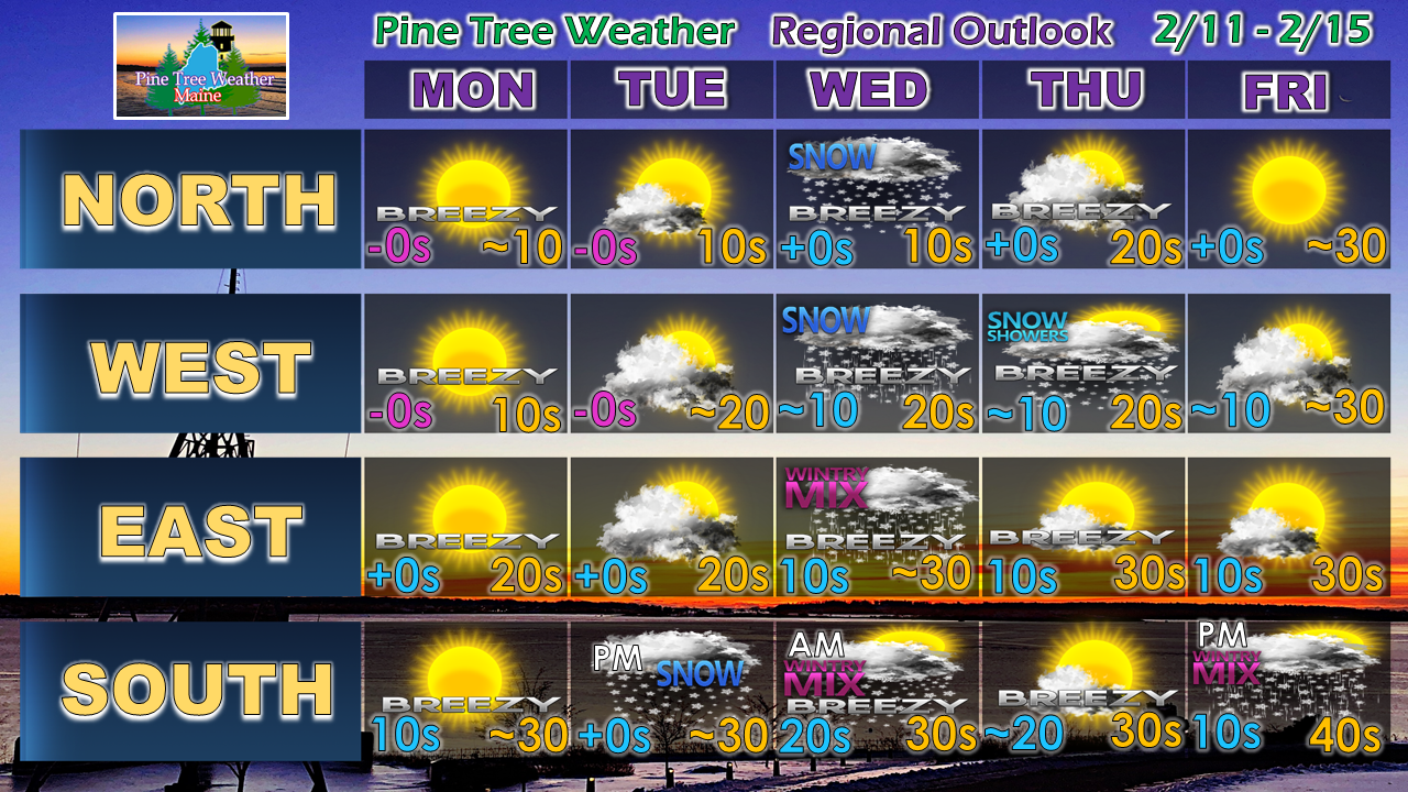 Expect a mix to rain event to impact the region to start the weekend.
► ► For the latest official forecasts, bulletins and advisories, please check in with the National Weather Service in Gray for western and southern areas, or Caribou for northern and eastern parts of Maine. For more information from me, please follow the Pine Tree Weather Facebook page and my Twitter feed. ► ► Your financial donations are much appreciated to keep this site funded and for further development. I sincerely appreciate your support not only financially, but also in sharing my efforts with others. Always stay weather aware! - Mike |

Mike Haggett
|


