
Playing conservative on this oneOver the previous 24 hours, guidance has been flip-flopping around as far as IF the warm nose makes an appearance and how far inland it goes. Warm fronts are flaky. They have a tendency to overperform in summer. In winter, it can be the opposite. With cold, bone dry high pressure to the north, it boils down to how quickly the atmosphere saturates in order for it to snow. I am seeing a trend where the dry air may have more influence, thus reducing the amount of liquid equivalent precipitation. Models have had a tendency of being overly juiced in the long term, then reduce closer to the event. This clipper that is passing through Tuesday night is good case in point. That was a 1-4" snow event three days ago, and now it's flakes for most over western and southern areas to a couple inches of fluff in the mountains. Patience is a virtue in the weather forecasting world. That continues to get drilled into my thinking in my 12th winter doing this. Regardless, there will be enough snow around to cause travel problems Thursday morning, and many areas over the southern two thirds of the state will need a plow. 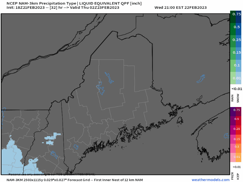 Wednesday 9 PM to Thursday Noon - The amount of "thump" has settled down a bit. There will some, no doubt, and where it does, snowfall rates could be in the 1-2+" an hour range over western and central areas in the wee hours of Thursday morning. Folks in the York County area may hear some pinging noises from sleet heading in the early morning hours to just after sunrise as well. Precipitation tapers off over the area Thursday morning, with the chance of snow showers through the remainder of the daytime hours. 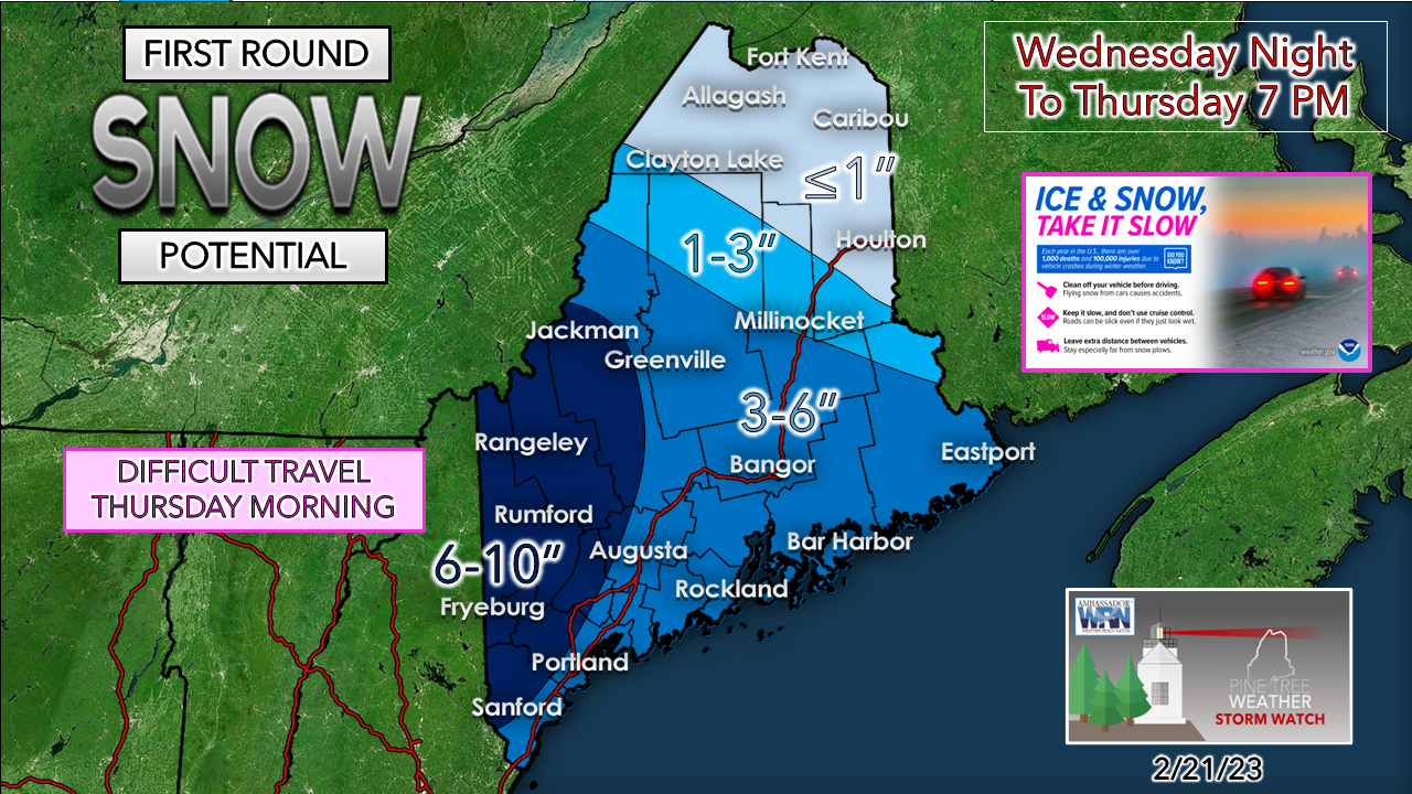 Where there is bust potential on the high end is if the warm nose doesn't move in far enough, over southern areas. The 6-10" area could shift southeast to Rockland and include the MidCoast and southwest coast. I do expect the taller ski hills to get a foot out of this. Where banding occurs could bring additional bonus inches as well, again over western and central areas. This will be fluffy snow and easy to move around. With temperatures in the teens to low 20s for the day, this powder may be extra slick given the ice content and larger flake potential. The travel overnight into the Thursday morning commute will be slick for sure. Then there is round two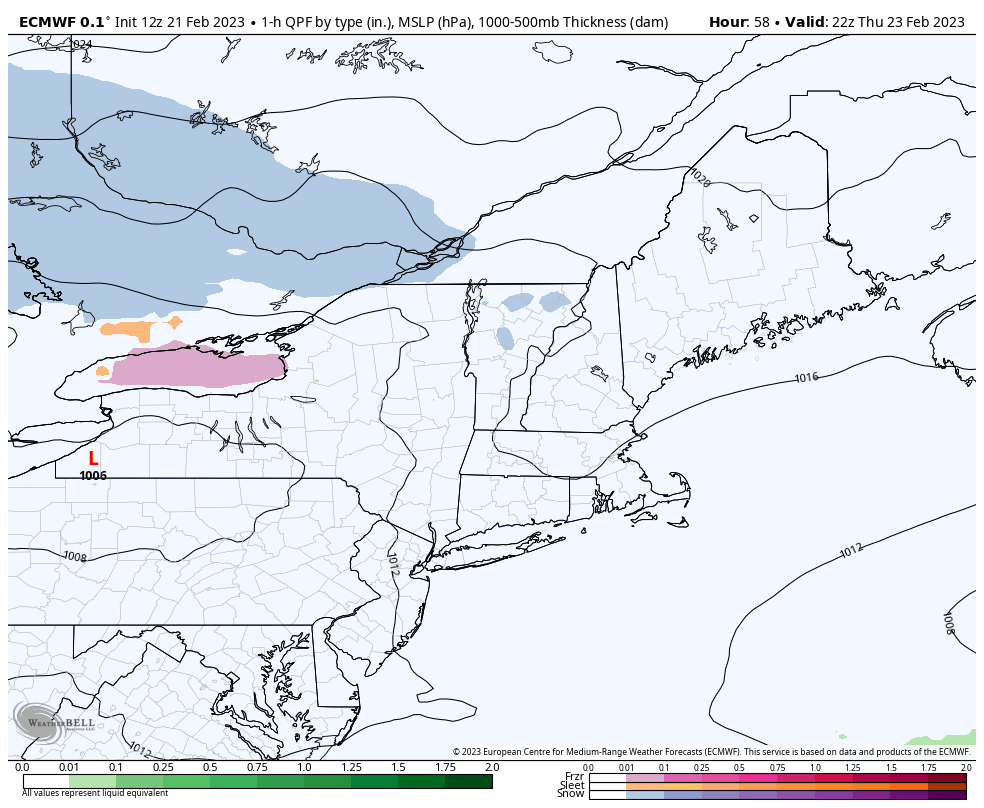 Thursday 5 PM to Friday Noon - We'll play this game again as low pressure rides along the boundary of the arctic high to the north. Northern areas get in on it this time. As far as additional accumulations go, a rough idea of 3-6" is possible from roughly Fryeburg to Lewiston to Rockland north to Houlton over to Clayton Lake, with lesser amounts south and north of that area. This will be updated, and I will have a snowfall map for Friday on Wednesday. 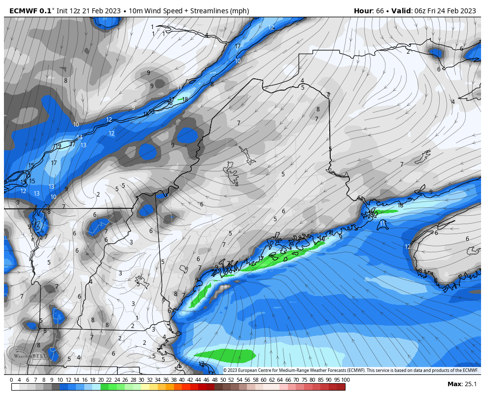 Friday 1 AM to Saturday 1 AM - What will make Friday a bit more difficult for travel and cleanup is the increase in wind speed. As the low heads for Nova Scotia, it intensifies, and thus the wind picks up. Gusts could reach 20-30 mph, possibly higher for the shorelines and mountains at 30-40 mph. Fluffy snow and wind means blowing a drifting of snow, and potential for pockets of whiteout conditions. The wind settles Friday night as high pressure moves in and brings calmer conditions for Saturday. Temperature outlook and one to watch for next week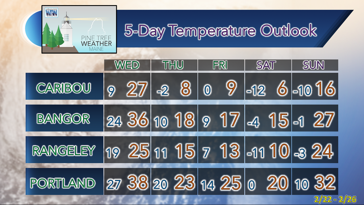 Temperatures after Wednesday get chillier and it will be a three dog night Friday night, with most areas falling below zero. There is still the chance for snow showers Sunday as an inverted trough taps into a storm offshore. 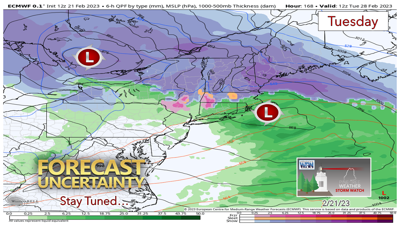 I mentioned in yesterday's update that an upper level low over the southwestern states late week needed to be watched for next week. Here's an idea that may come out of it. I don't want to get the horse too far ahead of the carriage here, but the pattern makes sense. As the old story goes, March roars in like a lion, and it very well could. This will be something to stay mindful of heading into the weekend. The term "backloaded winter." I've been saying it for a while now. I am not budging from that idea. March could be interesting. Stay tuned.  Thank you as always for your support! You may not like the weather, but I hope you like what I do! Please hit the like button on Twitter and Facebook, and share! Financial donations to fund what I do are always appreciated! Stay updated, stay on alert, and stay safe! - Mike NOTE: The forecast information depicted on this platform is for general information purposes only for the public and is not designed or intended for commercial use. For those seeking pinpoint weather information for business operations, you should use a private sector source. For information about where to find commercial forecasters to assist your business, please message me and I will be happy to help you |

Mike Haggett
|


