
A busy pattern into next week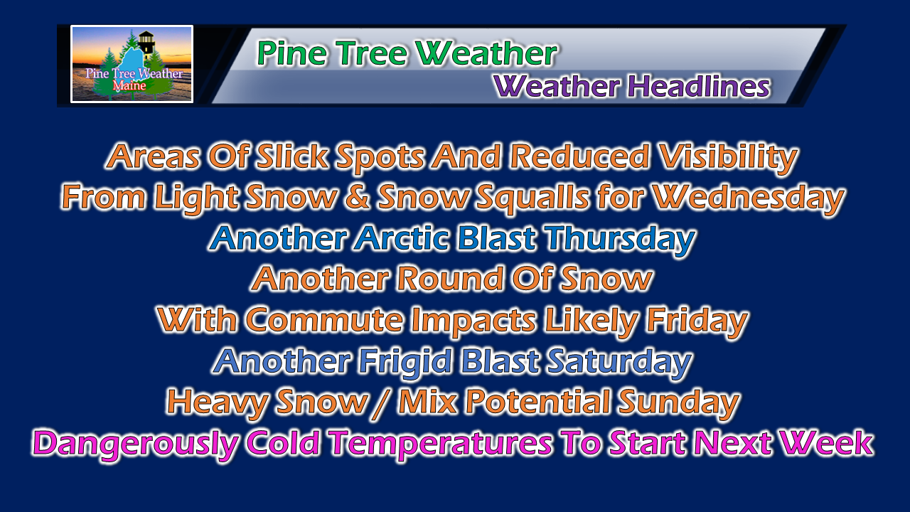 January 15th marks the official halfway point of meteorological winter. The western mountains and the far north have done extremely well in the snow department so far, and that trend appears to continue. Folks who live along the coast with little snow on the ground from the ice and rain should hang tight.... February is coming. Wednesday's clipper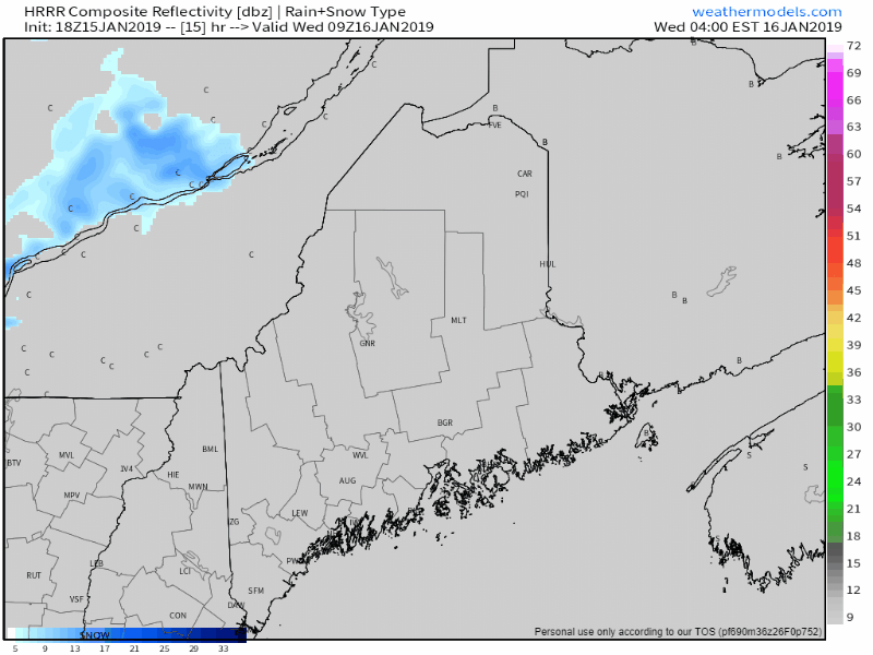 At first glance of this radar simulation from the HRRR model, it may not appear to be a big deal. For most areas, it may not. Northern areas have the best chance for accumulation through midday. An arctic front sweeps through in the afternoon, and could bring some potent snow squalls over interior areas, with a few reaching the coastline by the evening commute. 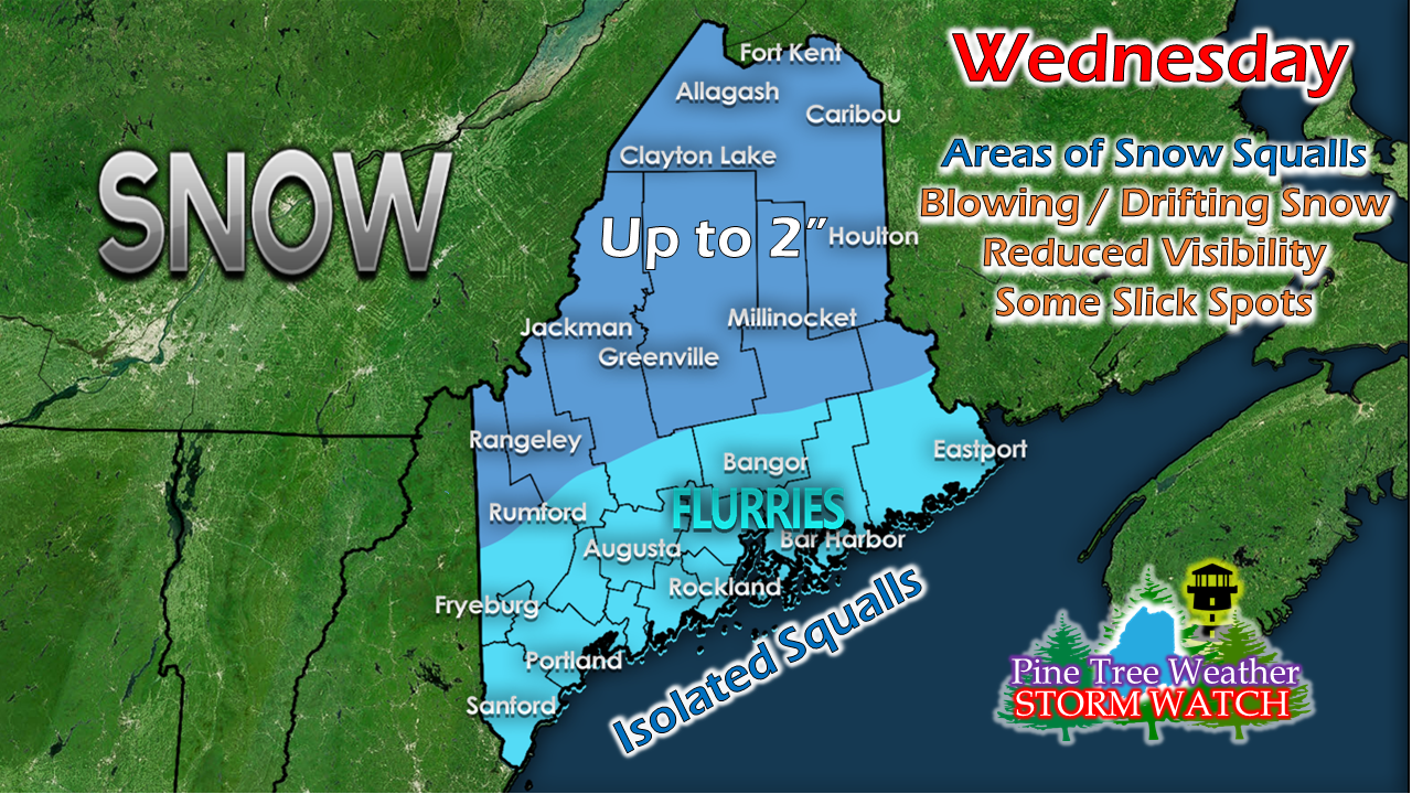 No changes in thinking with this one. Any isolated squalls that make the coastal plain to the shorelines may drop a quick inch. More of a concern will be for sudden changes in driving conditions where squalls occur. With the arctic front, blowing and drifting snow will again be an issue for the north. At this point, it is just another day in The County. Thursday' chill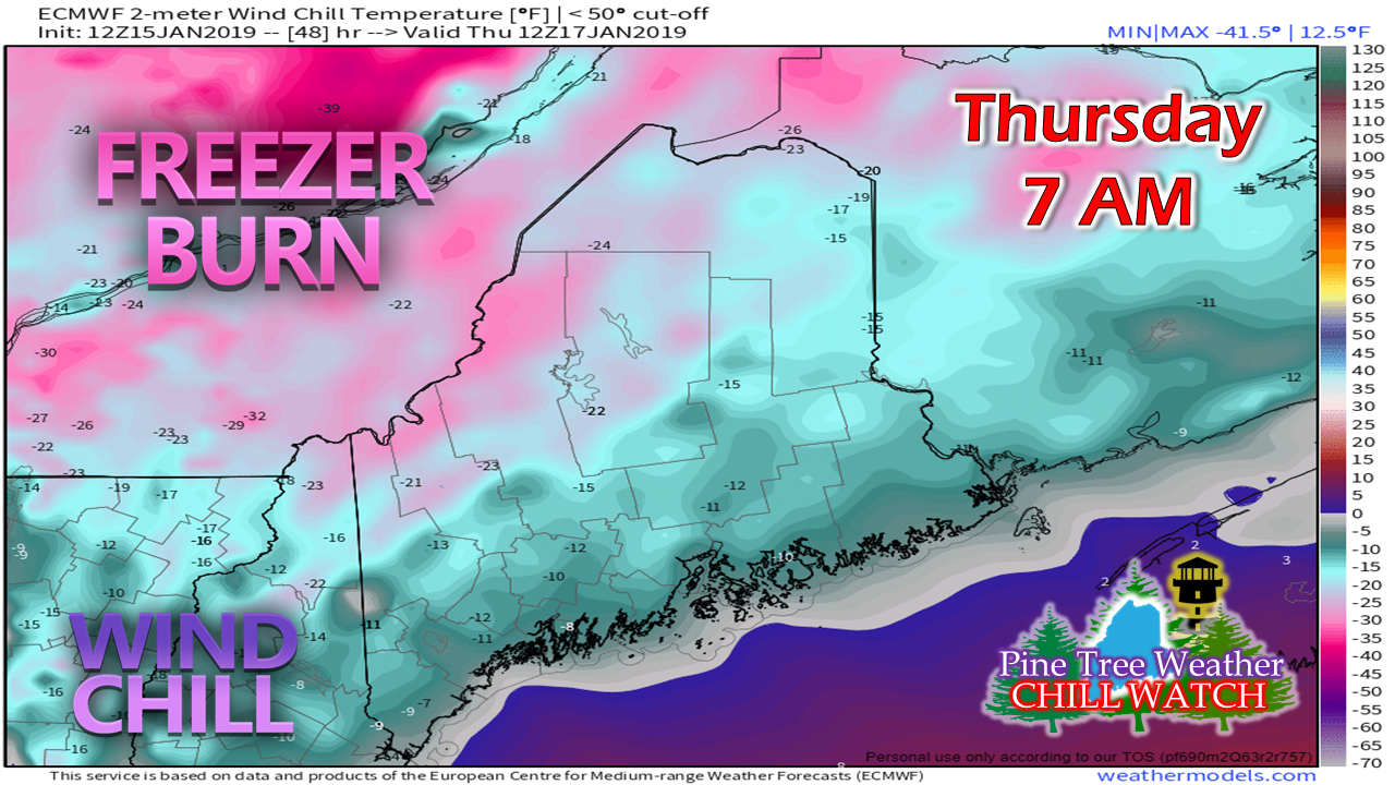 Northwest wind will continue into Thursday as high pressure passes through the region. It will be another butter start with many areas experiencing double-digit below zero wind chill to start off. The mountains and north appear to remain below zero for wind chill for the day, with feels like temps in the single digits for the coastal plain for the mid-afternoon. A snowy end to the week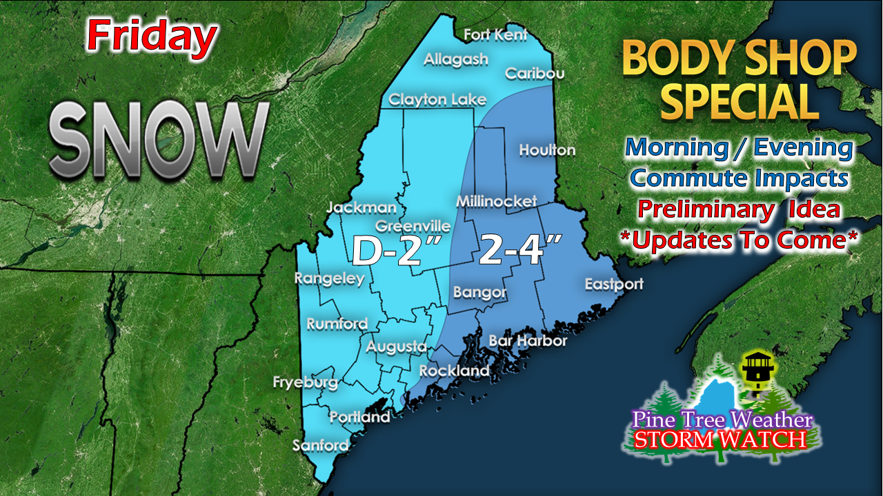 This is my preliminary idea for snowfall Friday. The MidCoast and eastern areas appear to get the higher accumulations at this point. It's still a bit early and there could be some subtle changes on this. This is definitely in the Body Shop Special range (1-4") which appears to affect the morning commute for western and southern areas, both commutes for Bangor, and midday and evening travel times for northern areas. I'll have a better idea on timing on this as we head into the rest of the week. Saturday's arctic feel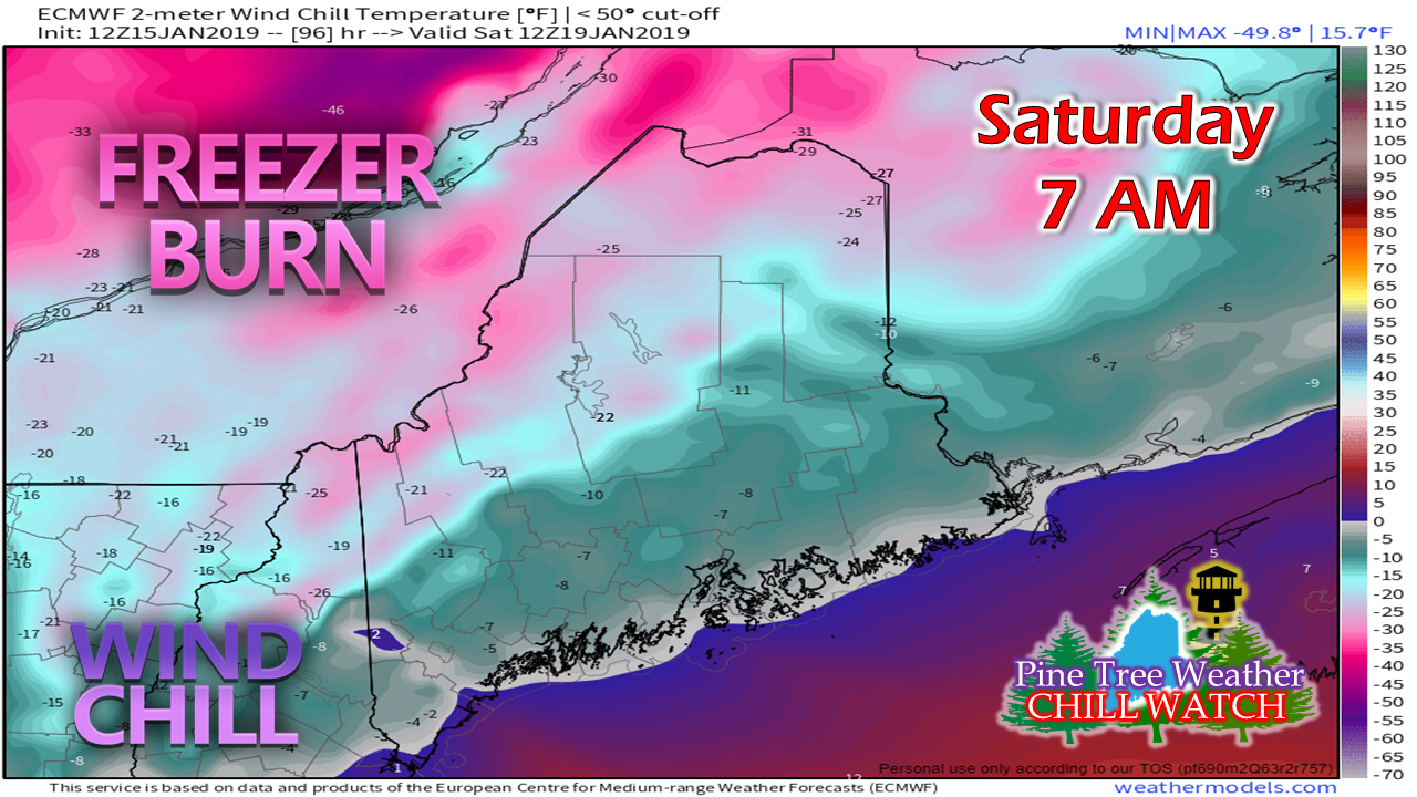 Pardon me if you've seen this clip already, but this is another repeat performance of storm departure bringing in bitter cold with a northwest wind. The results of that is an arctic start to the weekend. This cold will play a considerable role in what happens for Sunday. The latest on Sunday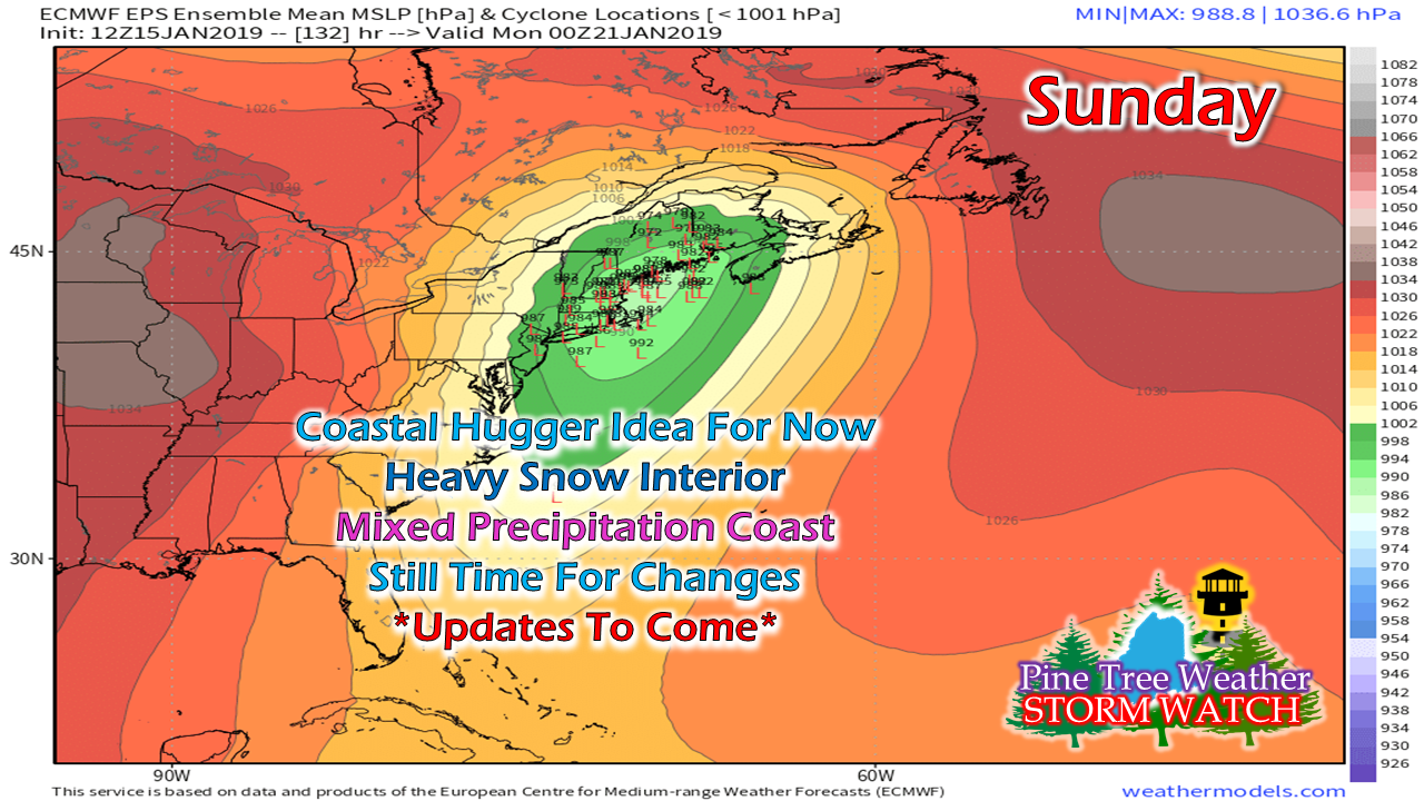 A few more clues on what may happen Sunday have been revealed in model suites of the past 24 hours. The cold will be around away from the shorelines as it appears for now. The key at this point is figuring out storm track to factor in precipitation type. As we've seen several times this winter, these coastal huggers bring the kitchen sink to the coast and foothills to the south central highlands, and heavy snow for the ski hills and far north. I will say that I am concerned that this could bring an icing event over the coastal interior where cold air damming regularly comes into play. On top of that, comes wind. This appears to be as stronger storm as far as surface pressure goes. The combination of heavy snow and/or ice with gusty wind could spell bad news for potential power outages. I am concerned for the shorelines as well. Fortunately, there is nothing astronomically going on with them, but high surf and beach erosion may be an issue here. If you have to travel anywhere on Sunday, I suggest that you travel Saturday and plan on staying where you are until Monday, if you can. Sunday does not appear to be a day to travel for interior areas. Time will tell for shoreline areas. Stay tuned for more on this. This is not the final answer. More details on timing and precipitation type will come later in the week. Next week starts off with that North Pole feeling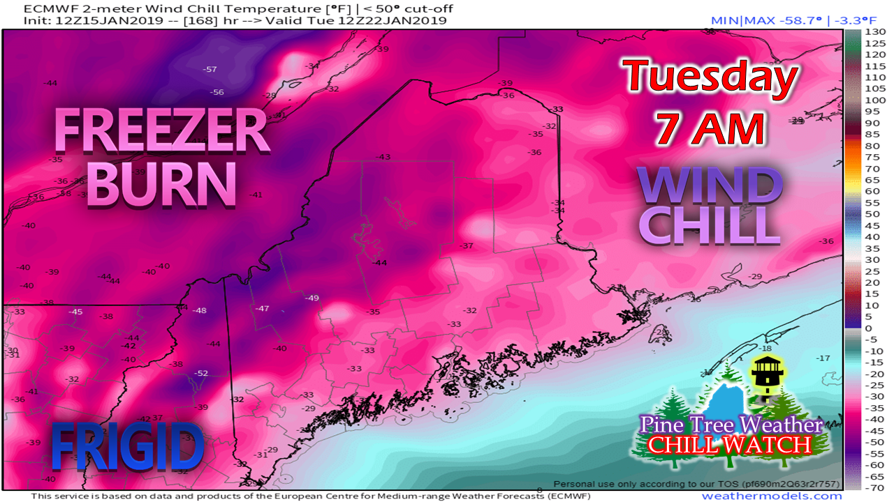 If Thursday and Saturday don't get your attention when you step out the door, the temperatures next week may raise your eyebrow, or simply freeze it off. For those that can't read the fine print, those are dangerous wind chill values ranging from -40° to -30°. Actual temperatures could be double digits below zero for most all areas away from the shorelines. This will be the coldest air of winter, and it may not modify much until later next week. This cold could be especially concerning for areas that could lose power from the storm on Sunday. The wind appears to settle down on Wednesday, but the bitter cold isn't going very far as it appears for now. A word to the wise...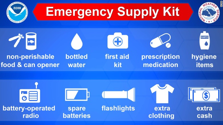 I am not predicting an apocalypse here, but it's time to check your oil and/or propane supplies, get your wood inside or under cover in case of ice. Have dry gas (anti-gel for diesels) and jumper cables on hand. Fill up your gas tank in your vehicle(s). If you have an engine block heater plug, chances are you may need to use it. Check your generator, if you have one. Make sure you have the necessary food and medicine supplies. Have your cell phone chargers and anything other electronics charged or extra batteries on hand. With dangerous cold in the forecast. you will want to be prepared and ready for it in case of power loss that may go more than just a few hours. If not for Sunday, February is coming. We have plenty of winter left. Outlook through Sunday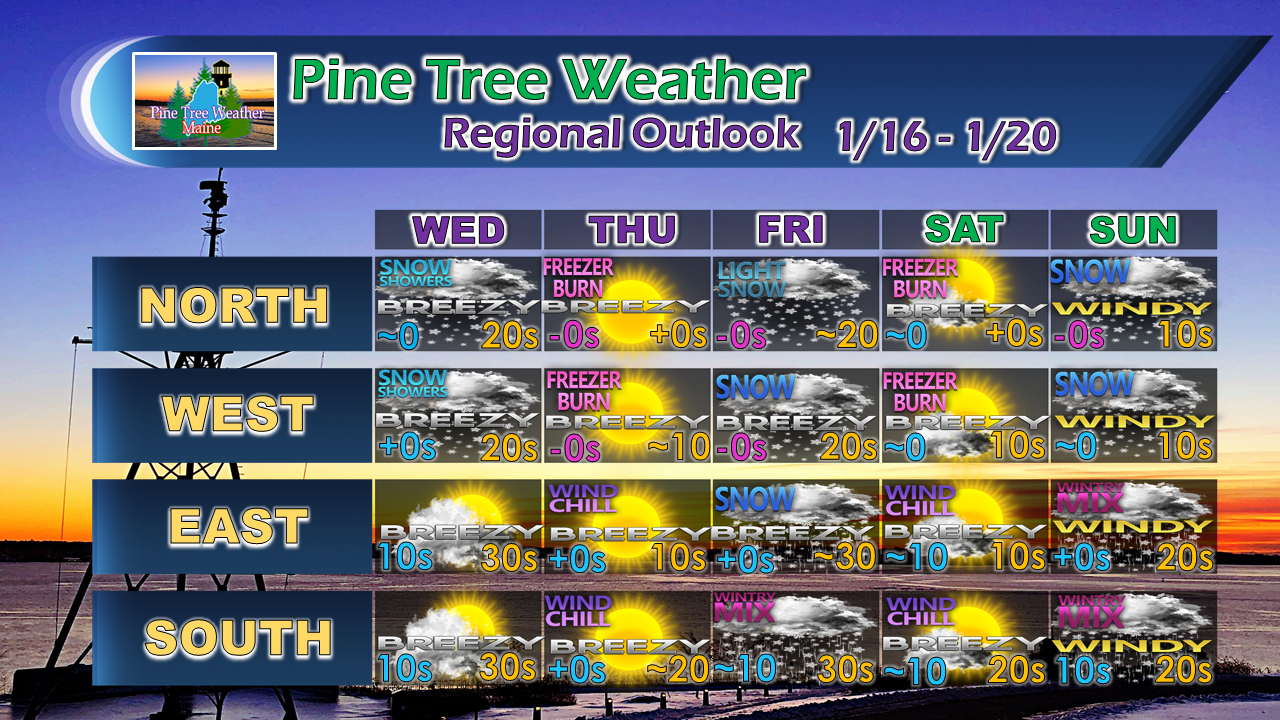 More updates coming.
For the latest official forecasts, bulletins and advisories, please check in with the National Weather Service in Gray for western and southern areas, or Caribou for northern and eastern parts of Maine. For more information from me, please follow the Pine Tree Weather Facebook page and my Twitter feed. Your financial donations are much appreciated to keep this site funded and for further development. I sincerely appreciate your support not only financially, but also with sharing with others. Always stay weather aware! - Mike |

Mike Haggett
|


