
Greasy areas for the mountains and north Thursday AM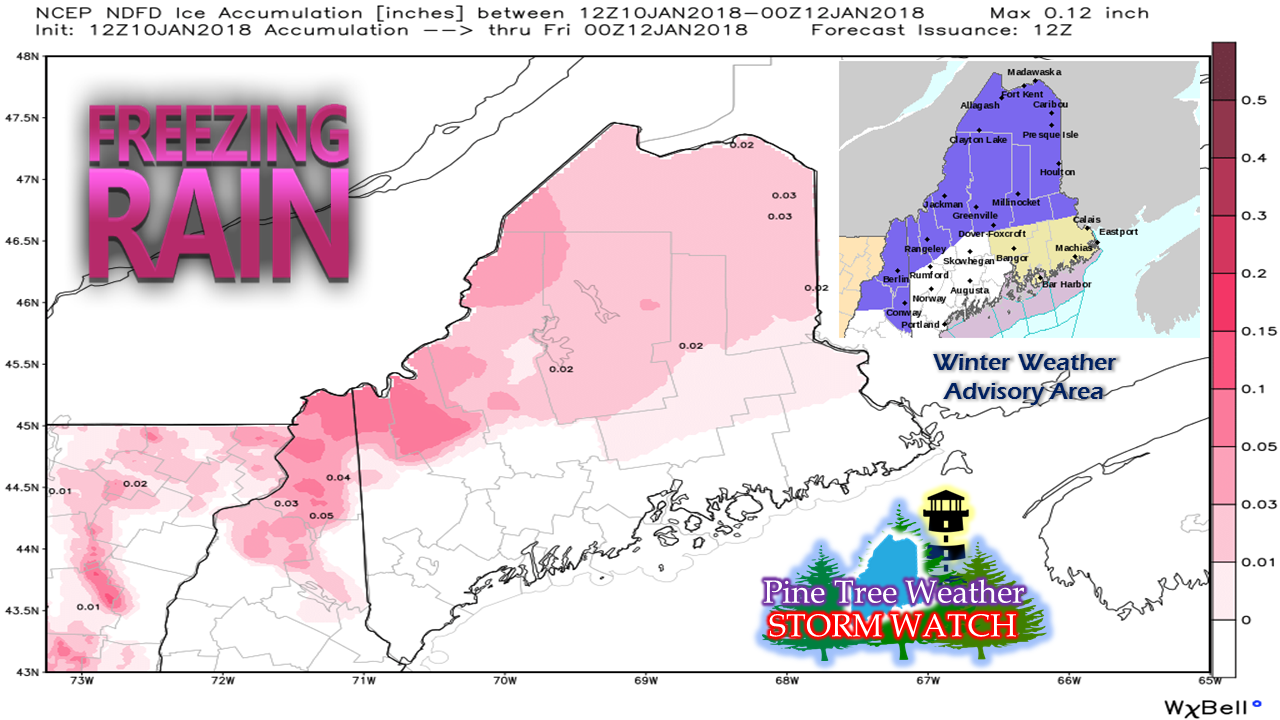 The National Weather Service has issued winter weather advisories for freezing rain for the overnight hours of Wednesday into Thursday morning. There is not a whole lot of ice accretion associated with this system, but enough to cause slick spots. Simulated radar into Friday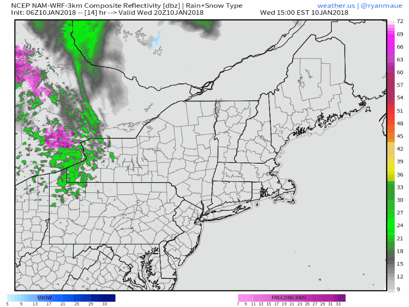 Radar idea presented here from mid-afternoon Wednesday through Friday afternoon to present a rough idea of what to expect. Simulated radar like this from the NAM and the HRRR do a poor job with freezing rain (pink) due to the low level warm air, so don't let the rain color (green) fool you in regards to Wednesday night into Thursday morning. I WILL CAUTION that the areas which are not under advisory could see some patchy freezing rain or drizzle. Any area away from the shorelines should expect areas of black ice and slick spots for the morning commute. As the surface temperature warms to above freezing, the threat diminishes during the day on Thursday. Showers will be scattered in nature, and temperatures rise into the 40s and will teeter around that through the overnight into Friday. Rain will increase with intensity as the front approaches Friday morning and into the afternoon. A concerning amount of water involved here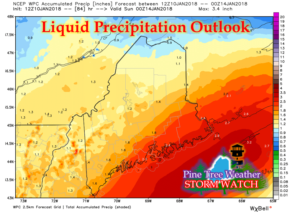 This is the forecast outlook from the Weather Prediction Center of liquid equivalent precipitation through Saturday evening. Flooding concerns of runoff from the rain in combination with warm temperatures melting snow are possible in areas. Ice jams are possible for rivers, brooks, and streams. Urban street flooding from clogged storm drains are possible as well. Saturday to be a certified mess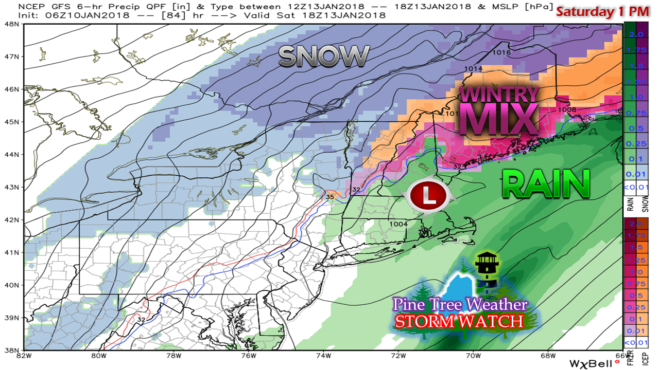 It's still a bit early to get into detail on what to expect for Saturday as far as precipitation type and amounts, but there is high confidence that it will be a very messy day. As the front slides offshore Friday night, cold air will bleed down from the northwest which will set up potential for freezing rain. A warm nose may work into the atmosphere and bring sleet into the picture. I am still thinking that most areas of the state will see some sort of combination of rain, freezing rain, sleet and snow by the time this event ends Saturday evening. Roads, sidewalks, parking lots all have potential to be slick. Cold air damming at the surface in conjunction with warm air aloft is always an interesting weather set up, and this one is on track to create issues.
As always, stay up to date with the National Weather Service for the latest bulletins and advisories that could change. The 5-Day Outlook page has been updated. Stay tuned. - Mike |

Mike Haggett
|


