
A manageable widespread snow event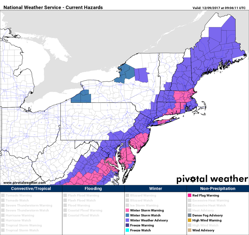 Most of the state is under Winter Weather Advisory for Saturday into Sunday morning. Winter storm watches were canceled. As I mentioned on Facebook on Friday, this was a borderline warning criteria event. The National Weather Service may decide to elevate some areas to warning level, but it will be because it just meets their 6"+ criteria and not much more than that. 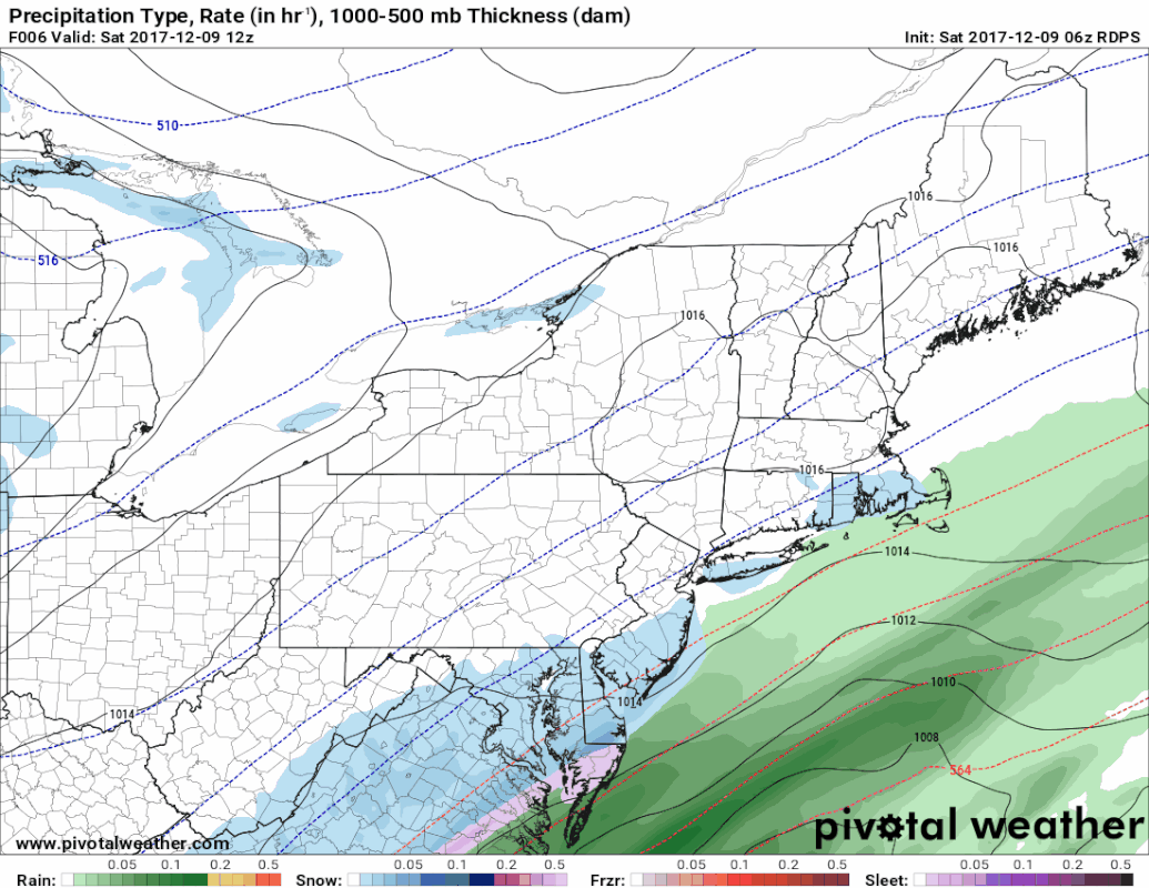 The Canadian RGEM model is presented here in three hour steps to show the duration of the event. Snow develops statewide during the course of the day, ending Sunday morning. Snow showers and flurries may continue for interior areas during the afternoon, but won't offer much in additional accumulation. 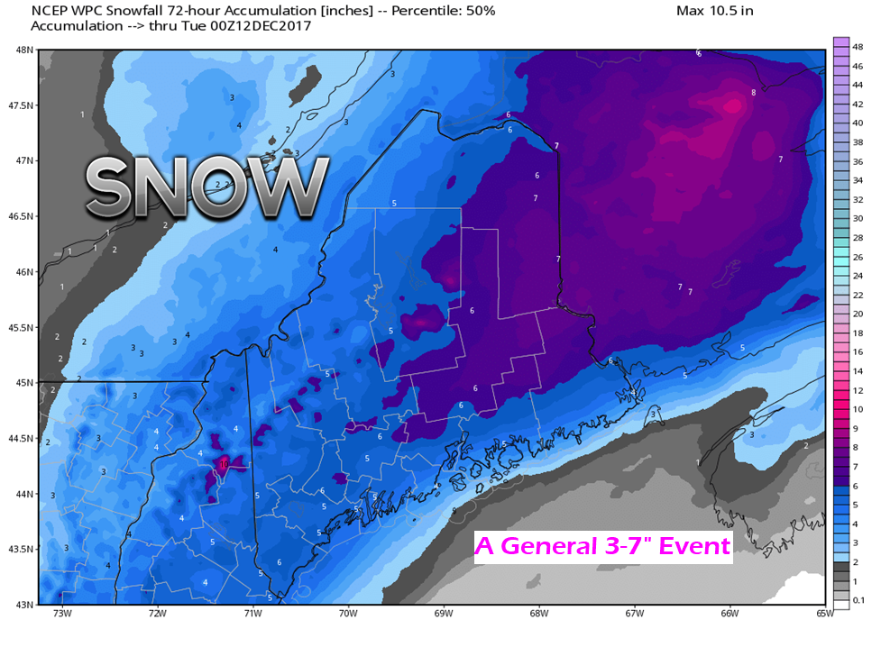 All in all, a general 3-7" is expected to fall statewide. Areas where it could under-perform would be northwestern Aroostook and DownEast coastal areas. I still think a coastal front sneaks in for Hancock and Washington Counties and keeps accumulations down in the 1-3" area along the shorelines. Snow in that area is likely to be on the slushy side. Otherwise, this is a powder event, which will be easy to clean up. 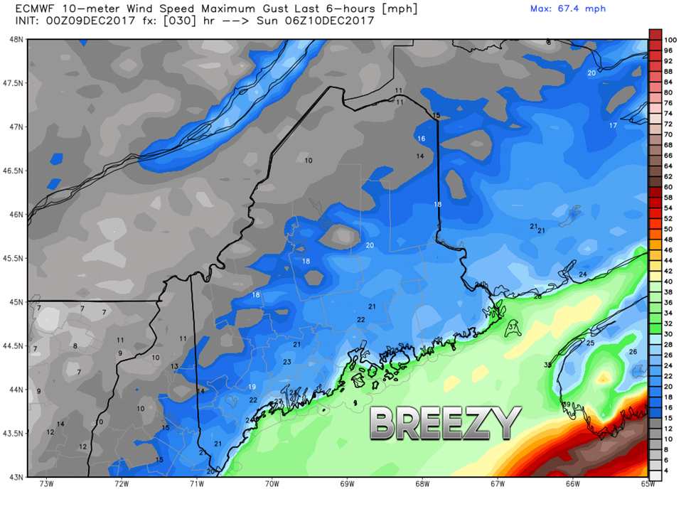 I haven't mentioned anything about wind, because it really isn't a big deal with this event. Given the position of the front, wind direction appears generally from the north, and in that case the coast sees the strongest wind. Gusts in the 15-25 mph are possible overnight, which may bring some brief whiteout conditions and reduce visibility. A look aheadMore chances for snow are on the way for the middle part of the week and again late week. This cold air isn't going anywhere anytime soon. There does not appear to be anything major. While surface maps have their place in showing precipitation, sometimes they can be overdone or underdone. You will see me use the 500 mb vorticity (upper level energy) maps a lot more in the future because they do a better job than surface maps when properly explained. 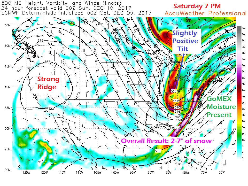 I am going to start off with the weekend event. Models had thought the upper level trough was going to be more of a neutral tilt, which jacked up their snow / liquid equivalent output. Sensing there was a misconception of that, I didn't take the bait. I presented ensemble ideas as a safeguard, and they proved my theory right. In the end, the trough will be slightly positive with the convergence of the southern stream happening over Atlantic Canada. Our region gets 2-7" of it. 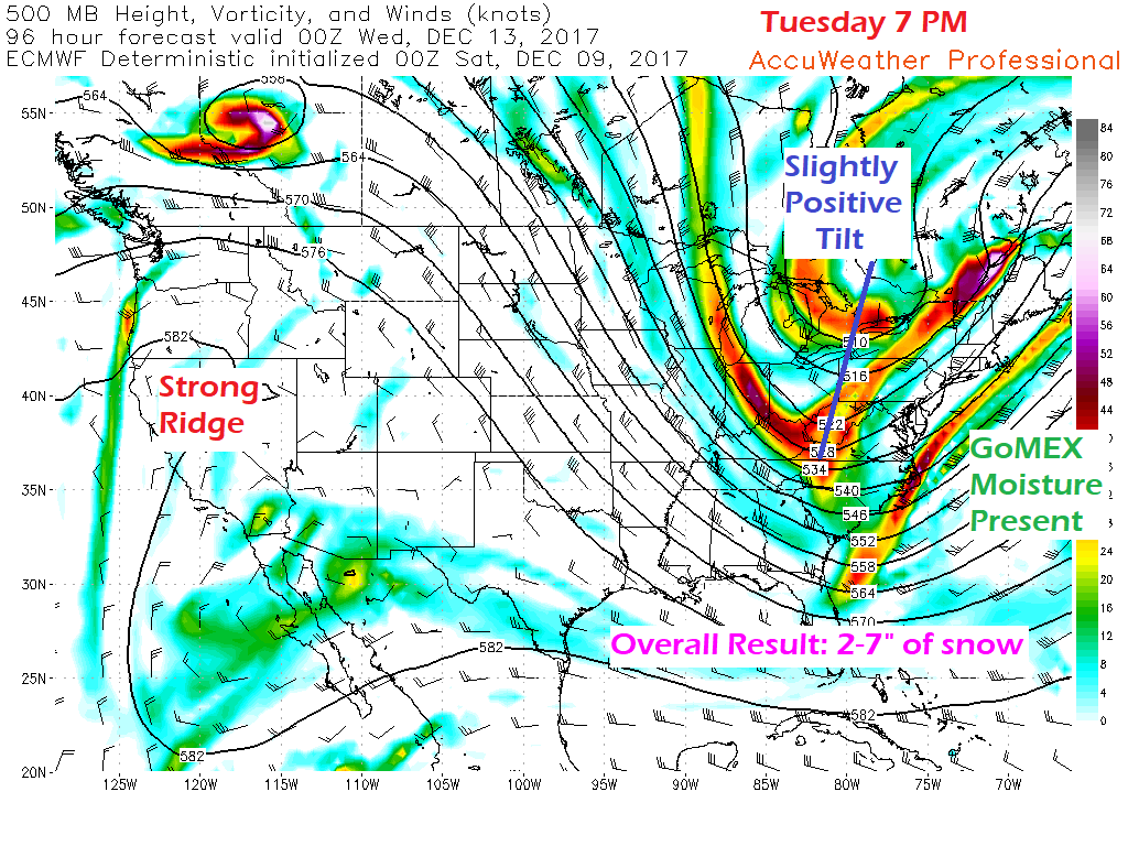 Almost a carbon copy appears on the way for Tuesday. So long as the trough stays positive, the region escapes with low impact snow events. Just be forewarned this is what I deem a "Body Shop Special" since this will impact during the day in the work week. Just enough snow for people to think it isn't a big deal, but enough to cause numerous accidents by careless driving. 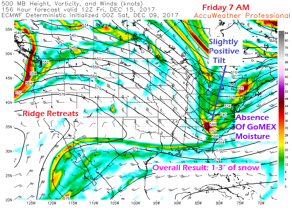 Late week is a different situation. The lack of a southern moisture stream reduces snowfall potential. It will be enough for a sand and a scrape, and if the timing is right, slow down the morning commute. With Tuesday's results of the Body Shop Special fresh in people's memory banks, that should reduce the number of potential accidents and respect the snow for how it can impact on driving. You may find my comments a bit sarcastic here, but I've lived here long enough and personally commute 300 miles a week for work, going on 20 years. It's like clockwork. I have seen this situation play out over and over again, year after year after year. I am going to speak the truth and call it as I see it. 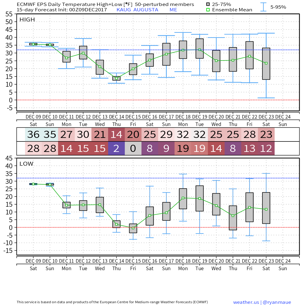 This is Augusta in the eyes of the European ensembles for temperatures. I will say this is a rough idea of what to expect. The Euro tends to be a bit on the warm side. I use this to drive home the idea that cold isn't going anywhere. Temperatures will modify a bit at times, but sub 32° can be expected for interior areas leading up to Christmas. This means snow chances will continue.
- Mike |

Mike Haggett
|


