
Snowy, but manageable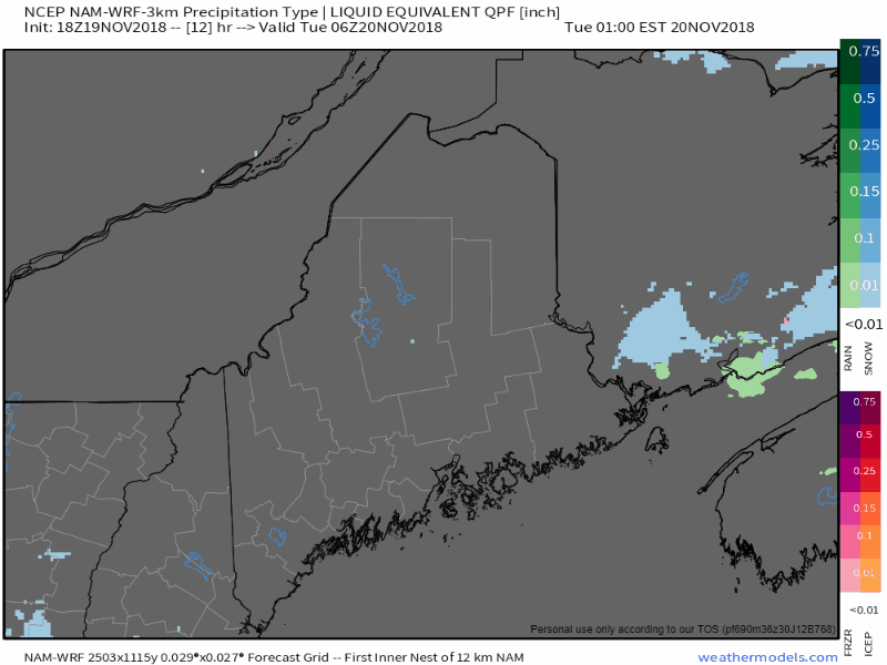 Let's cut to the chase with this one. This is more or less a garden variety light to moderate snow event that will likely be more annoying than anything else. The main threat areas will be for the coastal plain, although areas in the foothills of southern Oxford and southern Franklin counties may get in on the action, too. Southwest coastal areas may see steady moderate snow in the 4 AM to 10 AM which will then become light. The time frame for moderate snow along the entire coastal plain in the afternoon runs from around 1 PM to 7 PM west of Penobscot Bay, 4 PM to 10 PM for DownEast areas. Once it shuts off, it's over. This isn't anything the plow crews should have a whole lot of difficulty with. Sure, it could be greasy on the secondary roads in areas, but if caution is used, folks should be able to get around alright. 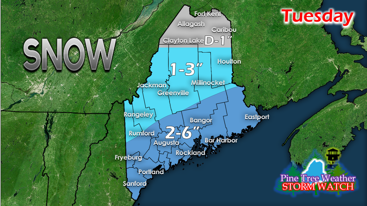 The best bet for higher end snow totals appears to be interior York County and coastal DownEast areas. The further north and west, lesser amounts. This event ends in western areas between 7-9 PM, eastern areas by midnight. Wednesday looks squally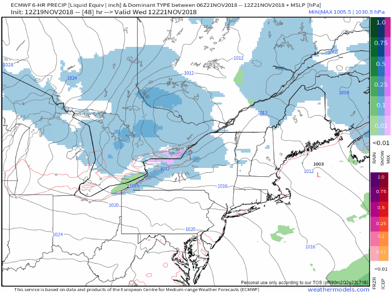 As the Tuesday system departs, a weak low spins through the region Wednesday which may bring scattered snow squalls. Some of these snow squalls may cause whiteout conditions and drop a quick inch or two of snow. Not everyone is going to get one, but enough snow may drop in areas where crews will get called out to treat the roads. The main threat occurs Wednesday afternoon into the early evening. The mountains may see squalls linger into early Thursday. The Big Thanksgiving Chill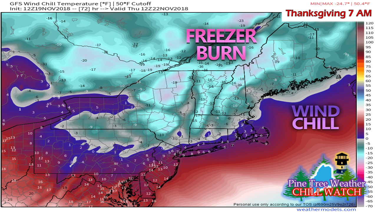 After the weak low pulls away on Wednesday, the coldest air of the season arrives and it's going to hurt. We're used to seeing double-digit below zero wind chill in January. I can't believe I am using the Freezer Burn graphic this early! Folks hitting the slopes are going to want to bundle up. There may be delays on openings of the peak trails due to wind gusts around 30 mph. It is likely to be breezy through the day. High pressure settles in Friday which will shut the wind down, but teens are the best to expect for high temperatures for the day for the north country. Your support is valued and appreciated!Please consider making a donation to keep Pine Tree Weather going through the year ahead. My data cost expense is increasing. The operation is 75% funded and needs your help to get through the winter. You can set up a monthly pledge on my Patreon page or send me a message from the Facebook page or direct message on Twitter to get my address to mail a check or set up bill pay.
For the latest official forecasts, bulletins and advisories, please check in with the National Weather Service in Gray for western and southern areas, or Caribou for northern and eastern parts of Maine. For more information from me, please follow the Pine Tree Weather Facebook page and my Twitter feed. Always stay weather aware, and thank you for your support! - Mike |

Mike Haggett
|


