
The roller coaster ride continues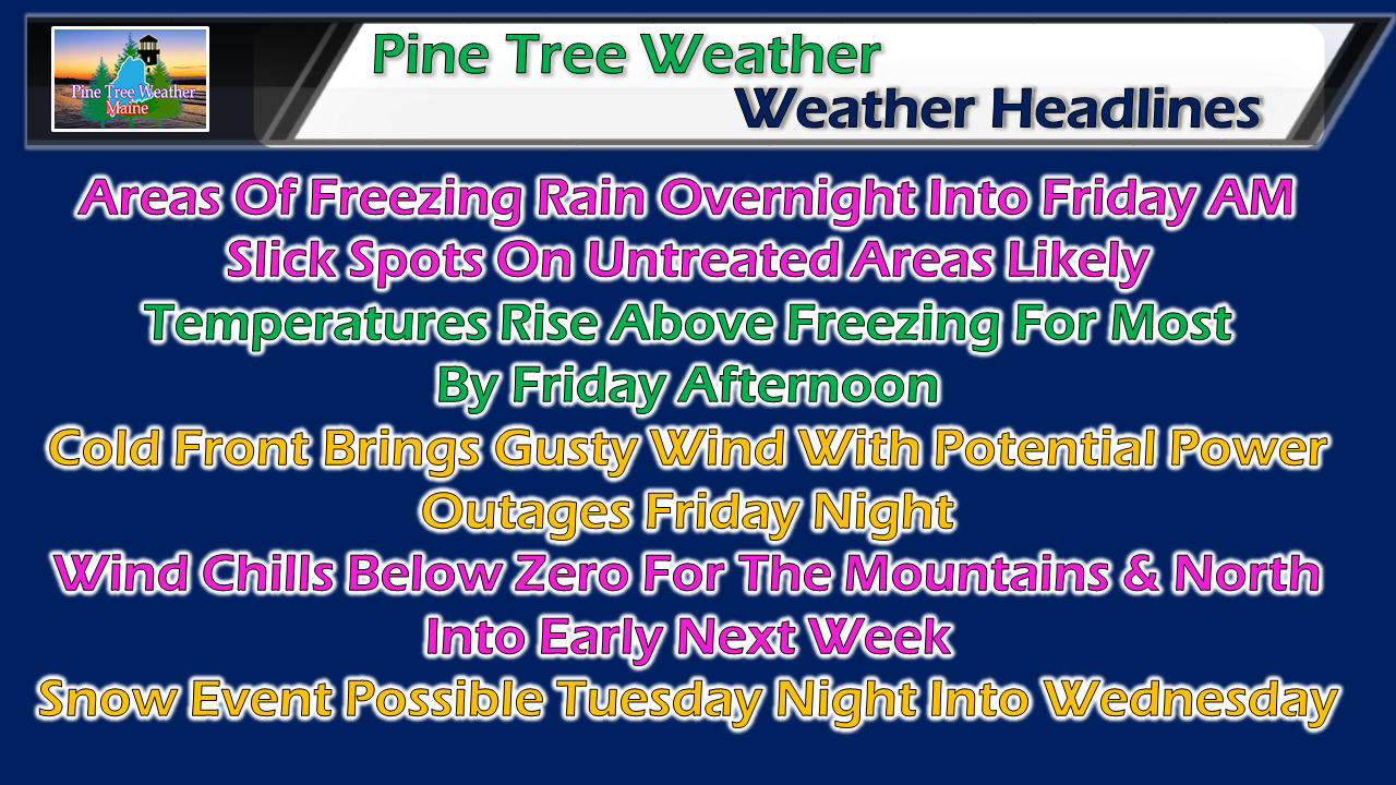 A warm front pushes northeastward overnight Thursday into Friday morning. As the low levels of the atmosphere warm up, cold air damming at the surface could be stubborn in relinquishing control. It would not surprise me to see the ground temperatures stay below freezing into the daylight hours for the mountains and north into the day on Friday. Southwesterly wind should take over, which will washout the cold air. The only question mark for this forecaster is exactly when, and how far north that will happen before a cold front moves through Friday night. Ice for some before rain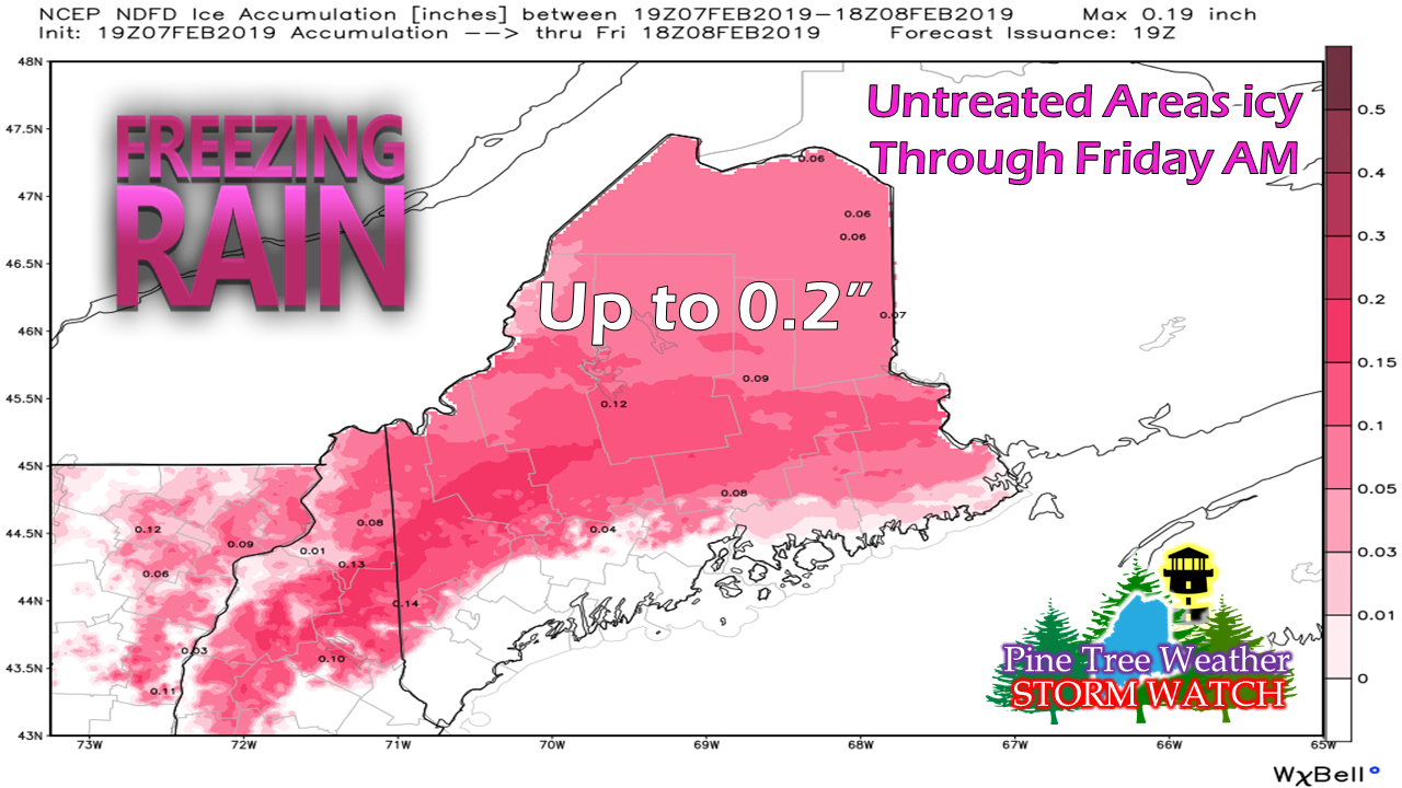 This ice forecast by the National Weather Service also indicates which areas stay above freezing (white) and what areas do not (pink) overnight into Friday. Most major roads that are well treated may not have much issue, outside of a patch of black ice here or there. The roads less traveled, sidewalks, parking lots, walkways and driveways may see some amount of ice accretion. Use caution if you travel overnight into the Friday morning drive. As the lower atmosphere warms, fog will be an issue especially in areas of heavier snow pack. Expect reduced visibility as you travel through the day. 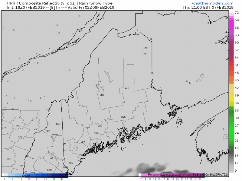 Areas of freezing drizzle may pop out ahead of the precipitation shield overnight. Western and southern areas appear clear of precipitation by mid to late morning, early afternoon for eastern and northern areas. Temperatures are expected to rise into the upper 30s for the mountains and north, 40s for eastern areas, and 50s for southern areas. If the sun can get out, some areas of York County may flirt with 60°. 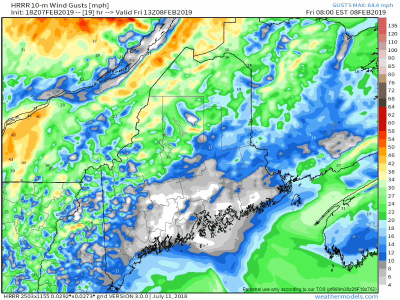 A cold front moves into the area Friday night and arctic air will bring the freezer back to the state. The wind could be gusty at times, especially for the higher elevations. Gusts 30-40+ mph are possible. This may cause some spotty power outages. The cold air will freeze up any liquid on the roads, which could cause areas of black ice Friday night. The chill returns for the weekend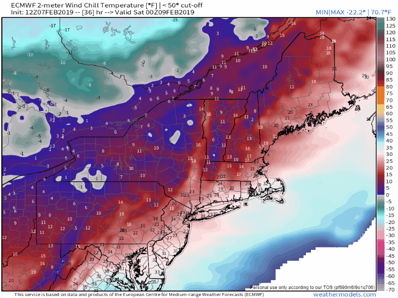 Wind chill indices below zero appear to be the standard for interior areas through the weekend, with single digits above for the coast. The wind slowly settles heading into Monday. Air will begin to moderate a bit as the arctic high moves east to start the week, but below freezing temperatures are likely to hold strong heading into next week. Potential snow event midweek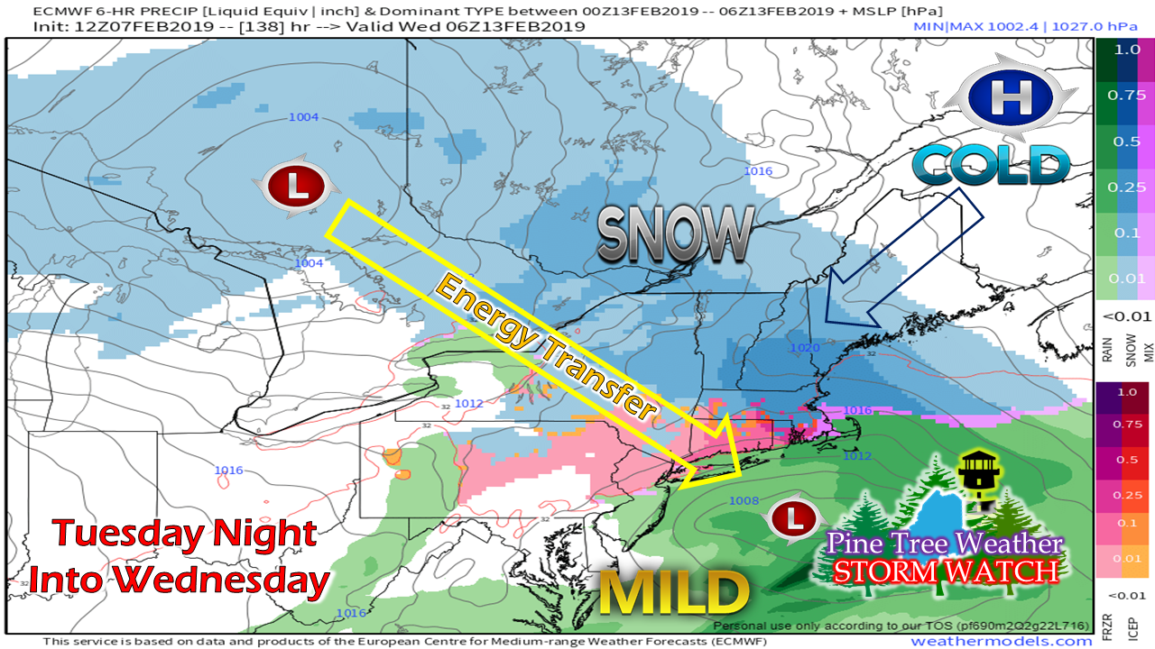 It's a bit early to get into specifics on what happens with this one. The general idea is for an ocean storm to form south of Long Island Tuesday afternoon and travel to the east/northeast. The air around the region appears to be cold enough for snow, with the only question would be for the shorelines. Time will tell if this will be an all snow event, or potentially mix along the coast. Answers to questions will begin to come this weekend. At the very least, Tuesday night into Wednesday does appear to be a snowy affair, with track and intensity to determine snowfall amounts. Stay tuned. Outlook through Tuesday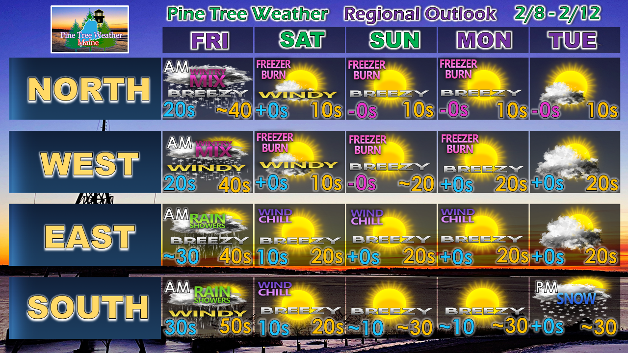 ► ► For the latest official forecasts, bulletins and advisories, please check in with the National Weather Service in Gray for western and southern areas, or Caribou for northern and eastern parts of Maine.
For more information from me, please follow the Pine Tree Weather Facebook page and my Twitter feed. ► ► Your financial donations are much appreciated to keep this site funded and for further development. I sincerely appreciate your support not only financially, but also in sharing my efforts with others. Always stay weather aware! - Mike |

Mike Haggett
|


