
The switch has been flipped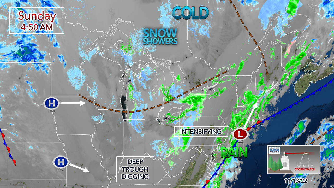 The recent stretch of exceptionally warm weather for November is now over. Expect the pattern to be more active with cold being a focal point with precipitation type and temperature. As seen in November 2020, the first half of the month was exceptionally warm, then the second half was sharply cooler. That is the set up that is evolving here. There is no better indicator as to how cold the air mass is than what is demonstrated with infrared satellite, which is depicted above. The gray indicates ice crystals at high altitudes. Temperatures in the week ahead are similar to late November. Winter is shaping up to be front loaded with cold, starting now. Precipitation chances appear close to normal through February according to the long-term ideas I see. These moderate La Niña patterns are usually not winter weather enthusiast friendly for this area, but each one is different. We'll see what happens and watch it unfold. Low pressure works up the coast Sunday and intensifies on its way to the Gulf of St. Lawrence Sunday night. It will tap into the cold air over Quebec and bring northern areas their first plowable snow event of the season. 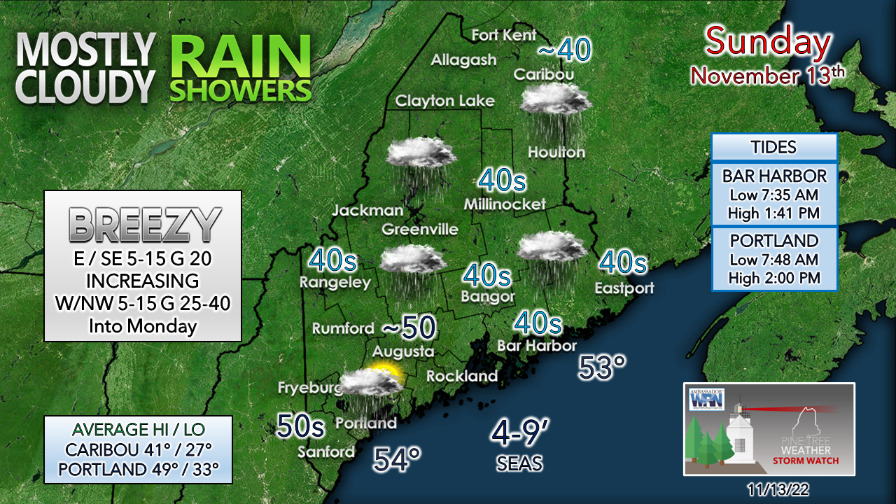 Expect high temperatures to be 10-20° cooler than Saturday. Expect the wind speeds to increase during the day and into Sunday night as the storm bombs out to the north/northeast. 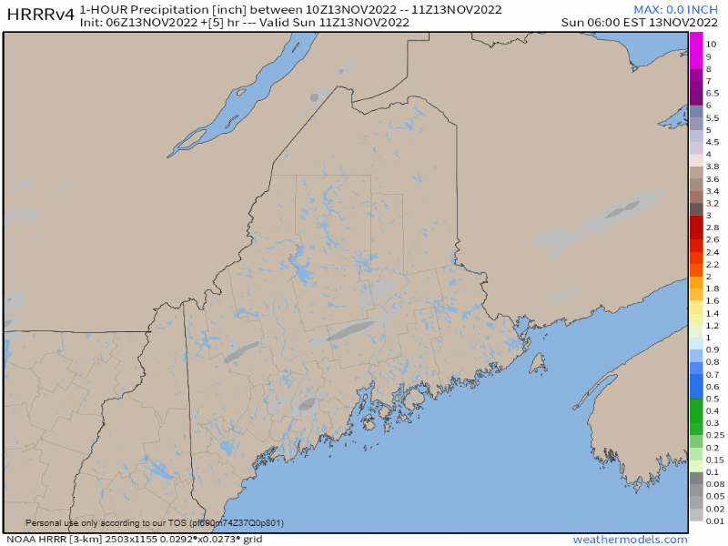 Sunday 6 AM to Monday 6 AM - A look at one hour precipitation amounts from the HRRR model indicates potential for some light to moderate shower activity overspreading the region. Showers taper off over the southwest early in the afternoon, and the sun may poke out before sunset. As the storm intensifies, it draws in moisture from the ocean and drags cold air into it, and rain turns to snow over the north Sunday evening, with snow showers continuing into Monday. 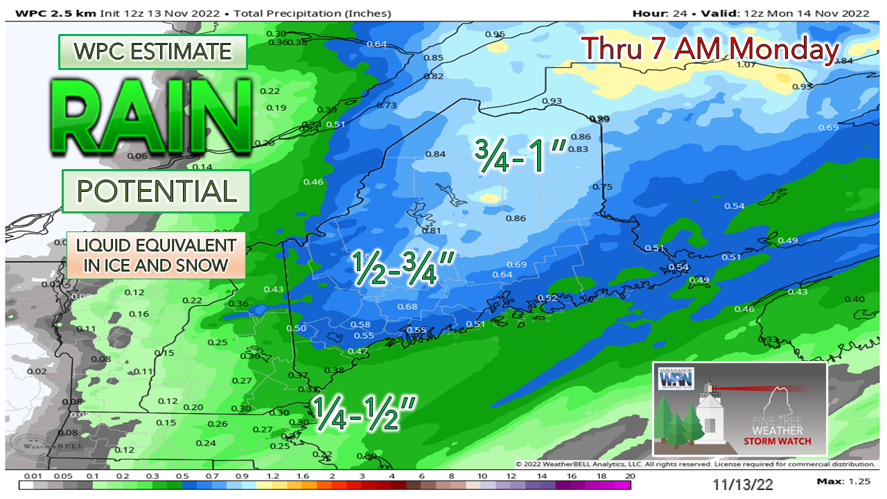 With the intensification occurring further to the north, the north is where most of the moisture ends up, and most of it comes in the frozen version. 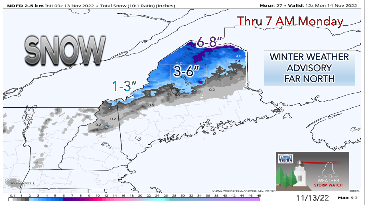 The rooftop is where the higher end totals are expected to fall. The Rangeley area, border crossings like Coburn Gore and Jackman could see an inch or two out of this as well. Midweek NorEaster potential increasing in confidence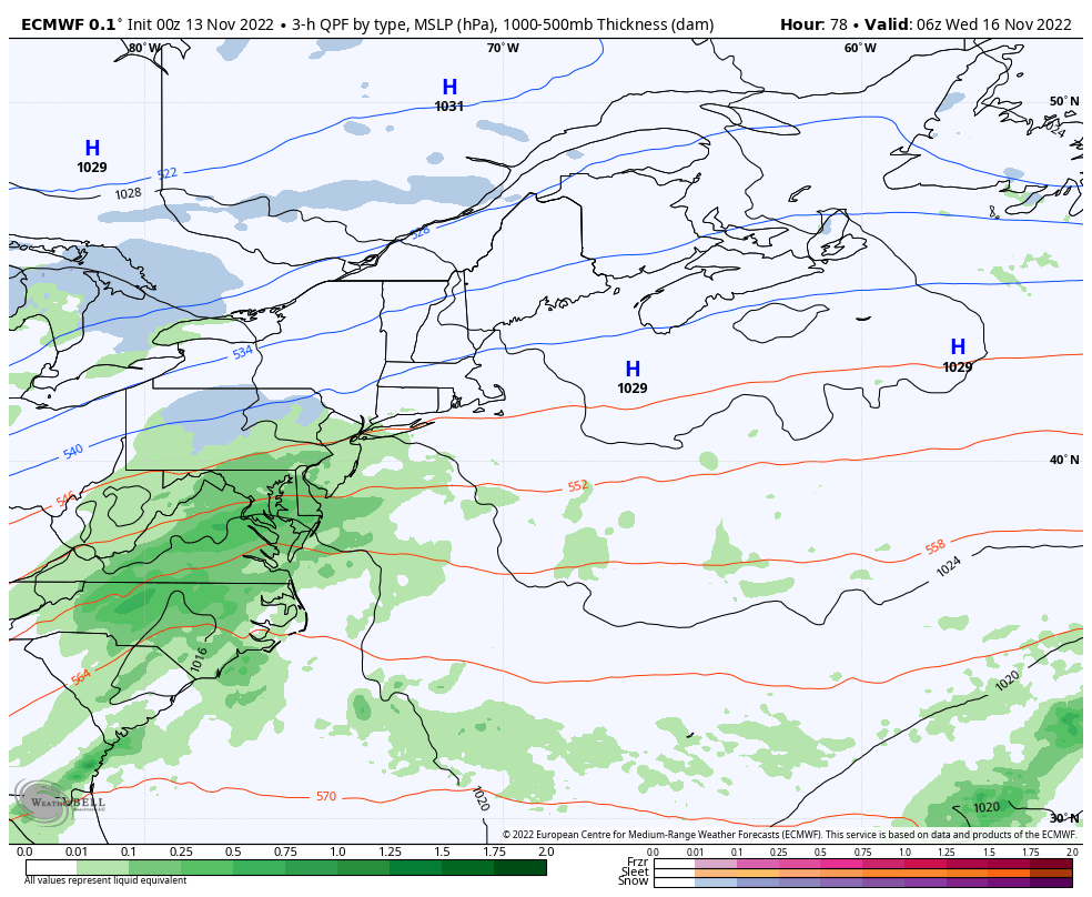 Wednesday 1 AM to Thursday 7 PM - This loop presented as a general idea on timing of the storm for planning purposes. While operational ideas have homed in on a track along the Gulf of Maine, confidence isn't high enough just yet to iron out where the rain / mix / snow lines occur and for how long. 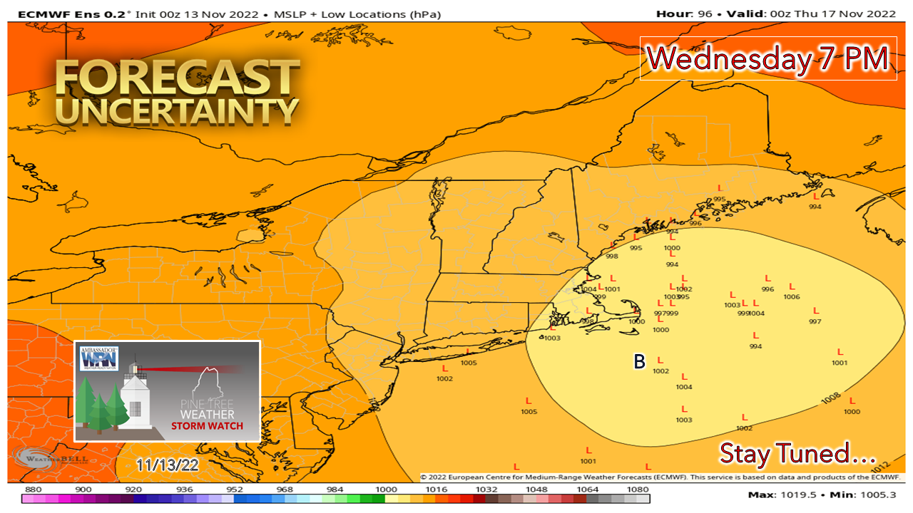 A look at individual ensemble ideas shows opportunity for the forecast track to change. Note the "B" for the benchmark 40° N / 70° W point and the location of the L's (low pressure centers) to the northeast of it. At this point, this idea favors mountain snow, a mix for the foothills and interior coastal plain, and rain for the coast IF that is the way it plays out. 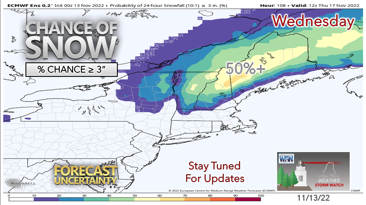 The European ensemble mean has flipped back to favoring a 3"+ snowfall for the mountains with the two previous runs, so this could help jump start the ski hills with natural snow. Fryeburg, Skowhegan, Bangor and Danforth may see at least some flakes and perhaps some accumulation on grass surfaces. A better read on amounts and impacts starts to come into focus on Monday. Stay tuned! The future of Pine Tree Weather is your call... Temperature outlook through Friday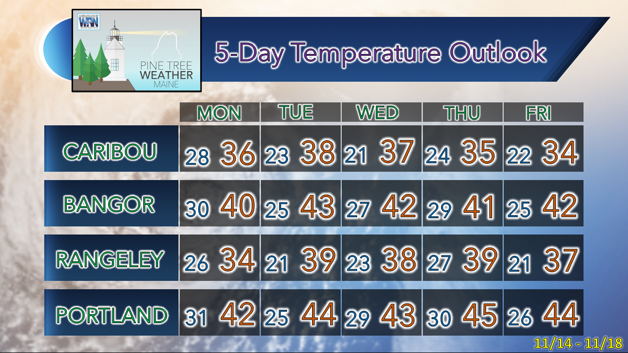 Thank you as always for your support! Stay updated, stay on alert, and stay safe! - Mike NOTE: The forecast information depicted on this platform is for general information purposes only for the public and is not designed or intended for commercial use. For those seeking pinpoint weather information for business operations, you should use a private sector source. For information about where to find commercial forecasters to assist your business, please message me and I will be happy to help you |

Mike Haggett
|


