
Another mixed bag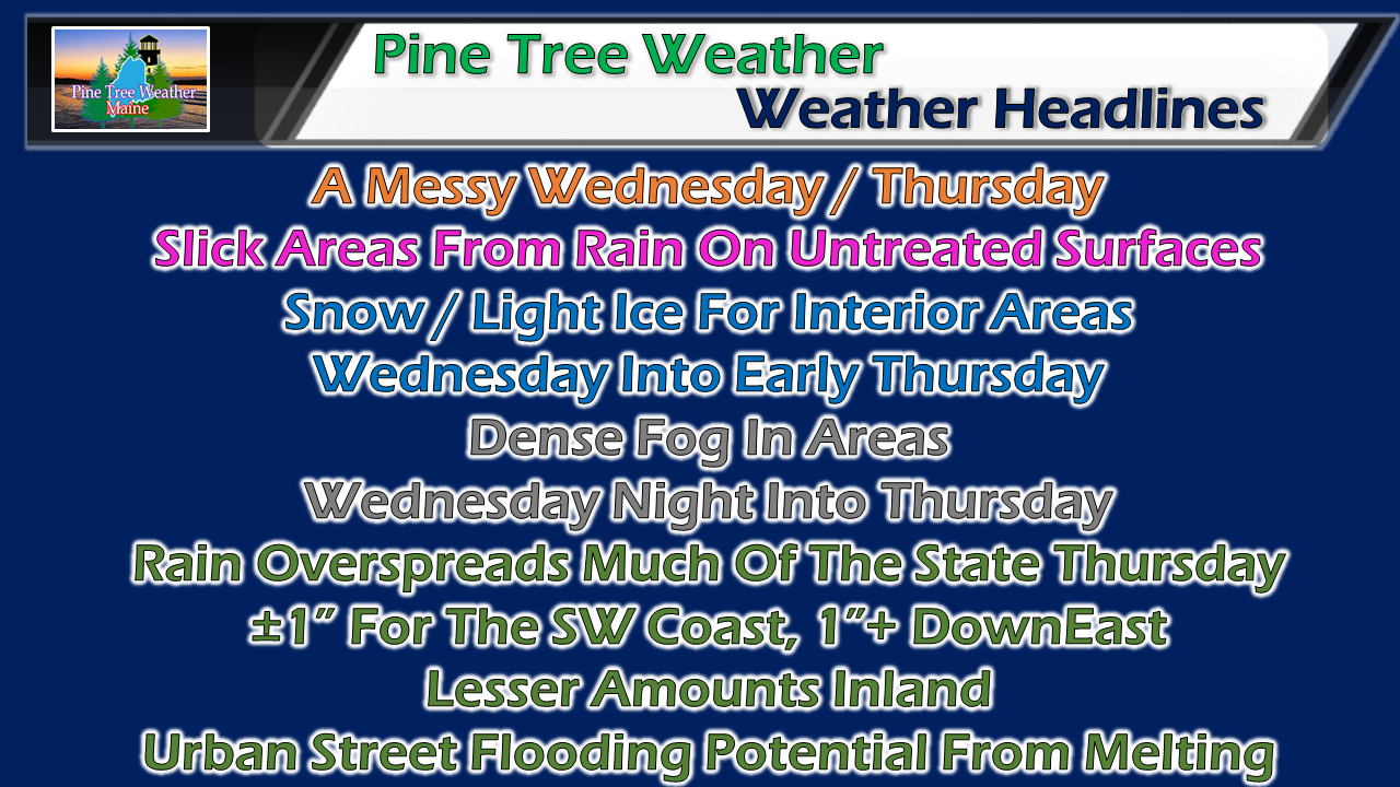 Every mixed precipitation forecast is a bit of a challenge, and this one is no different. With the deep cold over the region, past experience dictates that the cold will not go away gracefully. This is where it will be tricky for areas away from the shorelines through Thursday. 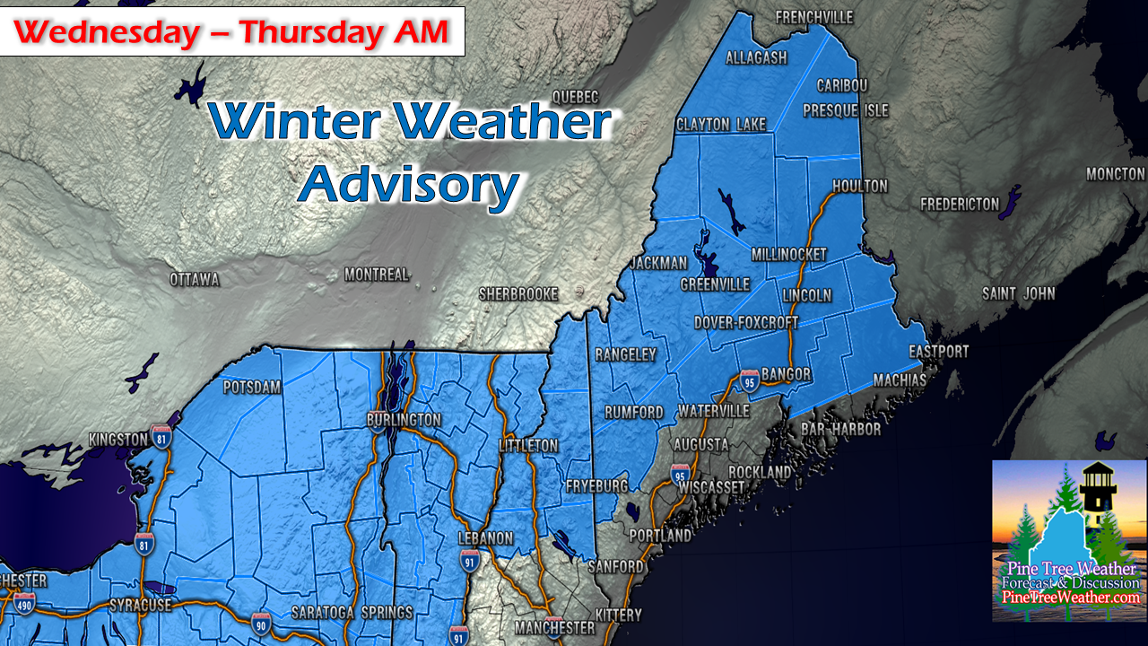 A winter weather advisory for snow and freezing rain is in effect for western areas beginning at noon, northern and eastern areas starting at 5 PM. This will go on overnight into Thursday morning. For now they are scheduled to end at 5 AM for the west and 7 AM for the north and east. Pending on how this evolves, those advisories may be extended. No real changes to idea posted last evening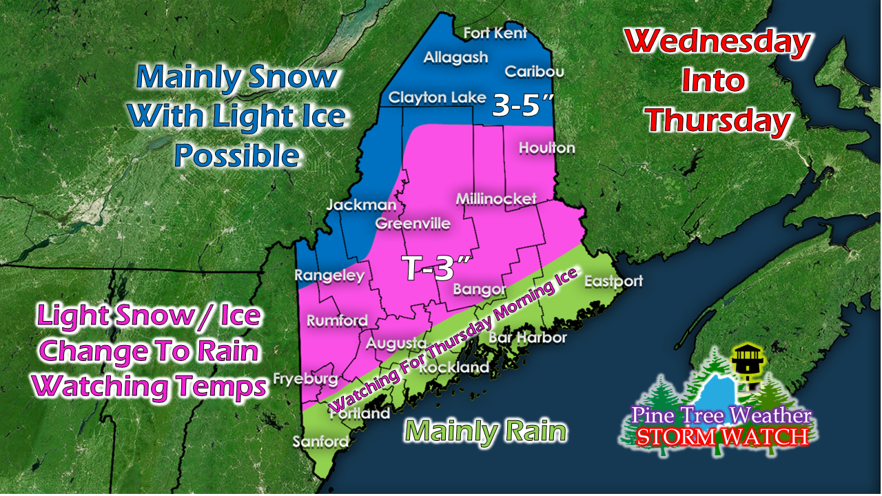 Areas along the Quebec border on up into northern areas (blue) see mainly snow with light ice with this system. The central interior areas (pink) could see some light snow accumulations Wednesday, then flip to spotty freezing rain Wednesday night. Temperatures will dictate what happens there on Thursday. The coastal plain (green) won't get into the ballgame until overnight Wednesday into Thursday. With the ground so cold, it may not technically be freezing rain that falls (temperature dependent), but rain which could freeze on contact. This is where is gets tricky with where the thermometer is and what areas could be affected by the two precipitation types. Wednesday Northern and western areas of the state deal with snow showers beginning roughly midday. Warm air invades the atmosphere Wednesday evening and changes the precipitation type to a bit of sleet and pockets of freezing rain. Showers that pop up along the coastal plain may also be pockets of freezing rain also. As temperatures begin to rise, areas of dense fog are likely to become an issue towards Thursday morning. Anyone travelling overnight should be prepared for slick roads and areas of poor visibility. Thursday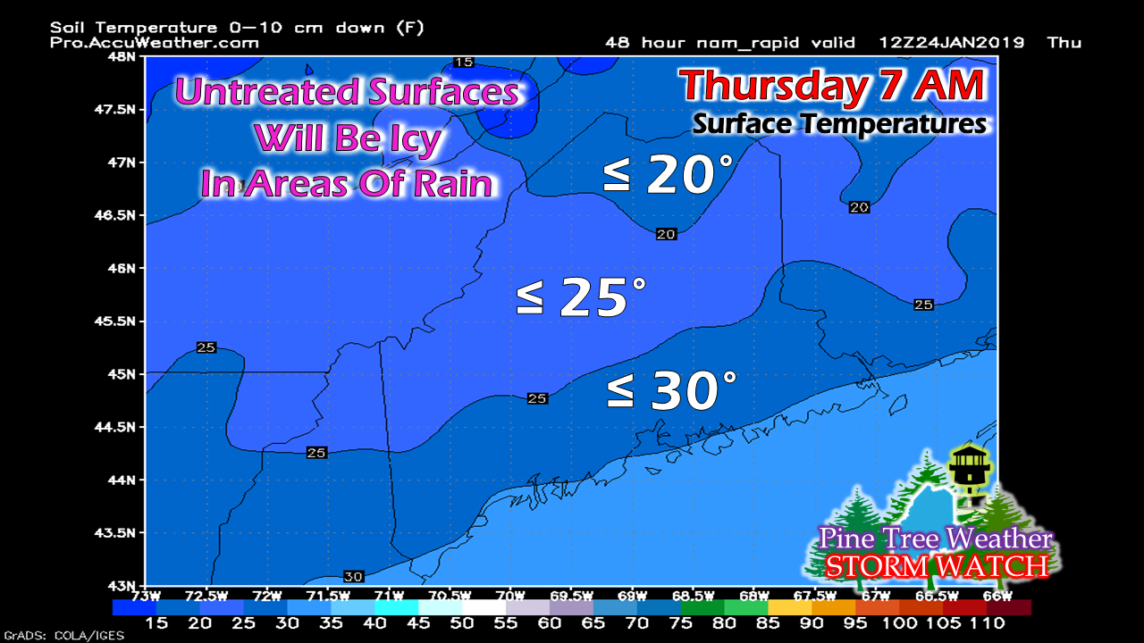 For much of the state away from the shorelines, the ground surface is frozen solid due to the recent cold and snow pack. Any areas of actual rain may stick to untreated walkways and roadways and freeze on contact. This is where watching the thermometer is so critical. I say once again that if your car thermometer reads between 32° - 37° degrees, the roads could be below freezing, which presents the chance for slick conditions. As one of my loyal Facebook page followers notes, if you do not see spray from rear tires, chances are you are driving on ice. Fog will be an issue for the morning commute most everywhere causing reduced visibility for much of the state. 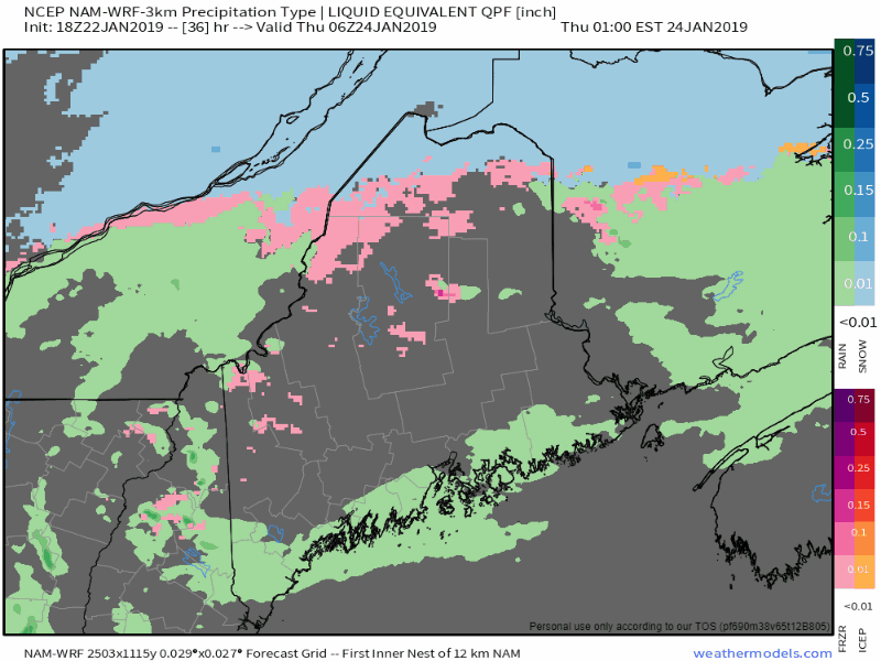 Precipitation will increase and become heavy at times, especially along the coast, where the heaviest rain is likely to fall. I am concerned about urban street flooding from melting snow, and potential for hydroplaning on the higher speed roads. DownEast areas are also a concern for some minor flood potential. For areas away from the shorelines, the thermometer will need to be watched closely. Cold air damming is something that will need to be watched for interior areas. Don't be caught off guard if this turns into more of an ice event. This is going to be a wait and see situation as it unfolds. It should also be noted that wind speeds will pick up as the storm passes through Thursday afternoon, and could be gusty at times with higher end gusts at 25-35+ mph along the coast. For my island followers, it could be a bumpy boat trip home. Be on alert for any surprises, and plan your travel accordingly. Outlook through Sunday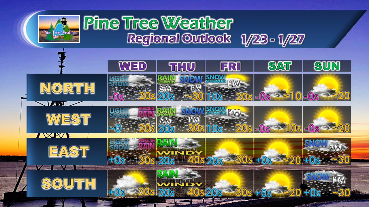 A coastal storm may brush southern and eastern areas late Sunday into Monday morning. That will be monitored and updates will be forthcoming. There is plenty of time and guidance uncertainty for that to change, so stay tuned.
► ► For the latest official forecasts, bulletins and advisories, please check in with the National Weather Service in Gray for western and southern areas, or Caribou for northern and eastern parts of Maine. For more information from me, please follow the Pine Tree Weather Facebook page and my Twitter feed. ► Your financial donations are much appreciated to keep this site funded and for further development. I sincerely appreciate your support not only financially, but also in sharing my efforts with others. Always stay weather aware! - Mike |

Mike Haggett
|


