|
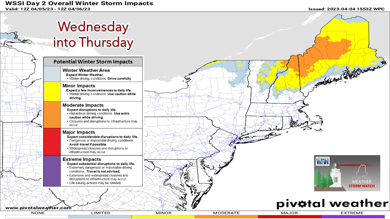
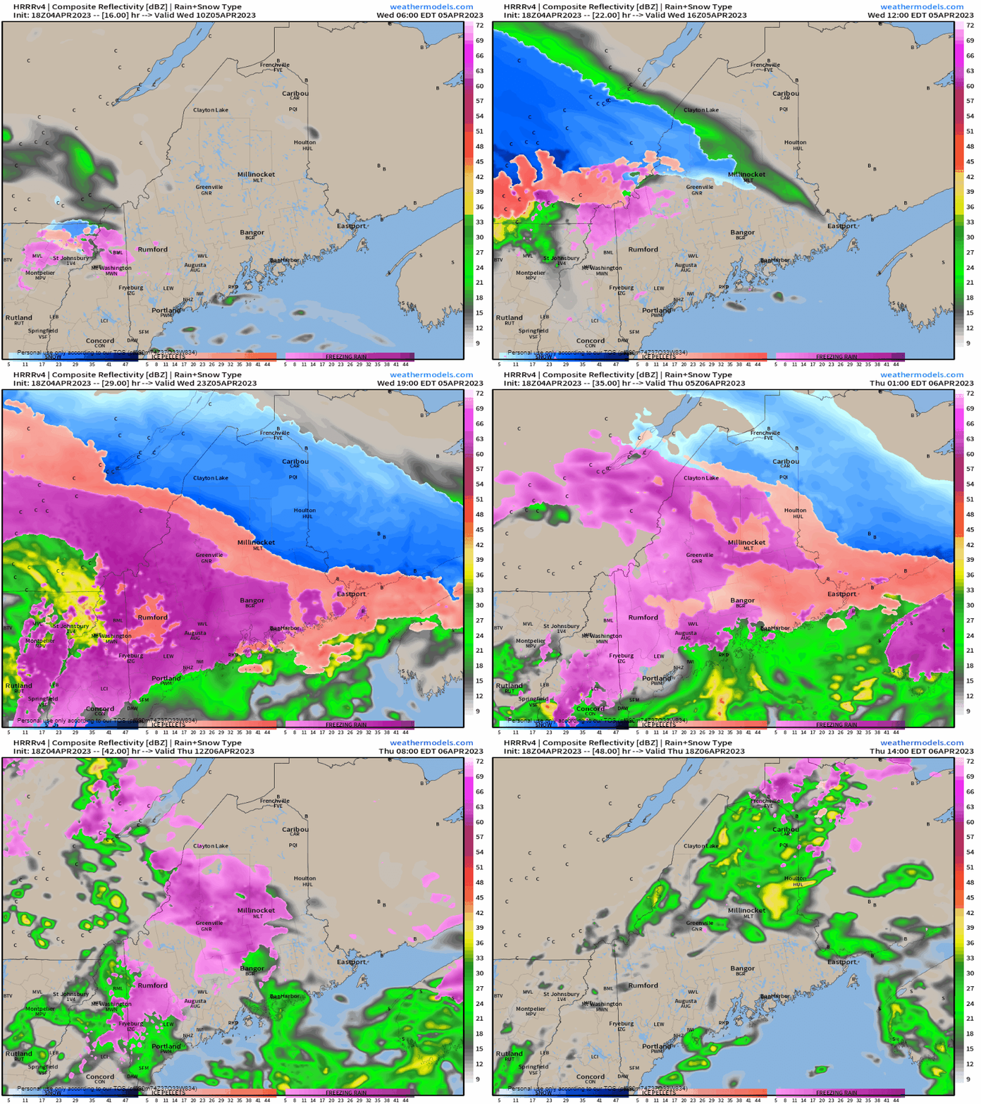
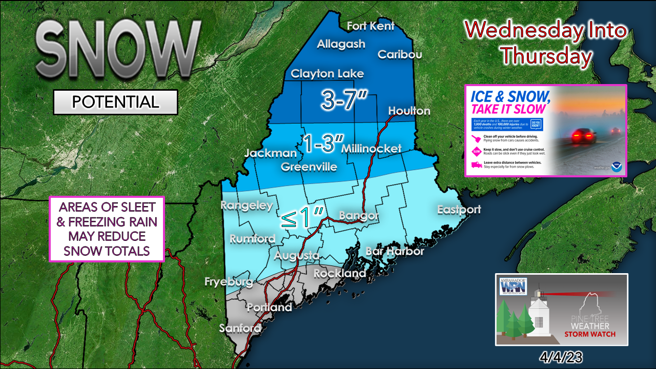
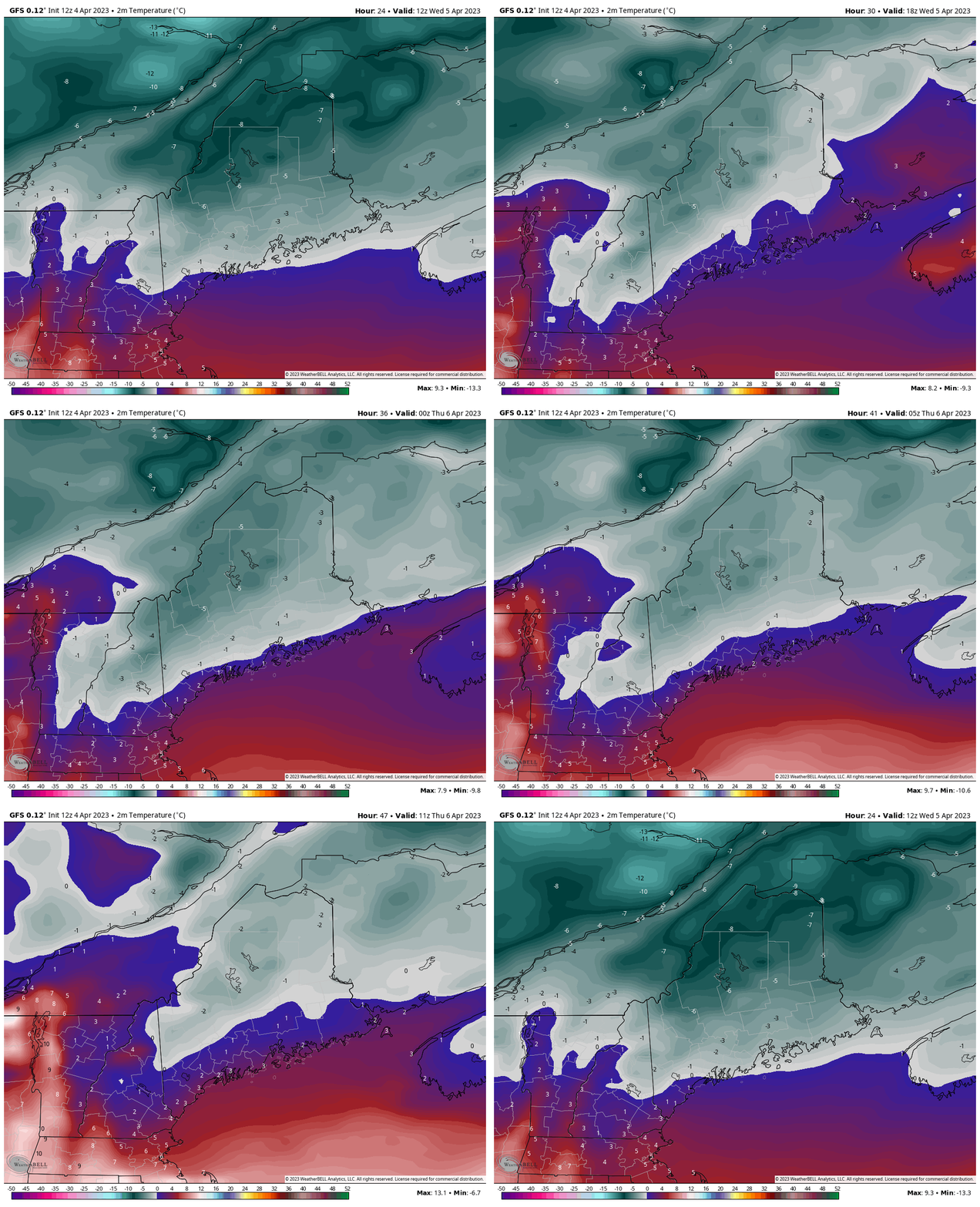
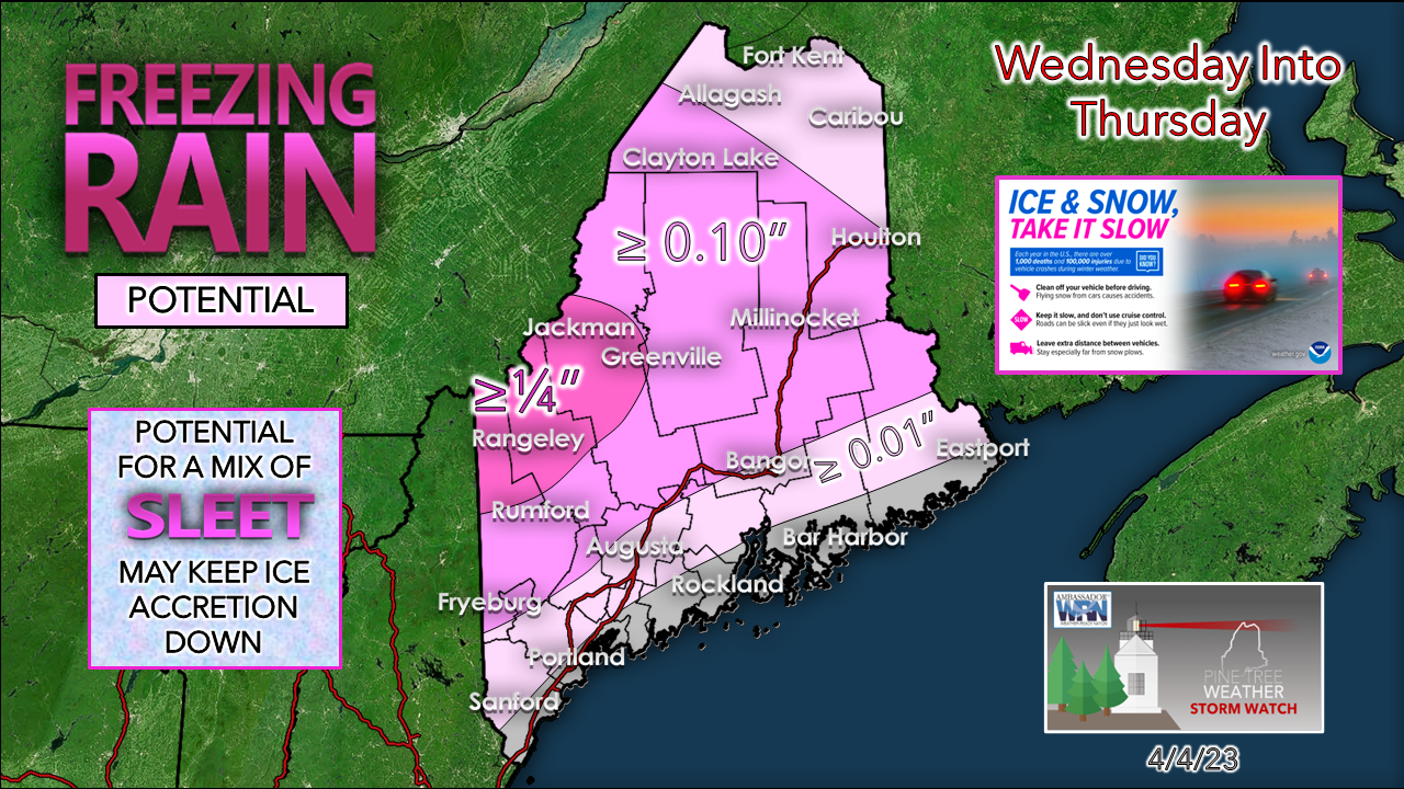
Just a quick update on my status: The most recent break here did me well. While that was not the plan, I ran into computer issues at my office that took several days to get worked out. I now have a new 32" screen to work off that the PC agrees with. Who knew that some monitors and PCs didn't get along? I know that now. My thumbs are in great shape. I have gone several days without pain. I am staying the course with my change in lifestyle. Praise God for all of that. Now with all of that in the rear-view mirror, we have a junk storm on the way. Main concerns for ice, sleet and snow over interior areasThese junk storm events are tricky to predict in winter. What gives this outlook credibility is two-fold. Old friend cold air damming, and most of the precipitation falling at night. The result will be slick travel over the interior starting Wednesday afternoon and into Thursday. A Winter Weather Advisory has been posted for areas away from the coast. Plan accordingly. A little bit of everything can be expected with this oneWednesday 6 AM to Thursday 2 PM - I am not confident that all the pretty colors on this loop are going to line up with what is making landfall, which is why you should report your observations to mPing to help forecasters see what the radar may not be. As of Tuesday afternoon, the idea is for most of the precipitation associated with the warm front to fall between Wednesday afternoon and Thursday morning, with showers of various precipitation types to continue through the day and into the evening. Snow for the southern half of the state appears minimal. The Great North Woods on up into The County is where the shovels will be needed. While the south won't shovel the ice threat is certainly a possibility over the interior. Wednesday 8 AM to Thursday Noon - Cold air damming fools models. I have berated that fact in these updates virtually from the start of my meteorological pursuits. In situations like this, I look for the coldest model idea. In this case it is the GFS. The gray indicates temperatures below 0°C (below 32°F). The question I have is whether the ice that comes Wednesday night into Thursday morning will be able to melt in time before sundown. If this were February, all bets are off. But with the sun angle up above 45° along with a fair chance that the sun may poke through around midday into the afternoon, that will be great news. If the clouds hold tight over the western mountains and temperatures hover around freezing, I do have concerns. The western mountains appear to be the region where most of the ice is accreted. This would be concerning IF the temperatures do not rise above freezing as a cold front is expected to pass through Thursday night, and a cold windy day is expected on Friday with gusts upwards of 40 mph. I want to believe that it will, as this could be a power outage concern. There may be some anyway given the wind speed, whether there is ice on the trees or not. If the ice does not melt, the power outage threat is real. If the GFS model is right, I don't get the warm fuzzies that ice will be quick to melt. Let's hope that temperatures do rise, and some sun gets out before the cold front and wind arrives Thursday night. Stay tuned! Pine Tree Weather is funded from followers like you. I would appreciate your financial support. Click here for how you can contribute. You may not like the weather, but I hope you like what I do! Please hit the like button on Twitter and Facebook, and share! Stay updated, stay on alert, and stay safe! - Mike NOTE: The forecast information depicted on this platform is for general information purposes only for the public and is not designed or intended for commercial use. For those seeking pinpoint weather information for business operations, you should use a private sector source. For information about where to find commercial forecasters to assist your business, please message me and I will be happy to help you. |
Mike Haggett
|

