|
I want to express my continued appreciation for those who are chipping in with a few bucks for me to pay my bills and keep this entity going. What I love about this is those who donate are from across the state and the northeast. It always gives me a guide to where my supporters are, and each year it is fascinating to see. For those sending checks, the mail is trickling into us in Kennebunk. If you sent one in the past couple of weeks and have not seen it clear, I have not received it. I can say firsthand that some important documents I sent recently were lost by the post office and I had to resend them via FedEx. Any mail I send goes priority mail at this point. Just keep that in mind. For information on how you can contribute and help me erase this $950 deficit for the year, please click on the banner below or the DONATE page on the menu for options. A fair mid-November day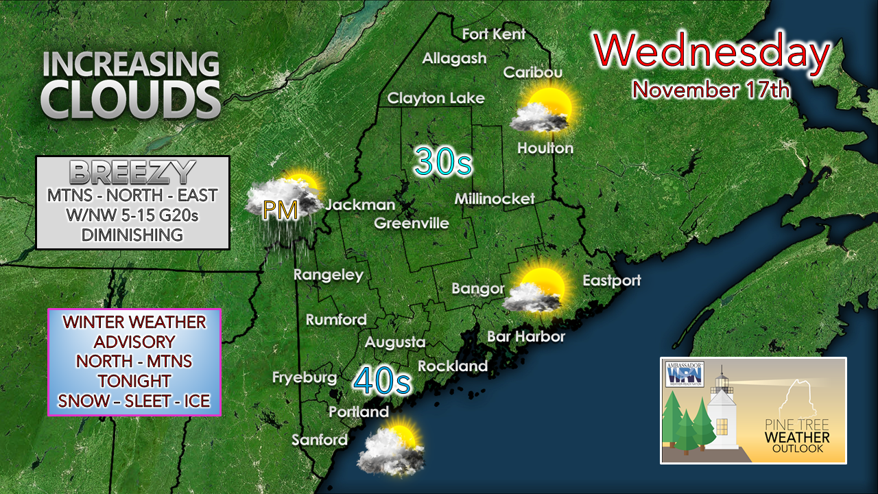 An area of high pressure to the southwest slides to the southeast on Wednesday. As it does a southwesterly wind flow aloft brings in warm air, along with increasing clouds. The mountains may get a shower as outflow from the advancing ridge juices up the atmosphere, but for most of the daylight hours, the region stays dry. Breezy conditions over the north and east settle down this afternoon as the high shifts east and the storm to the northeast heads out into the north Atlantic. The mountains see a southwesterly breeze increase Wednesday night with the advancement of the warm front. Winter weather advisory for the interior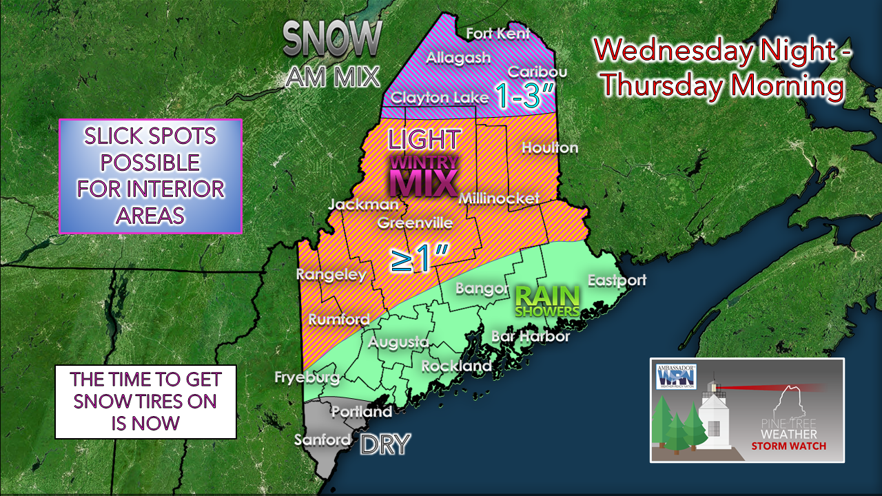 While not a lot of precipitation is expected, it will be enough to potentially create slick spots. The White Mountains do their job and creates the cold air damming effect for the valleys in the foothills and mountains, which presents the chance for pockets of freezing rain and freezing drizzle. There could be some snow at the onset, then a chance for some sleet before the icing potential arrives. For much of the coastal plain, it appears to cold rain showers. For far southern areas, I can't rule out a very light shower or sprinkle by Thursday morning, but it appears to stay mainly dry. 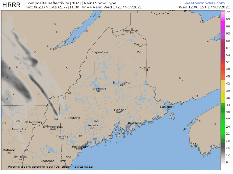 Wednesday Noon - Thursday Noon: The precipitation shield from the advancing front arrives after dark Wednesday evening and overspreads much of the region by midnight. Shower activity becomes widely scattered by late morning over the north. 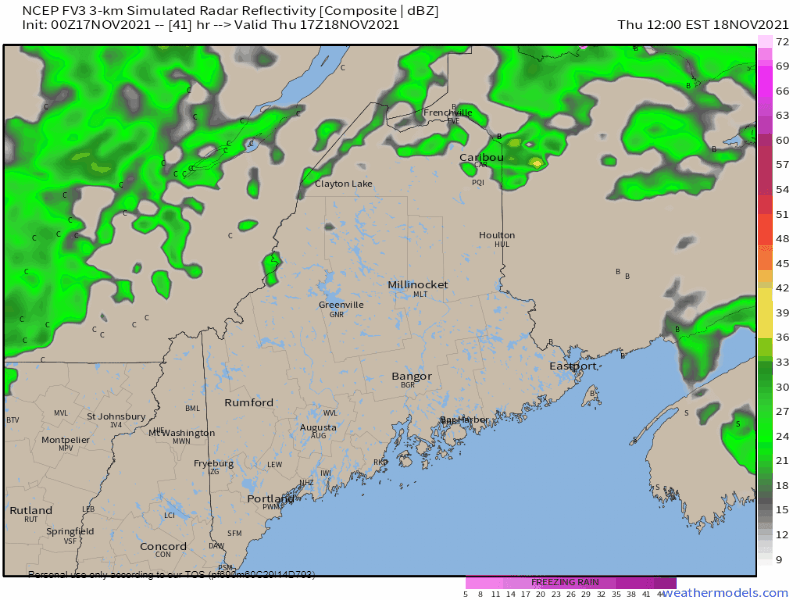 Thursday Noon - Friday 7 AM: A cold front advances toward the region Thursday afternoon and rain shower activity increases from northwest to southeast in the afternoon into the overnight. As cold air moves in aloft, rain changes to snow in the mountains, where 1-3" are possible elevation dependent by Friday morning. Expect snow showers continue into Friday morning for the hills, while the rest of the region clears out by late morning. The weekend appears to be fair with no precipitation expected.  The next one and temperatures through Monday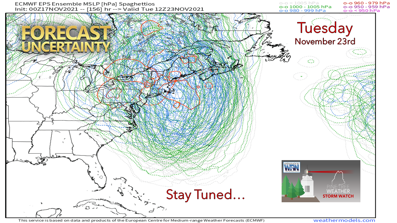 Models are playing around with the idea of a potential storm early next week as a sharp trough digs in from the northwest. This model idea that looks like a preschool coloring project depicts various surface pressure from 51 members of the European ensembles shows a great deal of uncertainty on how this could play out. While it appears wet for now, there is plenty of room for changes. For those travelling for Thanksgiving, keep this storm in mind for potential travel impacts. Updates will be forthcoming.  Rain with a Temperature Near Freezing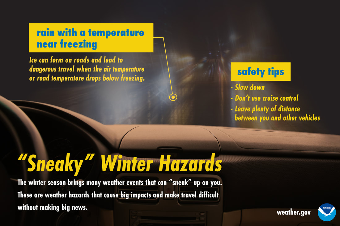 Rain may seem like less of a winter driving hazard than snow, but when temperatures are near freezing, that’s not the case. Ice can form quickly and make roads slick. In these conditions, slow down, don’t use cruise control, and keep plenty of distance between you and other vehicles. Don’t let this winter hazard sneak up on you! Be prepared to receive alerts and stay updated!
 For more information in between posts, please follow Pine Tree Weather on Facebook and Twitter.
Thank you for supporting this community-based weather information source which operates by reader supported financial contributions. Stay updated, stay on alert, and stay safe! - Mike |

Mike Haggett
|