
Headlines remain consistent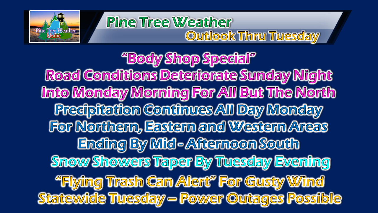 No real changes on potential impacts that were posted here Saturday evening. Expect slick roads for the morning commute for southern, western and eastern areas. Conditions deteriorate over northern areas through the afternoon. Northern, eastern and parts of western areas can expect snow accumulating for the evening commute. As the steady snow tapers, wind will increase and cause blowing and drifting snow over interior areas into Tuesday. Some power outages are possible Tuesday into early Wednesday. Timing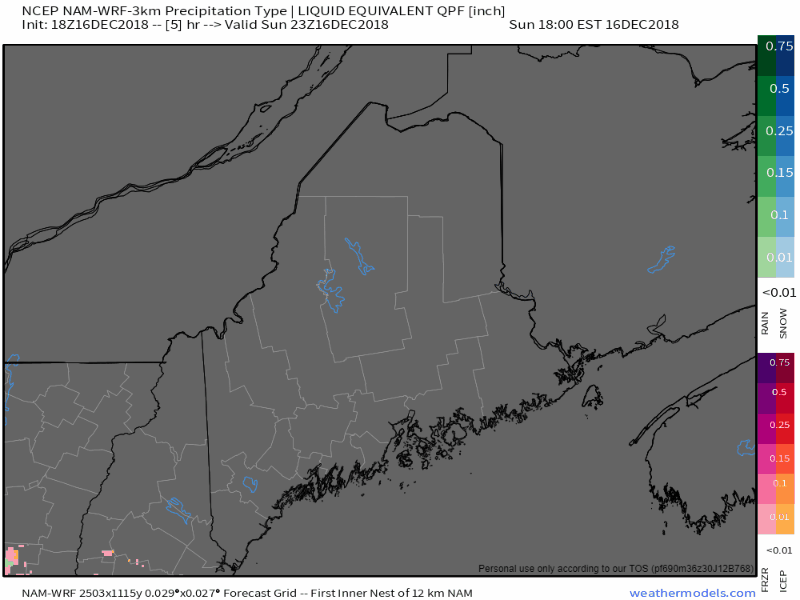 This event appears all but over for most of southern areas by midday Monday. Steadier precipitation begins to taper Monday afternoon for western areas, and evening for eastern and northern areas. Given the arctic front approach early Tuesday, I do expect snow showers to linger in higher elevations through Tuesday morning and perhaps in the the afternoon. Slight revision in snowfall idea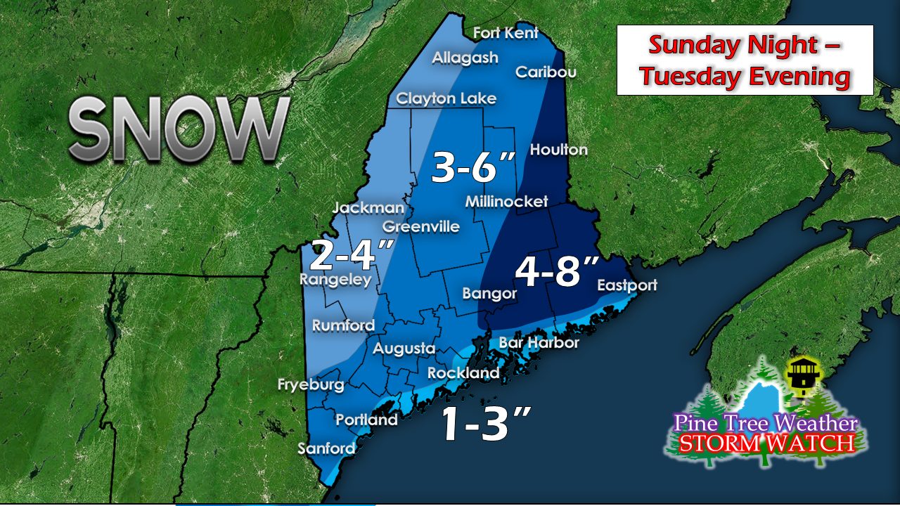 The western mountains and shoreline areas remain on the low end of snow accumulations due to storm track. Eastern areas remain the jackpot zone. Some isolated areas in Northern Washington County or southern Aroostook may end up in double digits when all is said and done. 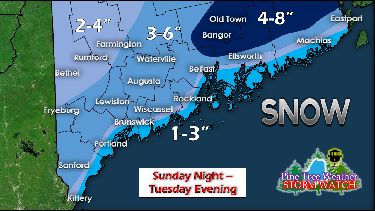 A zoom in look over the southern half of the state shows the gradient a bit better. A coastal front bringing sleet, freezing rain and straight rain will likely keep totals down, but 10-20 miles inland makes a difference for snow amounts. Outlook through Friday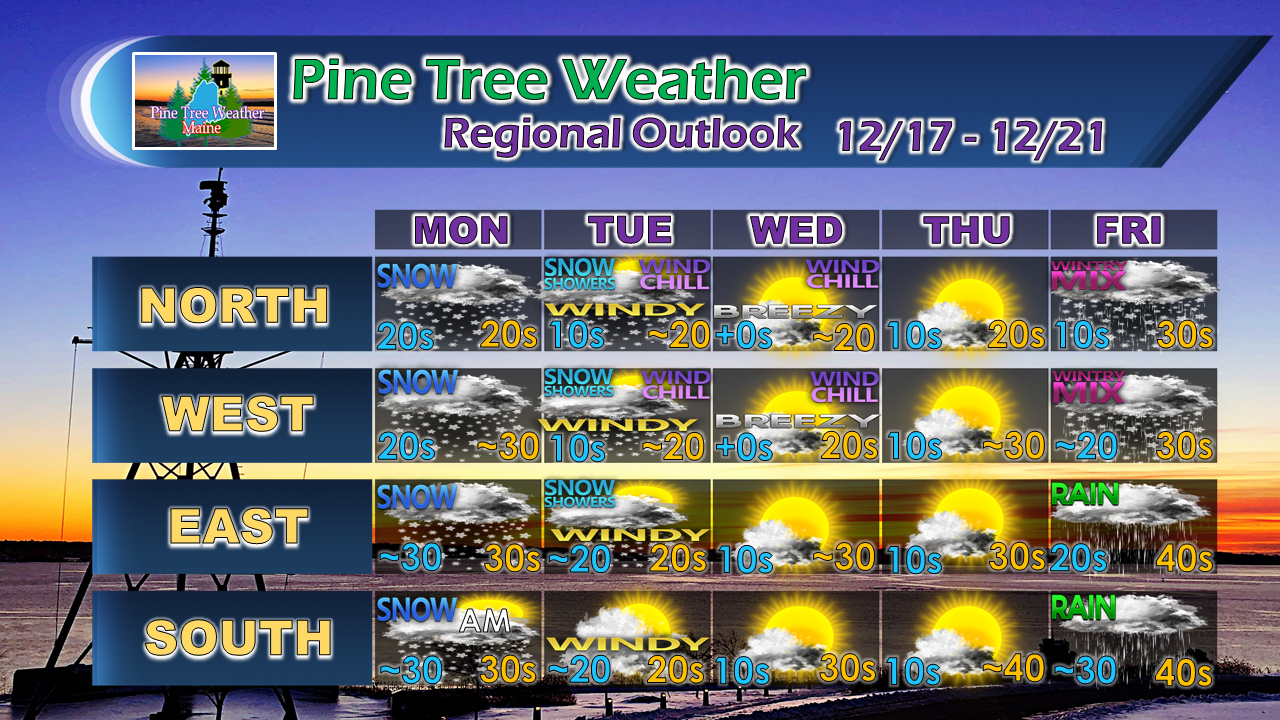 After the cold snap mid-week, temperatures rise head of our next system that is on track to arrive on Friday. This may start off of as a ice / sleet mix over interior areas. How long it stays that way is yet to be determined. More details on that as the week unfolds. For the latest official forecasts, bulletins and advisories, please check in with the National Weather Service in Gray for western and southern areas, or Caribou for northern and eastern parts of Maine.  Pine Tree Weather is now 90% funded to get through October of 2019. My anticipated current deficit now stands at $380 remaining to be raised to reach my goal. I am sincerely blessed and humbled by your financial contributions, cards, and messages of encouragement. It's been an amazing journey over the past 7 years, and to see my efforts appreciated by those that follow is a wonderful reward for my work. I have asked simply for $1 per month / $12.00 per year through my Patreon page or by sending me a message on Facebook or Twitter to mail a check. The popular contribution has been $5 per month / $60 per year on Patreon, and the check donations average out to same amount as well.
I would sincerely appreciate your support in order to be fully funded by the end of the year. For more information from me, please follow the Pine Tree Weather Facebook page and my Twitter feed. Always stay weather aware, and thank you for your support! - Mike |

Mike Haggett
|


