Timing, wind and temperatures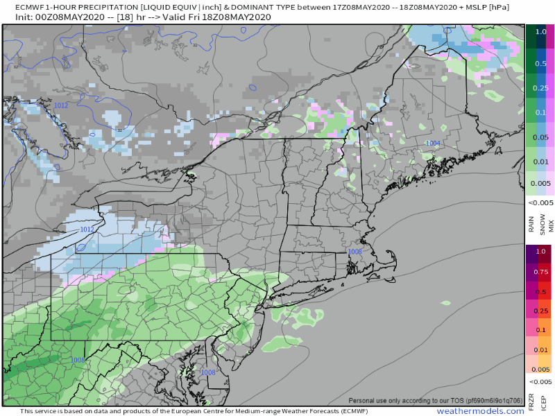 European model 1-hour precipitation type and sea level pressure from 2 PM Friday to 8 AM Saturday Friday will be mainly dry until around dark as the storm begins to arrive. Western and southern areas see precipitation falling by midnight, and reaches the far north by around daylight Saturday. 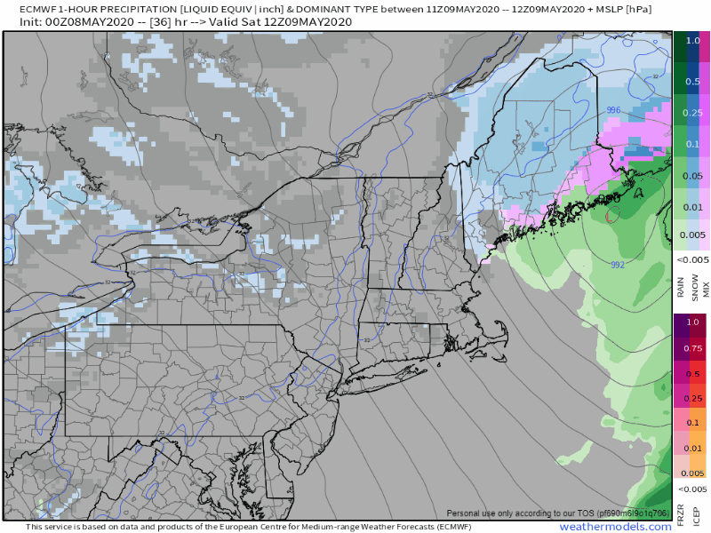 European model 1-hour precipitation and sea level pressure from 8 AM Saturday to 4 AM Sunday Steady precipitation ends over southwestern areas by mid morning, but flakes could fly at times through the day. Western areas see steady snow end by mid-afternoon, but snow showers are likely to persist there. Eastern areas see steady precipitation end by early evening, with snow showers continuing until around midnight. Northern areas see the last flakes fly in the wee hours of Sunday, ending just before daylight. 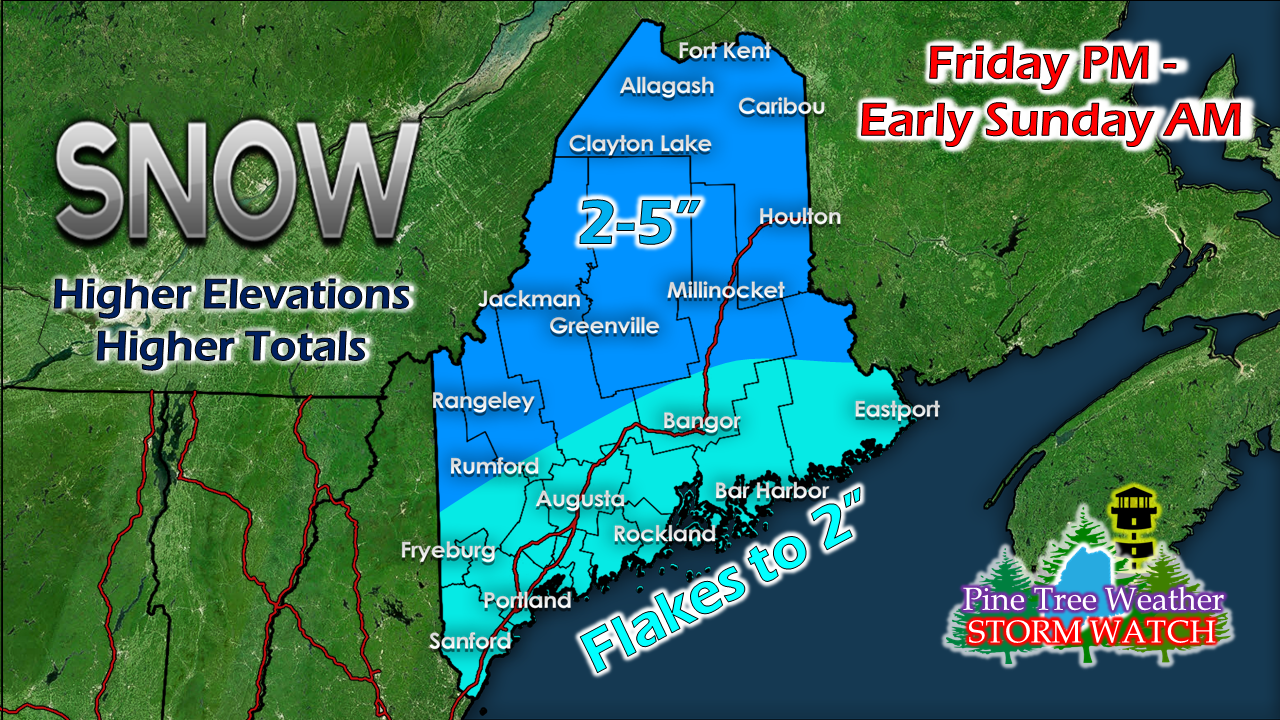 Only a slight adjustment to the snowfall map. The higher hilltops may see 6-8" (3000'+). This will be a heavy wet snow, and where that sticks will cause power outage concerns. 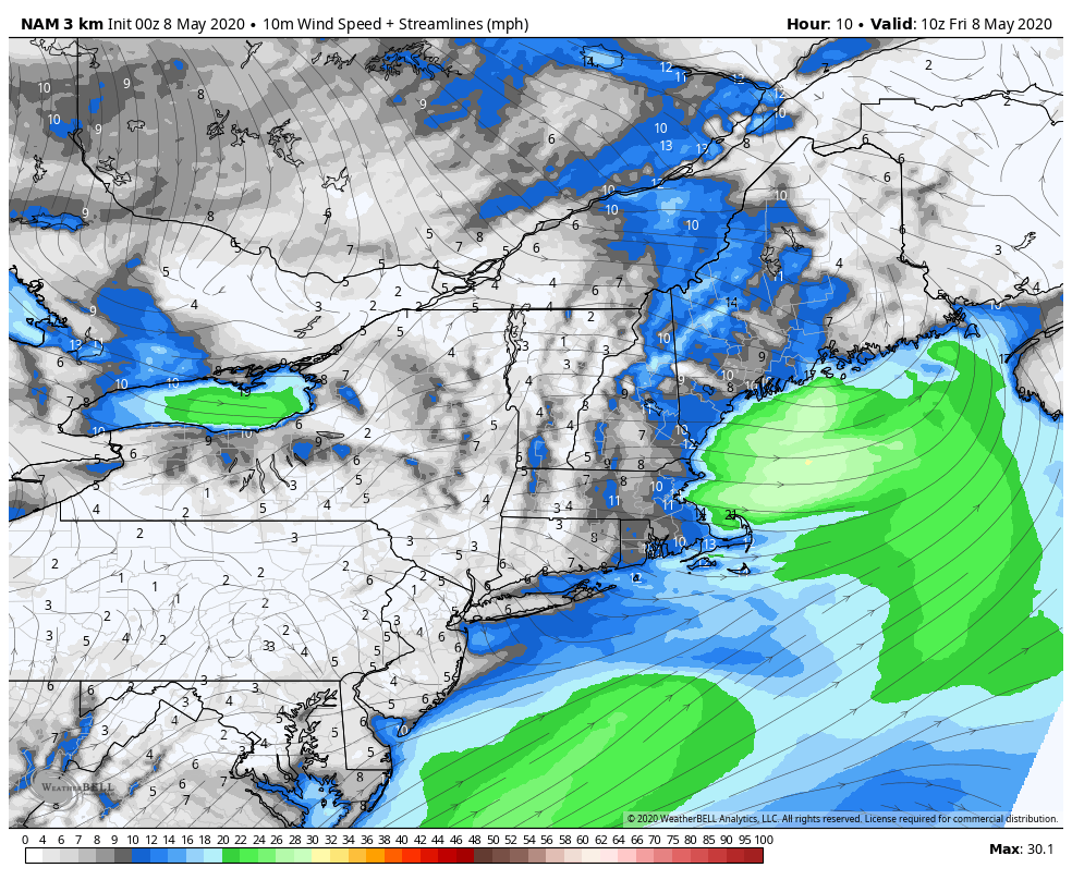 NAM model 10-meter wind speed from 6 AM Friday to Midnight Saturday Looking at wind, expect breezy conditions through the day Friday as it gets gusty at times behind the passing front. The wind settles down for a bit Friday evening as the storm to the south begins to organize. 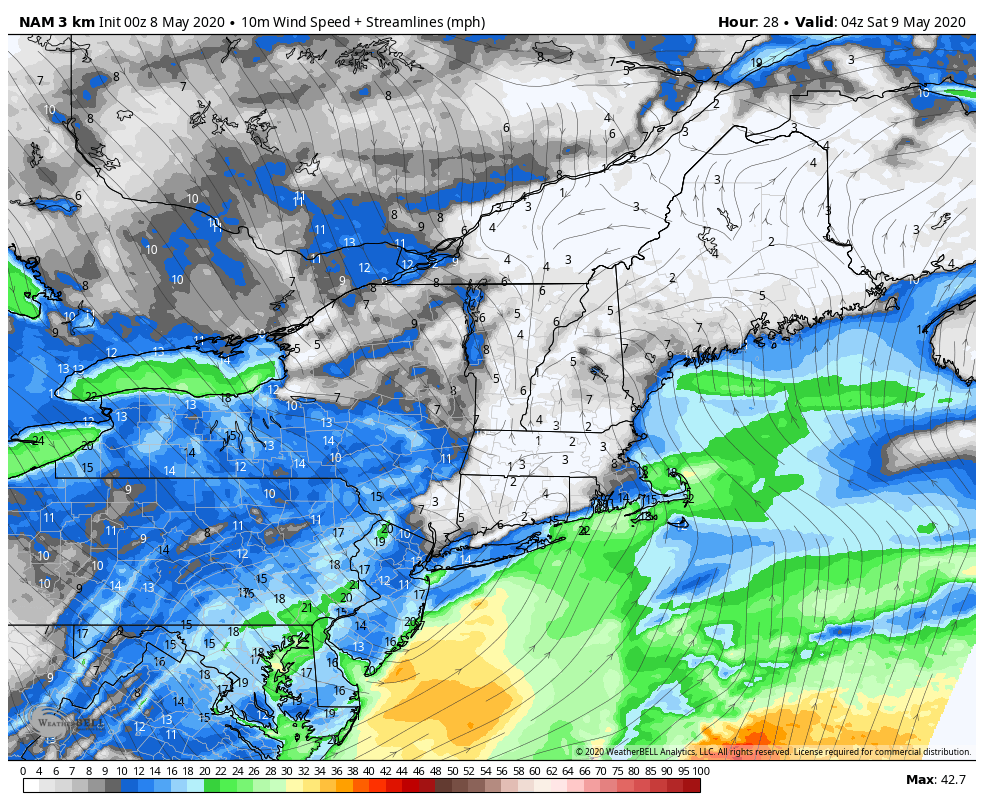 NAM model 10-meter wind speed from Midnight Saturday to 8 AM Sunday Once the storm reaches the Gulf of Maine, it will intensify and the wind speeds will pick up. Gusts could range 30-40 mph through Saturday into Saturday night, and remain gusty into Sunday. 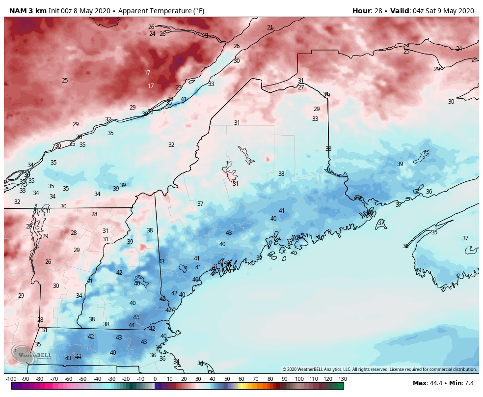 NAM model apparent temperature forecast from Midnight Saturday to 8 AM Sunday With the wind comes wind chill, and it will feel more like March Saturday night into Sunday morning. Apparent temperatures in the teens and 20s for all areas are expected to start Sunday morning. Perhaps this cold can take out a few blackflies in the process. I don't think I would get too many complaints about that. We're turning the corner... finally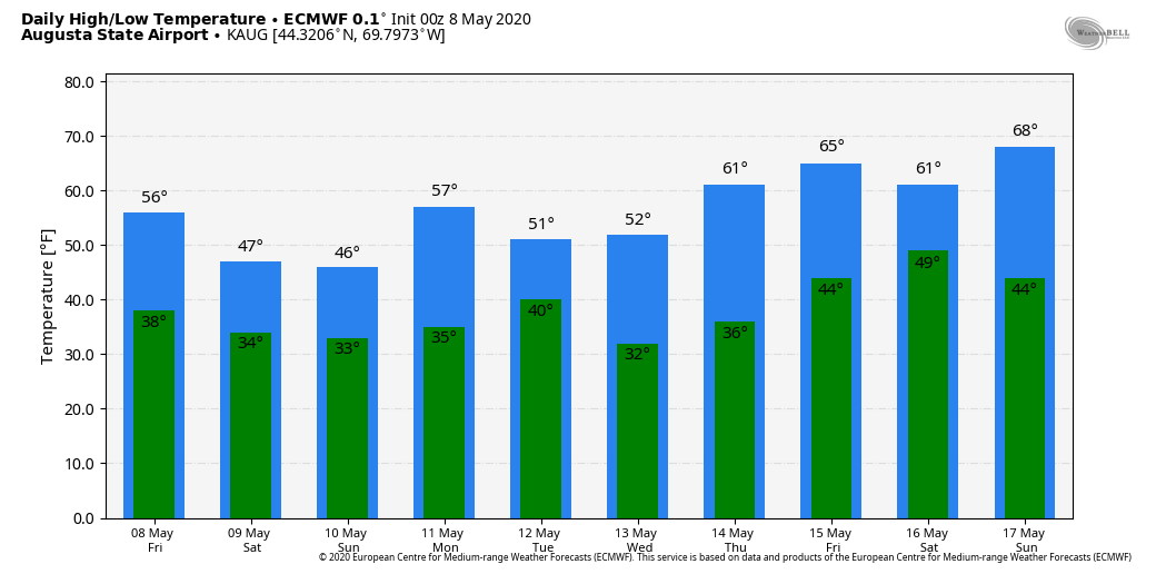 After this storm clears out and the wind settles from it, temperatures gradually climb as we head toward next weekend. Southern areas have a couple chances for 70s Friday and Sunday, and all areas could reach 60°+ by Saturday. We can stick a fork in winter for all but far northern areas after this storm. A couple backdoor cold fronts could bring flakes up there, but accumulating snow appears done statewide after this. Help the weather community and stay informed!
► ► For the latest official forecasts, bulletins and advisories, please check in with the National Weather Service in Gray for western and southern areas, or Caribou for northern and eastern parts of Maine.
Thanks as always for your support! - Mike |

Mike Haggett
|