|
Hello again, everyone! Thanks for hanging in there with me as I continue to work through my final semester of school. I've been forecasting for Raleigh, North Carolina over the past week as a part of my course work. While it was fairly quiet there last week, this week will be much more active in that area. I am starting to get a case of "senioritis" as I will wrap up my studies by the end of April. I haven't felt this way in 30 years, so it's kind of a cool feeling, to be honest. Thanks for your patience and support as I continue to work through this. Winter's last blast comes in Sunday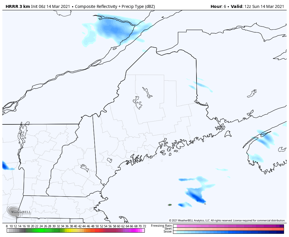 Snow squalls associated with an arctic front and wind are the primary features for Sunday. Snow showers and squalls touch off around midday over the north and mountains as move from northwest to southeast during the afternoon. Much of the activity ends by around by early evening, with a few stragglers over the mountains through late evening. Impacts could feature white out conditions, quick accumulations of snow, and wind gusts in the 30-40 mph range. Some areas could pick up as much as 2" of snow as these squalls and snow showers pass through. Stay on alert if travelling. 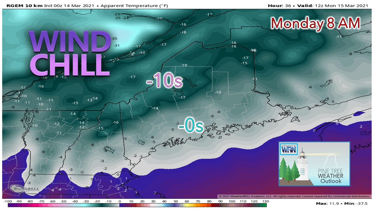 A wind chill advisory has been issued for the north and mountains where indices could reach in the -30° to -20° range with wind gusts as high as 30-40 mph overnight. All areas are likely to start the day with values below zero. Bundle up and keep the fire going. Outlook for the week ahead: cool, and dry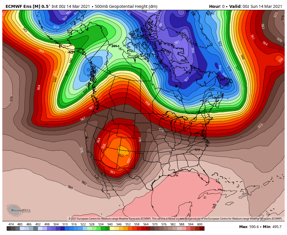 The winter blast the area experiences to start the week appears to be the last of bitter cold for the season. A look at the upper-level pattern shows the cold paying a short visit and will move quickly east. An upper low works through the country to the south later in the week. A ridge builds in the west, which means cooler temperatures overall for the east. 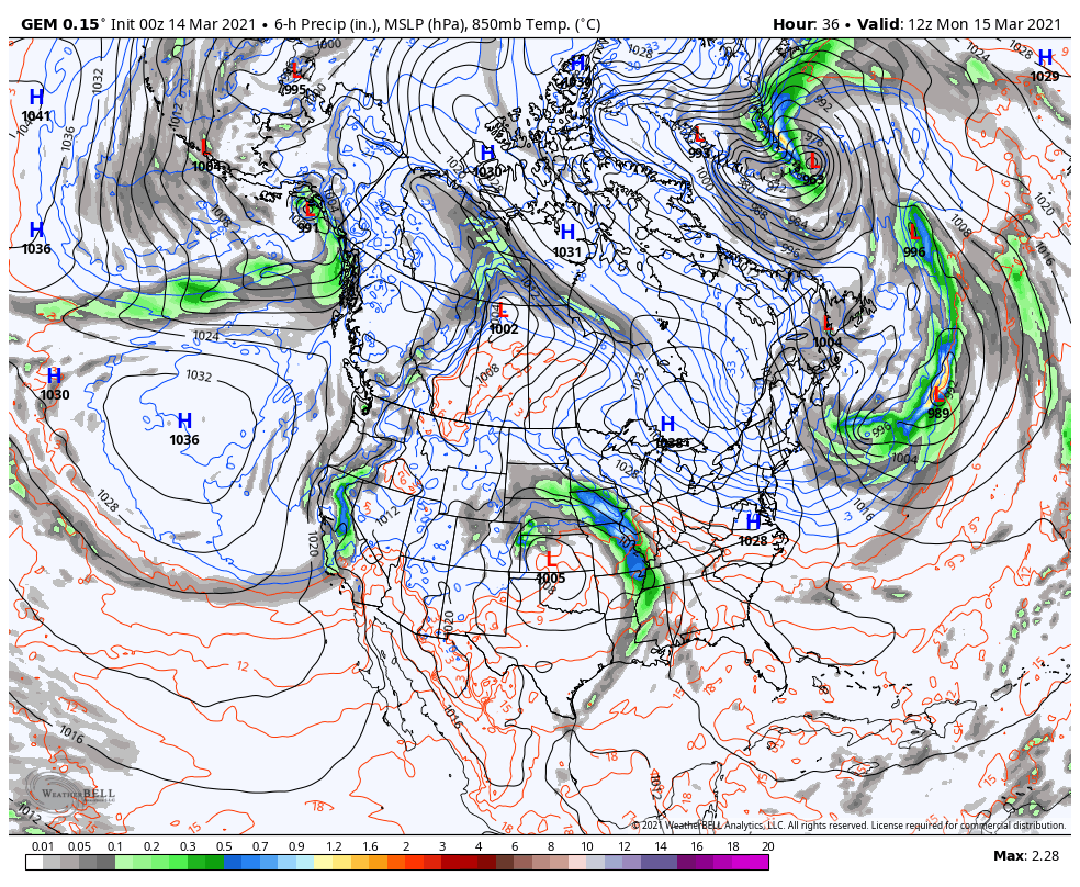 Looking at the view from the surface, a strong area of high pressure over Quebec controls the pattern as we head into late week and keep the storm pattern south. 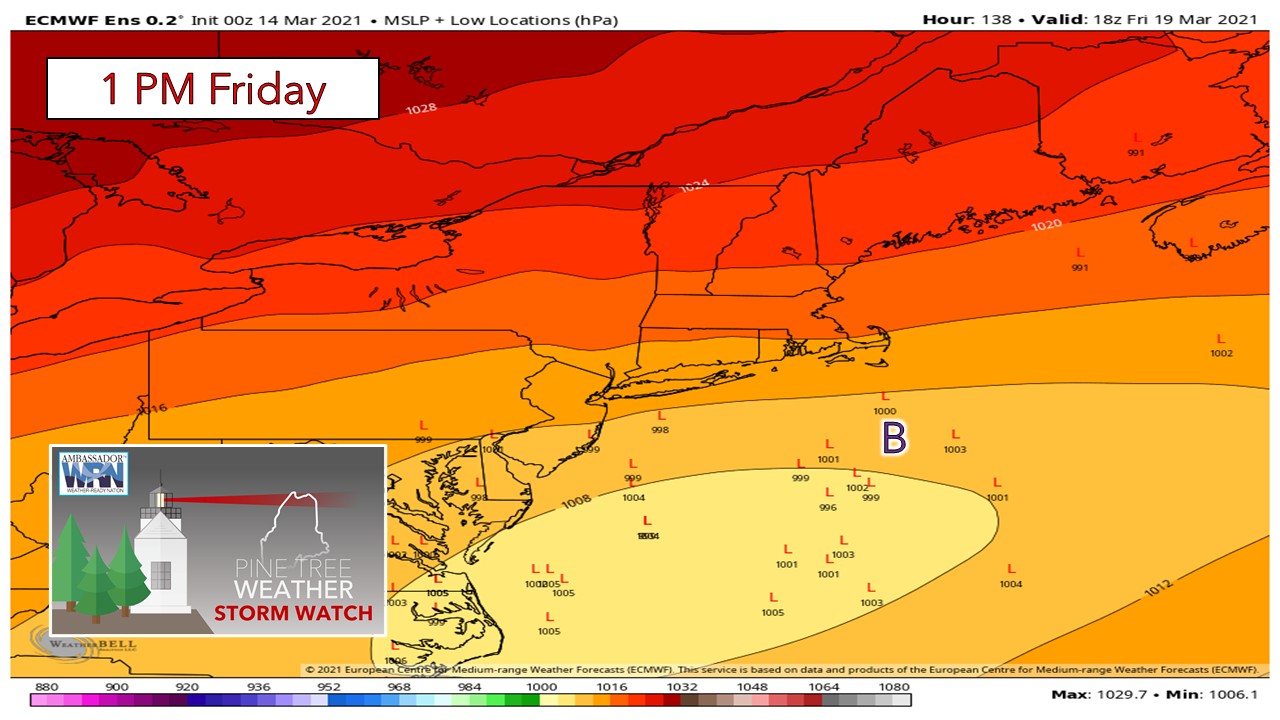 Long term deterministic models had been playing around with a potential storm in the latter part of the week. That idea appears to be squashed. There is an outside chance for a coastal brush, but the ensemble ideas stay south as high pressure over southern Quebec governs the pattern. 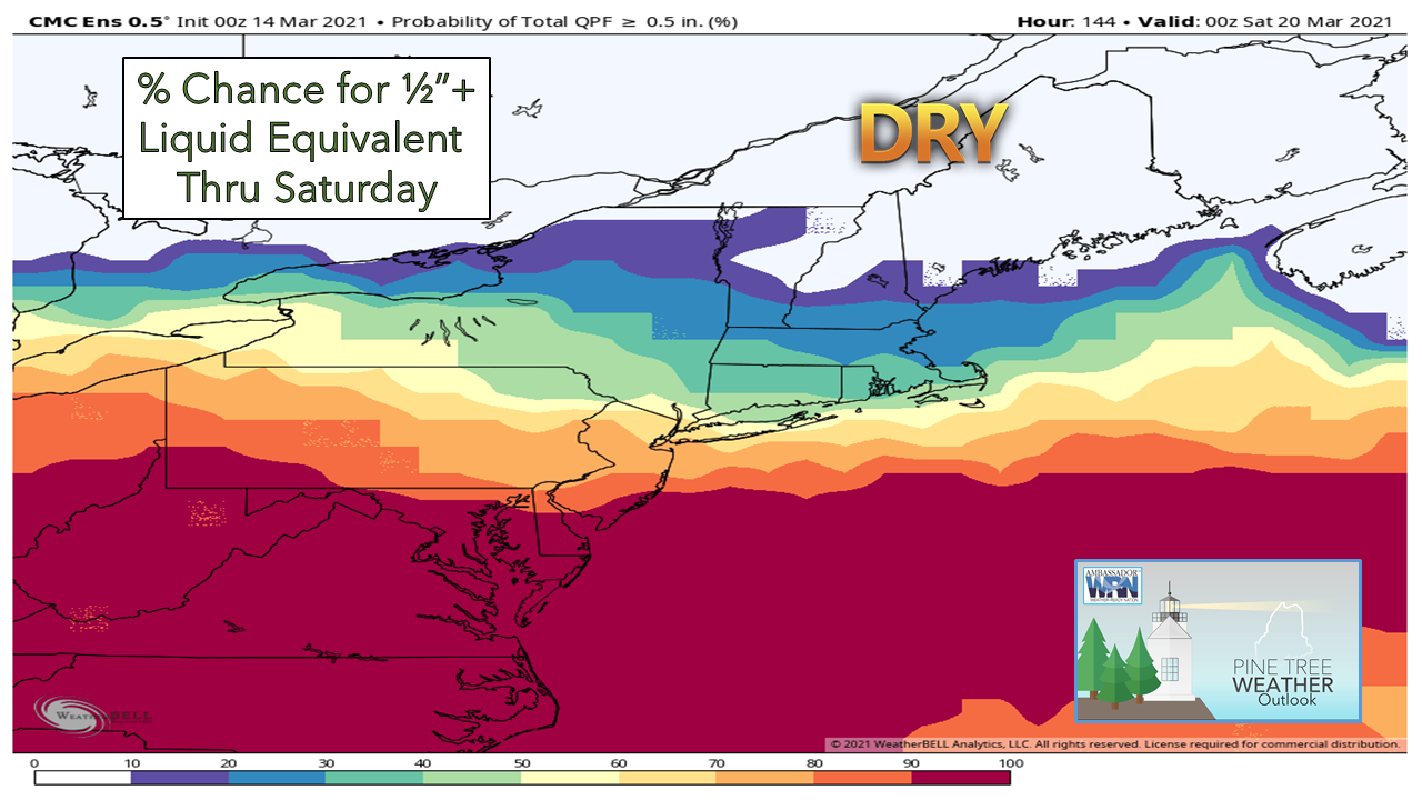 Even with the snow squalls pass that through on Sunday, there does not appear to be any meaningful precipitation for the week. I am growing more concerned over drought conditions to start growing season, along with elevated wildfire risk. On the other side, spring flood potential remains below normal. A slow gradual warm up appears to be in offing, which helps quell the flood threat, along with easing the impacts of frost heave and mud season, while providing a steady sap run. Ten-day temperature outlookI am usually hesitant to post long term temperature ideas in spring due to the volatility of the season, but the sensible weather pattern fits the outlook. Anointed numbers on the left and right show the normal high and low for March 14th and March 24th. The pattern is generally cool overall, with above normal temperatures possible as we head into the latter part of the month. 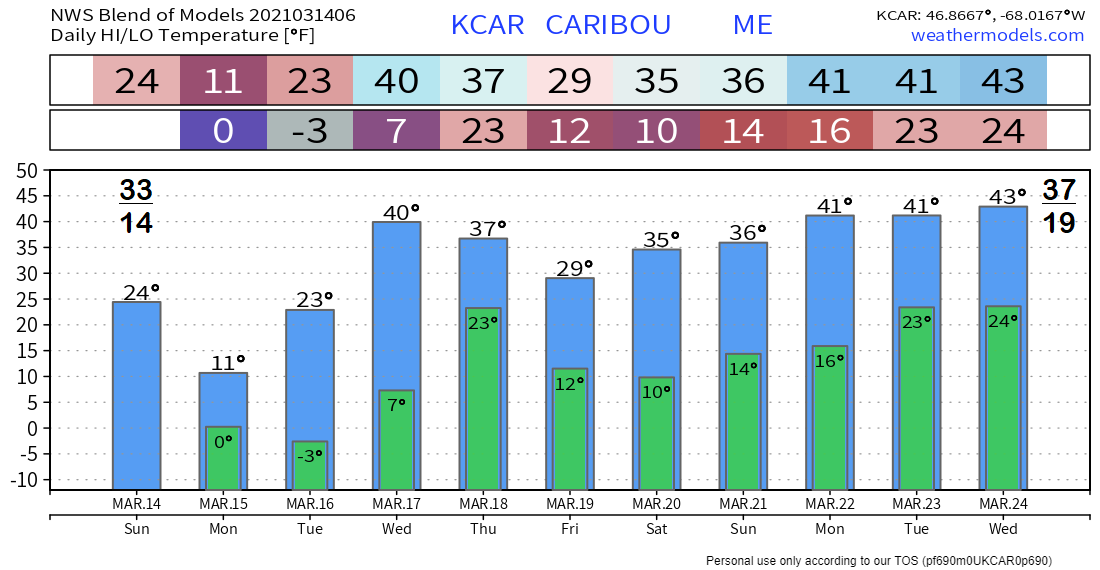 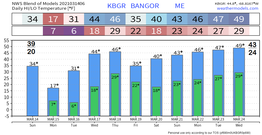 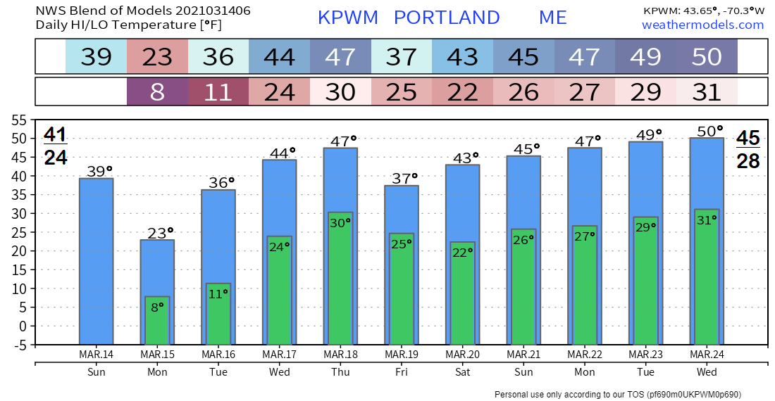 Help fill the gaps!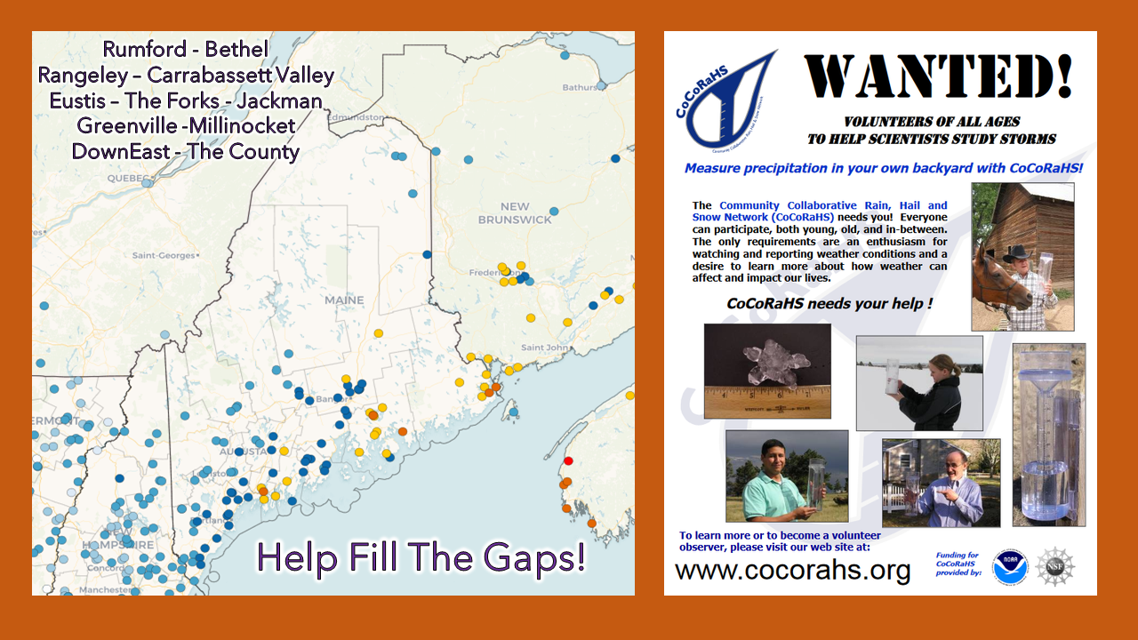 For folks in western, eastern, and northern areas, the Community Collaborative Rain, Hail and Snow Network could use your support! Verification of precipitation is especially important to improve forecasts. All ages can participate. Reporting is easy, and it takes little time to do. For more information, please check the CoCoRaHS Maine website. I would be more than happy to answer any questions you may have about the program! Be prepared to receive alerts and stay updated!
For more information in between posts, please follow Pine Tree Weather on Facebook and Twitter.
Thank you for supporting this community-based weather information source which operates by reader supported financial contributions. Stay updated, stay on alert, and stay safe! Thank you as always for your support! - Mike |

Mike Haggett
|