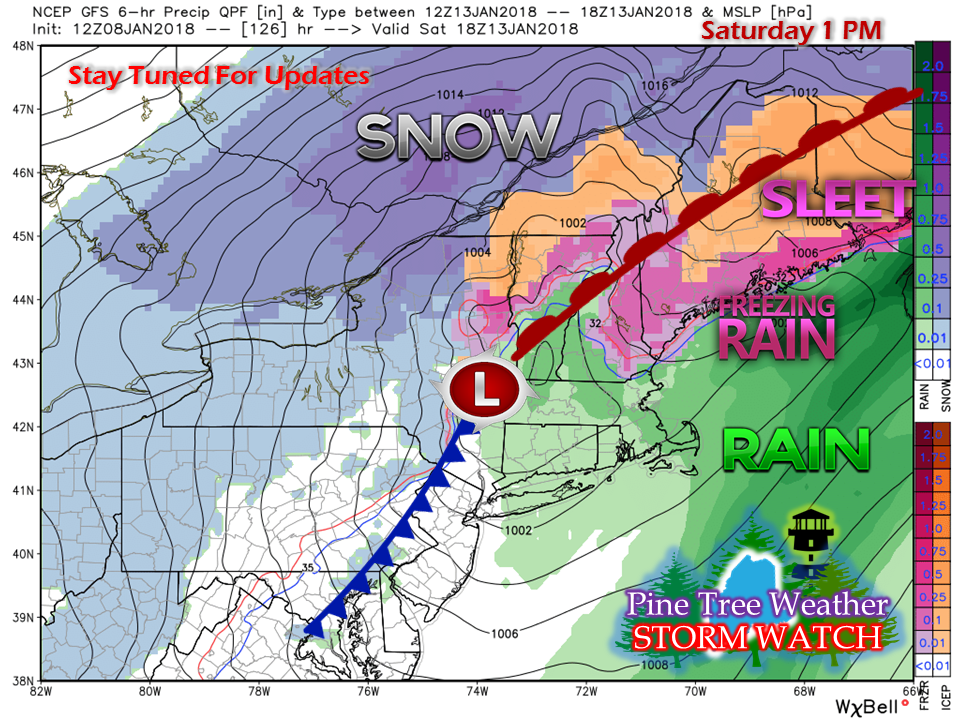
The price of the brief warm upA quick update here as I am pressed for time... No real changes to the forecast through late week. Snow showers Tuesday, primarily in the mountains and north, with little to no accumulation. Wednesday is void of precipitation until evening. There appears to be some light freezing rain/drizzle Wednesday night into Thursday, changing to all rain by Thursday afternoon. Rain continues into Friday. A cold front approaches the region Friday night, and low pressure travels up along it into Saturday. This is where it becomes as mess. As you can see with the graphic, all four food groups of precipitation types are on this chart. Confidence is growing that this storm will track southwest to northeast over the interior of the state, which will bring the wintry mix. It is still early to hammer out details, but a slick, icy day on Saturday with snow on the backside into early Sunday is on the discussion table. So if you have weekend plans, you will want to stay tuned for updates. AnnouncementI am very pleased to announce that I have joined the American Meteorological Society as an associate member. I have been a member of the National Weather Association since June of 2016. This is yet another step for me in my journey. To have the support of many in the weather community as helped me get to the level I am at now. This helps me take it a step further to gain resources and grow relationships with people in the public and private sector. It also helps to grow my passion and education of weather forecasting. For me, what I do with Pine Tree Weather is a dream come true. I want to thank all of you for coming along in this journey with me. It will only get better.
As I post on my Facebook page and Twitter accounts, as I well as I do here, Matthew 19:26... with God, ALL things are possible. I am blessed to be here to serve you, and continue to work hard to give you the best I have, with the time I can give it. #IntegrityFirst - Mike |
Mike Haggett
|


